 Hiking
Hole-In-The-Wall Rock Art
Hiking
Hole-In-The-Wall Rock Art
Mojave National Preserve
Overview
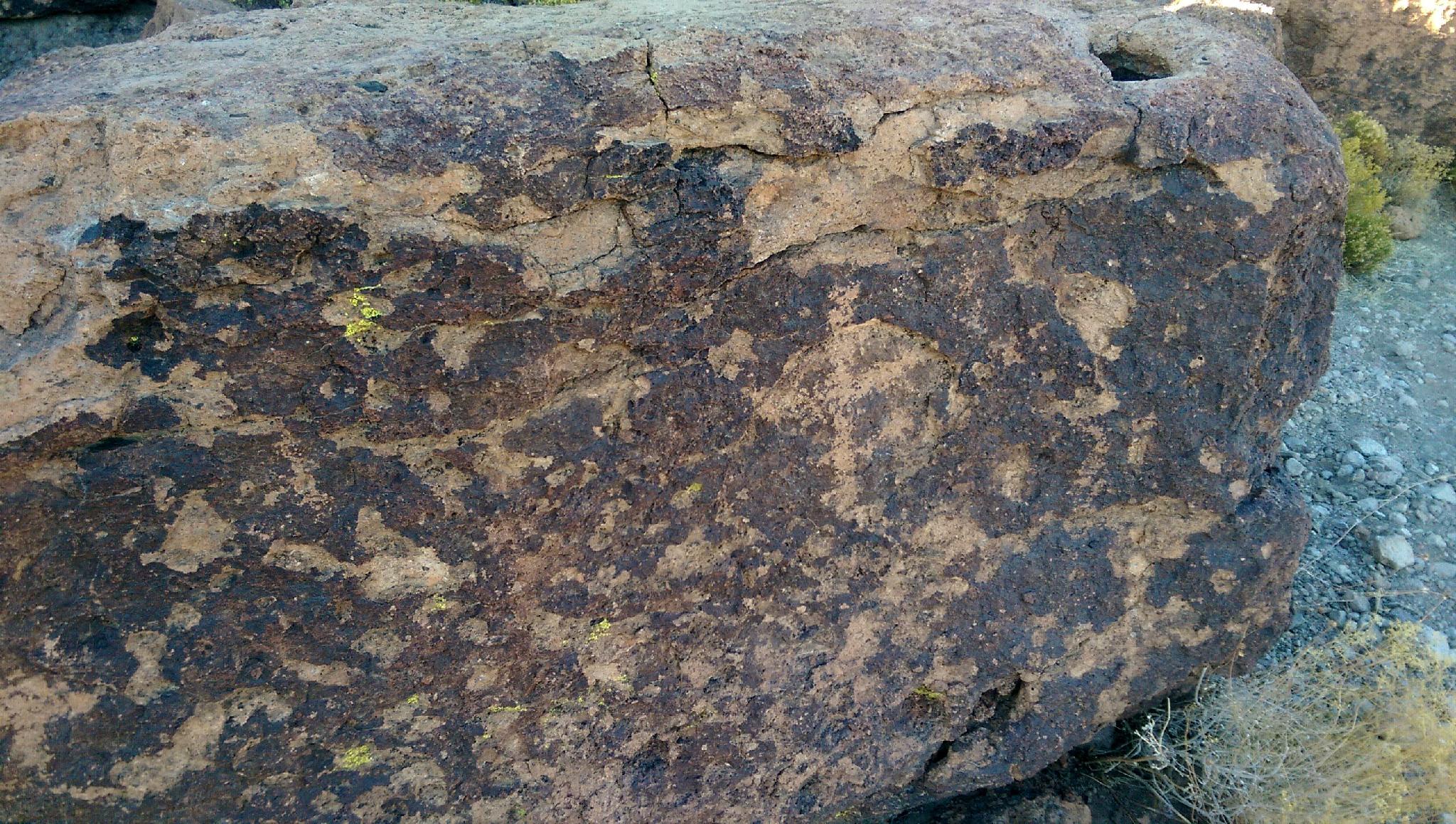
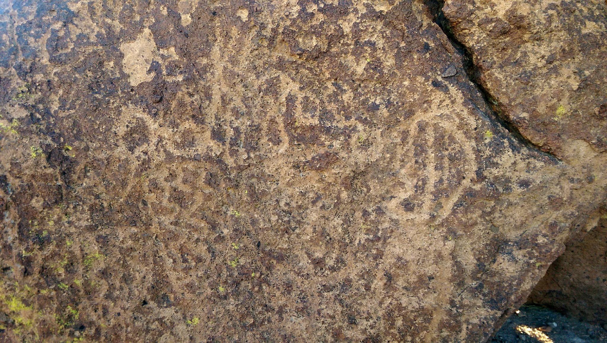
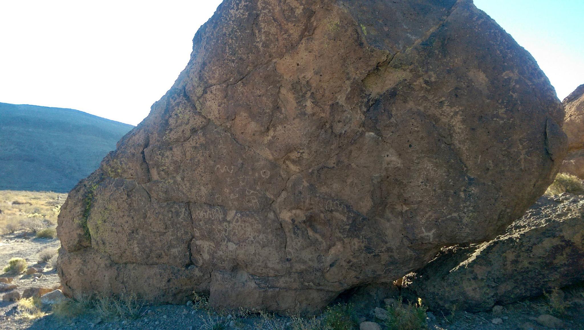
This is the first part of the Rings Trail and makes a great shorter adventure if you're not feeling up to tackling the Rings Trail, or are short on time. The short trail visits an impressive area of boulders that are covered in rock art. A fascinating glimpse into the ancient peoples that either called the area home or traveled through.
Getting There
Hole-In-The-Wall Information Center is the trailhead. This is a long way into the interior of the park with about 15 miles of dirt road involved in reaching the trailhead. The road can be a bit washboard but is passable by all vehicles.
From Baker, CA, head south into the Preserve by taking exit 246 off of I-15 and heading south on Kelbaker Road. Follow this paved road 34.5 miles to Kelso, an old railroad station that now serves as a visitor center. If you have time, it is a great stop.
Go left just BEFORE the railroad crossing in Kelso. (Kelso Cima Rd) Follow this paved road northeast for 14.3 miles to a signed road on the right for Hole-In-The-Wall. Take this road. It quickly turns to dirt.
At 6 miles a junction is reached. Go right, for an additional 9.5 miles to a signed junction to the Information Center on the right. There is a parking area at the Information Center that is also the trailhead.
Route Description
Rock art and historic sites are fragile, non-renewable cultural resources that, once damaged, can never be replaced. To ensure they are protected, please:
- Avoid Touching the Petroglyphs: Look and observe, BUT DO NOT TOUCH!
- Stay on the Trails: Stay on the most used trails when visiting sites, and don't create new trails or trample vegetation.
- Photography and Sketching is Allowed: Do not introduce any foreign substance to enhance the carved and pecked images for photographic or drawing purposes. Altering, defacing, or damaging the petroglyphs is against the law -- even if the damage is unintentional.
- Pets: Keep pets on a leash and clean up after them.
- Artifacts: If you happen to come across sherds (broken pottery) or lithics (flakes of stone tools), leave them where you see them. Once they are moved or removed, a piece of the past is forever lost.
From the trailhead, follow the trail south. The trail is flat and stays near the bottom of the hill. A few minutes from the trailhead, where the trail begins to curve west, rock art is easily visible on the large boulders that line the trail.
Once complete, return the way you came, or if you are feeling adventurous, continue on the Rings Trail!
Maps

11S 646382E 3878881N
35°02'31"N 115°23'42"W
11S 646520E 3878481N
35°02'18"N 115°23'37"W