 Hiking
Mount Terrill
Hiking
Mount Terrill
Fish Lake
Overview
At 11,547 feet, Mount Terrill is the third highest peak on the Fish Lake Plateau behind Fish Lake Hightop and Mount Marvine. There are many routes up the mountain, most very straightforward. This is generally easy country to wander with open sagebrush slopes and small areas of trees. Though many summit via U M Pass to the south, this route from the north is very aesthetic, straightforward, easy access, and I think the best route up.
The area has some of the best fall colors in Utah, and ample primitive camping. It is an excellent place to spend a fall weekend camping. Because of high elevations, the road may not be passable until early summer most years.
Getting There
From Fish Lake, head east on UT-25 along Fish Lake, then on to Johnson Valley Reservoir about 6 miles past Fish Lake. Turn left here on the recently paved road (FR640) that connects Johnson Valley Reservoir and I-70 to the north. At mile marker 10 on this road, at the road summits the ridge, turn right on a dirt road that heads south (FR1240). This dirt road requires high clearance, but only in a couple of rough spots. It can easily be walked or biked if needed. There are several good primitive camping sites here just off the paved road.
Follow the dirt road south for 1.5 miles to its end at a parking area and the trailhead. Ignore the side road leaving on the left that climbs steeply near the end of the road.
Route Description
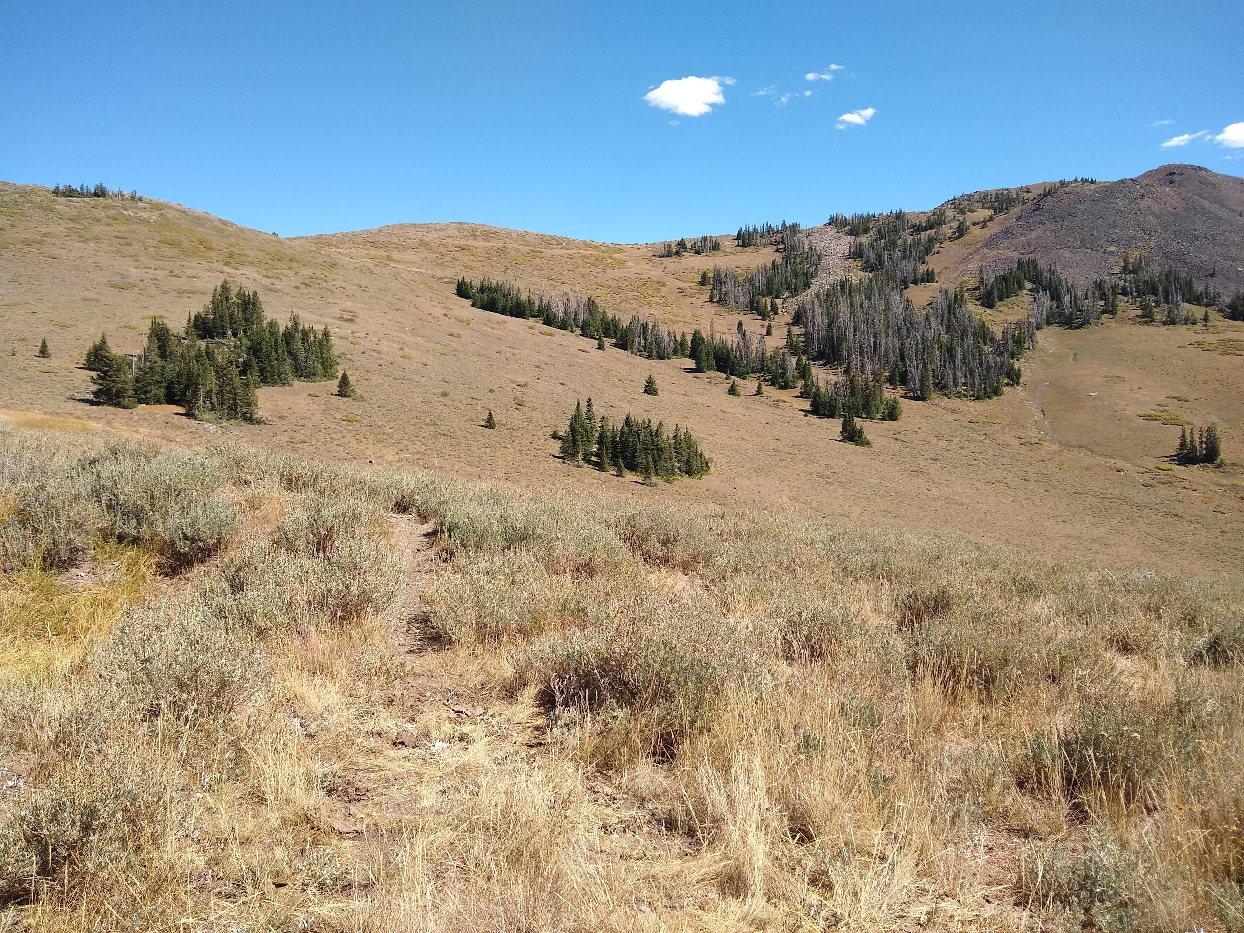
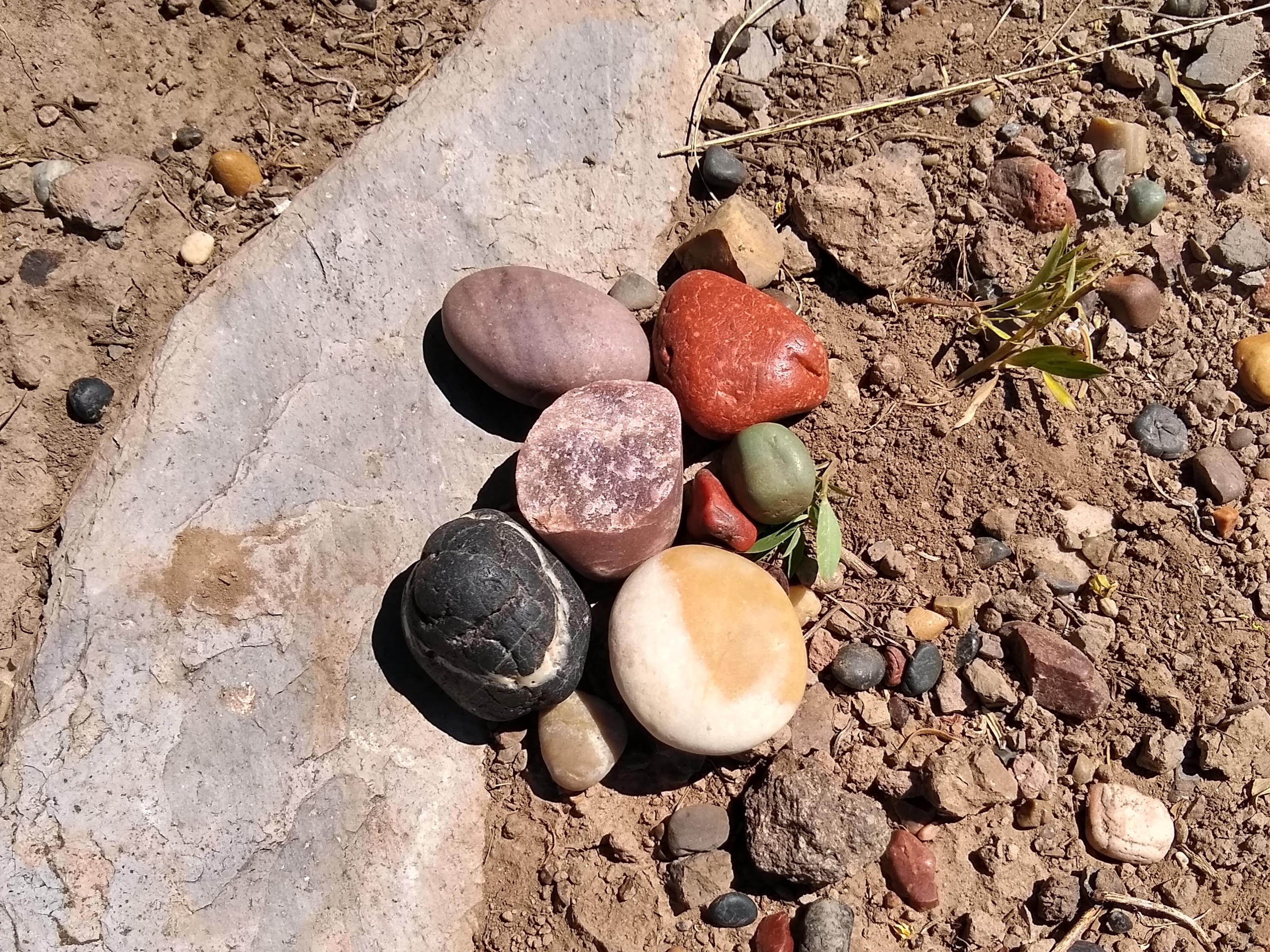
From the parking area, head east on a well-developed trail. You will drop a little elevation and then turn south. Admire the beautiful and colorful polished rocks along this section of trail and in the small washes you pass through. The trail will turns towards the south and then, In a little over a quarter mile, disappear or become very faint near a stand of trees. From here, head east towards the ridge, either heading towards the north end of the ridge or cutting to the southeast to get to a small pass (recommended), staying to the west of the forested area either way. There may be the faint appearance of a trail in places, but for the most part you will not be following a trail.
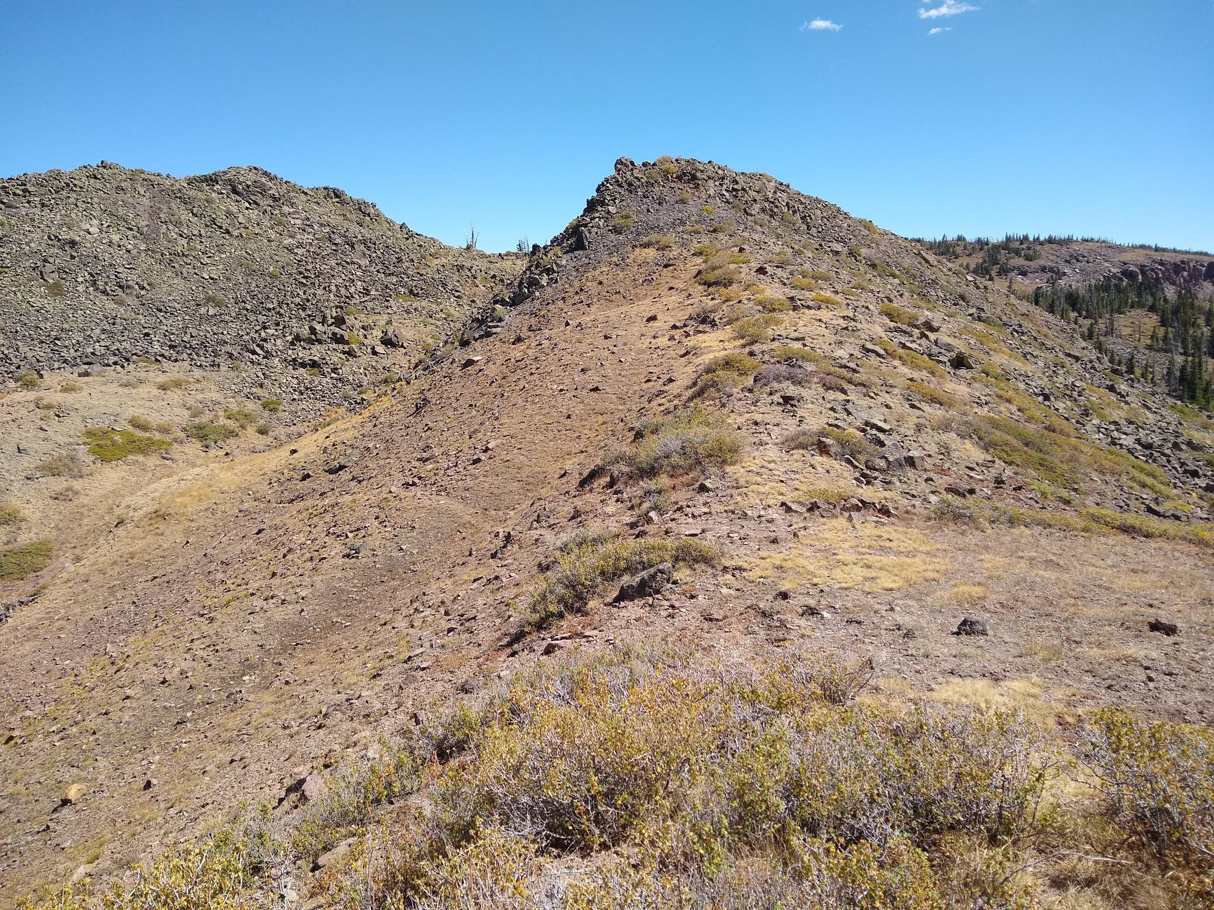
Follow the ridgeline until you get to a small boulderfield, which was marked with a large cairn in September 2020. Pick your way through the boulders, then stay close to the ridgeline, dropping just below it to the east or west to avoid dense shrubs as needed. Head towards a low pass between two small peaks, then down a ridge. You will soon see a trail cutting off to the left through a bare slope to a cobbly gully. Take this trail, then scramble up the gully and down a moderately steep boulderfield on the other side. The peak is a little over a quarter of a mile at this point and visible, though it will become obscured by trees and the low angle as you get closer. Head southeast to the peak until you reach the top.
The top is covered in thin slabs of volcanic rock that are called clinkstones due to the ringing sound they make when struck by a hammer; these rocks have been piled up into small towers and shelters. There is a communication tower and benchmark on top. Enjoy the views, particularly of Mount Marvine and Fish Lake to the south, before heading back the way you came.
Photos
Maps

12S 442458E 4286757N
38°43'39"N 111°39'43"W
12S 442940E 4286453N
38°43'30"N 111°39'23"W
12S 443110E 4286113N
38°43'19"N 111°39'16"W
12S 443081E 4285558N
38°43'01"N 111°39'17"W
12S 443740E 4285044N
38°42'44"N 111°38'50"W