 Hiking
Devils Crack
Hiking
Devils Crack
Vernal
Overview
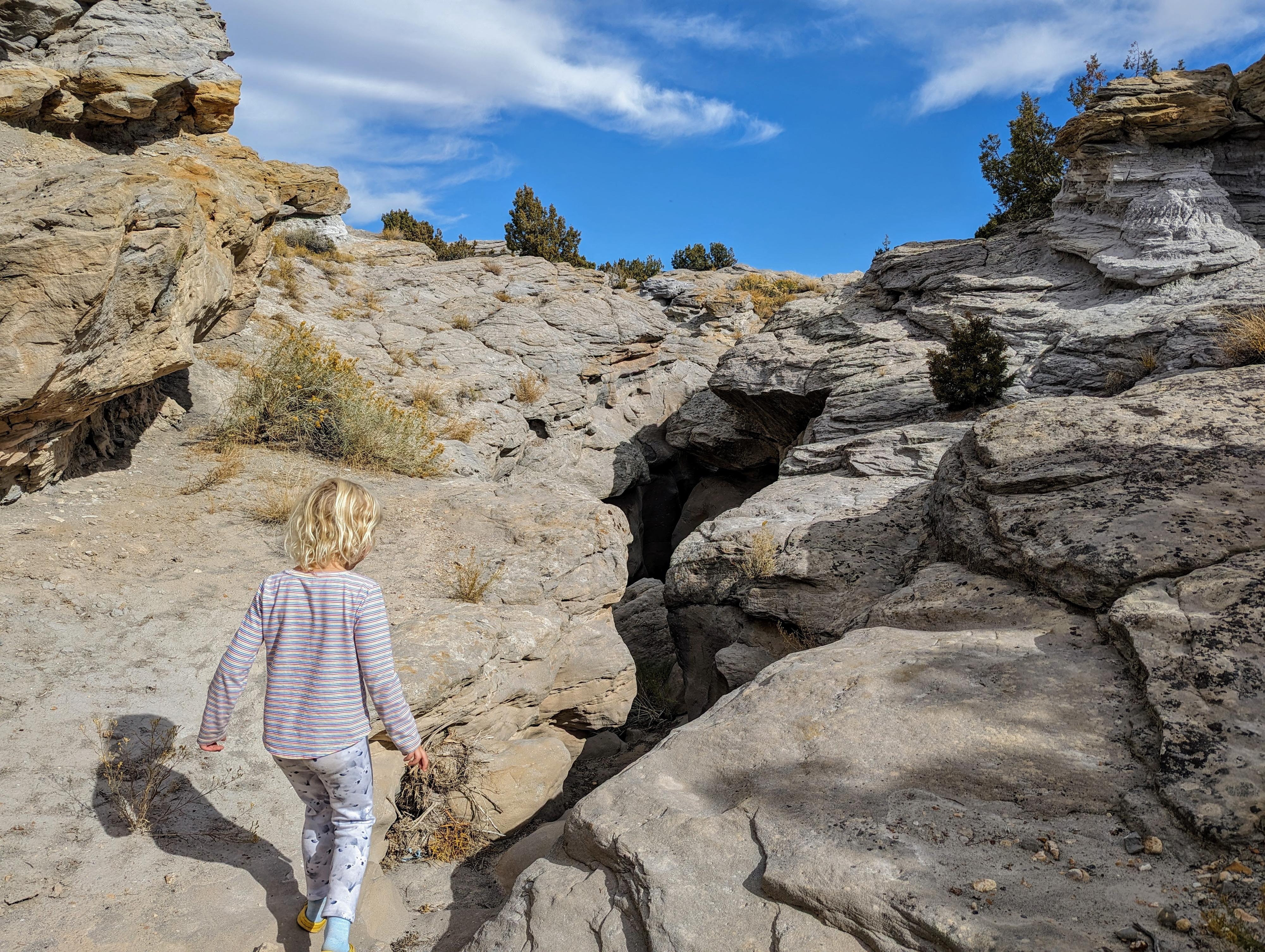
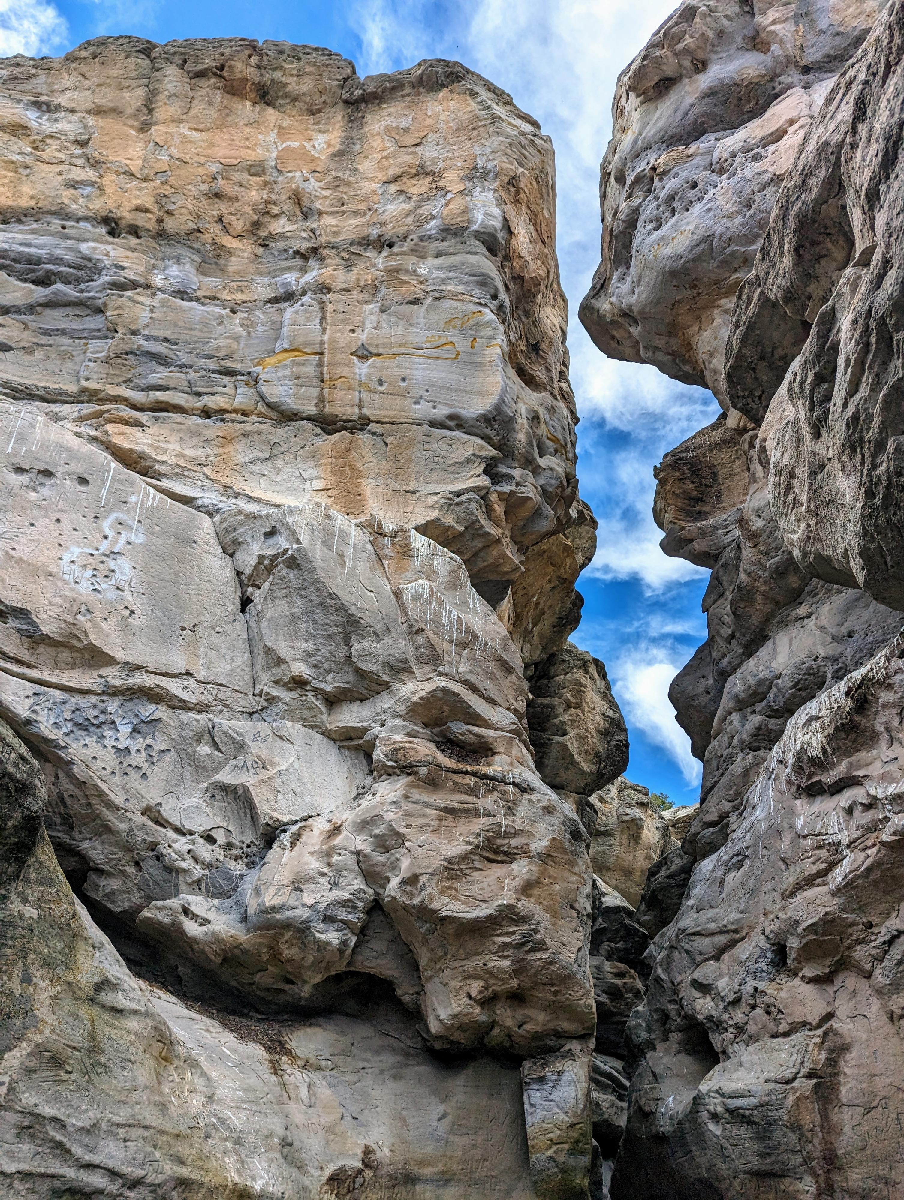
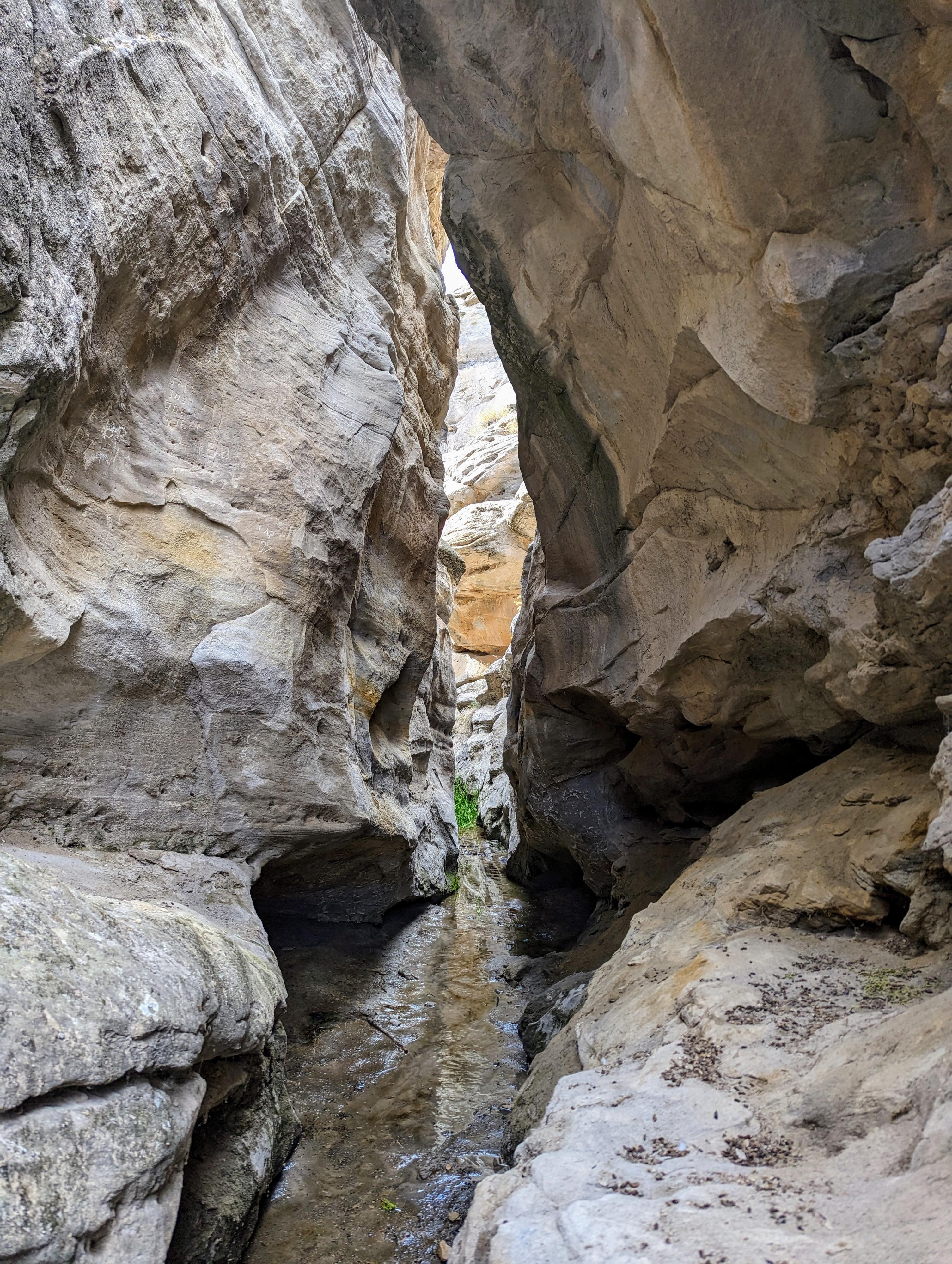
I have never had such a strong and opposing opinion on a canyon as I have Devil's Crack, aka Devil's Hole. This short canyon, south of Naples, Utah, was striking beautiful and stood out in contrast to other outings and scenery in the area. I adored the sculpted walls, easy access, and fun little climbing moves like a schoolboy with a first crush.
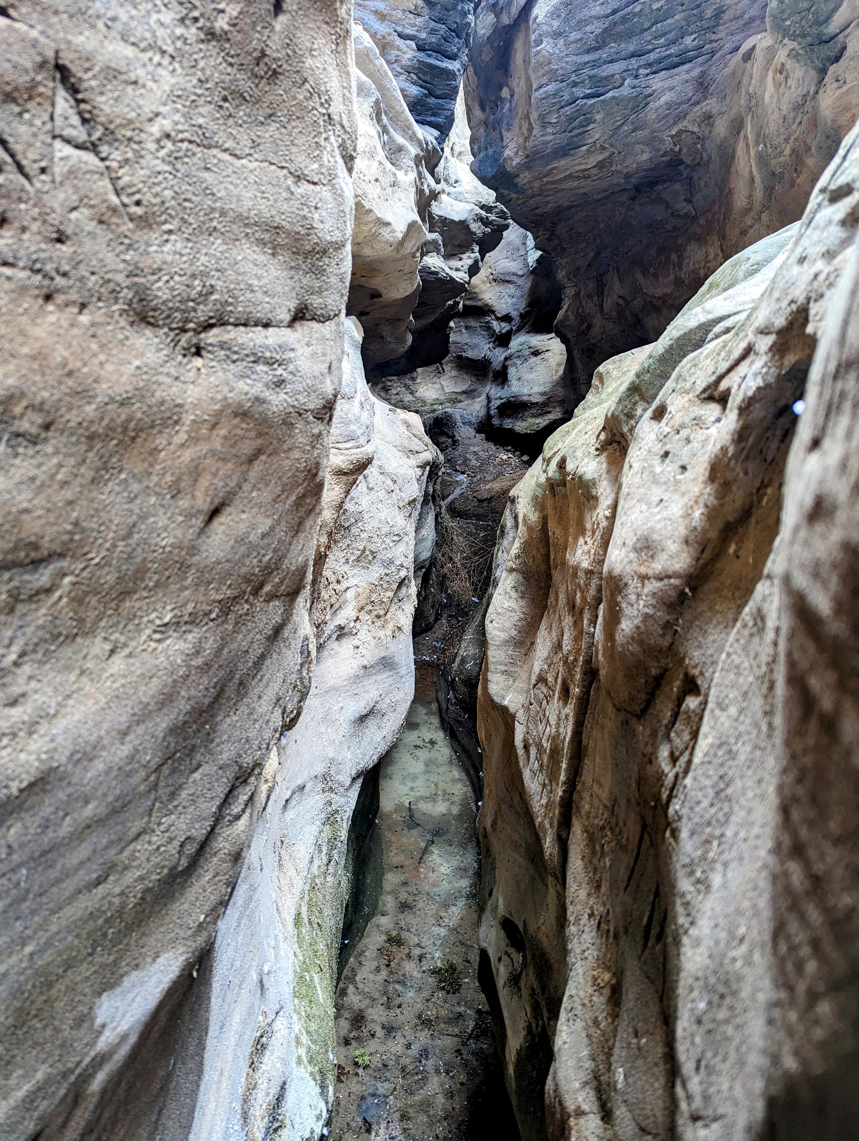
Alas, though, every rose has its thorn, I suppose. The crushing negative to Devil's Crack is that it is home to dozens of birds. That doesn't sound so bad, you may be thinking. Well, consider on my visit that the bottom of the canyon was literally 3-4" inches of thick slurry. The slurry was composed of sulfur water bubbling up from underground springs and bird droppings from roosting birds above, with a few feathers mixed in for just a bit more of a yuck factor. I can't even describe the smell.
In the end, this is not a canyon I would recommend to most. Perhaps I visited during a particularly awful period, but I suspect it is always quite pungent. Perhaps after recent heavy rains have flushed it out? It is too bad because the canyon is beautiful. Ample graffiti shows many people visit.
Getting There
From Vernal, head east on US-40. The highway curves south, and splits not too far from Vernal. Go straight here on state highway 45, where US-40 goes east instead. You are heading south, through Naples. After about 4 miles on state highway 45, at mile marker 36, turn right (west) onto a dirt road. There is a large parking area on the right, just off pavement.
Follow the main dirt road west. At 0.35 miles is a junction. Go right here, on a less used road. Follow it, staying straight at the next 4-way junction. 0.5 miles from pavement is the trailhead, right before a fence and gate.
Route Description
From the trailhead, walk through the gate and follow the dirt track for 100 feet or so to where it crosses the wash. Head down the wash, this is Devil's Crack!
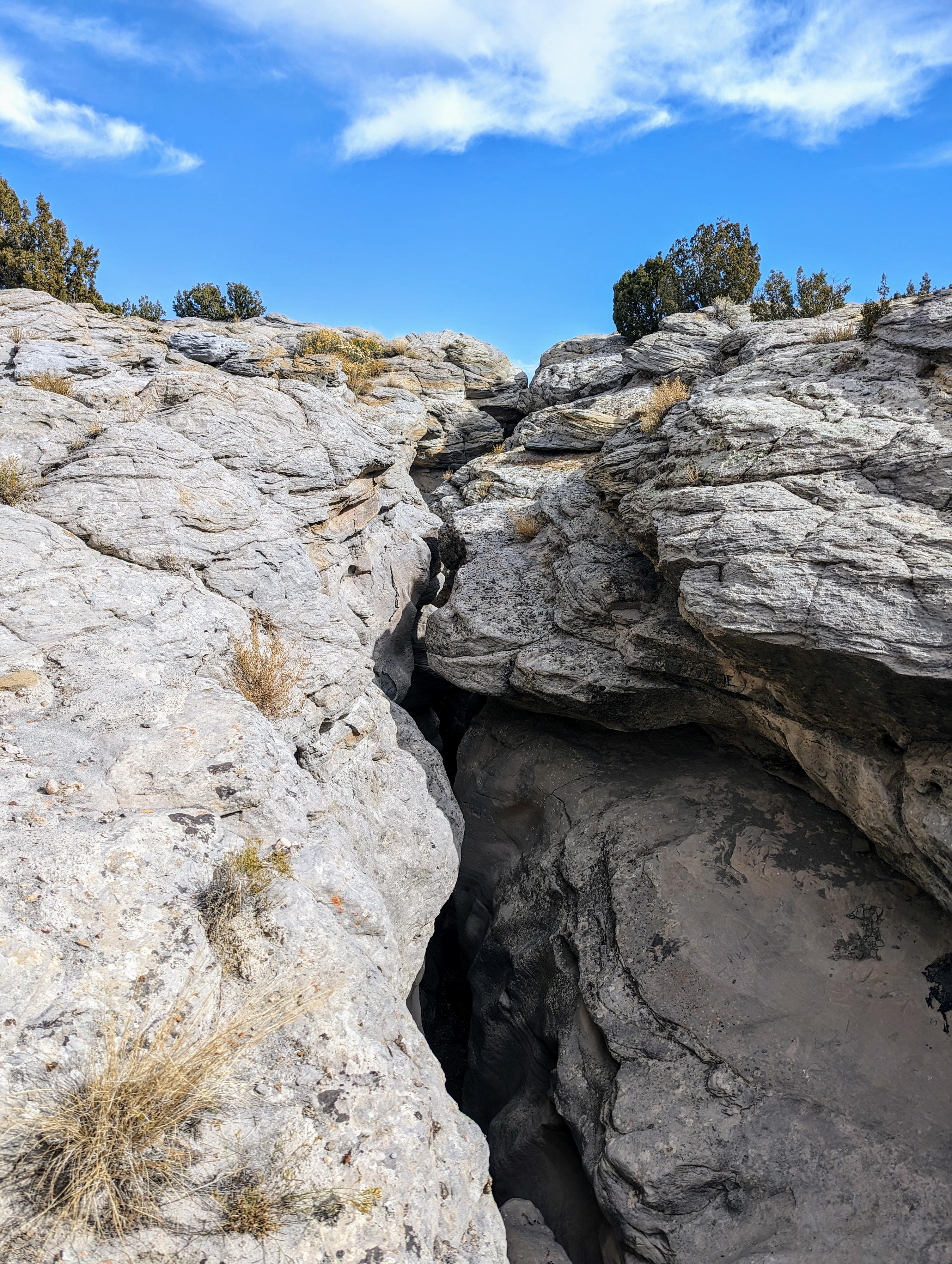
The canyon is shallow at first with a few minor obstacles. Just a couple of minutes down stream from the road, however, it drops in to the sinuous slot it is named for. A short downclimb marks the start of the good stuff. Much graffiti marks the walls. On our visit, the birds, and filth were in this first section not far after the downclimb then it got a bit better.
The going is easy for a few minutes in a wonderful slot, then it suddenly opens into a grassy area.
Climb out on the right as soon as it is easy to do so, and follow the rim back to the road and gate. Our trip probably took a total of 30-45 minutes car-to-car.
Maps

12T 627531E 4468445N
40°21'25"N 109°29'53"W
12T 627027E 4468639N
40°21'31"N 109°30'15"W
12T 626898E 4468870N
40°21'39"N 109°30'20"W
12T 626869E 4468910N
40°21'40"N 109°30'21"W
12T 627037E 4468953N
40°21'41"N 109°30'14"W
12T 626984E 4468740N
40°21'34"N 109°30'16"W