 Hiking
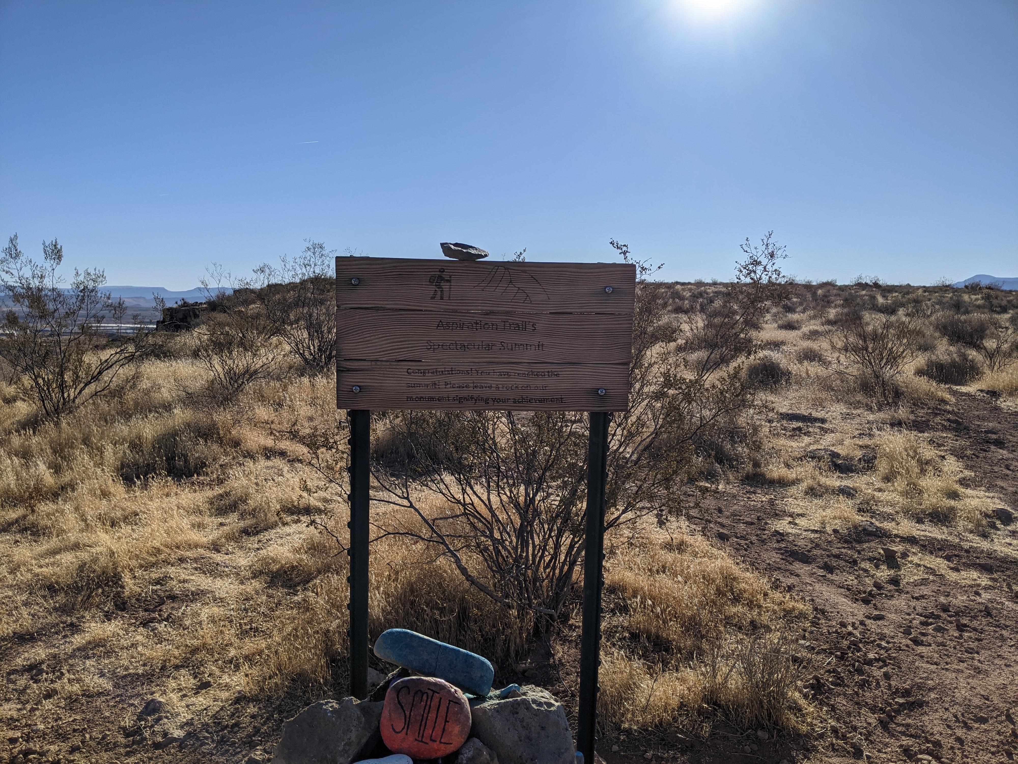
Aspiration Point
Hiking
Aspiration Point
St. George
Overview
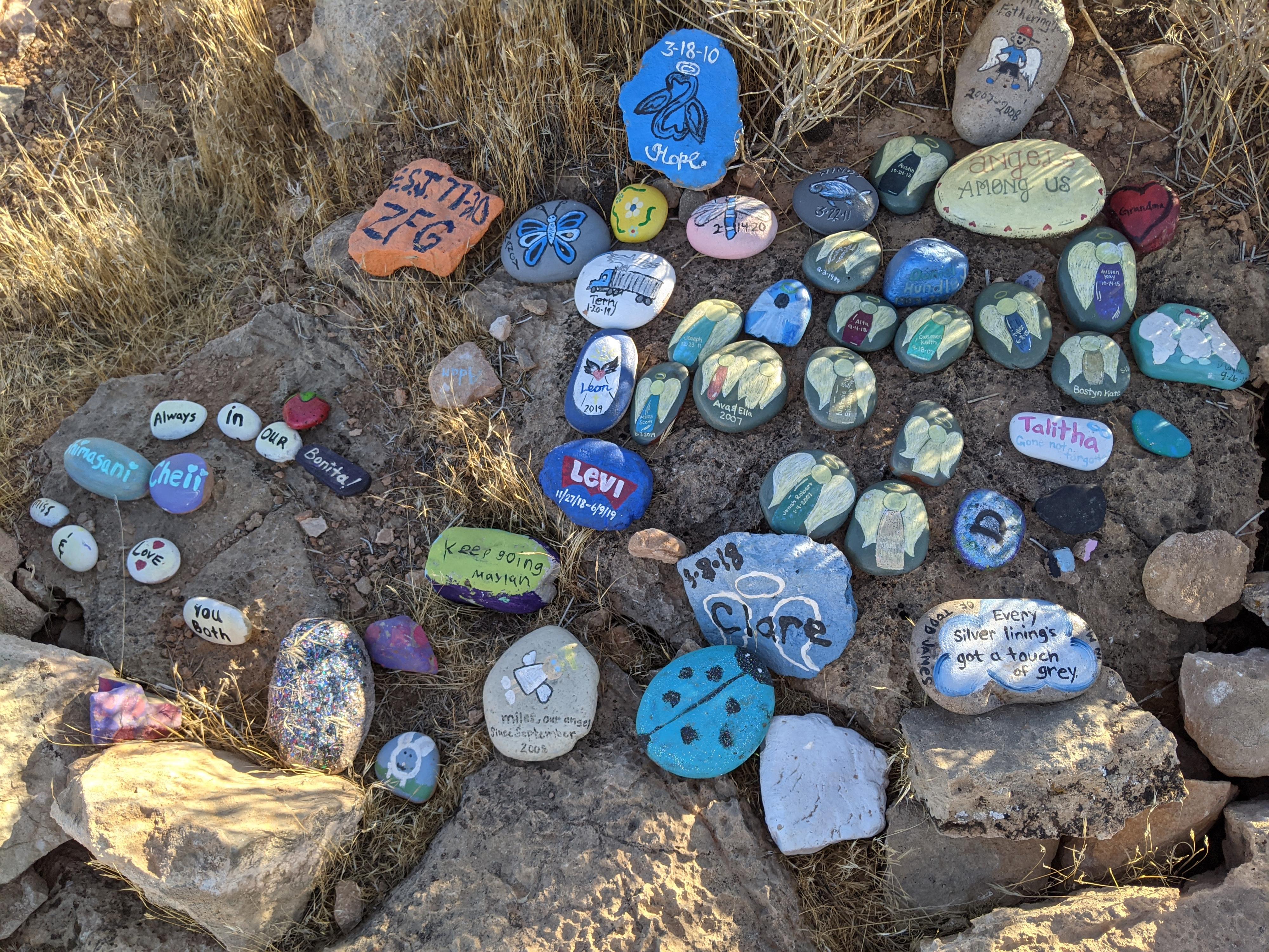
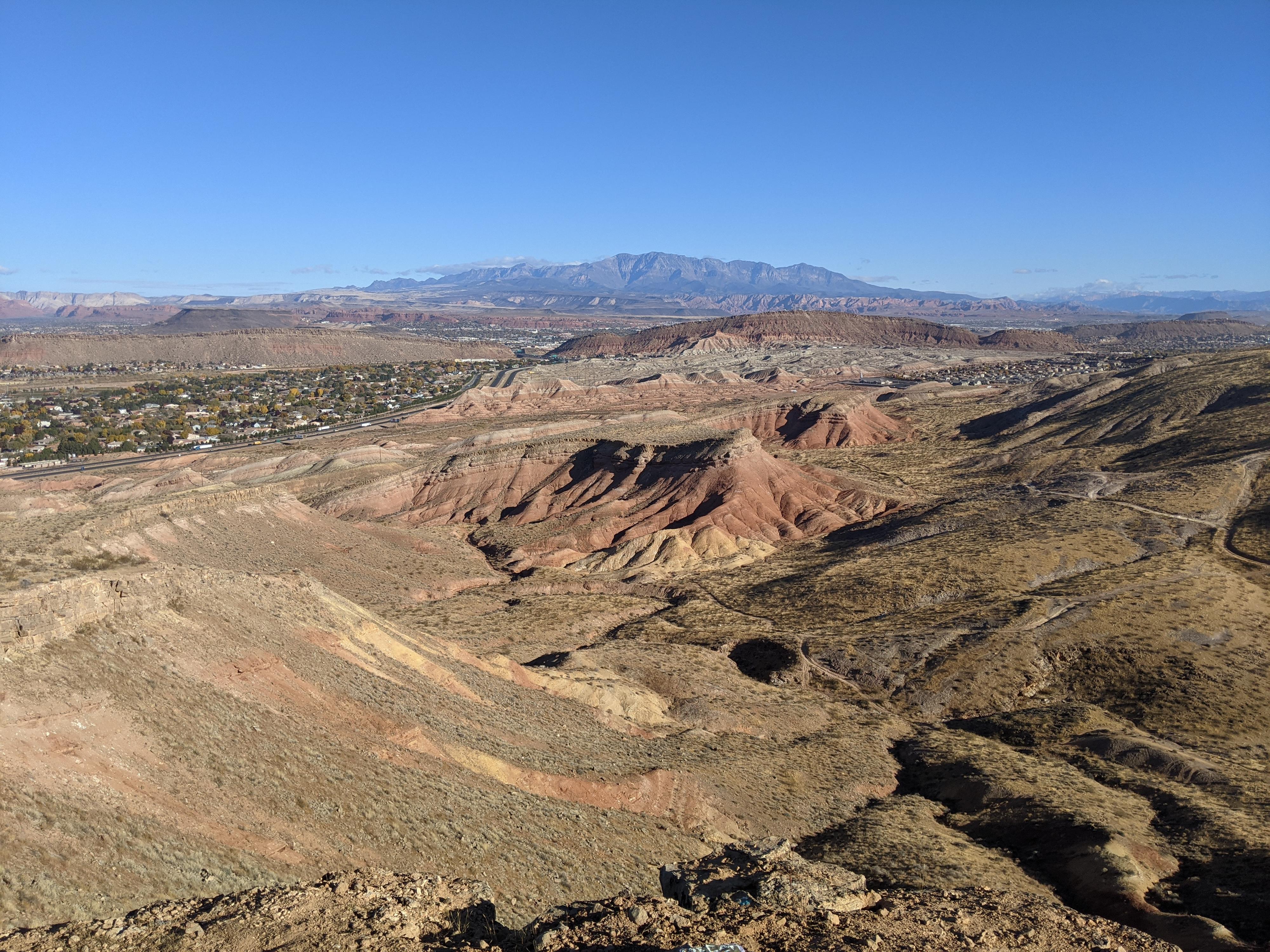
Close to downtown St. George is the Aspiration Point trail. This short trail is a great family friendly outing to get your aspirational quotes, as well as take in some excellent views of St. George and the surrounding area. This was a fun outing while passing through the area. Our daughter absolutely loved wandering along the trail taking in the many colorful rocks and prompting us to read rocks that caught her eye.
Bring a painted rock with you to contribute if interested. The trail is a mix of rocks painted with aspirational quotes as well as just painted rocks.
Getting There
On the south side of St. George, take exit 2 off Interstate 15 onto the Southern Parkway. Go east on the Southern Parkway for 0.25 miles and take Exit 1.
At the first intersection, go right on Desert Color Pkwy. Follow Desert Color Pkwy 0.7 miles to a dirt road leaving on the right. Follow this dirt road 0.5 miles as it climbs up the hill to a bend. There is a small parking area on the left of the bend that is the trailhead.
Route Description
The trail makes a loop. From the trailhead, follow the trail north. It comes to a junction in a couple of minutes. Go right here. The trail climbs the hillside to an overlook and flagpole. The top has excellent views!
To make a loop, continue the trail north past the flagpole as it stays near the edge of the small cliff band. The trail meanders down and reaches a junction. Go left here to loop back to the start trailhead.
Maps

12S 269233E 4101946N
37°02'07"N 113°35'40"W
12S 269255E 4102069N
37°02'11"N 113°35'40"W
12S 269513E 4101518N
37°01'54"N 113°35'29"W
12S 269333E 4102119N
37°02'13"N 113°35'36"W
12S 269263E 4102088N
37°02'12"N 113°35'39"W