Hiking Mud Wash Narrows
Gold Butte National Monument
Overview
Fri 102 | 75 |
Sat 101 | 76 |
Sun 103 | 75 |
Mon 106 | 77 |
Tue 105 | 81 |
View Full Weather Details |
Fri 102 | 75 |
Sat 101 | 76 |
Sun 103 | 75 |
Mon 106 | 77 |
Tue 105 | 81 |
View Full Weather Details |
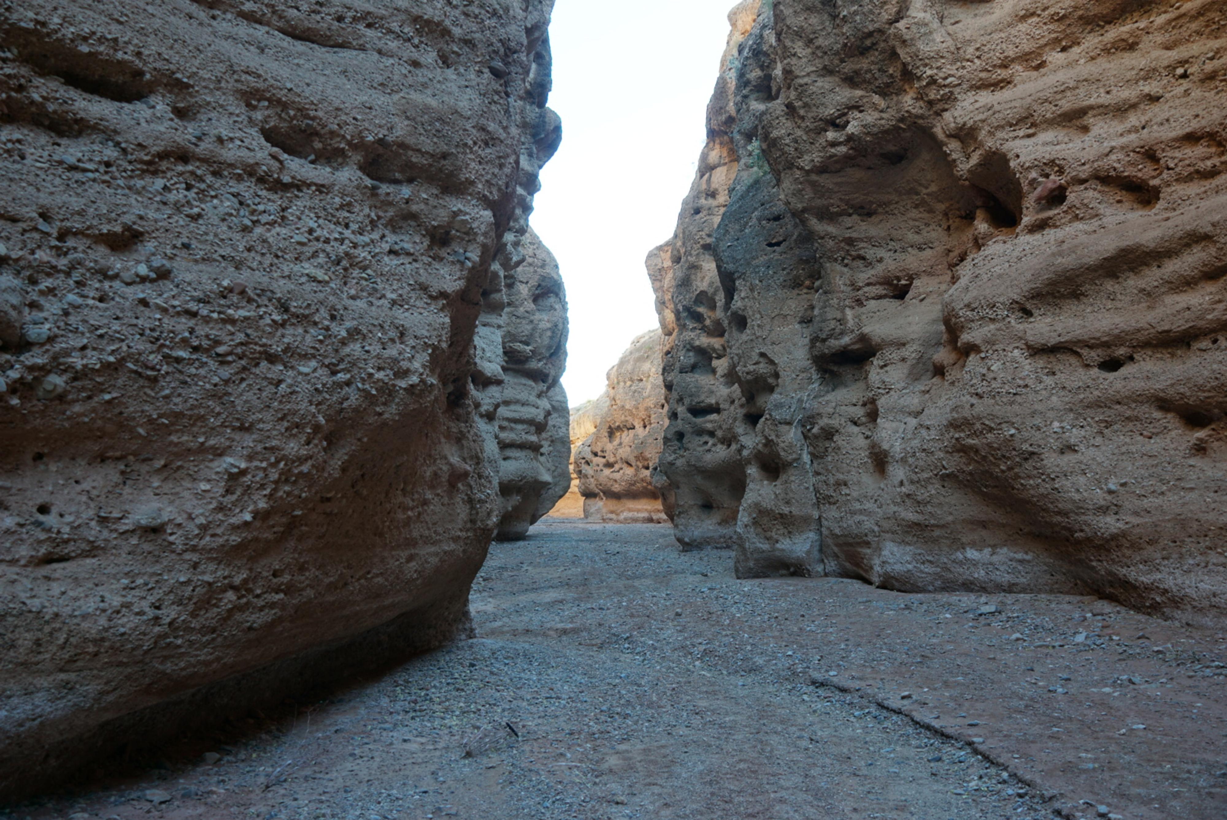
Gold Butte is made up of mostly sandstone outcroppings, jagged limestone peaks, and some granite on its southern end. Mud Wash, as it meanders its way down from the interior region of Gold Butte National Monument to the Virgin River cuts through a different layer than the rest of the monument. The wash narrows and cuts through a layer of conglomerate rock creating the Mud Wash Narrows just before reaching the Virgin River above Lake Mead.
The narrows are quite different than the rest of the monument and are a good out and back hike. Before becoming a monument, the narrows were part of a popular off-road loop but are now closed to motor vehicles.
Getting There
Reaching Gold Butte starts by taking exit 112 off Interstate 15. This is about 70 miles east of Las Vegas, or 10 miles west of Mesquite Nevada. From exit 112, head south for 3.1 miles on NV-170 toward Riverside. Just after the road crosses the Virgin River, turn right onto Gold Butte Road.
- Reset your odometer as you turn west onto Gold Butte Road. This is an old paved road that is a bit rough and gravel in sections, but passable by all vehicles in most conditions. ( 11S 748409E 4068726N / 36°43'54"N 114°13'05"W )
- 19.9 miles - Side road on the right to a couple of good primitive camping spots. ( 11S 754383E 4046395N / 36°31'45"N 114°09'32"W )
- 21.1 miles - Whitney Pocket. Good camping on the right. ( 11S 756034E 4045904N / 36°31'27"N 114°08'26"W )
- 21.15 miles - Major junction. Large parking/camping area on the right. A good road goes left (east) along the base of Whitney Pocket. This is the Whitney Pass Rd. Stay straight and reset your odometer. ( 11S 756076E 4045807N / 36°31'24"N 114°08'24"W )
- From Whitney Pocket - 3.9 miles - North Mud Wash Side Road to Little Finland, Seven Keyholes, etc... Go right here onto the side road. ( 11S 754067E 4040421N / 36°28'32"N 114°09'51"W )
- Mud Wash Side Road - Jct of Mud Wash Road and North Mud Wash Road. Both about 3.0 miles from the main road. Reset your odometer here. ( 11S 752017E 4036817N / 36°26'37"N 114°11'18"W )
- Mud Wash Side Road - 0.74 miles - Side road on the right. This is the Mud Wash Dunes side road to the Lollipop/Dunes Trailhead. ( 11S 751014E 4036361N / 36°26'23"N 114°11'59"W )
- Mud Wash Side Road - 0.75 miles - The road comes close to a sandstone wall along the wash. This is the Mud Wash Panel. ( 11S 750916E 4036284N / 36°26'20"N 114°12'03"W )
- Mud Wash Side Road - 1.35 miles - Easy to miss junction. Right (the wash) continues to Little Finland. Left leaves the wash, makes a quick turn, and climbs up to higher ground. This is the Cutoff Road. Go LEFT here, leaving Mud Wash. Reset your odometer as you turn onto the Cutoff Road. ( 11S 750313E 4036001N / 36°26'12"N 114°12'27"W )
- Cutoff Road - 0.3 miles - Small parking area and trail (old road) on the left. This is the grotto trailhead. ( 11S 750134E 4036026N / 36°26'13"N 114°12'34"W )
- Cutoff Road - 1.86 miles - Jct. Left. ( 11S 748092E 4036755N / 36°26'38"N 114°13'55"W )
- Cutoff Road - 1.9 miles - A major junction. Go on the second left, not the first hard left here. ( 11S 748080E 4036630N / 36°26'34"N 114°13'56"W )
- Narrows North Road - 500 ft - Jct - Right to Mud Wash Narrows. This is a rougher two track. Follow this side road 2.3 miles as it descends down the Gold Butte Wash bottom to rejoin Mud Wash just above the Mud Wash Narrows. ( 11S 748095E 4036475N / 36°26'29"N 114°13'56"W )
- Narrows Road - 2.3 miles - Mud Wash Narrows Trailhead in the wash bottom at the confluence of the two washes. ( 11S 745403E 4038473N / 36°27'37"N 114°15'41"W )
Route
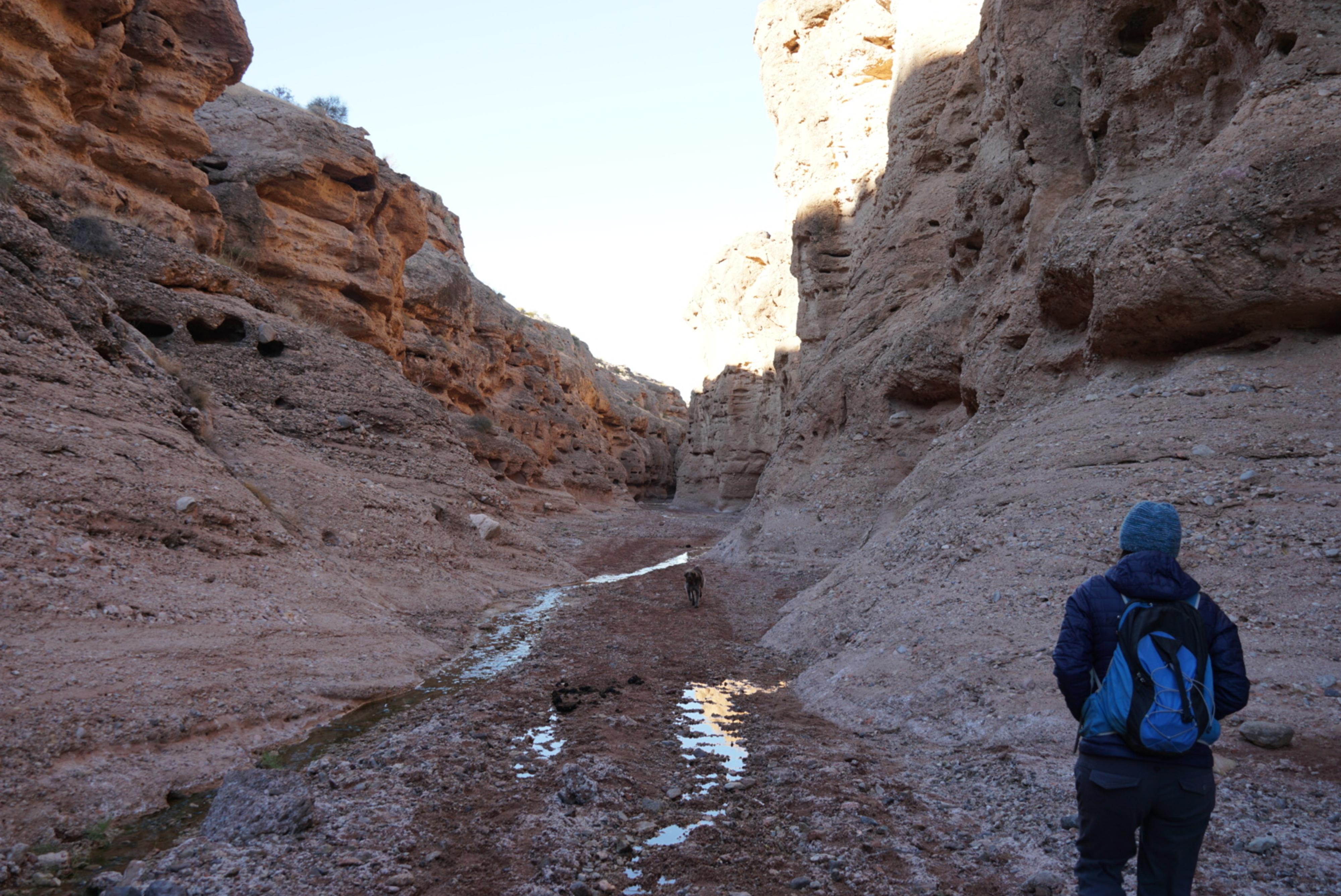
Navigation is easy on this outing. From the trailhead, walk down the wash. In just a minute or two, it turns right, narrows, and enters the conglomerate rock layer. Springs feed a small stream here that is easily hopped over. It is absorbed by the ground again not too far down into the narrows. The deepest part of the canyon is near the start.
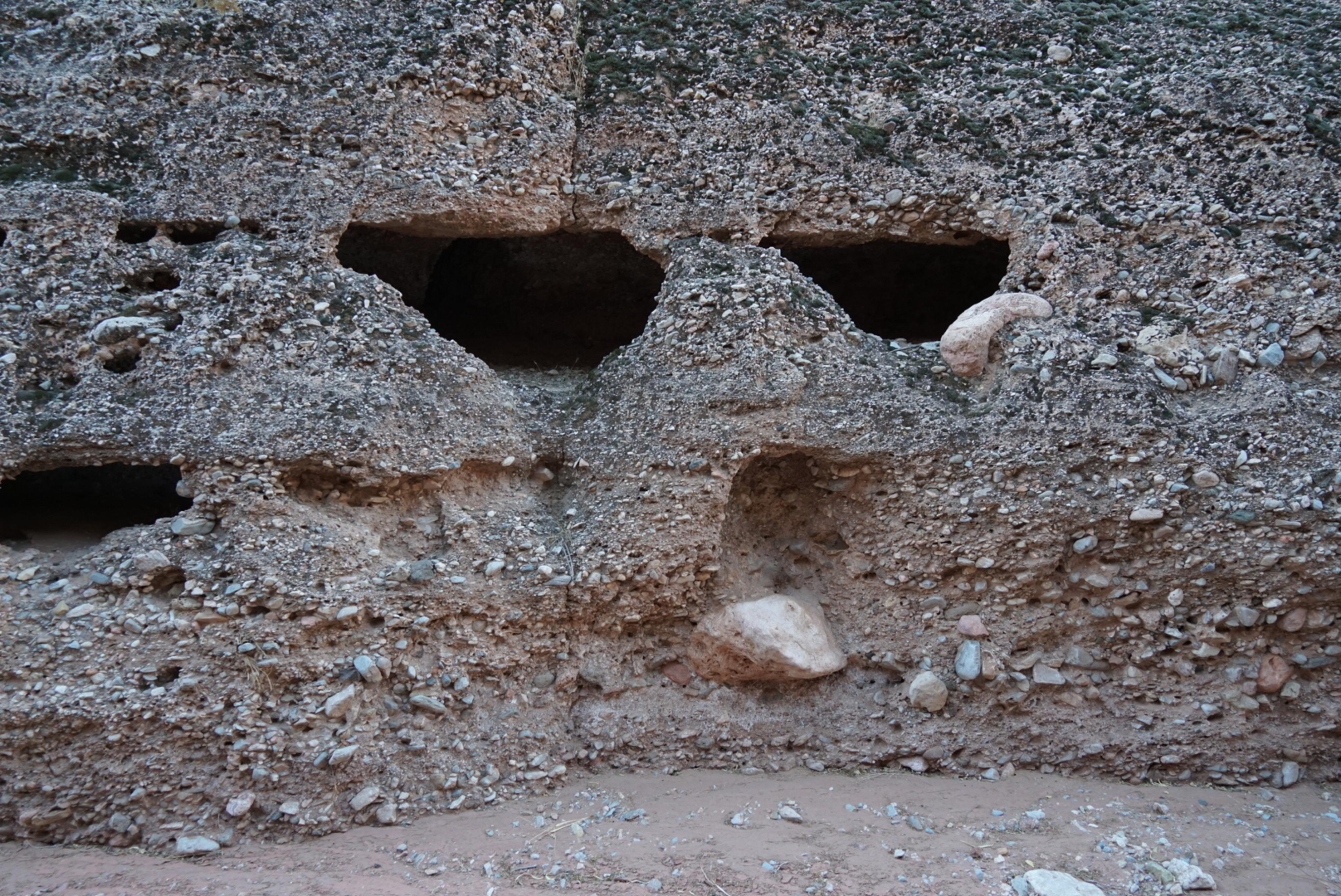
There are numerous solution pockets in the wall that are neat to see, and that our preschooler loved to poke her head in.
Continuing down, the canyon begins to slow open as the walls widen and change from cliffs to slopes. Return whenever motivation dictates. Once the canyon opens, to my eye, it becomes a fair bit less interesting.
Mud Wash Narrows Trailhead |
11S 745404E 4038482N 36°27'37"N 114°15'41"W |
Narrows |
11S 745237E 4038417N 36°27'35"N 114°15'48"W |