 Hiking
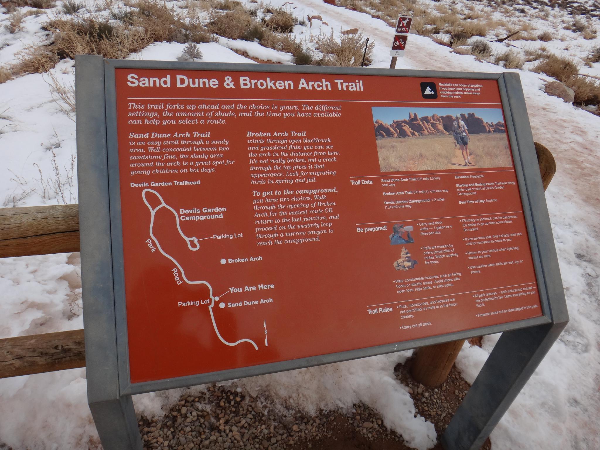
Sand Dune and Broken Arch
Hiking
Sand Dune and Broken Arch
Arches
Overview
If you have kids and are visiting Arches National Park, Sand Dune Arch would be one of my top recommendations to stop at. A short hike, shade, sand for the kids to play in, and a nice arch, this hike has it all!
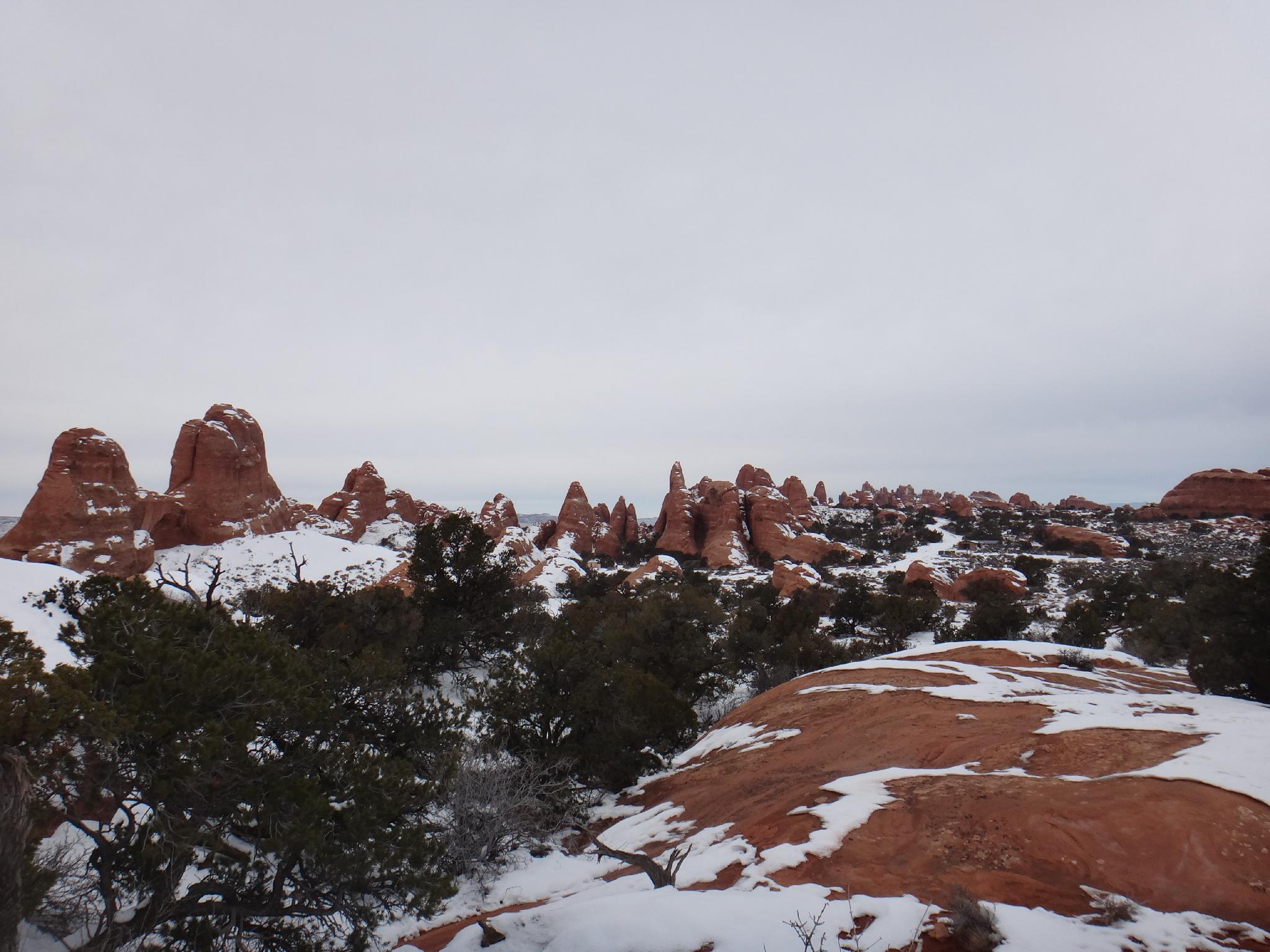
For the more motivated, continuing along and making the loop hike visits Broken Arch, circles through the campground, and returns with great views of close up walls and towers as well as distant views of the La Sal mountains.
Getting There
From the Arches National Park visitor center, follow the Arches Scenic drive 15.9 miles from the visitor center. The trailhead is signed on the right. This is about two miles before the end of the scenic drive and campground, and about a mile before the Skyline Arch trail.
Route Description
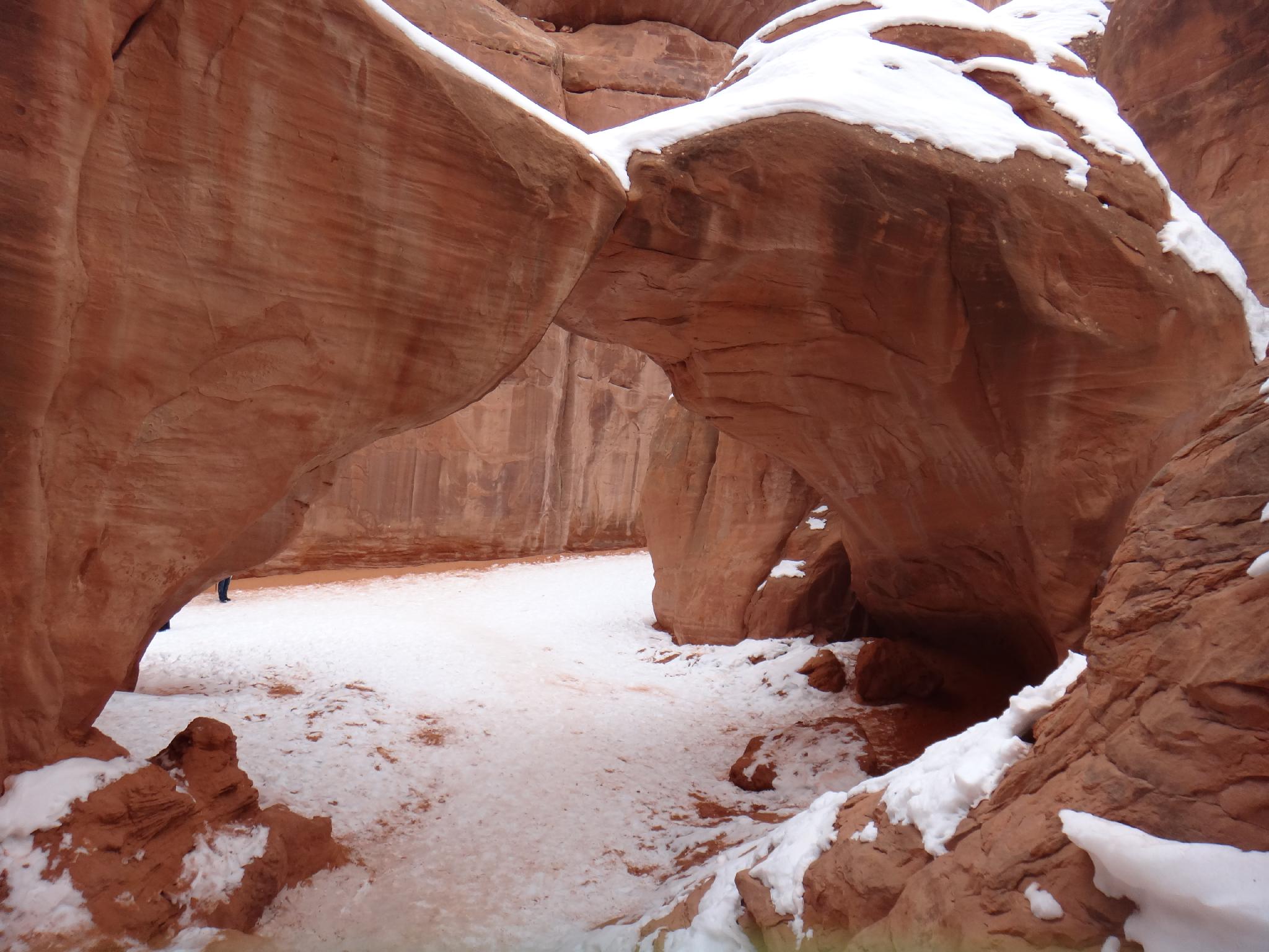
From the trailhead, follow the trail a couple of short minutes to the junction for Sand Dune Arch. This side trail, less than a quarter of a mile round trip, meanders between fins to the impressively hidden Sand Dune Arch. This is a great family destination, particularly on hot days.
Motivated? From the Sand Dune Arch junction, continue along to the loop junction in about 0.3 miles. Going right at the loop junction, Broken Arch comes into view in 5-10 minutes.
From Broken Arch, the trail meanders across open country, then to the Devils Garden Campground. From the campground, go south to the end of the loop road, where the trail picks up again. From the campground, the trail passes near large fins before reaching the Loop Junction again.
Right from the Loop Junction returns to the trailhead.
Maps

12S 623072E 4291624N
38°45'53"N 109°35'00"W
12S 623170E 4291678N
38°45'55"N 109°34'56"W
12S 623293E 4292167N
38°46'11"N 109°34'51"W
12S 623553E 4292389N
38°46'18"N 109°34'40"W
12S 622755E 4292686N
38°46'28"N 109°35'13"W
12S 622831E 4292561N
38°46'24"N 109°35'10"W