 Hiking
Days Fork
Hiking
Days Fork
Big Cottonwood Canyon
Overview
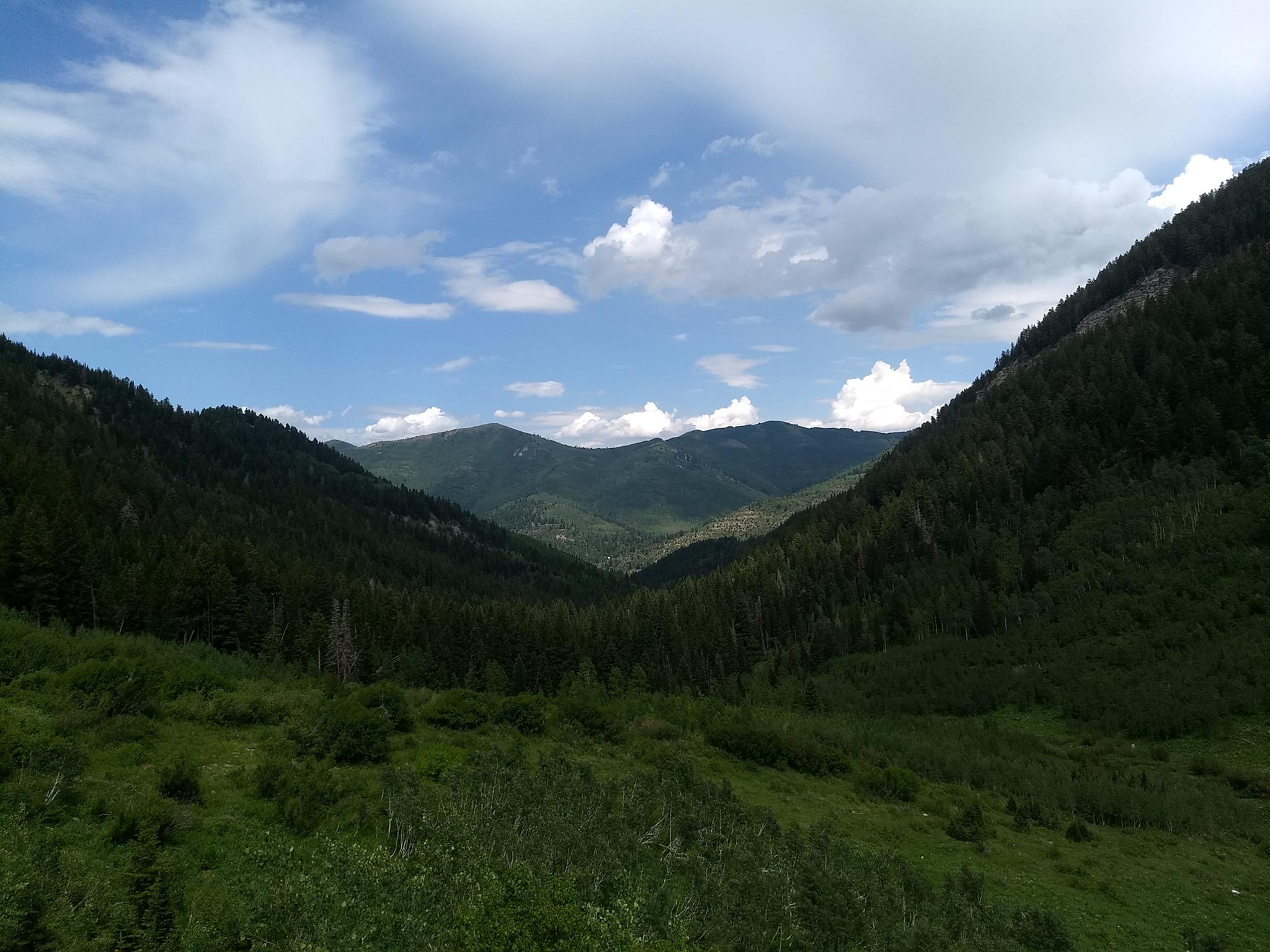
Hiking up Days Fork is a treat! Like many routes in the Wasatch, this one feels steep in parts but is a delightful mix of forested area interspersed with small, lush meadows. In summer, the trail is likely to be lined with a variety of wildflowers. By fall, the wildflowers give way to autumn leaf colors. Most of the hike has only occasional fleeting views of the larger surrounding, until near the Eclipse Mine, where the trees subside into a picturesque bowl.
The Eclipse Mine is the hiking destination for many groups and has some rusted iron workings as a testament to those early mining days. It makes a great lunch spot and turnaround.
For hikers with more energy, it is a reasonably short addition to continue to the ridge overlooking Little Cottonwood Canyon and Alta ski resort. Highly recommend!
Getting There
Big Cottonwood Canyon is on the east side of the Salt Lake City Valley. Get there by taking I-215 to the east, taking exit 6 off the interstate and heading east.
Follow 6200 South which becomes Wasatch Blvd for 1.8 miles to the stop light and signs for Big Cottonwood Canyon.
Turn left at the light and reset your odometer.
Drive up Big Cottonwood Canyon. The trailhead is at 9.7 miles, at the Spruces Campground on the right (south) side of the road.
Route Description
To The Mine (3.6 miles)
From the road, enter Spruces Campground. Take the first right, and follow the one-way paved road to the first large group area. There is a large grassy ballfield area here and some benches. The Days Fork trail leave along the west side of the field and starts as an old jeep road. It is signed, but somewhat easy to miss.
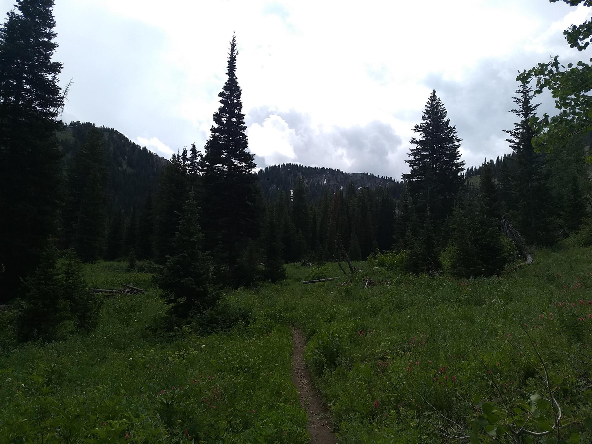
Follow the Days Fork trail. The road passes water systems, then becomes a steep trail as it ascends a narrow chute. At the top of the chute, just after the path levels out and becomes less steep. The side trail to Greens Basin leaves on the left here, stay straight instead. The trail meanders up the bottom of Days Fork with picturesque meadows.
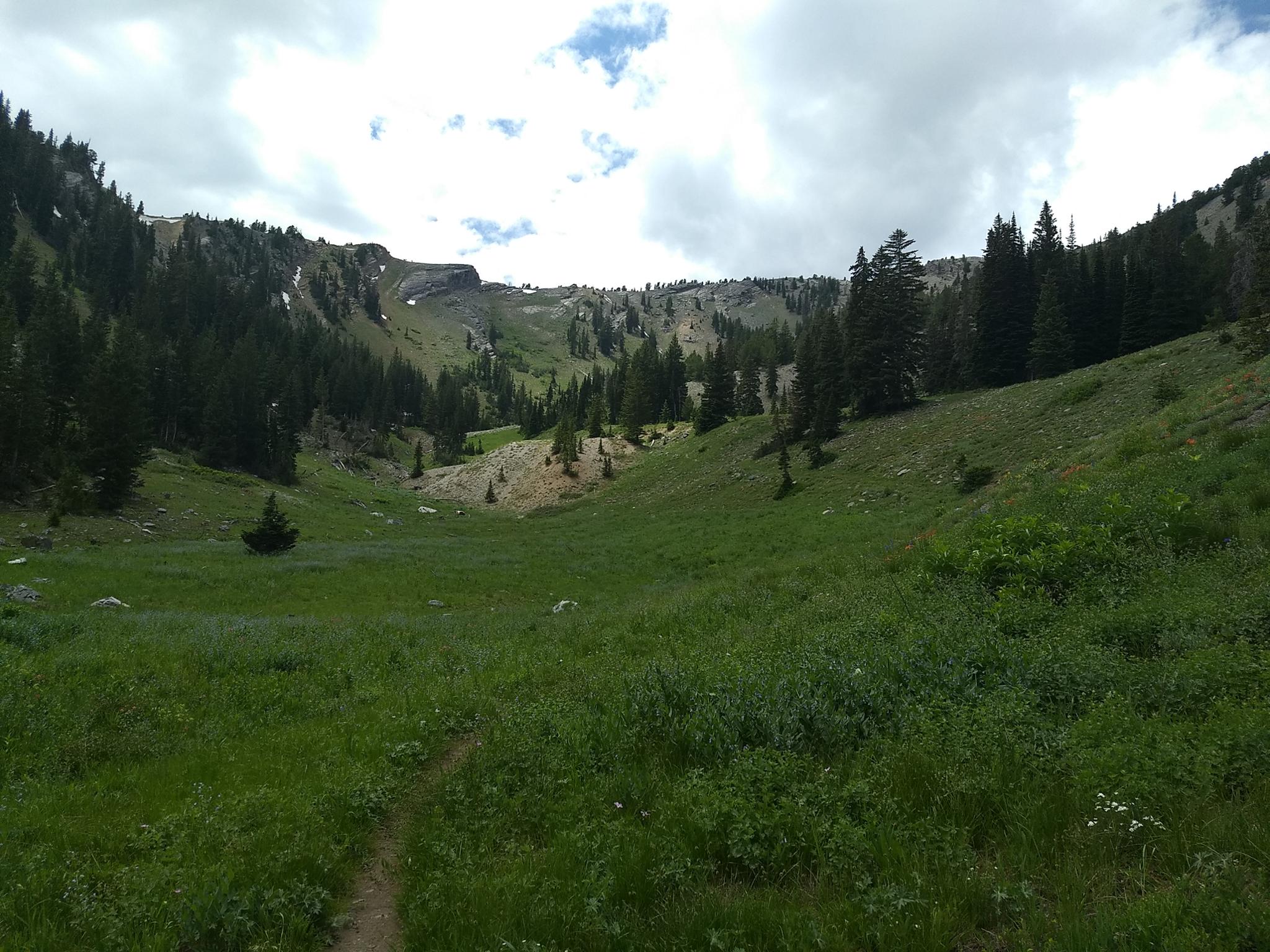
As the trees subside into a large open area, the trail climbs steeply up the west side of the canyon, then re-enters the forest, crosses to the east side of Days Fork, climbs steeply, then passes back to the west side.
This final crossing to the west side occurs as the upper bowl comes into view. Note the trail junction here. If visiting the ridge overlook, this left junction is the path you want. To visit the Eclipse Mine, continue up the right trail a few minutes to the large tailing pile and rusted machinery.
Little Cottonwood Overlook (1 mile from the Eclipse Mine)
From the trail junction at the bottom of the bowl, follow the trail east as it climbs up to a ridge. As it crosses the ridge, a faint trail leaves on the left.
This faint trail descends into the west fork of Silver Fork and can be used to make a loop hike down Silver Fork. The upper part of this trail is faint and hard to follow, but once in the bottom of Silver Fork, the path becomes more distinct. See the Silver Fork write-up for information on Silver Fork.
Continue on the well-used trail as it contours along the hillside to the ridge overlooking Little Cottonwood.
Return the same way.
Photos
Maps

12T 446125E 4499325N
40°38'35"N 111°38'14"W
12T 446181E 4494926N
40°36'12"N 111°38'10"W
12T 445996E 4494824N
40°36'09"N 111°38'18"W
12T 446691E 4494441N
40°35'57"N 111°37'48"W