Skyline Arch | Arches

Hiking Skyline Arch - ArchesRoadside Attraction Skyline Arch - Arches Skyline Arch

Arches

Overview

Fri Sunny, with a high near 68. North northeast wind 10 to 15 mph, with gusts as high as 25 mph.
68° | 40°
Sat Sunny, with a high near 72. South wind around 5 mph.
72° | 41°
Sun Mostly sunny, with a high near 77.
77° | 46°
Mon A chance of rain showers before noon, then a slight chance of showers and thunderstorms. Mostly sunny, with a high near 75.
75° | 52°
Tue A slight chance of rain showers. Mostly sunny, with a high near 69.
69° | 49°
RATING: Easy Hiking
MAPS: MOLLIE HOGANS, UT;
SEASON: Any
WATER: None
Fri Sunny, with a high near 68. North northeast wind 10 to 15 mph, with gusts as high as 25 mph.
68° | 40°
Sat Sunny, with a high near 72. South wind around 5 mph.
72° | 41°
Sun Mostly sunny, with a high near 77.
77° | 46°
Mon A chance of rain showers before noon, then a slight chance of showers and thunderstorms. Mostly sunny, with a high near 75.
75° | 52°
Tue A slight chance of rain showers. Mostly sunny, with a high near 69.
69° | 49°
Skyline Arch from near the trailhead on a winter day.

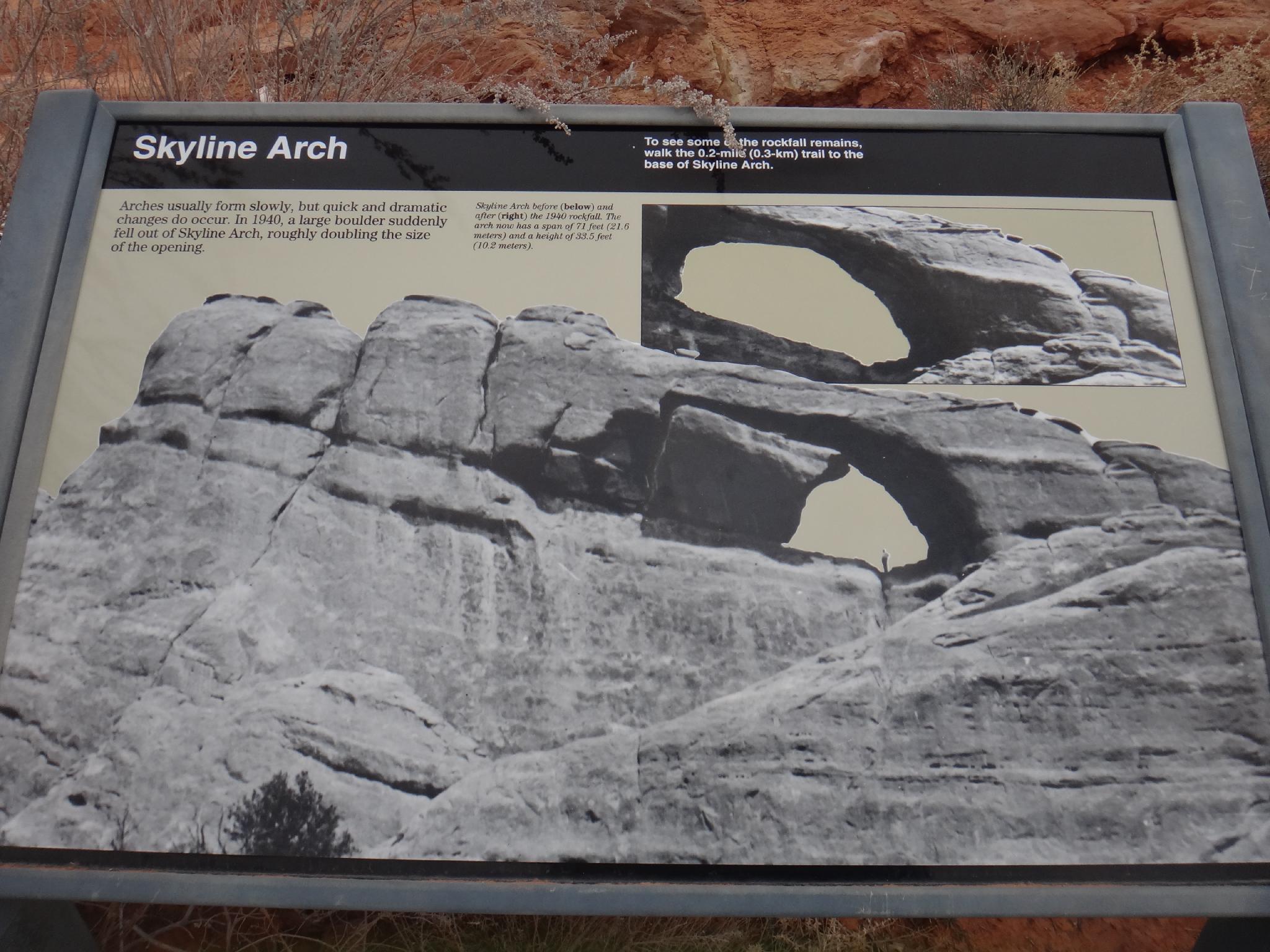
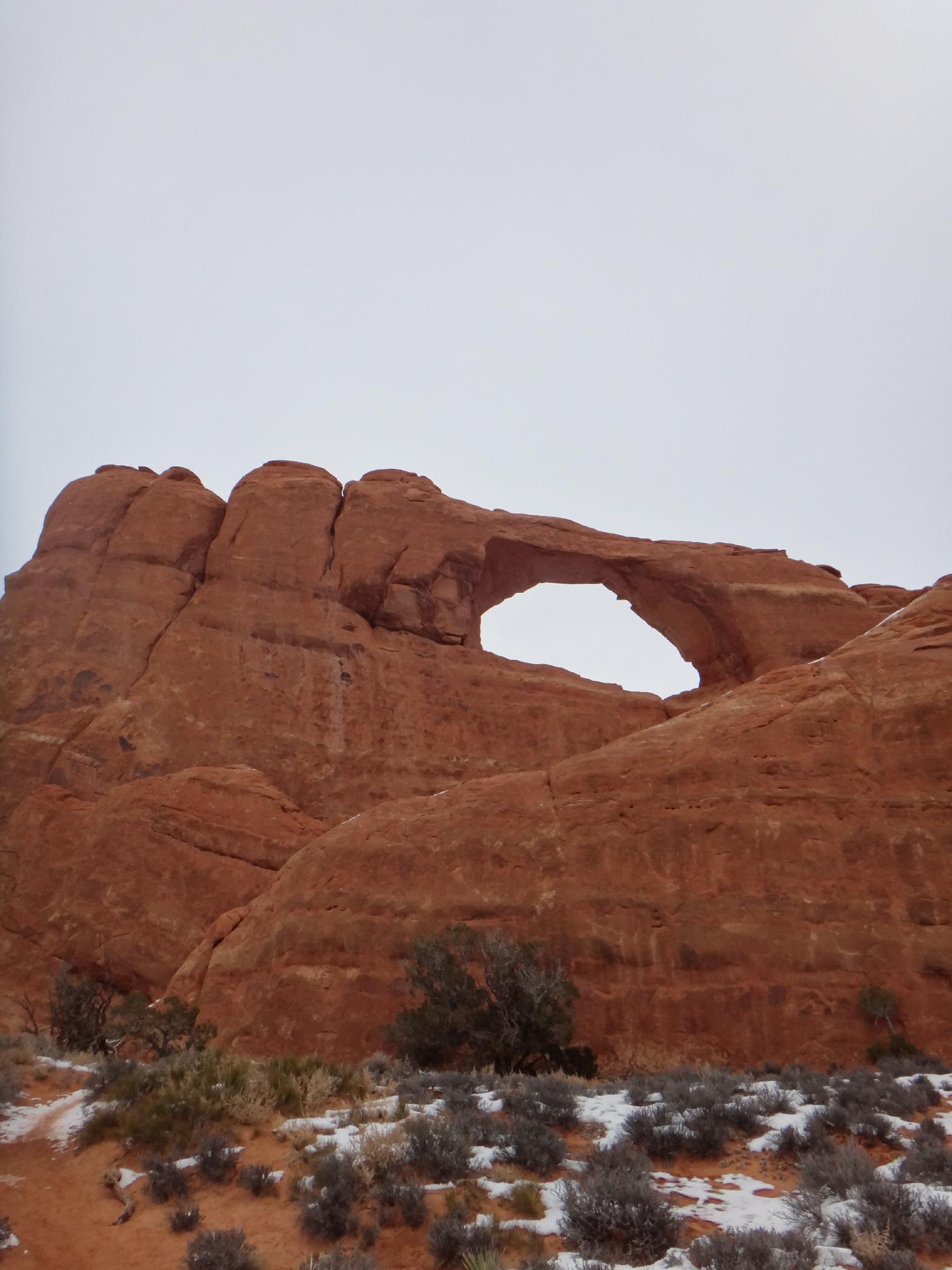
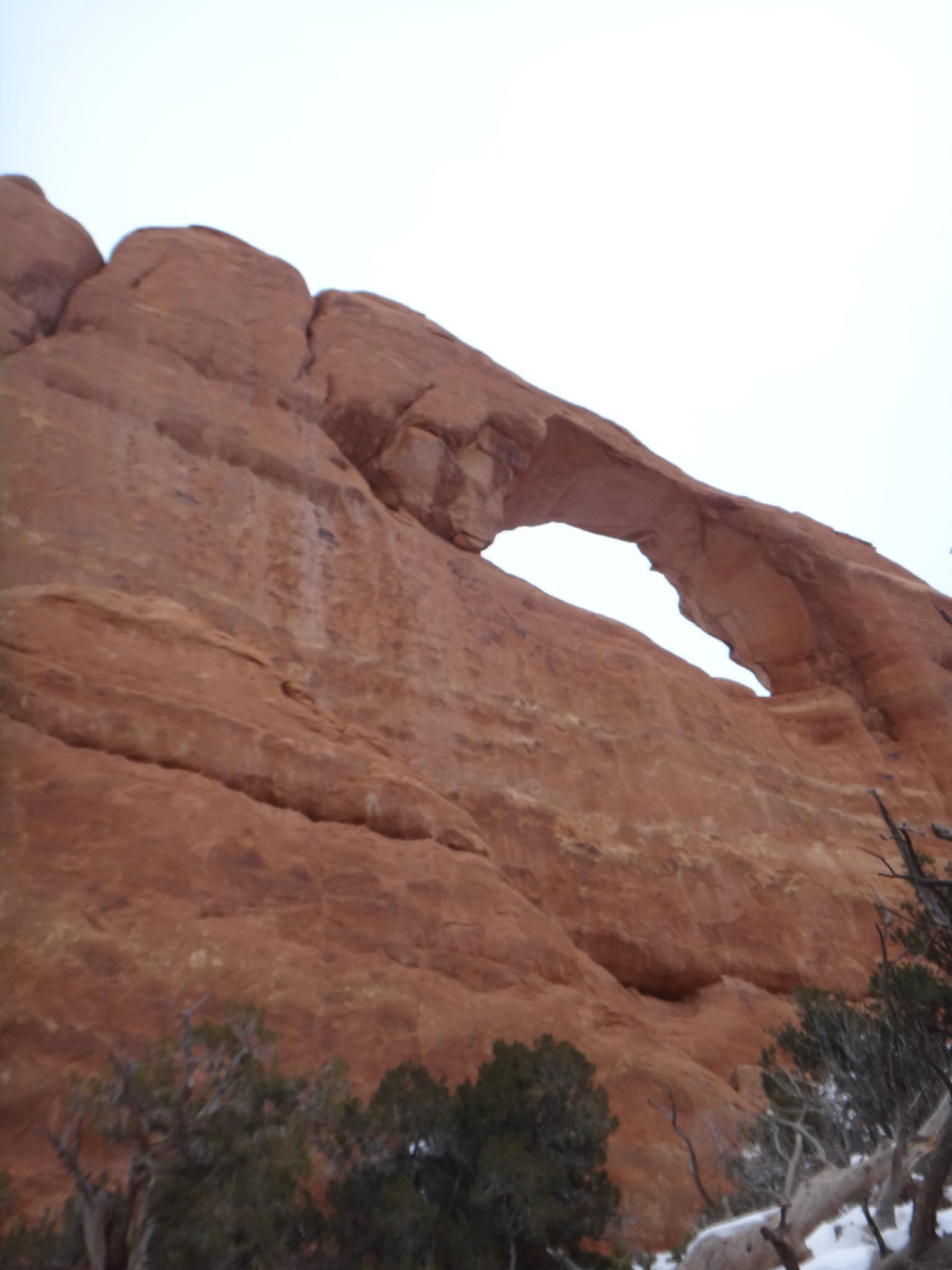
A short leg stretcher, Skyline Arch makes a nice family outing. The arch is a good example of seeing geological events happened fairly recently. Skyline Arch was about 1/2 the size it currently is until rockfall in 1940 doubled the size of the arch. Boulders from the rockfall in 1940 are visible at the bottom of the arch. The collapse must have been quite dramatic.

The current arch size is about 33 feet high by 77 feet across, at least until the next geological event. The freeze-thaw cycle is one of the biggest contributors to rockfall and collapses in Arches, and will eventually be the demise of many arches over a long enough time span.

Skyline Arch informational sign.

Getting There

From the Arches National Park visitor center, follow the Arches Scenic drive 16.7 miles from the visitor center. The trailhead is signed on the right, and the arch visible from the trailhead. This is about a mile before the end of the scenic drive and campground.

Skyline Arch
Skyline Arch
Skyline Arch
Skyline Arch

Route Description

The arch is visible from the trailhead and a short amble. It is possible to scramble up and under the arch directly, but there is a steep cliff on the other side, keep an eye on children!


Photos

Maps

Route / 0.41 miles / Elevation Range 5,176 - 5,219 ft.
Printable Maps:

Trailhead
12S 622407E 4292413N 38°46'19"N 109°35'27"W
Skyline Arch
12S 622435E 4292716N 38°46'29"N 109°35'26"W

Comments