 Canyoneering
Upper Telephone Canyon
Canyoneering
Upper Telephone Canyon
Zion Main Canyon
Overview
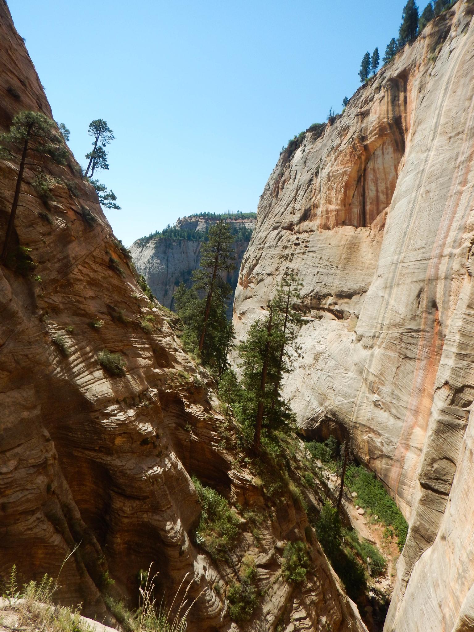
Ah, Upper Telephone is one of the canyons I kept putting off doing. The long-ish approach and short nature had led me to believe it wasn't going to be very good. Turns out it is charming and quite beautiful. This is a short canyon with a lot of rappels situated high up on the West Rim. The name comes from back when the telephone line used to be run through this canyon up to the West Rim.
Doing just Upper Telephone is a charming day and will take most groups a pretty decent chunk of time (6-8 hours). Motivated and fast groups can link Upper Telephone with either Behunin Canyon or Refrigerator Canyon to double the bang for the buck. Of the two I would recommend Behunin as the runner-up since it is a bit prettier and more interesting than Refrigerator.
Getting There
The trailhead is the Grotto Shuttle stop in the main Zion canyon. During summer months, the Zion shuttle is the only way to access the trailhead.
Route Description
Approach (2-3 hours)
How is your cardio? This approach will let you find out.
From the trailhead cross the bridge over the Virgin River, and turn right toward the signed Scout Lookout/Angels Landing. The trail begins climbing and makes a few switchbacks before entering Refrigerator Canyon. The cool shade of Refrigerator Canyon is a great respite from the heat in the summer.
A few minute up Refrigerator Canyon, the trail begins climbing again up the right side, soon entering Walter's Wiggles. The Wiggles are a unique section of 21 switchbacks. Zig-Zag up them, reaching Scout Lookout. There is a toilet available at Scout Lookout, but no water.
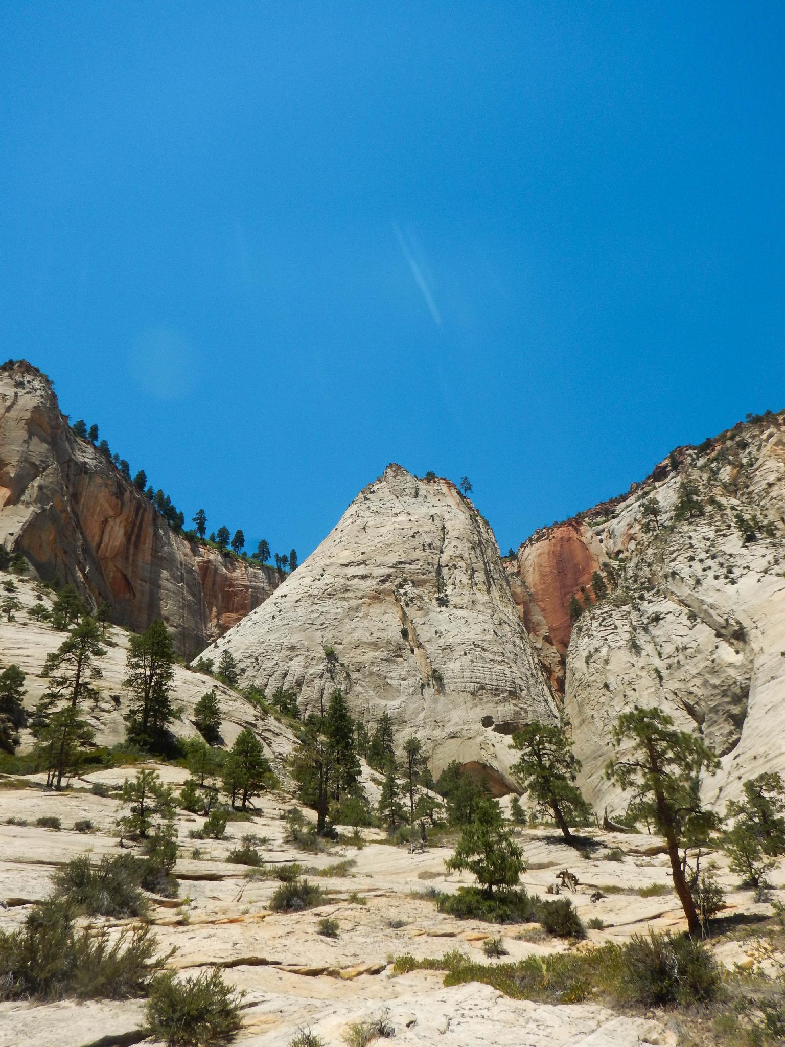
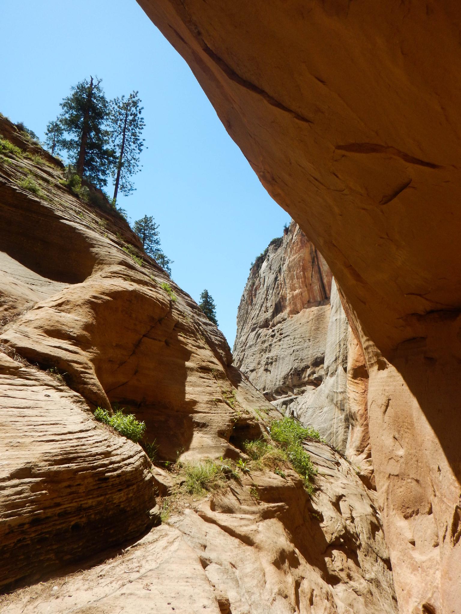
Continue left on the West Rim trail. It climbs a bit more, passes the head of Refrigerator Canyon, then descends a bit and contours around Mount Majestic before it starts climbing again. Telephone Canyon is visible on the right here. Follow the West Rim trail as it makes a steep ascent up the slickrock slope to a trail junction on top.
Take the signed Telephone Canyon trail on the right. After a few minutes, Telephone Canyon is visible on your right as a shallow canyon. Work down through the scrub oak on game and social trails to the canyon bottom, then down the canyon to the first rappel where the canyon drops quickly.
Canyon
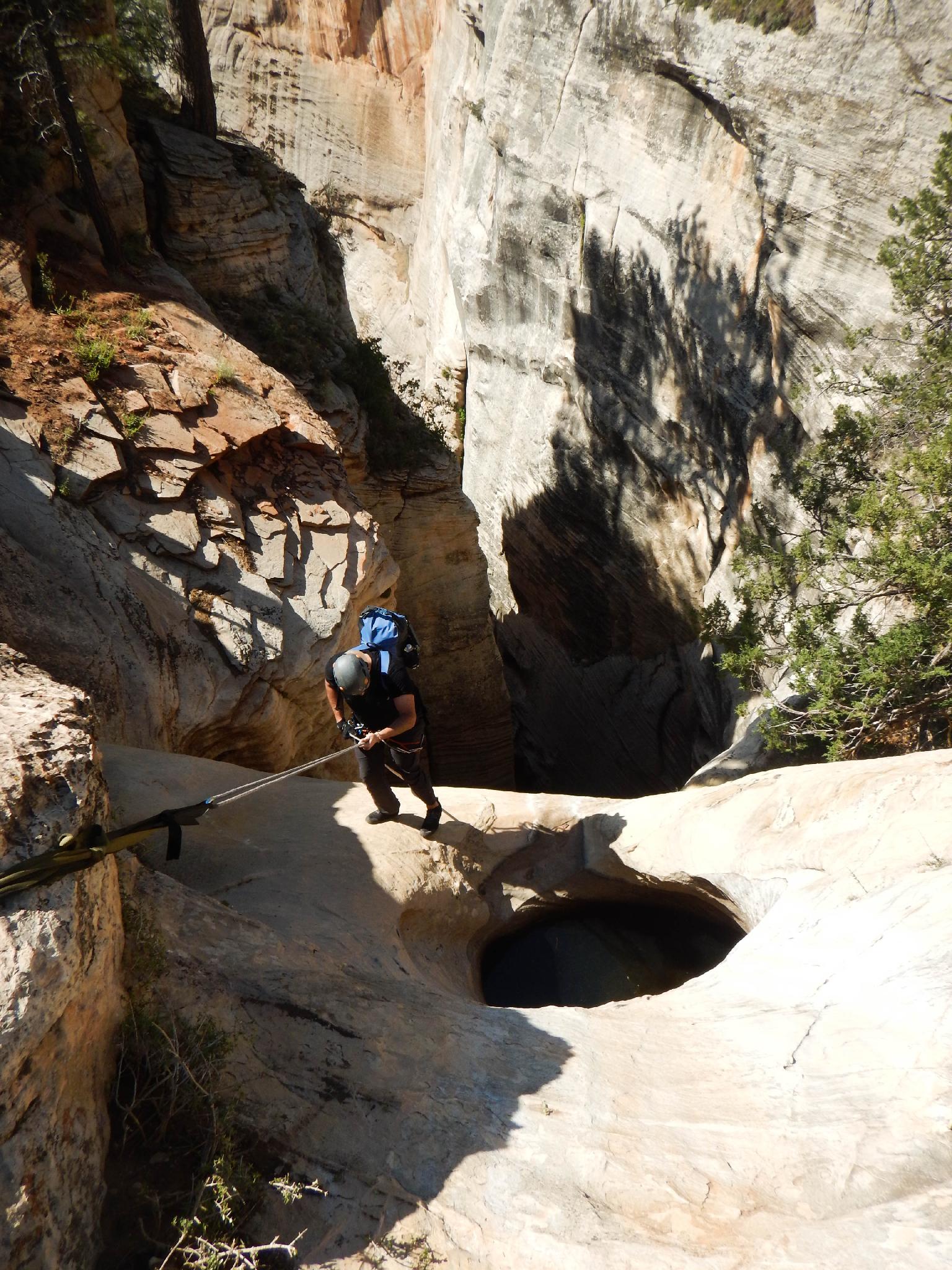
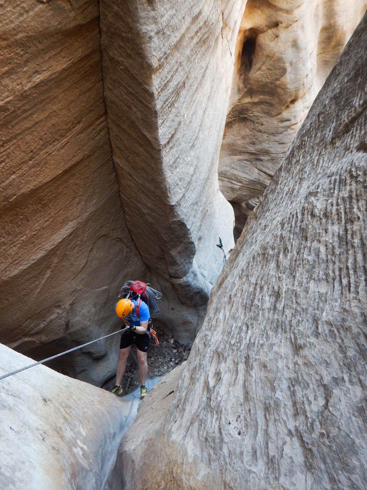
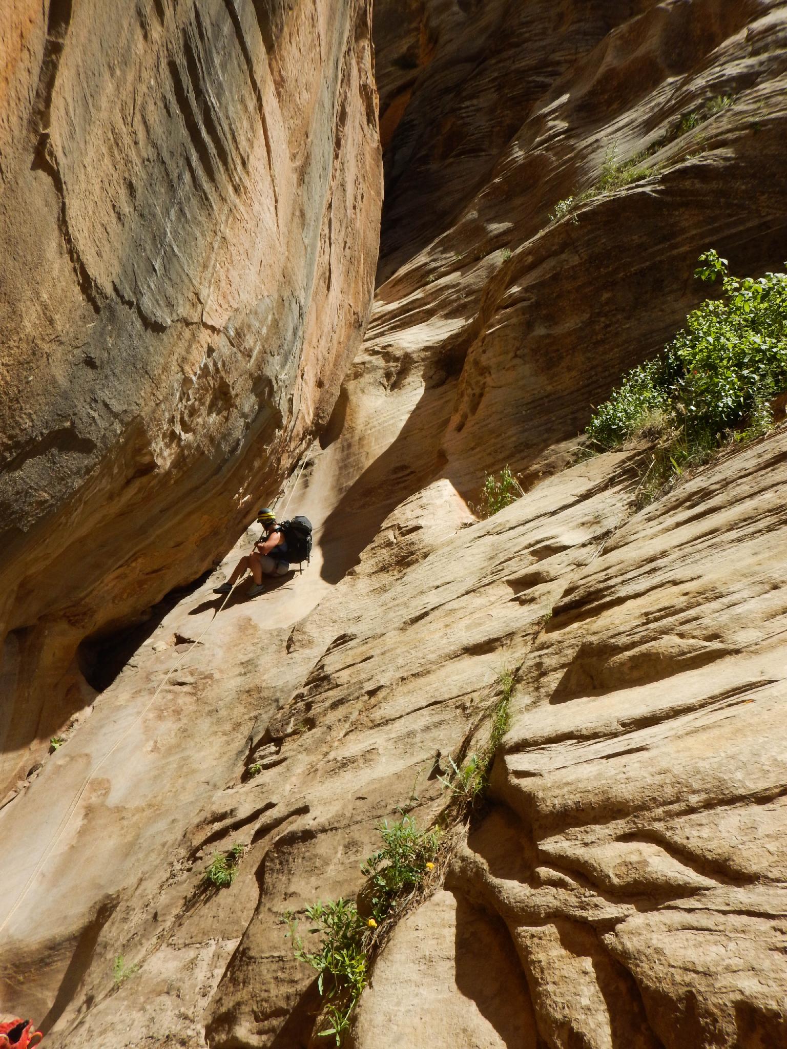
R1 - 46 m ( 151 ft. ) - The big one of the day. All others come in rapid succession.
R2 - 10 m ( 33 ft. )
R3 - 14 m ( 46 ft. )
R4 - 30 m ( 99 ft. ) - This is a low angle drop over a couple of shorter drops.
R5 - 25 m ( 83 ft. ) - Another low angle slot rappel.
R6 - 30 m ( 99 ft. ) - Big views at this rappel anchor as the canyon opens! Rappel down a vertical wall about 20 m ( 66 ft. ), then an additional 10 m ( 33 ft. ) down a low angle slab.
R7 - 10 m ( 33 ft. )
R8 - 4 m ( 14 ft. ) or downclimb
R9 - 4 m ( 14 ft. )
R10 - 12 m ( 40 ft. ) - two stage.
R11 - 8 m ( 27 ft. )
R12 - 7 m ( 23 ft. )
R13 - 7 m ( 23 ft. )
R14 - 6 m ( 20 ft. )
R15 - 6 m ( 20 ft. )
R16 - 20 m ( 66 ft. ) - Phew! The final rappel is down over two stages from the top of an old landslide. From here the canyon opens.
Exit
Continue down the canyon. A few small drops are easily bypassed on the left or right. If you keep an eye out, the West Rim trail is easy to spot when near the base of Mount Majestic. Once close, follow a social trail up to the West Rim trail and return via the West Rim trail.
Photos
Maps

12S 326999E 4125431N
37°15'34"N 112°57'03"W
12S 327056E 4127157N
37°16'30"N 112°57'02"W
12S 325502E 4128496N
37°17'12"N 112°58'07"W
12S 325414E 4129125N
37°17'33"N 112°58'11"W
12S 325550E 4129214N
37°17'36"N 112°58'05"W
12S 325517E 4128569N
37°17'15"N 112°58'06"W