
 Burr Point Trail
Dirty Devil
Overview
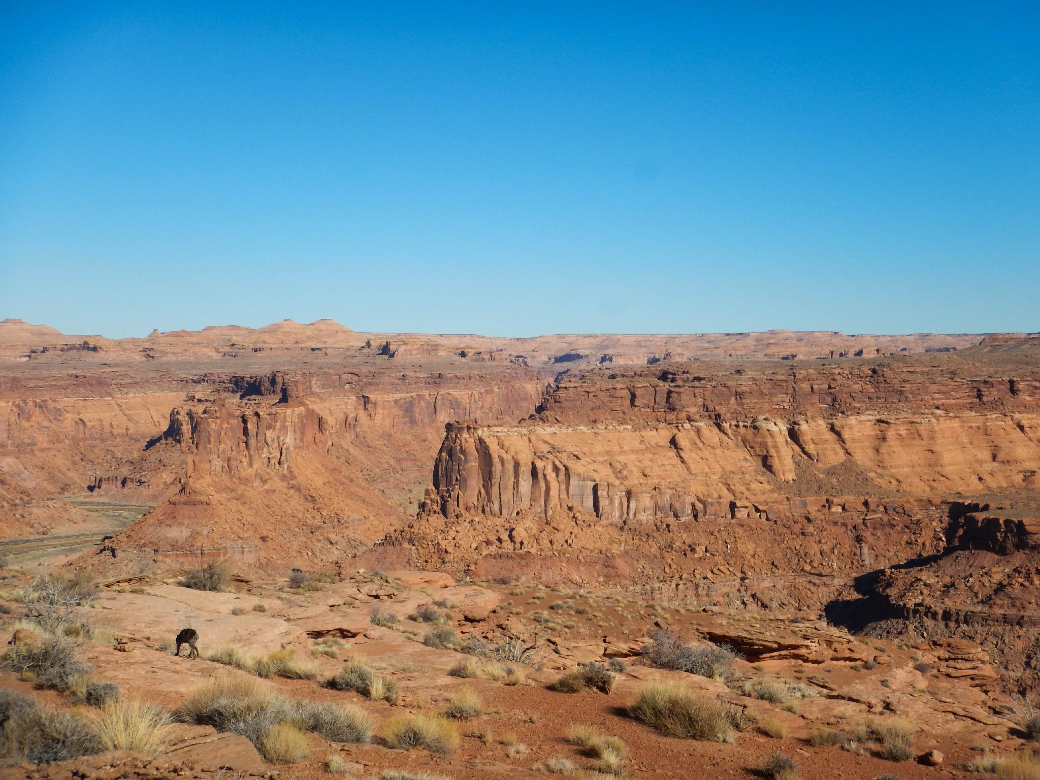
There are some hikes to do in order to take in the views. This is a hike to do to become part of the views and absorbed into the landscape. The trail from Burr Point down to the Dirty Devil is everything a good hike should be in my mind; dramatic, improbable, and elegant.
The hike starts with big views of where you are headed, then takes a devilishly elegant route down into the canyon using slickrock and improbable ledges with tremendous exposure to the inner canyon below tower walls, yet still high above the canyon floor. It is a magnificent outing for intermediate desert hikers that are comfortable with a bit of route finding and exposure. Both Diane and I felt like this was one of the most dramatic hikes in the area.
Those not motivated to hike can enjoy Burr Point as a roadside attraction with its big views into Robbers Roost across the Dirty Devil. If it is not windy, this is an excellent primitive camping spot. Can be very windy, however.
Also note, we stopped shy of the river. Our stopping point is marked on the map as viewpoint, however, the trail does meander around one more corner and descends to the river. To the river and back in a day would be a pretty full outing. If using this as an entry point for backpacking in Robbers Roost, a short 10 m rope may be prudent for lowering the packs at the one class 4 section.

Getting There
From Hanksville, head south on Highway 95 towards Hite for 15 miles to mile marker 15.5. Turn east on the well graded and signed road to Burr Point and reset your odometer.
Route Description
From the drill hole, hike over to the rim and take in the sights. To the north (up river) is a Great Alcove, then a flat mesa area halfway between the rim and the river. The hike reaches that mesa area after passing under the Great Alcove.
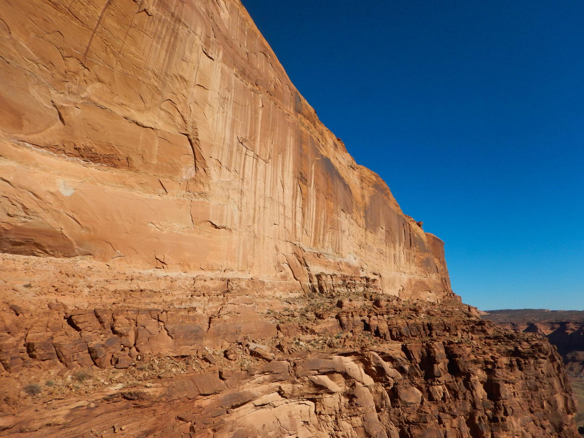
To the east, across the river, are two towers. Start by descending from the rim following cairns, crossing a shallow drainage, and heading for a pass between two small Navajo domes. The dome on the left has broken rocks on top of it, pass to the right of that dome. At this point, cairns coalesce and you should find a cairned path heading down the other side of the domes and to the left (upriver). This path angles down to a saddle with a small tower where the Navajo layer ends.
The saddle marks the crux of the route. Downclimb the north side of this saddle carefully using the ledge wall (class 4). This ends on a ledge that is traversed to the left, then down to a dirt use trail.
Once on the dirt use trail, the navigation difficulties are over, as the trail is well beaten in and easy to follow. It meanders around, past several towers, then begins counting in and out of small side canyons on the way to the Great Alcove. The views in this section are jaw dropping.
From a distance, the Great Alcove traverse looks improbable and downright scary. Once there, however, the ledge is relatively wide and it is easy to pass. The trail climbs up ledges after the traverse and flattens out on easier terrain. Continuing to the peninsula in the distance makes a great return spot and offers big views upstream in the Dirty Devils and of Sams Mesa Box and Twin Corral Box canyons coming in from the east side of the river.
Return the same way.
Photos
Maps

12S 547106E 4225045N
38°10'20"N 110°27'44"W
12S 547785E 4225334N
38°10'29"N 110°27'16"W
12S 547936E 4227226N
38°11'30"N 110°27'09"W