 Hiking
Wasatch Crest
Hiking
Wasatch Crest
Big Cottonwood Canyon
Overview
Wow! If you are a mountain biker or trail runner, the Wasatch Crest is a must-do! This stunning trail traverses the ridge separating Big Cottonwood Canyon from Park City, then continues above Millcreek Canyon before dropping to either the upper trailhead in Millcreek Canyon or Park City. It is an excellent outing with ever-changing views.
A few notes:
- The trail is high elevation and often has at least some snow patches into the summer. Summer and fall are the recommended times to visit.
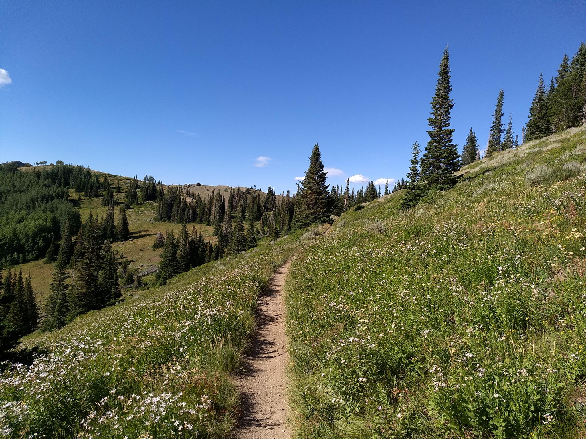
- Summer finds the trail covered in wildflowers, fall awash in fall colors.
- If biking the crest, bikes are NOT allowed on the upper Millcreek Canyons trails on odd-numbered days. You cannot bike down the Millcreek side if the date is odd. Park City is an alternative. On even days, Park City or Millcreek are options.
- The trail is popular with bicyclists and runners/hikers alike. Be courteous to fellow users.
- If hiking the trail, I thought the most stunning section was from Guardsman to Desolation Lake. Going down Desolation Trail to Big Cottonwood would make for a great and shorter outing than the full trail. If backpacking, Desolation Lake is likely the only place to camp with reliable water.
- The trailhead at the top of Guardsman Pass is now a drop-off only area. If you are leaving a car, you can park at the Blood Lake Trailhead about 3/4 mile east of the pass. Most will want a shuttle for the hike anyway, making the drop-off point a good option.
- If a biker, there are shuttle companies for the Wasatch Crest, including Big Rack Shuttle ( https://bigrackshuttle.com/wasatch-crest-bike-shuttle/ ) and Fox N Rocks ( https://foxnroxshuttle.com/ ). If you are a runner or hiker, descending to Park City and taking an Uber/Lyft works well.
Getting There
Guardsman Pass (Start)
From Salt Lake City, go up Big Cottonwood canyon. (Signed Brighton Ski Area, exit 6 off of I-215 on the east side of Salt Lake).
Just before Brighton, the signed Guardsman Pass road goes off on the left (north side). It is a paved 2 lane road, but comes in quickly and can be easy to miss. If you end up at Brighton, just backtrack a short distance. Follow the Gaurdsman Pass road. At about 2.2 miles is a sharp curve with a dirt road leaving the pavement. This is the Great Western Trail start. If starting from Guardsman proper, continue on to the top of the pass about 0.8 miles past the Great Western Trail start.
Millcreek Exit
Millcreek Canyon is on the east side of the Salt Lake Valley, just south of I-80 and Parleys Canyon. To get there, take I-215 South from I-80 and take exit 4 off of I-215 and go left (east) on 3900 South.
Turn left on Wasatch Blvd just after crossing under the highway, then the next right on Millcreek Canyon Road.
0.7 miles from the junction of Wasatch Blvd and Millcreek Canyon Road is the entrance to Millcreek Canyon and the pay booth.
Mileage below is from the pay booth.
- 0.7 miles - Pipeline Trailhead on the left (north).
- 2.4 miles - Church Fork Trailhead on the left (north).
- 2.5 miles - Desolation on the right (south).
- 3.4 miles - Porter Fork on the right (south).
- 3.5 miles - Burch Hollow Trailhead (north).
- 3.7 miles - Terraces Picnic Area / Trailhead (south).
- 3.8 miles - Winter Gate Closure
- 5.4 miles - Elbow Fork Trailhead (Mount Aire)
- 6.9 miles - Alexander Basin Trailhead
- 8.3 miles - Lower Big Water
- 8.4 miles - End of the road and Big/Little Water Trailhead. This is the trailhead for Murdock Peak.
Park City Exit
If exiting to Park City, park at Canyons Village/Park City Mountain resort. This is north of Park City proper on UT-224. Turn west on Canyons Resort Drive. At the first round-a-bout, there is a large parking area that works well as the endpoint. There is no overnight parking at this lot.
Route Description
Guardsman Start to Puke Hill (1.4 miles)
From the parking area, cross the road and immediately go left on a signed single track for Scott's Bypass. This lovely section of trail lazily meanders down and around Scott's Hill before reaching a 4-way junction at the base of Puke Hill that is the road going uphill.
Great Western Trail Start to Puke Hill (0.7 miles)
Follow the road, passing through a gate quickly. Stay on the relatively steep road as it climbs to a 4-way junction at a saddle. The Guardsman Start joins here from the left. Go left here, up the road and Puke Hill.
Puke Hill To Desolation Lake (4.9 miles)
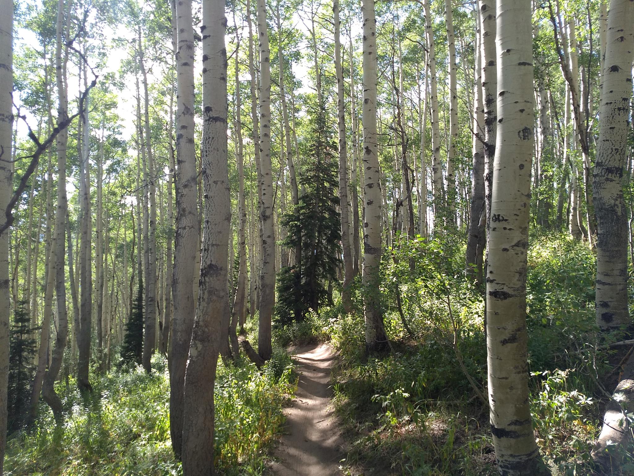
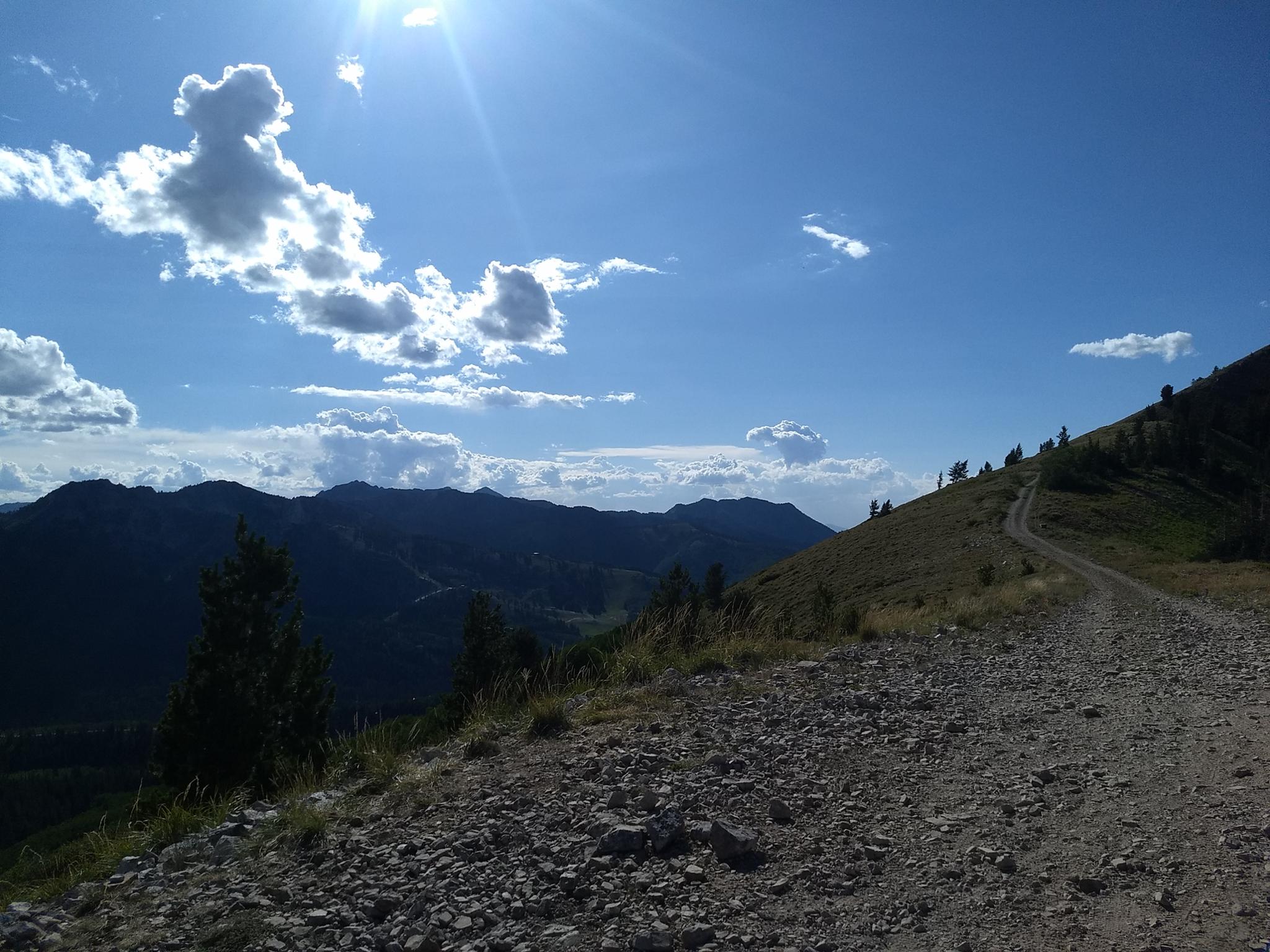
Bikers are likely to end up walking parts of Puke Hill. It is the biggest obstacle to reaching the ridge. One reaching the ridge, stay left. The roods soon give way to single track and enters National Forest land.
A little elevation gain is required to reach the top of Beartrap, where views of Desolation Lake come into view. The trail continues along the ridge and descends the rocky "spine" before reaching the trail junction to Desolation Lake. No shame in walking your bike down the spine if needed!
Desolation To Millcreek (2.4 miles)
From the Desolation Lake Junction, stay right. The trail climbs a bit again to reach the ridge above Millcreek Canyon. Stay straight and right at the two minor trail junctions along the way. The trail on the Millcreek ridge is smooth and a fast run/bike. A few small side trails go to overlooks into the Park City Valley.
Continue to a well-defined 4-way junction. The junction provides alternatives to descend to Millcreek Canyon or Park City.
Millcreek Exit (3.1 or 4.4)
Go left! The trail descends about a mile a junction. Either route will get you down to the Big Water Trailhead. Going left here is a bit over a mile longer than right, but more scenic in my opinion. Head downhill at all junctions, the trail is well signed.
Park City Exit (6.2 miles)
The trail system heading down to Park City is well marked, but a maze of different options. My route down:
- From the ridge, head down to the first trail junction. Go left on the Mid Mountain Connector trail. It lazily meanders downhill.
- At the junction with the Ridge Trail, go left on the now Mid Mountain Trail.
- The Mid Mountain Trail traverses and reaches the Ambush Connector. Take Ambush as it drops more steeply down. It joins Holly's Trail, stay left on Holly's.
- A side trail drops from Holly's to the dirt road in the bottom of the canyon. Follow this down to Park City Mountain Resort, or stay on Holly's for a bit longer descent to the resort.
Photos
Maps
")
")
")
")
")
12T 453049E 4495246N
40°36'24"N 111°33'18"W
12T 451701E 4496047N
40°36'50"N 111°34'15"W
12T 452756E 4496334N
40°36'59"N 111°33'31"W
12T 452923E 4495820N
40°36'43"N 111°33'23"W
12T 452456E 4496873N
40°37'17"N 111°33'44"W
12T 451844E 4497714N
40°37'44"N 111°34'10"W
12T 449283E 4501431N
40°39'44"N 111°35'60"W
12T 448855E 4501855N
40°39'58"N 111°36'18"W
12T 448862E 4502016N
40°40'03"N 111°36'18"W
12T 449180E 4504175N
40°41'13"N 111°36'05"W
12T 453720E 4504166N
40°41'14"N 111°32'52"W
12T 448010E 4503866N
40°41'03"N 111°36'55"W
12T 445336E 4503943N
40°41'04"N 111°38'49"W