 Roadside Attraction
Whitney Pocket
Roadside Attraction
Whitney Pocket
Gold Butte National Monument
Overview
Whitney Pocket is likely most people's introduction to Gold Butte National Monument. The sandstone outcropping is on the north end of the monument, and the one of the first places the main road passes by after leaving I-15 about 25 bumpy miles to the north.
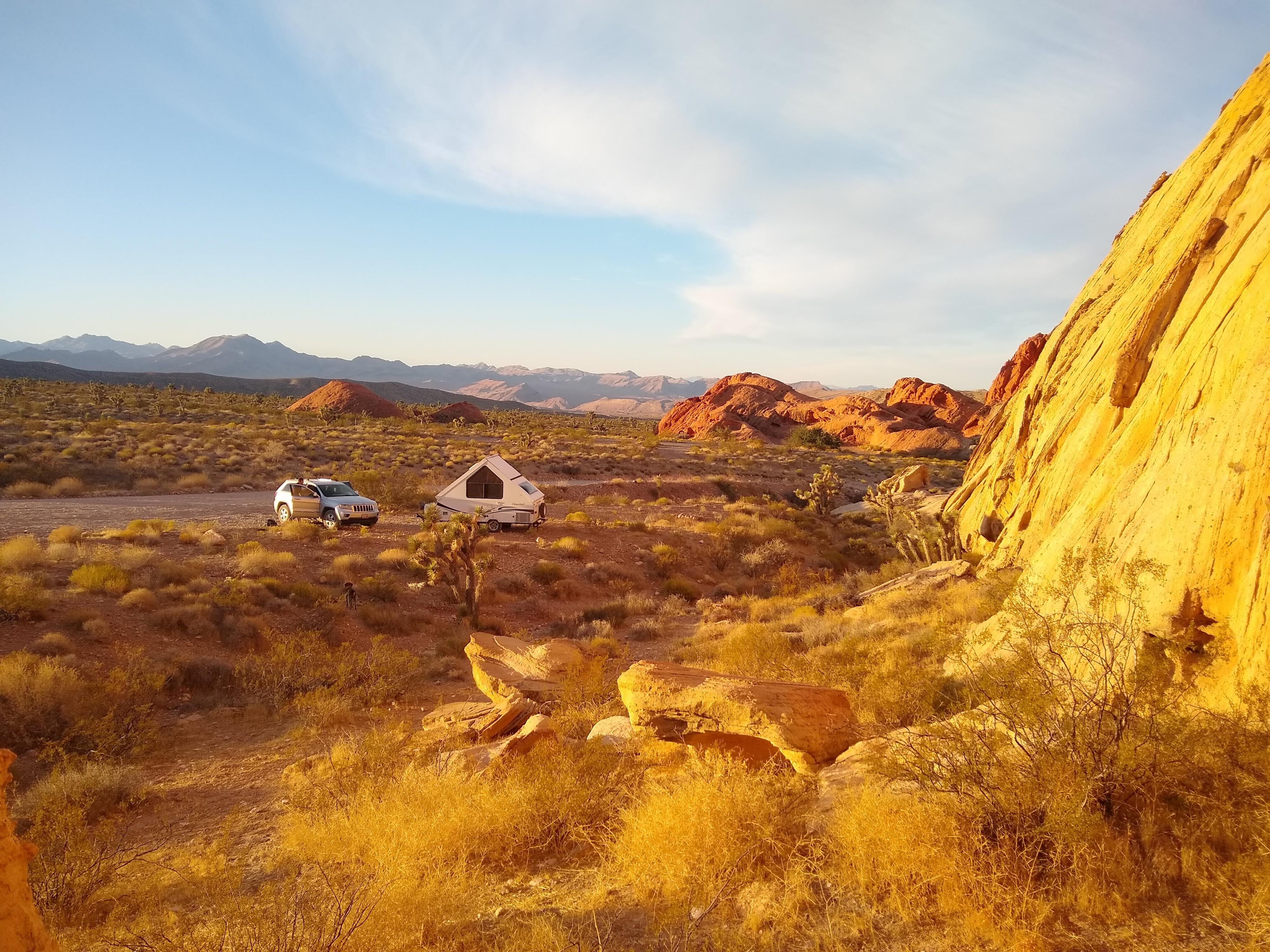
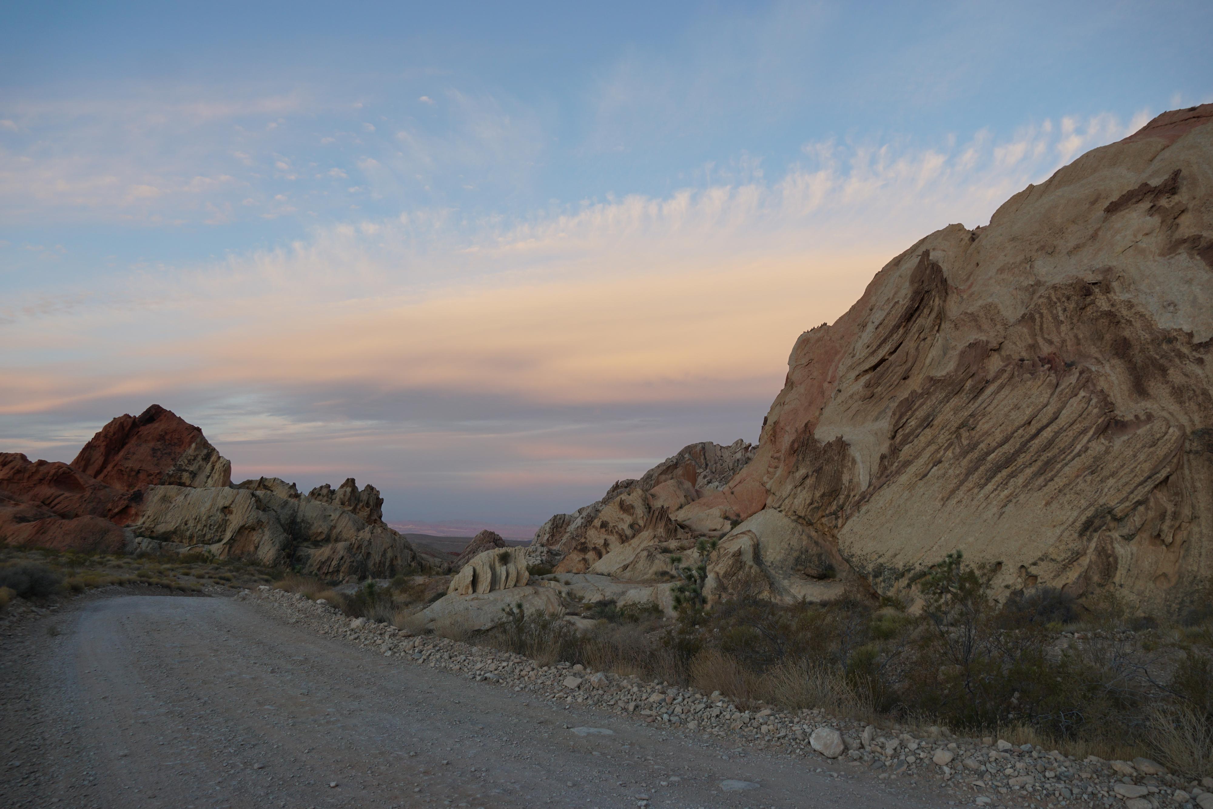
The area, with its white, red, and orange sandstone stands out in stark contrast to the Joshua Tree covered craggy grey peaks that surround it. It is a popular jumping off point for campers, ATV, and off-road enthusiasts. The road to Whitney Pocket is a bumpy mix of old pavement and a bit of gravel. All vehicles can make it to Whitney Pocket. Beyond the pocket, however, roads turn to rough and rocky dirt. If planning on continuing into the monument, high clearance required, 4x4 high clearance highly recommended.
George “Luke” Whitney came to the Gold Butte area in 1910. He and his family purchased and developed the Aravada Ranch east of Whitney Pockets. The Whitney's spent summers at the ranch, and soon began hosting guests. The ranch became an oasis and is still open today as a camping destination. Whitney Pocket is named for Luke.
In the 1930’s, the depression brought about the Civilian Conservation Corp (CCC). The CCC came to Whitney Pocket to establish a camp and build a cistern as well as other improvement projects in the Gold Butte area. It is their mark on the pocket that is most prominent today. The cistern they built is still in place, an immense block and concrete structure complete with stairs to climb up and down both sides. They also walled off several alcoves for storage, with some of the walls still in place.

Getting There
Reaching Gold Butte starts by taking exit 112 off Interstate 15. This is about 70 miles east of Las Vegas, or 10 miles west of Mesquite Nevada. From exit 112, head south for 3.1 miles on NV-170 toward Riverside. Just after the road crosses the Virgin River, turn right onto Gold Butte Road.
Route Description
Rock art and historic sites are fragile, non-renewable cultural resources that, once damaged, can never be replaced. To ensure they are protected, please:
- Avoid Touching the Petroglyphs: Look and observe, BUT DO NOT TOUCH!
- Stay on the Trails: Stay on the most used trails when visiting sites, and don't create new trails or trample vegetation.
- Photography and Sketching is Allowed: Do not introduce any foreign substance to enhance the carved and pecked images for photographic or drawing purposes. Altering, defacing, or damaging the petroglyphs is against the law -- even if the damage is unintentional.
- Pets: Keep pets on a leash and clean up after them.
- Artifacts: If you happen to come across sherds (broken pottery) or lithics (flakes of stone tools), leave them where you see them. Once they are moved or removed, a piece of the past is forever lost.
When first reaching Whitney Pocket, there is a couple of large parking areas on the right. These can provide good campsites. The road gets rougher from here. If in a very low clearance vehicle, parking at this first stopping point and walking the roads is a good option.
From the major junction on the south side of Whitney Pocket, go left. 0.3 miles from the junction there is a pullout on the left before the road climbs a small wash. This is the parking for the cistern, which is clearly visible to the north from the parking area. It is fascinating and just a couple of minute hike.
The first road on the right just past the cistern pullout visits the old CCC camp area and has a walled in alcove ruin from the camp.
0.4 miles from the main junction is a major camping area with several sites and a porta-a-potty on the left. This is an excellent campsite location. There is a good petroglyph panel just north of the campground on the eastern rock formation.
0.75 miles from the main junction is a final outcropping on the left (north) side of the road. There is a good camping spot here as well.
Photos
Maps

11S 756034E 4045904N
36°31'27"N 114°08'26"W
11S 756076E 4045808N
36°31'24"N 114°08'24"W
11S 756484E 4045819N
36°31'24"N 114°08'08"W
11S 756490E 4045733N
36°31'21"N 114°08'08"W
11S 756719E 4045913N
36°31'27"N 114°07'58"W
11S 757210E 4045918N
36°31'27"N 114°07'39"W
11S 756697E 4045999N
36°31'30"N 114°07'59"W