 Roadside Attraction
Wedge Overlook
Roadside Attraction
Wedge Overlook
Northern Swell
Overview
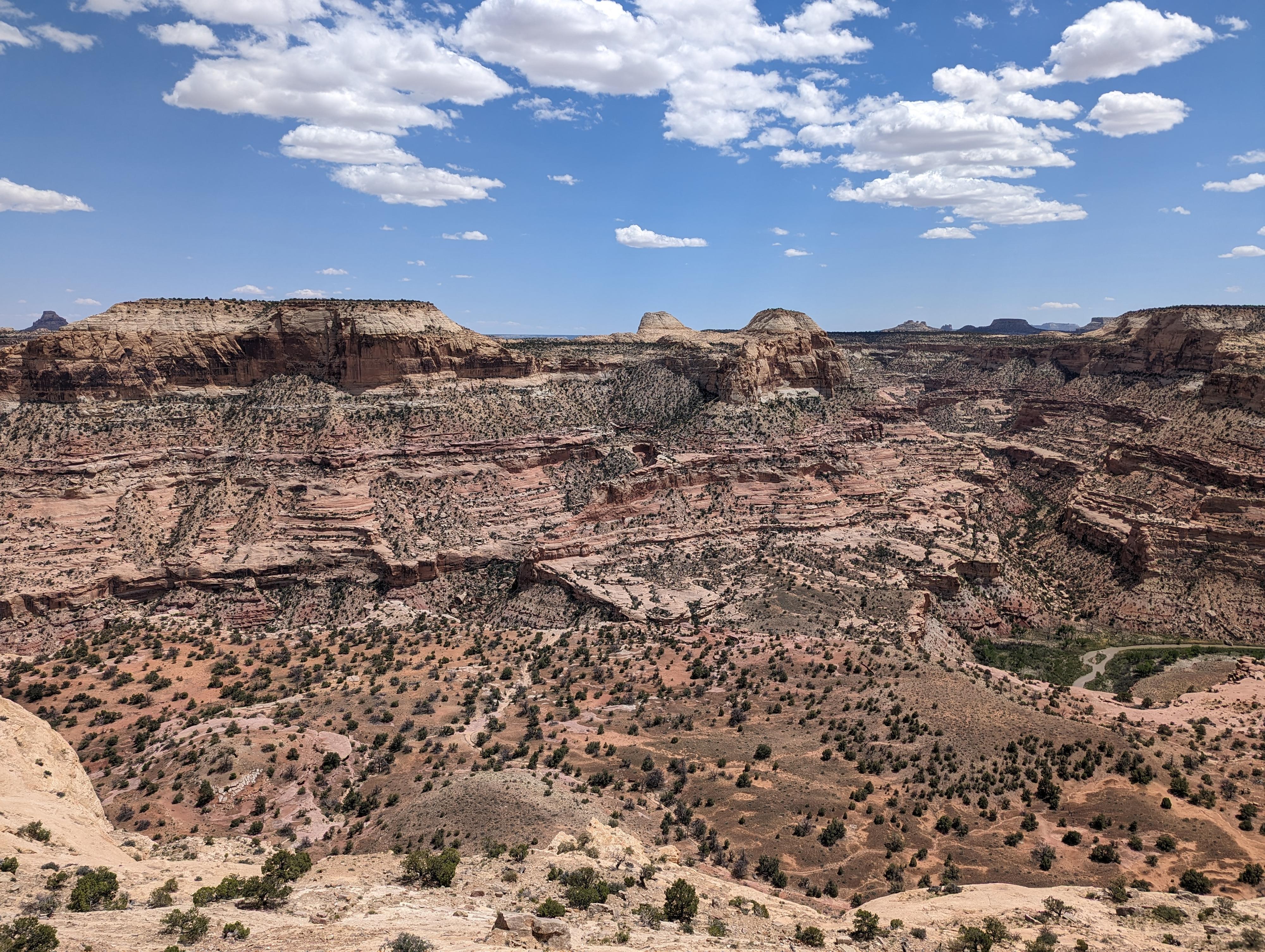
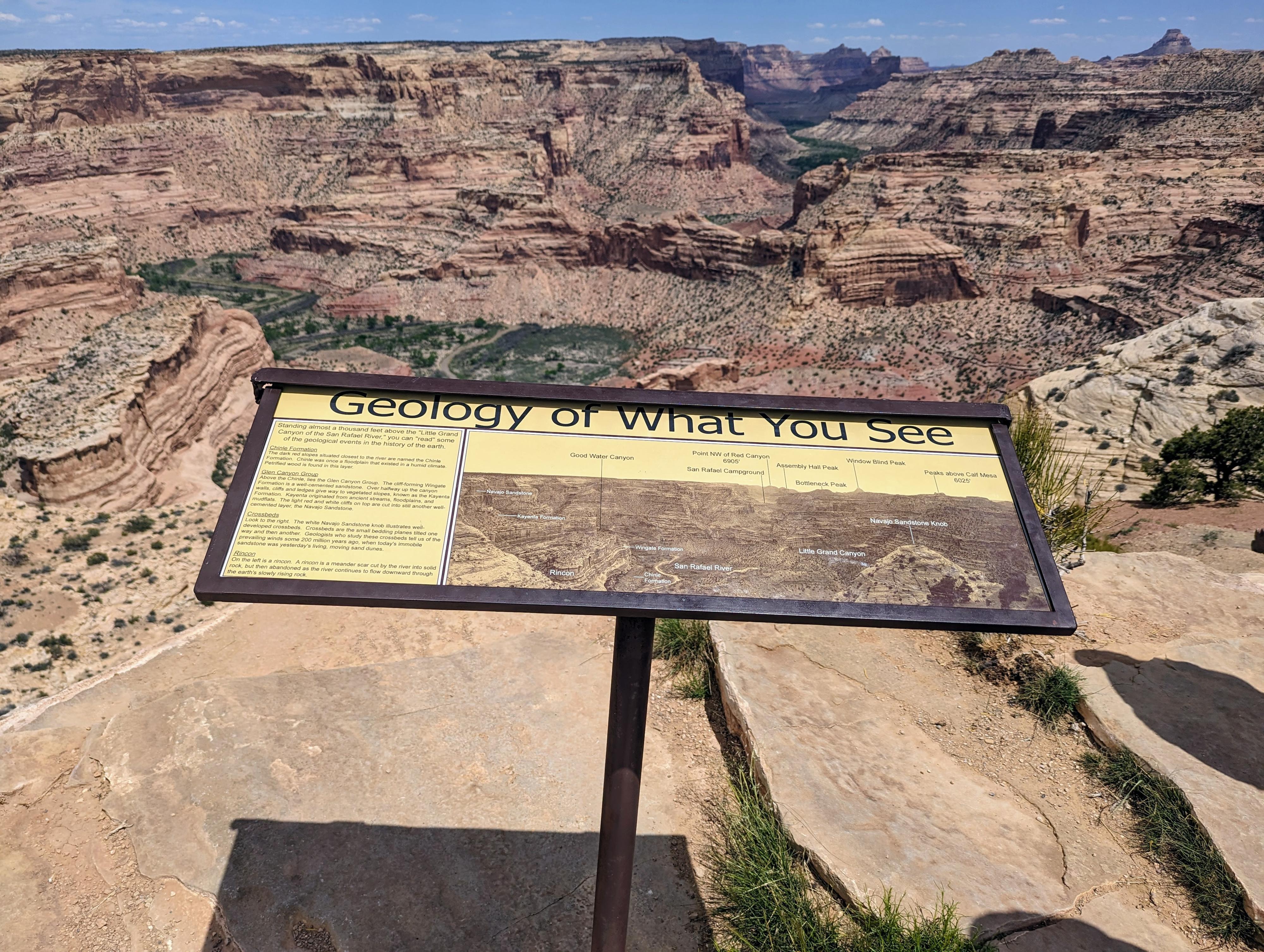
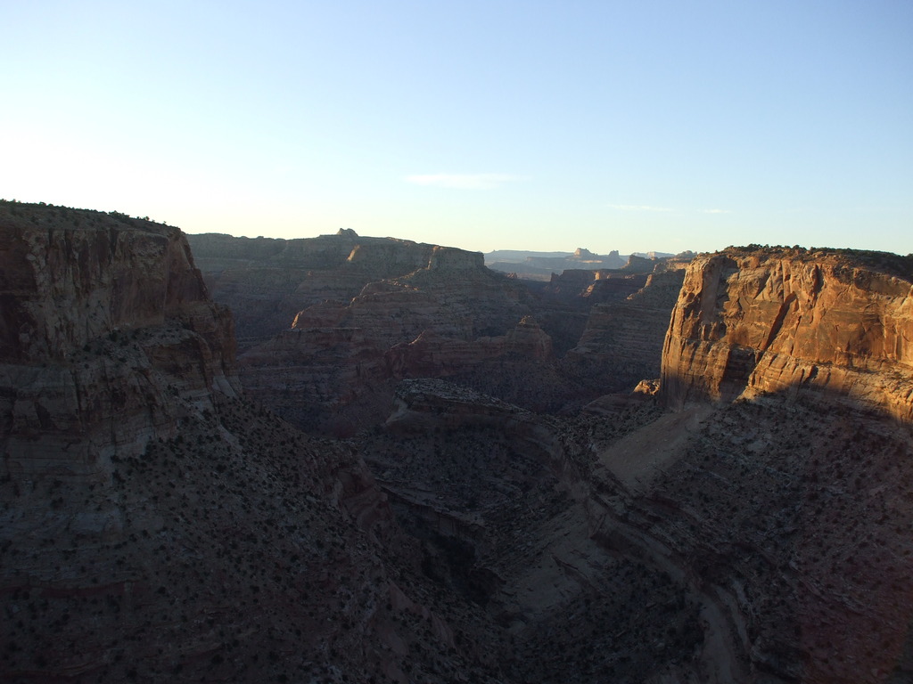
The Wedge Overlook, standing proudly high above the San Rafael River, is one of the premier attractions of the Northern San Rafael Swell. The gorge also goes by the name "Little Grand Canyon" as it has some resemblance to the Grand Canyon. This is an easy roadside attraction not to be missed by the Swell aficionado.
The area has many designated camping sites, and pit toilets, but does not have water available. It is a fantastic place for mountain bikers, ATV's, or families to camp with some of the best sunsets and sunrises around.
The addition of the Good Water Rim trail, a 15-mile (one way) trail that follows along the rim of Good Water Canyon, has become a mountain biking classic and has quite a few options for shorter loops using roads if desired.
Getting There
Take highway 10 south out of Price for about 28.2 miles.
Route Description
The San Rafael River is below, with Bottleneck Peak, Windowblind Peak, and the San Rafael Campground are visible downstream in the distance. The views in all directions stunning. I feel photographs never quite capture the scale of the canyon.
From the overlook at mile 7.2 in the description, those with keen eyes or binoculars may be able to spot a pictograph panel across the river. From the overlook, the panel is on a small sandstone butte almost due east and across the river, not far above the river. The butte has red dirt to the right of it, and behind it, making it somewhat distinct from all the other buttes. It is interesting to see if you can spot it.
Maps

12S 520859E 4327152N
39°05'36"N 110°45'32"W
12S 521673E 4327461N
39°05'46"N 110°44'58"W