
 Hole-In-The-Rock West
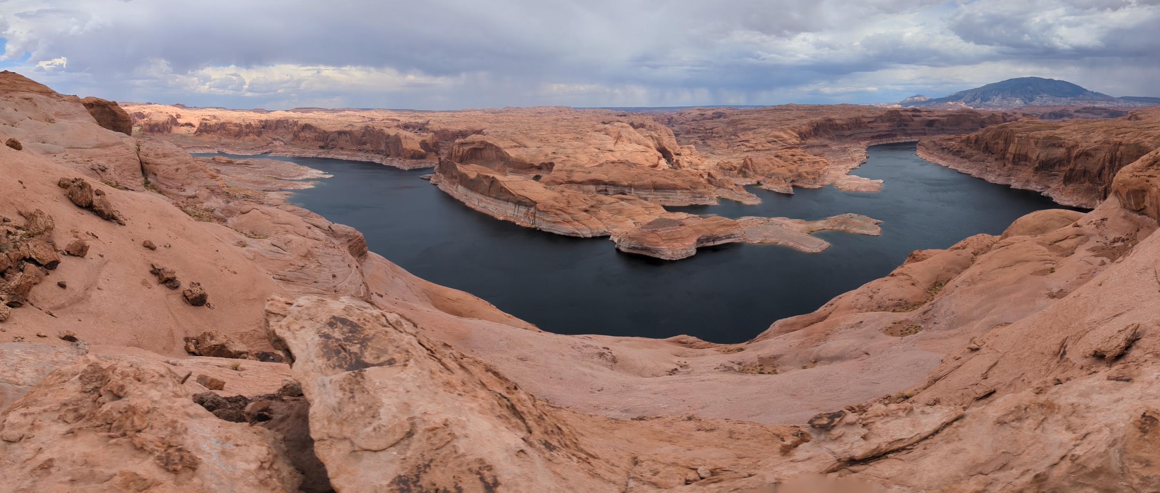
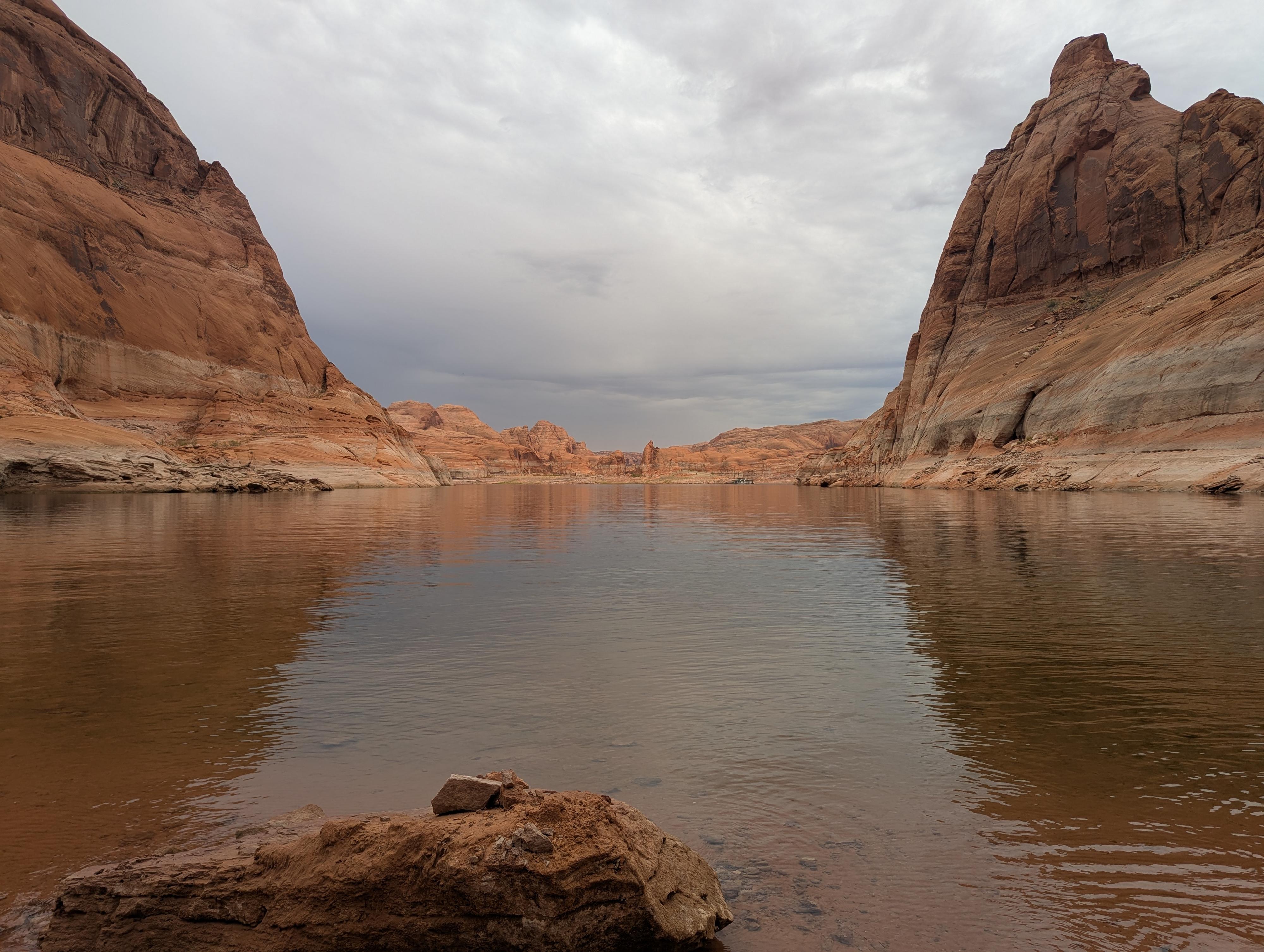
Middle Lake Powell
Overview
If you are interested in visiting Hole-in-the-Rock by car, see this description Hole-In-The-Rock - Hole In the Rock Road
The legend of Hole-in-the-Rock is a cornerstone of Utah history, chronicling an epic of grit and sheer Mormon pioneer willpower. While many modern visitors endure the long, bumpy, dusty 56-mile trek down the Hole-in-the-Rock road from near the town of Escalante, visiting from Lake Powell is easier if you have a boat. My first visit was via the lake, while on subsequent visits I have visited from the Hole-in-the-Rock road. I think approaching from the bottom is more dramatic!
The party encountered immense obstacles as they traversed the rugged terrain of the Glen Canyon area. When they reached a sheer sandstone cliff overlooking the Colorado River, they found a narrow crevice—later called the Hole in the Rock—which they painstakingly widened with blasting powder and hand tools over several weeks. This engineering feat allowed them to lower their wagons down the 1,200-foot drop to the river below using ropes, manpower, and ingenuity. After crossing the river, they continued eastward through equally formidable canyons and mesas.
After nearly six months of grueling travel—far longer than the six weeks they had planned—the expedition finally reached their destination and established the town of Bluff in April 1880. Despite the harsh conditions and loss of livestock, the pioneers succeeded in creating a settlement that would become a vital outpost in southeastern Utah. The Hole in the Rock route has since become a symbol of determination and pioneer ingenuity, and it remains an important historical and recreational landmark today.
It is astounding, but there was no loss of human life, and in fact, three babies were added to the population during the journey.
Getting There
Hole-in-the-Rock is about mile 66 on the lake. This is about 30 miles down the lake from Bullfrog Marina, or 66 miles up lake from Glen Canyon Dam. This is about 2 miles down lake from where the Escalante River and associated side canyons join the lake.
Route Description
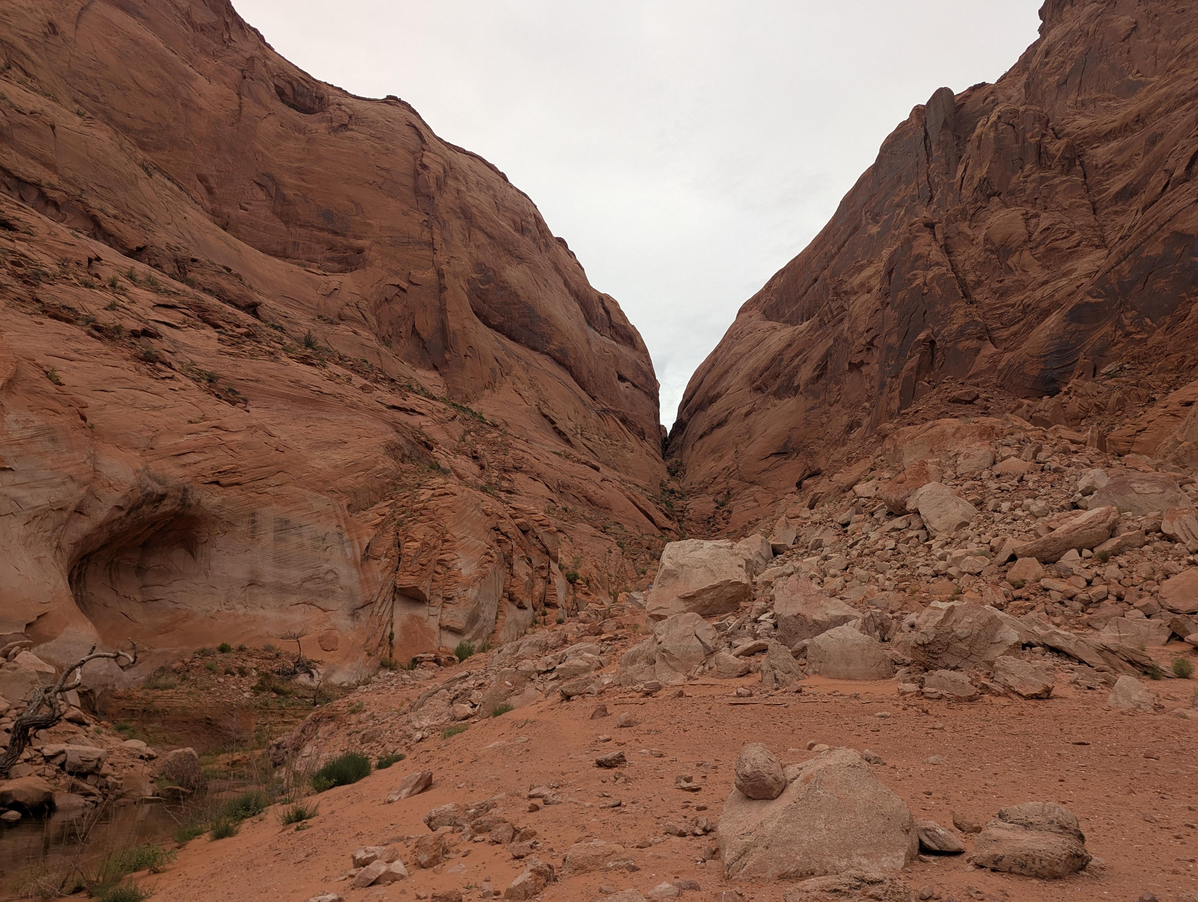
From shore, depending on lake levels, it can be a bit of sandy and rocky terrain to get to a social trail that heads up toward the cleft. The social trail heads up, then right and back left across the slope and some chiseled steps that came after the pioneers when the Hoskinini Mining Company was working in the area.
The trail then cuts back to the main cleft and stays mostly near the bottom from here to the top. There are spots you will have to scramble a bit and/or find routes around boulders. With a careful eye, nothing is very difficult or exposed. It gets narrower as you near the top.
When the pioneers descended this, it is significant to note, they had filled the bottom with sand and rocks to make a path for the wagons. Their wagons were about 70" wide, so as you walk up, you can imagine how much fill had to be put in at some spots. Since construction, the sand and fill have washed out, but there are still spots where you can see some chisel marks up 3-4' on the walls where they had to widen the spots just a bit to fit.
As you near the top, keep an eye out on the right for a ledge that goes over to a very graffiti-covered wall just before the top. If you are interested, it is worth checking out. It appears to have some old names as well as more modern ones. PLEASE DON'T ADD TO THE GRAFFITI! It is illegal and unsightly.
The trail pops out on top a short distance from the end of the Hole-in-the-Rock road on an expanse of slickrock.
Photos
Maps

12S 508775E 4123339N
37°15'24"N 110°54'04"W
12S 509471E 4122998N
37°15'13"N 110°53'35"W