
 Great Stone Face
Delta
Overview
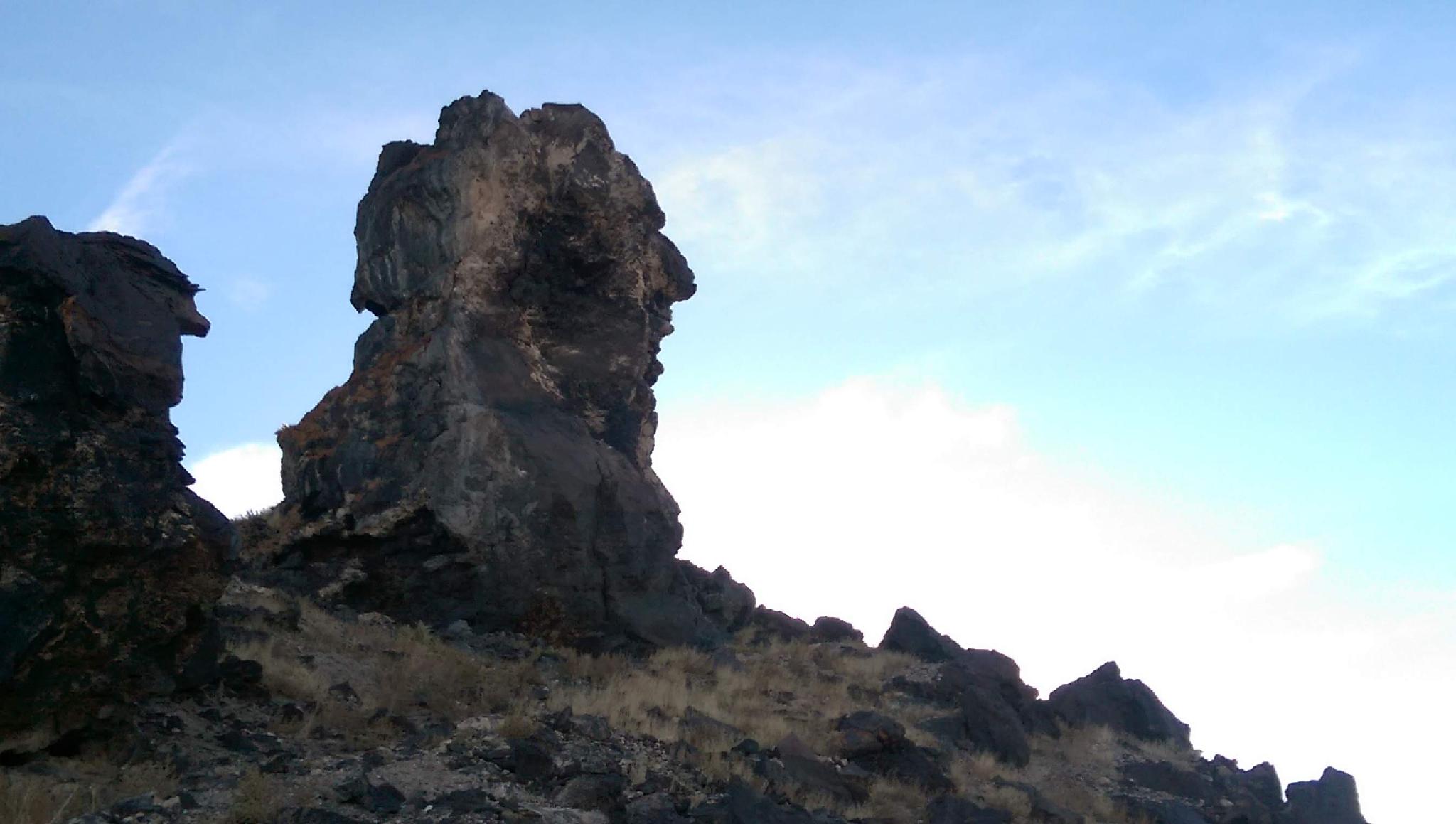
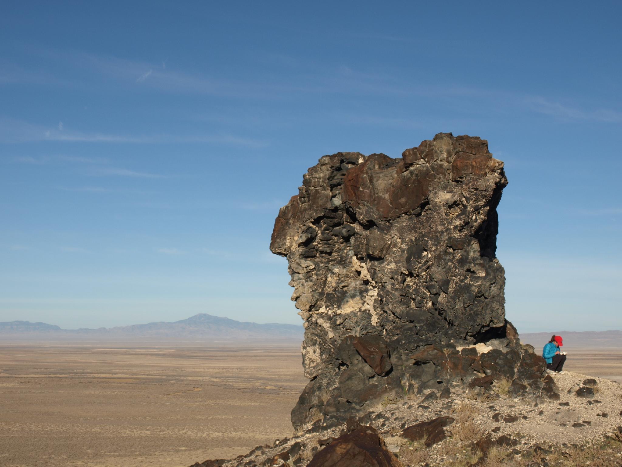
Located on a hillside a few miles southwest of Delta, Utah is a rock pillar that some think has a striking resemblance to Joseph Smith, the founder of the Mormon church. The 35-foot tall pillar is known as the Great Stone Face and has been a bit of a local attraction since at least the 1920s. Before it was known as the Great Stone Face, newspapers of the day referred to it as the "Guardian of Deseret."
Visiting the stone face requires a short but steep hike up a somewhat loose trail. The feature that looks like a face is on the west/southwest side, though I thought it was hard to spot.
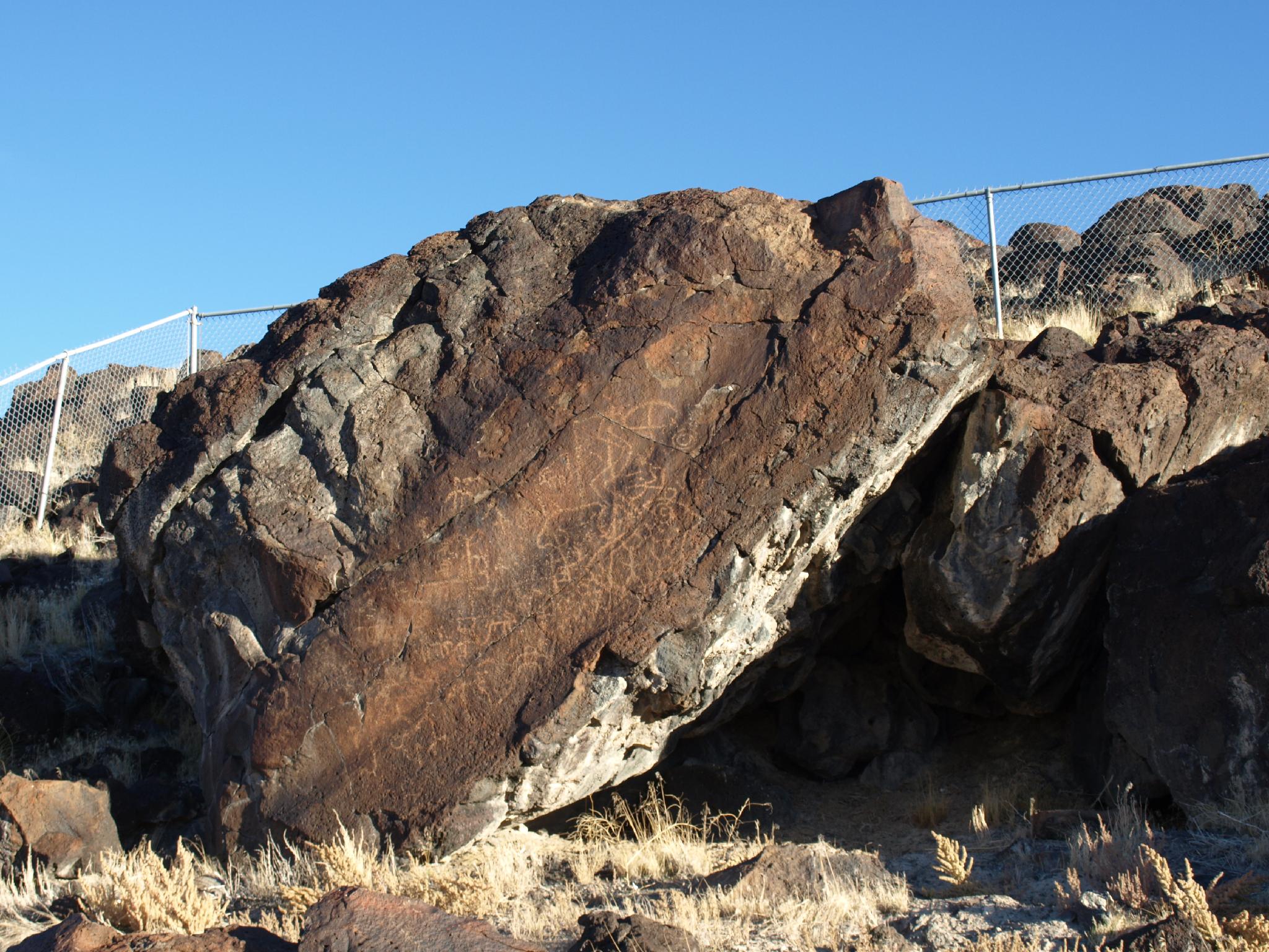
For my money, I found the Great Stone Face sort of a ho-hum attraction. There is, however, an interesting petroglyph panel a minute or so walk from the Great Stone Face parking area that I thoroughly enjoyed and think is well worth the drive.
The panel is now fenced in, and informational signs have been removed or stolen at some point. BLM believes the petroglyphs date back to pre-1000 A.D. Though pure speculation, some think the panels may have depicted a hunting and water agreement for the Native Americans of the area.
Getting There
From Delta, head west on US-50 toward Ely, NV. About 5 miles from downtown Delta, turn left (south) on UT-257. Follow this 6.1 miles to milepost 63.1. Turn right (west) here on a good dirt road.
Stay straight on this dirt road as it passes through many fields, then makes a bend to the left (south) and circles around a small hill area. At 6 miles from pavement, the good dirt road ends at the trailhead.
Route Description
Rock art and historic sites are fragile, non-renewable cultural resources that, once damaged, can never be replaced. To ensure they are protected, please:
- Avoid Touching the Petroglyphs: Look and observe, BUT DO NOT TOUCH!
- Stay on the Trails: Stay on the most used trails when visiting sites, and don't create new trails or trample vegetation.
- Photography and Sketching is Allowed: Do not introduce any foreign substance to enhance the carved and pecked images for photographic or drawing purposes. Altering, defacing, or damaging the petroglyphs is against the law -- even if the damage is unintentional.
- Pets: Keep pets on a leash and clean up after them.
- Artifacts: If you happen to come across sherds (broken pottery) or lithics (flakes of stone tools), leave them where you see them. Once they are moved or removed, a piece of the past is forever lost.
Panel
You drive past the panel on the way to the trailhead. If you happen to miss the panel on the drive to the trailhead, walk back on the road a minute or two from the trailhead to the obvious fenced in area.
Great Stone Face
A narrow trail leaves the trailhead and climbs the slope steeply. Near the pillar, the trail splits and makes a loop around the Great Stone Face tower. As you approach it, look for the face on the right side of the pillar.
Maps

12S 348829E 4344218N
39°14'03"N 112°45'05"W
12S 349052E 4344126N
39°13'60"N 112°44'56"W