 Hiking
Soldier Fork
Hiking
Soldier Fork
Millcreek Canyon
Overview
If you have ever wondered, when hiking the Big Water Trail in Millcreek, where the trail goes that leaves the main path at Soldier Fork, you have come to the right place! The side trail had been on my list to do for some time when I finally got around to it.
The trail, at least in my opinion, is a bit of a beast. It seems it was a maintained trail at some point, given the way it is cut and switchbacks in places, but is currently quite overgrown, with many downed trees. As I gingerly waded through waist foilage trying to find my way through the many hidden logs, I will admit to considering giving up. Alas though, there were enough glimpses of the trail to goad me forward.
If you are looking for solitude, this is the trail to do! You are very unlikely to run into other hikes once you leave the Big Water Trail. The reward is seldom trodden meadows with wildflowers and autumn colors higher up. The cost? Route finding, crossing quite a few downed trees, and a pretty steep ascent to the ridge.
For most, I would recommend a foray up Soldier Fork as far as motivation allows, then returning the same way. If you go all the way to the ridge, I found it more palatable to descend to the Desolation Trail about 200 vertical feet below the ridge on the south. Once on the Desolation Trail, head east, and make the loop back down the Big Water Trail from Dog Lake.
Getting There
Millcreek Canyon is on the east side of the Salt Lake Valley, just south of I-80 and Parleys Canyon. To get there, take I-215 South from I-80 and take exit 4 off of I-215 and go left (east) on 3900 South.
Turn left on Wasatch Blvd just after crossing under the highway, then the next right on Millcreek Canyon Road.
0.7 miles from the junction of Wasatch Blvd and Millcreek Canyon Road is the entrance to Millcreek Canyon and the pay booth.
Mileage below is from the pay booth.
0.7 miles - Pipeline Trailhead on the left (north).
2.4 miles - Church Fork Trailhead on the left (north).
2.5 miles - Desolation on the right (south).
3.4 miles - Porter Fork on the right (south).
3.5 miles - Burch Hollow Trailhead (north).
3.7 miles - Terraces Picnic Area / Trailhead (south).
3.8 miles - Winter Gate Closure
5.4 miles - Elbow Fork Trailhead (Mount Aire)
6.9 miles - Alexander Basin Trailhead
8.3 miles - Lower Big Water Trailhead
The Lower Big Water Trailhead (8.3 miles) is the Soldier Fork Trailhead.
Route Description
To Soldier Fork (0.4 miles / 15 minutes)
The trail starts from the Big Water Trailhead. Follow the Big Water Trail, ignoring the two side trails that go to other parking areas within a couple of minutes of the trailhead. The Big Water Trail heads west, then makes a turn and heads east. The first drainage it crosses as it heads east is Soldier Fork.
Up Soldier Fork (1 mile from Big Water Trail to Ridge / 45 minutes to 1 hour)
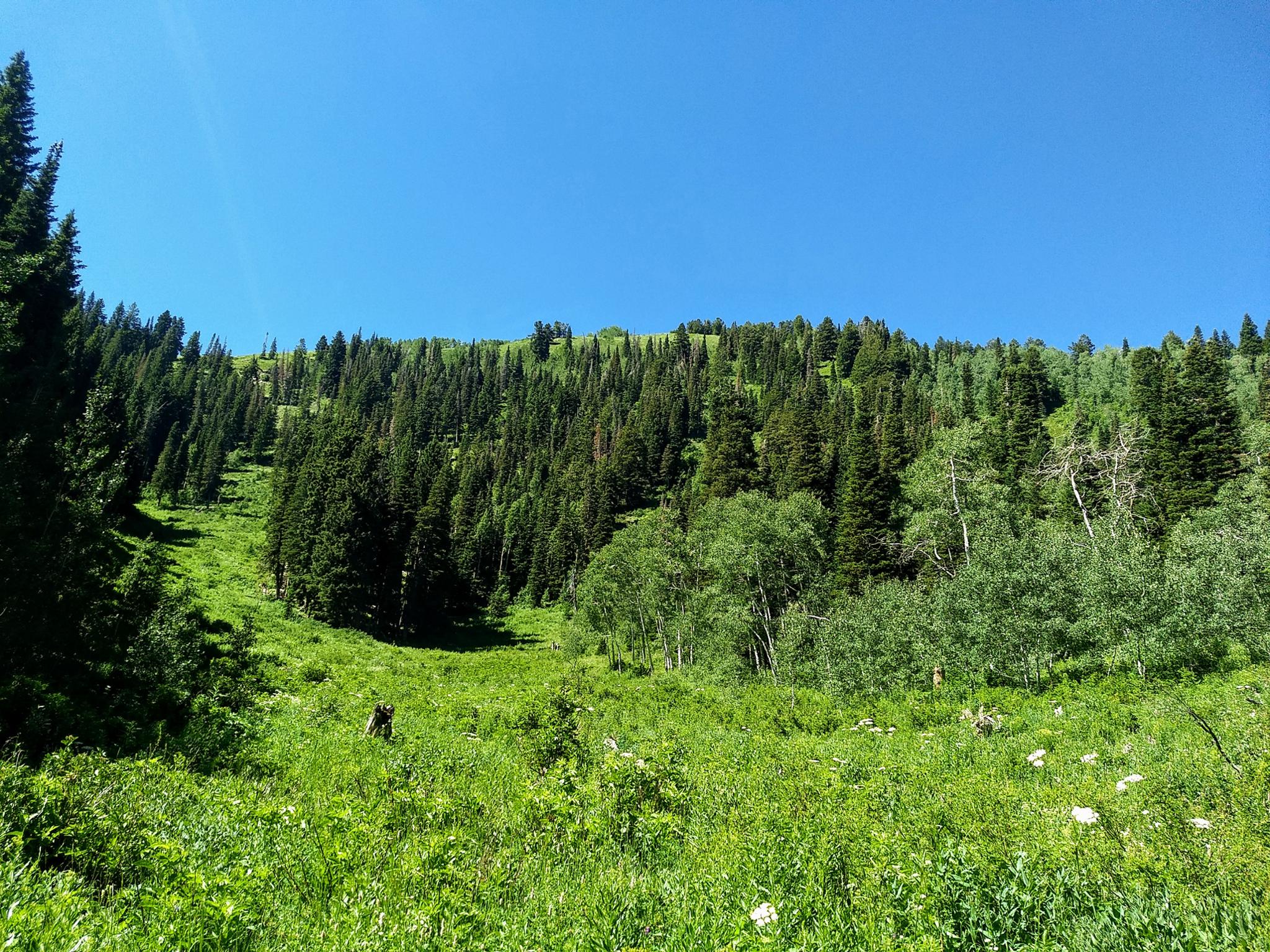
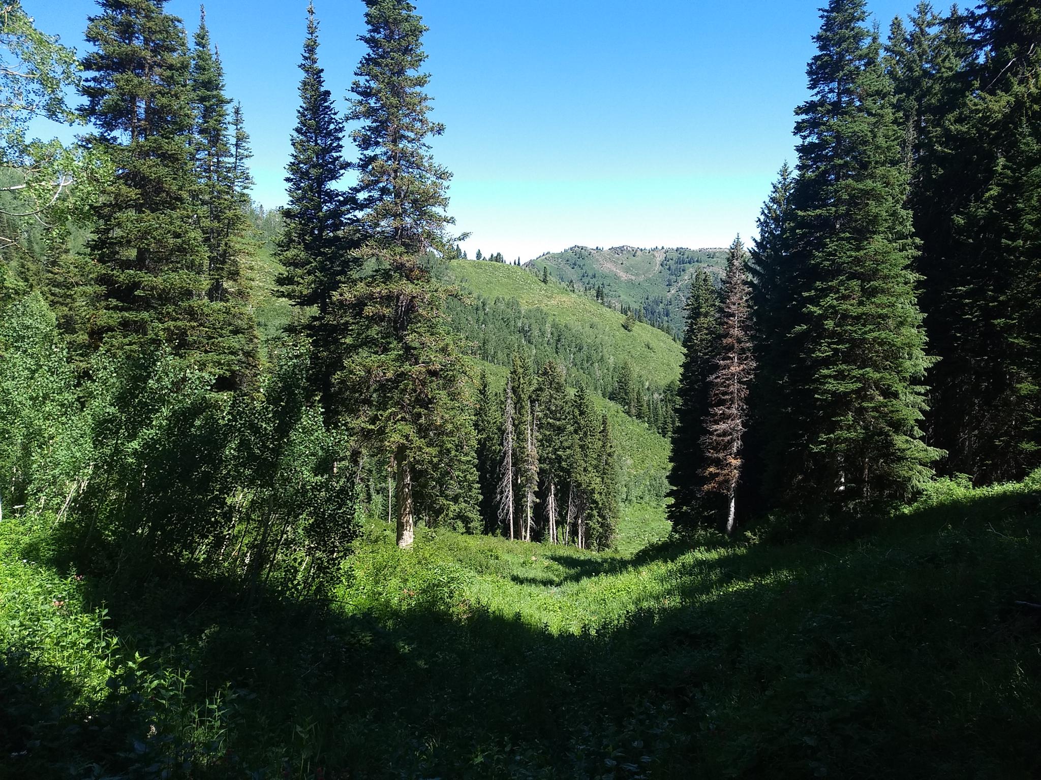
Leave Big Water Trail, and head up Soldier Fork. The trail is relatively easy to find as it starts its route up. Generally, it stays near the bottom or left side of the narrow drainage. The drainage climbs steeply through the conifer forest before changing to aspen and becoming more open.
As it changes to aspen and opens, there are great views of the north side of Millcreek as well as wildflowers. This open area is also the crux of the bushwacking. The old trail, I think, seems to stay right in the bottom of the drainage. It is hard to find. On my trip, animal trails on the left side of the drainage seemed the easiest route. Crossing the meadow to the headwall is tedious and slow.
After the meadow, it is a few hundred feet up the headwall to the ridge. This steep dirt section has remnants of the old trail climbing it in a series of switchbacks, though animals and tree fall have obliterated much of the old path.
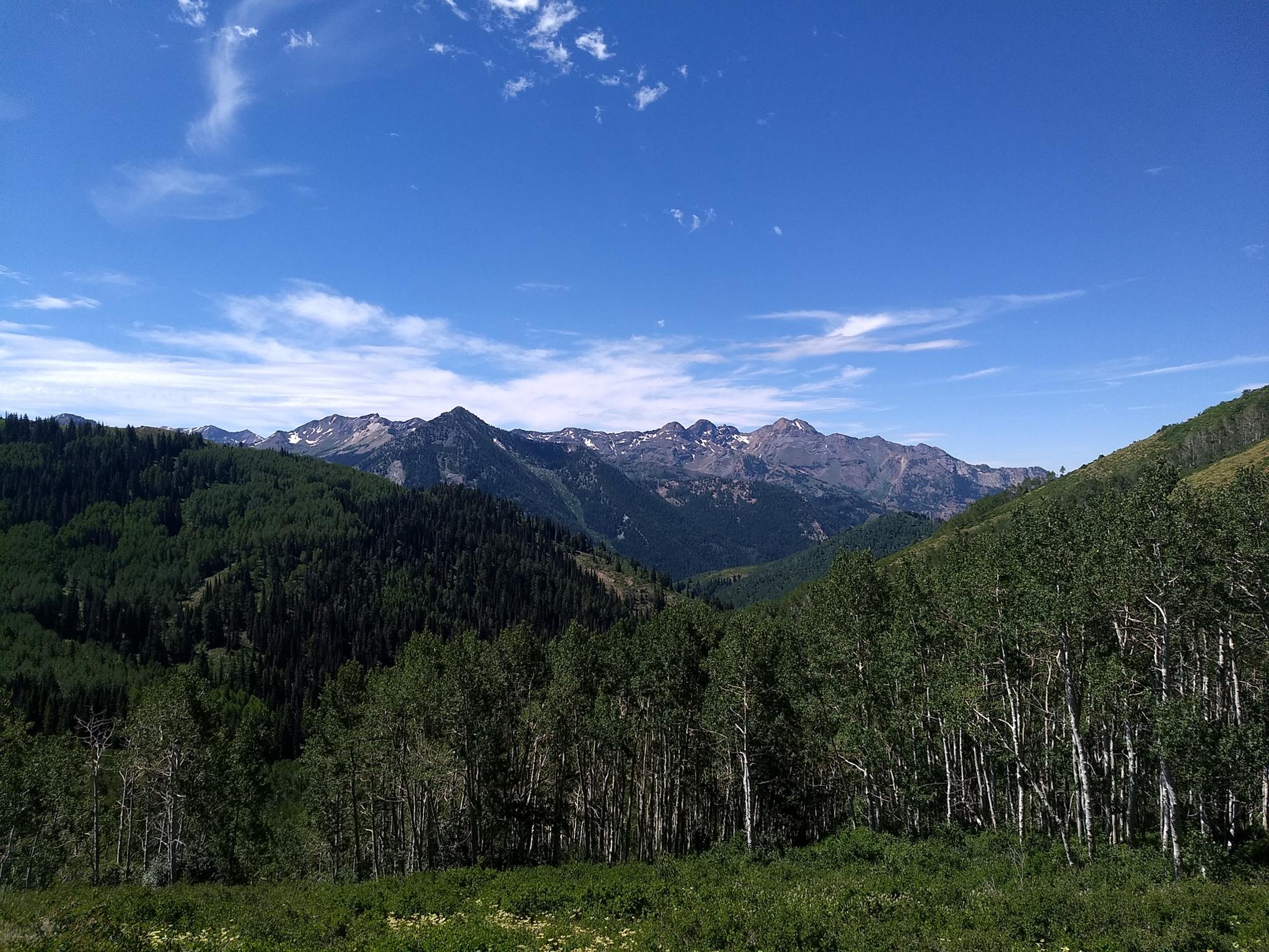
Once at the ridge, there are great views of the south side of Big Cottonwood Canyon.
Desolation Loop (3.25 miles From the Ridge to Big Water Trailhead / 1-1.5 hours)
If continuing to the Desolation Trail, contour east on game trails, then descend south through very brushy terrain until you reach the Desolation Trail. It would be virtually impossible to miss, and is well travelled and easy to find. Once on the Desolation Trail, go east and follow the trail signs back to the Big Water Trailhead.
Photos
Maps

12T 445187E 4503934N
40°41'04"N 111°38'55"W
12T 445181E 4503637N
40°40'54"N 111°38'55"W
12T 444737E 4502651N
40°40'22"N 111°39'14"W
12T 444959E 4502442N
40°40'16"N 111°39'04"W