Spirit Railroad | Northern Swell

Roadside Attraction Spirit Railroad - Northern Swell Roadside Attraction Spirit Railroad

Northern Swell

Overview

RATING: Roadside Attraction
LENGTH: 1 hour
MAPS: Chimney Rock, UT;

Sat

Sunny, with a high near 96. Northwest wind 6 to 9 mph.

96 | 68

Sun

Sunny, with a high near 98. North northwest wind 5 to 8 mph.

98 | 69

Mon

Sunny, with a high near 98.

98 | 70

Tue

Sunny, with a high near 98.

98 | 70

Wed

A slight chance of showers and thunderstorms after noon. Sunny, with a high near 95.

95 | 70

View Full Weather Details
SEASON: Any, hot in summer.
WATER: None.

Sat

Sunny, with a high near 96. Northwest wind 6 to 9 mph.

96 | 68

Sun

Sunny, with a high near 98. North northwest wind 5 to 8 mph.

98 | 69

Mon

Sunny, with a high near 98.

98 | 70

Tue

Sunny, with a high near 98.

98 | 70

Wed

A slight chance of showers and thunderstorms after noon. Sunny, with a high near 95.

95 | 70

View Full Weather Details
Views from the trailhead.

Views from the trailhead.

In 1881 the D&RGW railroad company decided to extend their line through the San Rafael Swell. The line was planned to leave Green River, UT, travel up Cottonwood Wash, across Buckhorn Flat, and to a junction near Huntington. From the junction, the line would split and go north to Price and south through Salina Canyon to Salina.

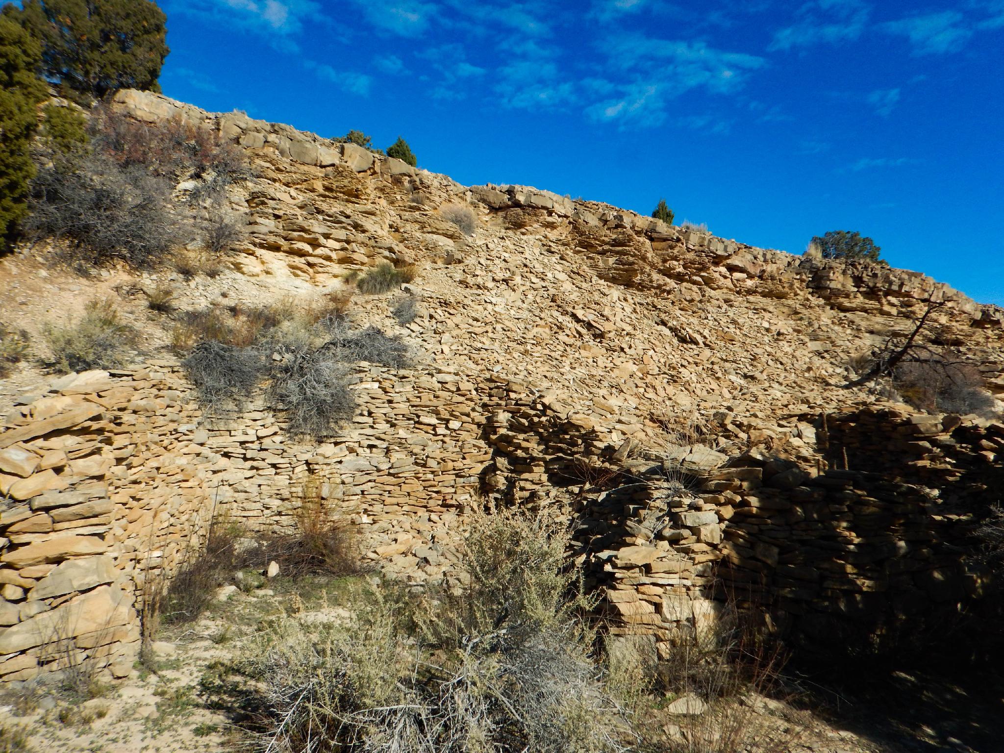
Though the railroad was never completed, hundreds of locals worked on the project and an impressive amount of railroad bed was prepared. Ties were even cut in Tie Canyon near Huntington and floated 20 miles down to sell to the railroad.

There are a few places in the Swell to see the railroad remains, though the Spirit Railroad Complex site that SITLA developed in 2016 is an excellent place to start and offers a lot of railroad remnants in a small area. Highly recommended for history buffs and railroad enthusiasts.

Rock building ruins near the railroad grade.

Rock building ruins near the railroad grade.

Getting There

The trailhead has a few rough sections, but most vehicles can make it if carefully drive.

There are two way to reach the trailhead, from Buckhorn Wash area, and from Highway 6.

From Highway 6

To reach the trailhead, take the Green River cutoff from highway 6 between Price and I-70. This good dirt road travels west off of highway 6 at mile marker 283.2 (16.4 miles north of I-70 on highway 6).

  • Reset the odometer as you leave the highway. ( 12S 557112E 4338541N / 39°11'39"N 110°20'19"W )
  • At mile 1.0, go left at the fork. ( 12S 555967E 4339649N / 39°12'16"N 110°21'06"W )
  • At 1.2, road goes under the railroad. ( 12S 555830E 4339248N / 39°12'03"N 110°21'12"W )
  • At 1.4 is a junction. Go right. ( 12S 555730E 4338742N / 39°11'46"N 110°21'17"W )
  • Follow this road, ignoring side roads until 12.1 miles. En route, you should cross cattle guards at 2.2, 5.1, and 10.9 miles. ( 12S 544541E 4336793N / 39°10'45"N 110°29'04"W )
  • Continue straight an addition 3.1 miles (15.2 from the highway) to a signed side road on the right. The road is signed for the Spirit Railroad. Reset your odometer. ( 12S 540042E 4336870N / 39°10'49"N 110°32'11"W )
  • From Buckhorn Wash
  • From the top of Buckhorn Wash, at the T junction, go right (east) on the Green River Cutoff road for about 5.2 miles to the second signed Spirit Railroad leaving the Green River Cutoff on the left (north) side. Reset your odometer as you turn onto this side road.
  • Both
  • 0.5 miles - Junction, go right. ( 12S 539516E 4337341N / 39°11'04"N 110°32'33"W )
  • 1.2 miles - Small side road on the left, stay to the right. ( 12S 540264E 4337811N / 39°11'19"N 110°32'02"W )
  • 1.4 miles - Trailhead and informational sign. ( 12S 540549E 4337976N / 39°11'24"N 110°31'50"W )
Book Cliffs in the distance from the trailhead.

Book Cliffs in the distance from the trailhead.

Route

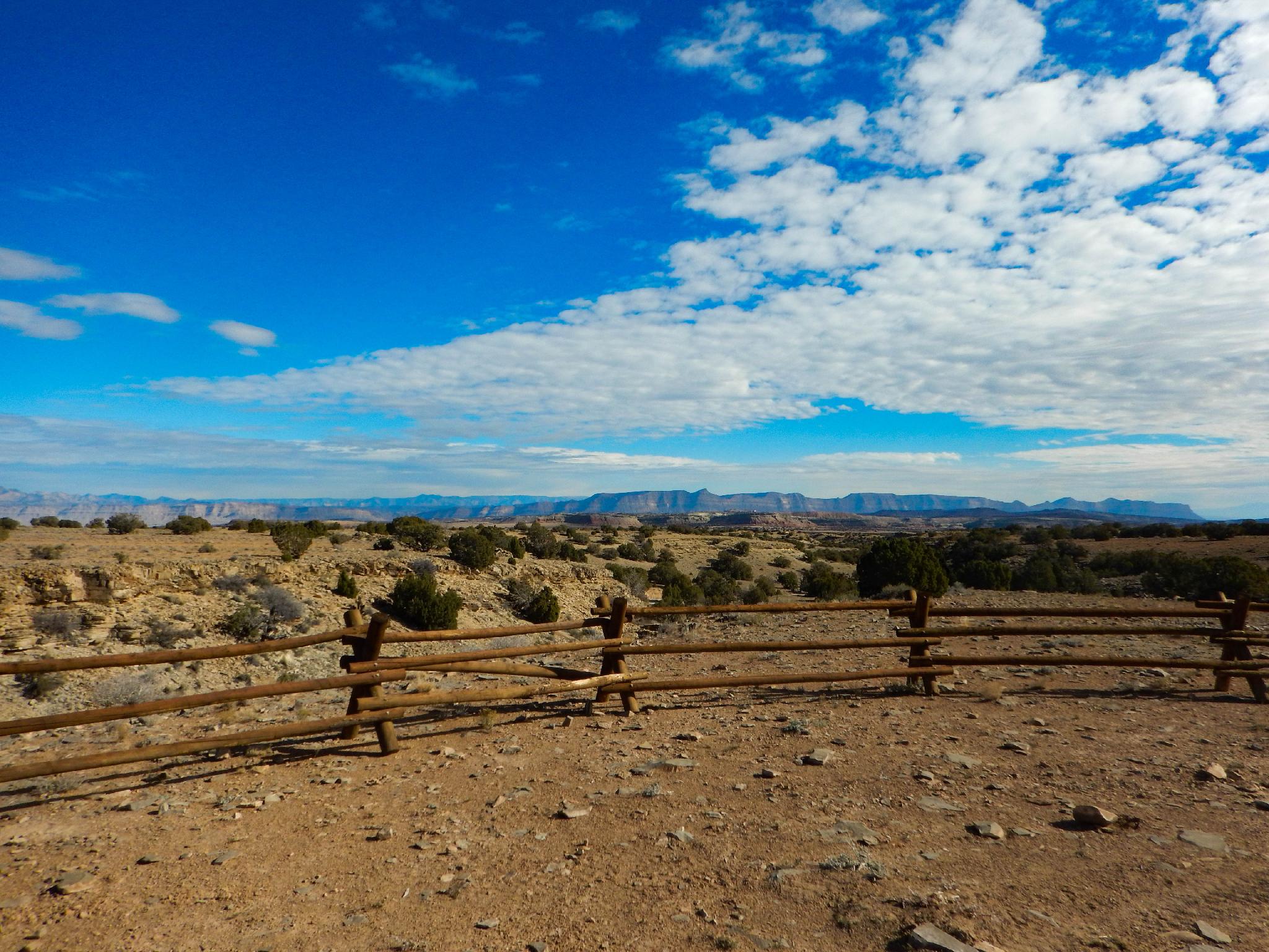
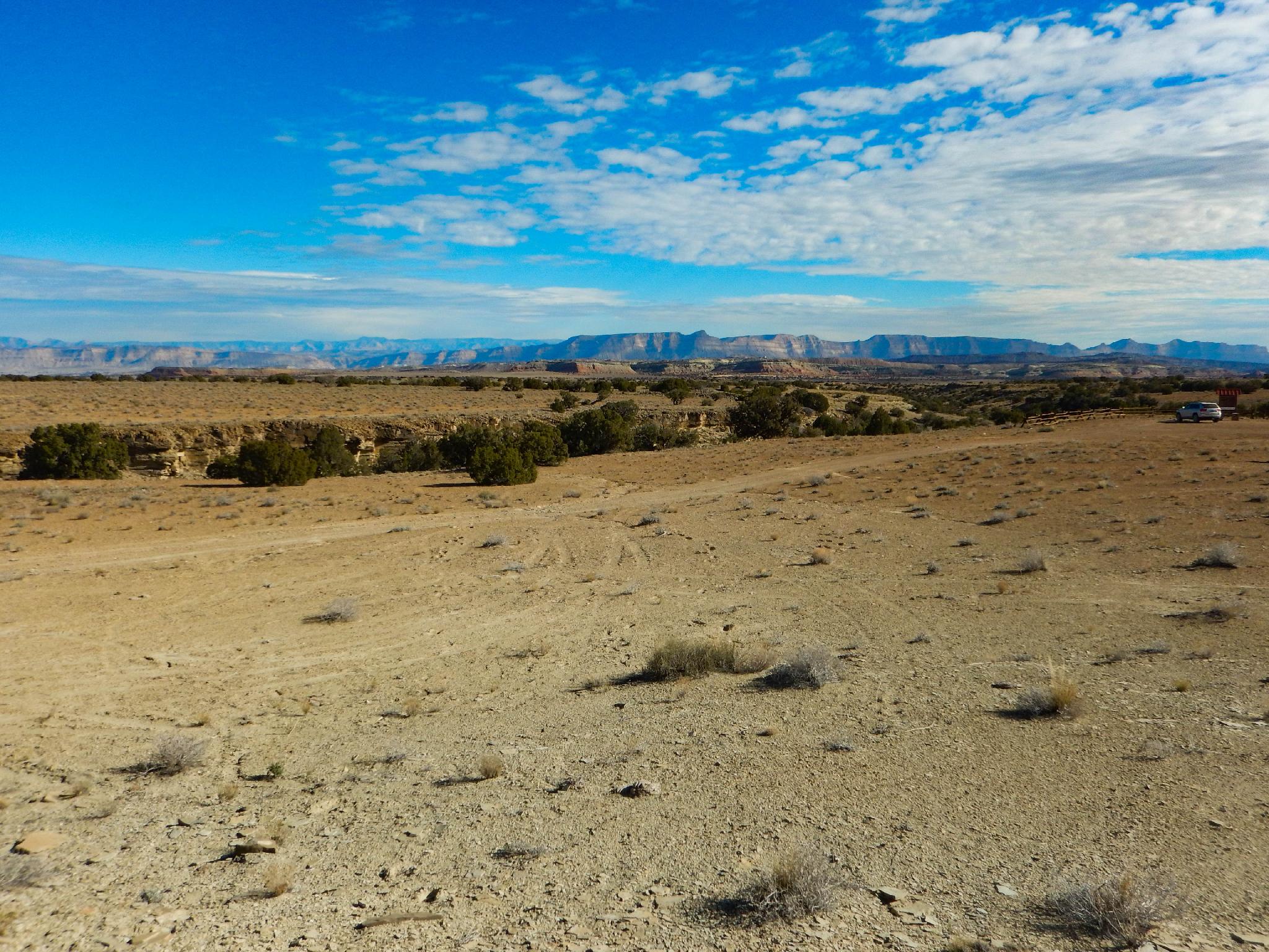
Once at the site, an informational board offers a reasonable overview map. Everything is within a 5-minute walk from the parking area. Check out the railroad grade, debris piles, old buildings, and dug-outs that the workers lived in. Bring a lunch, this is a great place to wander around, learn about the history of the railroad and take in the big views of the Book Cliffs to the East and Cedar Mountain to the north.


Maps

Printable Maps:

Green River Cutoff Road

12S 540042E 4336871N

39°10'49"N 110°32'11"W

0.5 miles - Junction, go right.

12S 539516E 4337340N

39°11'04"N 110°32'33"W

1.2 miles - Small side road on the left, stay to the right.

12S 540264E 4337810N

39°11'19"N 110°32'02"W

1.4 miles - Trailhead and informational sign.

12S 540549E 4337976N

39°11'24"N 110°31'50"W

Comments

Want to make a comment? Login and let yourself be heard.