 Canyoneering
Mighty Mouse Canyon
Canyoneering
Mighty Mouse Canyon
Zion East Side
Overview

"Here I come to save the day!" -Mighty Mouse
Though the cartoon character was endowed with flight, super strength, and invulnerability, the canyon that was presumably named in his honor does not embody such striking qualities. This is a very short, straightforward canyon that I can only recommend in clear conscience if it is combined with Deadeye Dick . If done as a combo, this is a fair day out. If done alone.. well.. you'll likely be disappointed.
Like Deadeye Dick, this is one I would recommend doing once, but certainly won't be rushing back to do again. The hiking time spent in the Virgin River on the exit (and approach if you go against my advice to do it with Deadeye Dick Canyon) is pleasant and a great place to mostly beat the summer heat that descends on the lower elevations of Zion in the summer.
Getting There
The trailhead is off the North Fork road, which starts 2.2 miles east of the east entrance of Zion National Park on highway 9. It is signed.
Route Description
From Chamberlain Ranch (4 miles / 1.5-2 hours)
So, your going against my advice and doing Mighty Mouse on its own? Head down the Narrows trail. It starts as a dirt road, then changes to a well worn trail in about 2.5 miles. Cross the stream numerous times, keeping an eye on the map. Mighty Mouse is about 4 miles down stream from the trailhead, and an obvious deep canyon coming in on the right (looking down canyon).
If you miss it, Deadeye Dick comes in on the left shortly below, turn around and retrace your steps about 10 minutes to Mighty Mouse.
From Deadeye Dick Canyon
Hike up stream from the confluence of Deadeye Dick and the Virgin River about 10 minutes to the first obvious slot canyon coming in on the left (looking up canyon). This is the bottom of Mighty Mouse Canyon.
From the Bottom of Mighty Mouse (1-2 hours)
Hike UP the Virgin River from the bottom of Mighty Mouse keeping an eye on the left wall. At a major bend to the left just a few minutes up stream, a rough break allows for exit up to the bench lands above. Scramble up this with a move or two of 4th class. Once up the cliff band, work left and up to the flat land above.
On the flats, hike north up the next small hill until you can look west down into the upper reaches of Mighty Mouse. It is open in this section. Work down the dirt hillside to the botom of Mighty Mouse and head down canyon.
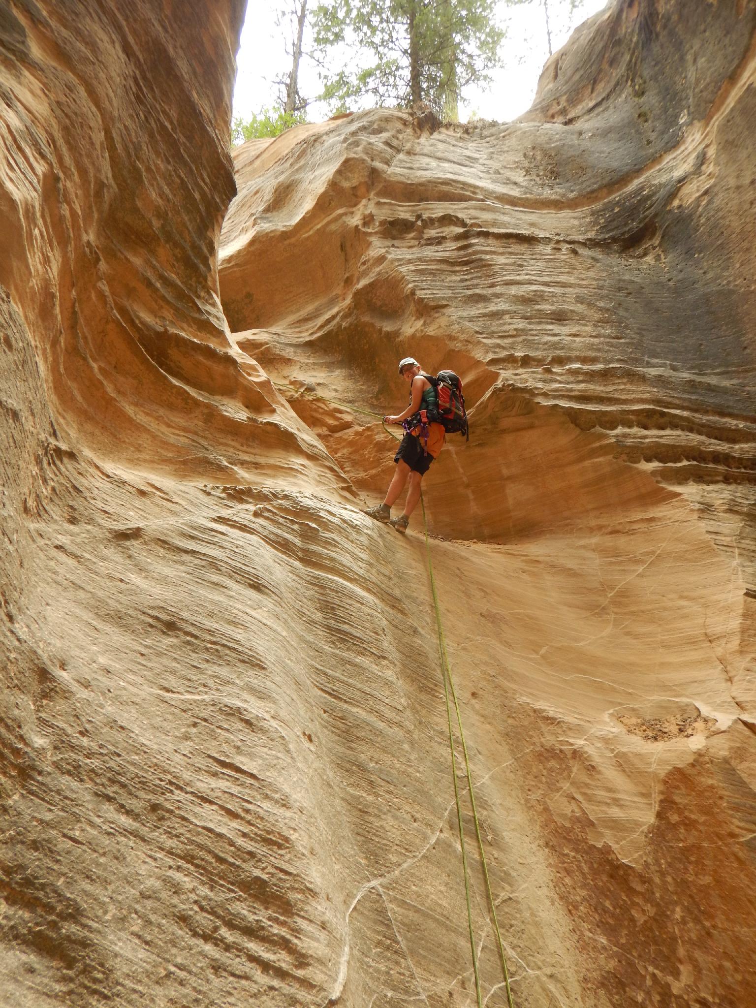
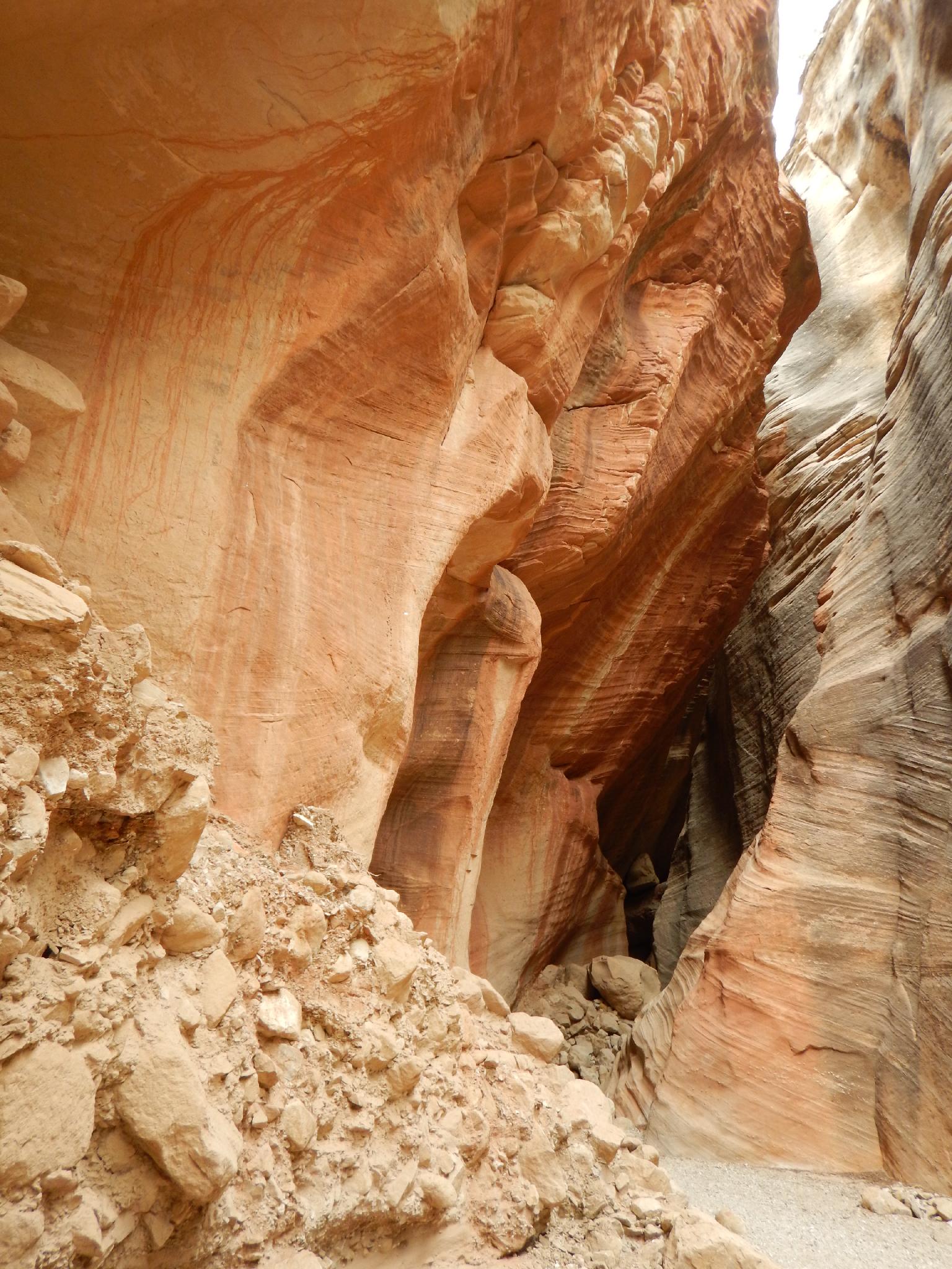
An easy downclimb is followed shortly by the technical section.
Rappel 1 (12 m ( 40 ft. )) - This rappel leads to a short canyon section before it opens again.
Rappel 2 (25 m ( 83 ft. )) - The canyon closes in again for the final few rappels and slot section. Be aware of rope placement on rappel 2 to try and not get it caught in the pinch. (easy pull on our trip, but the notch could be a rope sticker over time)
Rappel 3 (15 m ( 50 ft. )) - Just below rappel 2 is the rappel 3. Beware, it is an akward start.
Rappel 4 (7 m ( 23 ft. )) - A short drop leads to the end of the canyon and back to the Virgin River.
Up The Narrows (4 miles / 1.5-2 hours)
Turn left and head up stream. Continue up stream on the well used trail, criss-crossing the river endlessly. This section is quite beautiful, with towering walls and vivid colors.
After a couple of miles, the trail turns to an old road. Continue on it, passing Bullock's Cabin, then a farm building before reaching the Chamberlain Ranch trailhead.
Photos
Maps


12S 337204E 4139203N
37°23'07"N 112°50'20"W
12S 335879E 4138357N
37°22'39"N 112°51'13"W
12S 334710E 4137672N
37°22'16"N 112°52'00"W
12S 332674E 4137683N
37°22'15"N 112°53'23"W
12S 332906E 4137573N
37°22'11"N 112°53'13"W
12S 332712E 4137901N
37°22'22"N 112°53'22"W