 Hiking
Legend Rock
Hiking
Legend Rock
Thermopolis
Overview
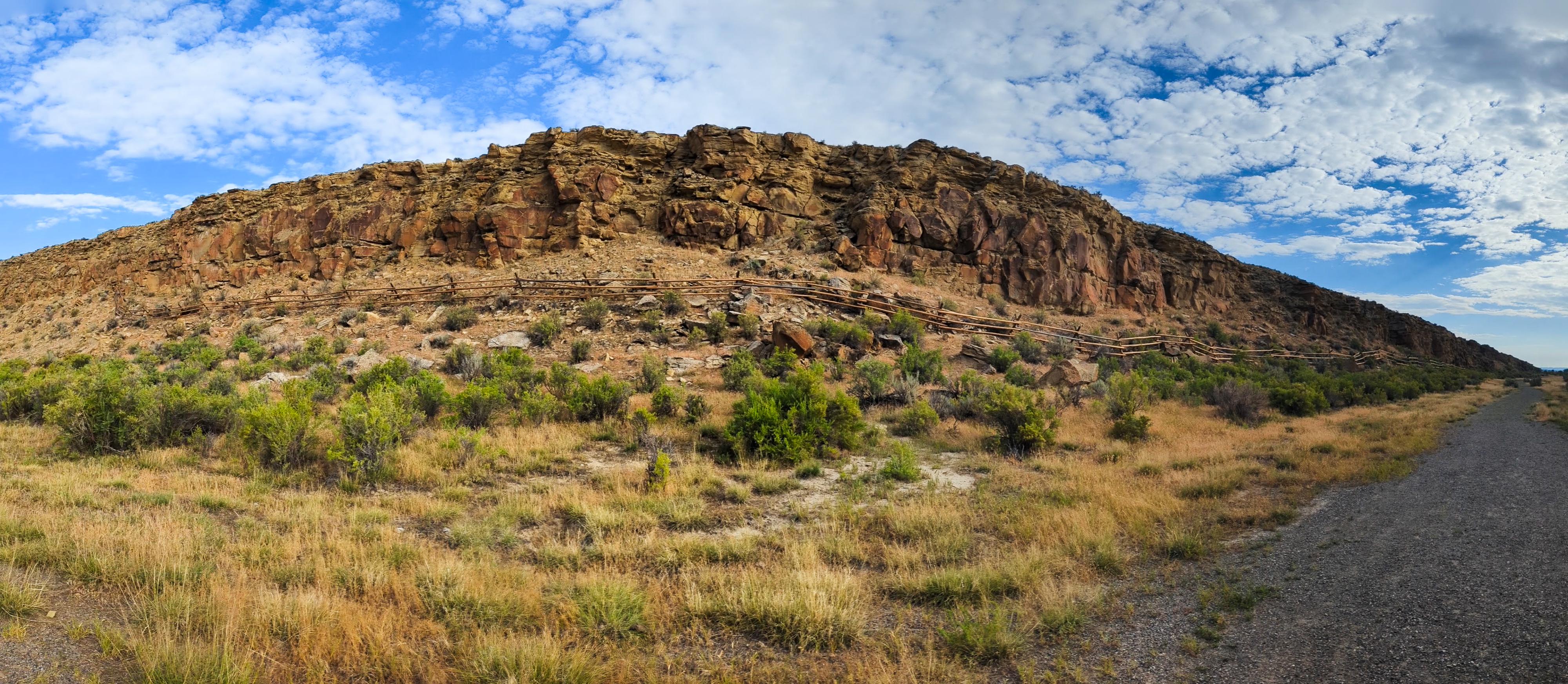
Tucked away in the high plains of central Wyoming, Legend Rock is one of the state's most remarkable archaeological sites. Located northwest of Thermopolis, the site stretches along a sandstone cliff face adorned with hundreds of ancient petroglyphs. These intricate carvings - some towering several feet in height - offer a window into the lives, beliefs, and artistic expressions of Native peoples who lived in the region long before written history.
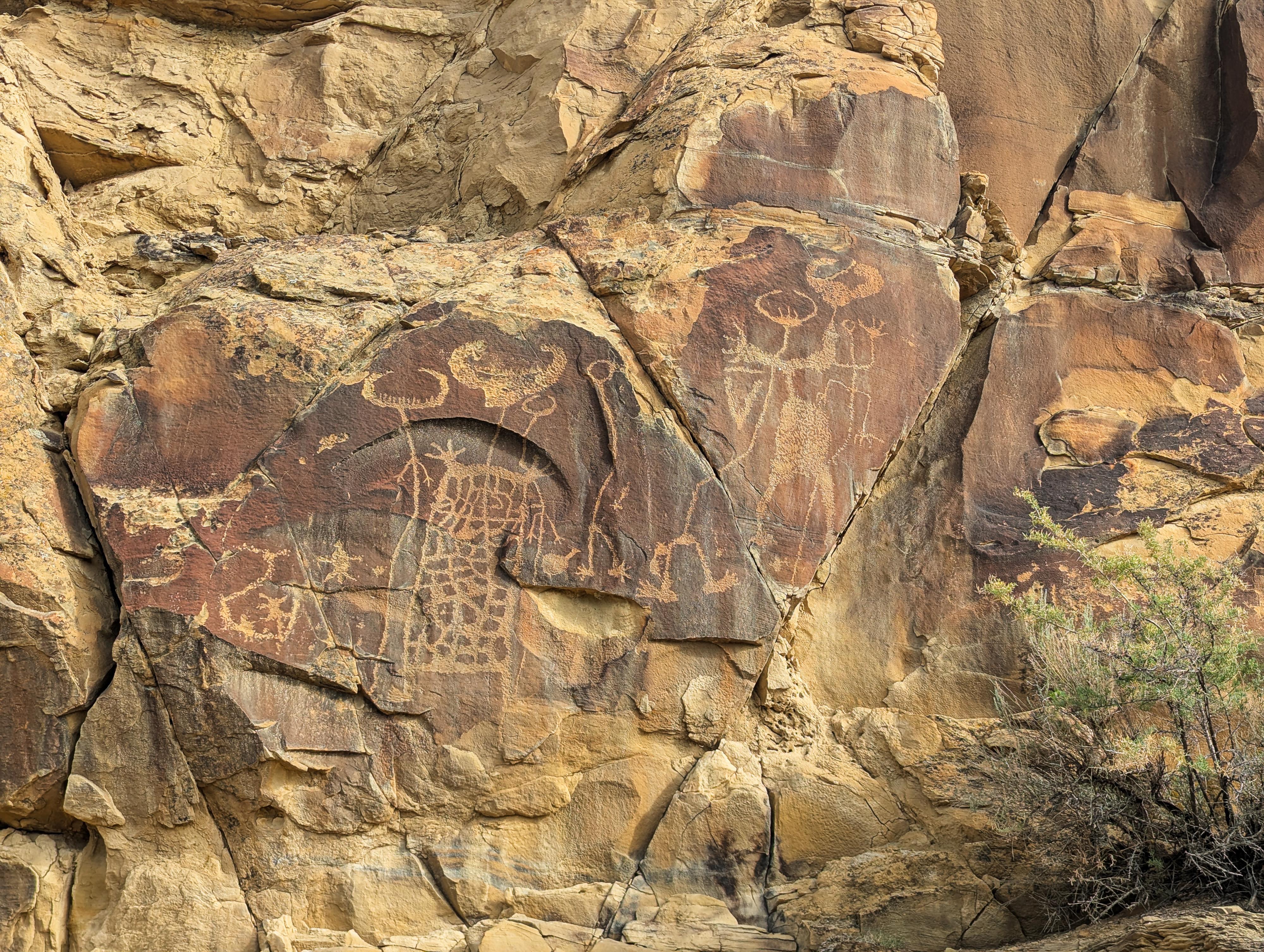
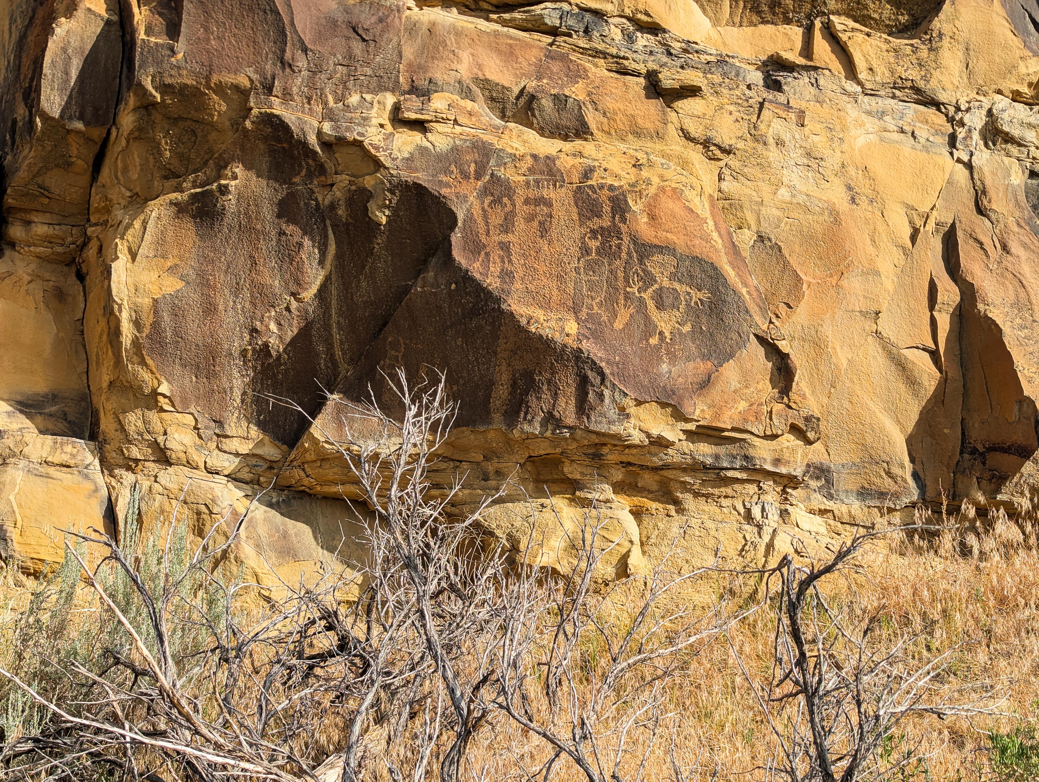
Legend Rock is particularly well-known for its association with the Dinwoody tradition of rock art, a style unique to central Wyoming. Dating back as far as 10,000 years, the petroglyphs depict a range of images, from highly abstract anthropomorphic forms with elaborate body decorations to recognizable animals like deer, bighorn sheep, and birds. The meanings of these carvings are not fully understood, but they are widely believed to be connected to spiritual practices such as vision quests or shamanic rituals. Unlike everyday scenes found at some rock art sites, the figures at Legend Rock seem to convey a deeper, symbolic language, possibly intended to record transformative or sacred experiences.
On my visit, in July, deer flies were moderate at the site. Bug spray recommended. This is a fairly isolated site; be sure to go prepared with plenty of fuel and water.
Getting There
From Thermopolis, head north on WY-120 W/Broadway Street for 21.1 miles.
Turn left onto Upper Cottonwood Creek Rd (signs for Hamilton Dome) and follow it for 5.3 miles to a junction.
Stay slightly right at the junction to stay on Upper Cottonwood Creek Road, and follow it for 2.2 miles to Legend Rock road on the left.
Follow Legend Rock road for about 0.5 mile to where it ends at the trailhead and parking area.
Route Description
Rock art and historic sites are fragile, non-renewable cultural resources that, once damaged, can never be replaced. To ensure they are protected, please:
- Avoid Touching the Petroglyphs: Look and observe, BUT DO NOT TOUCH!
- Stay on the Trails: Stay on the most used trails when visiting sites, and don't create new trails or trample vegetation.
- Photography and Sketching is Allowed: Do not introduce any foreign substance to enhance the carved and pecked images for photographic or drawing purposes. Altering, defacing, or damaging the petroglyphs is against the law -- even if the damage is unintentional.
- Pets: Keep pets on a leash and clean up after them.
- Artifacts: If you happen to come across sherds (broken pottery) or lithics (flakes of stone tools), leave them where you see them. Once they are moved or removed, a piece of the past is forever lost.
From the parking area, the trail to the site leaves near the ranger building. It heads south, then bends around the corner to the base of the cliff face. It is only about 600 feet or so from the start of the trail to where it reaches the start of the rock art.
Stay on the trail, along the fence, and follow it west to visit the panel. The hundreds of glyphs stretch for about 800 feet along the base of the short cliff band. There is lots to see.
Once at the end of the site, the trail loops back to the trailhead.
Photos
Maps

12T 693295E 4852477N
43°48'00"N 108°35'50"W
12T 693236E 4852347N
43°47'56"N 108°35'53"W