Kramer Arch |

Mojave Desert

Hiking Kramer Arch - Mojave DesertRoadside Attraction Kramer Arch - Mojave Desert Kramer Arch

Mojave Desert

Overview

RATING: Roadside Attraction / Easy Hike
LENGTH: 1-2 hours
MAPS: YERMO, CA

Fri

Patchy blowing dust. Sunny, with a high near 69. West wind 31 to 44 mph.

69 | 50

Sat

Sunny, with a high near 74.

74 | 47

Sun

Sunny, with a high near 79.

79 | 50

Mon

Sunny, with a high near 83.

83 | 54

Tue

Sunny, with a high near 86.

86 | 56

View Full Weather Details
SEASON: Any, hot in the summer
WATER: None, bring all you need.

Fri

Patchy blowing dust. Sunny, with a high near 69. West wind 31 to 44 mph.

69 | 50

Sat

Sunny, with a high near 74.

74 | 47

Sun

Sunny, with a high near 79.

79 | 50

Mon

Sunny, with a high near 83.

83 | 54

Tue

Sunny, with a high near 86.

86 | 56

View Full Weather Details
Abby posing in Kramer Arch

Abby posing in Kramer Arch

The Calico Mountains have a long and diverse history. The area is home to the Calico Early Man Site, where artifacts were found and have been dated to about 18,000 years ago, as well as a rock rings that may be over 100,000 years old.

In the late 1800s, the mountains came alive with the discovery of silver and then colemanite. Thousands descended on the range, trying to make their fortunes and creating the nearby town of Calico.

Today, Calico Ghost Town is a county park and popular with tourists. The mountains surrounding Calico are popular with ATV and outdoor enthusiasts.

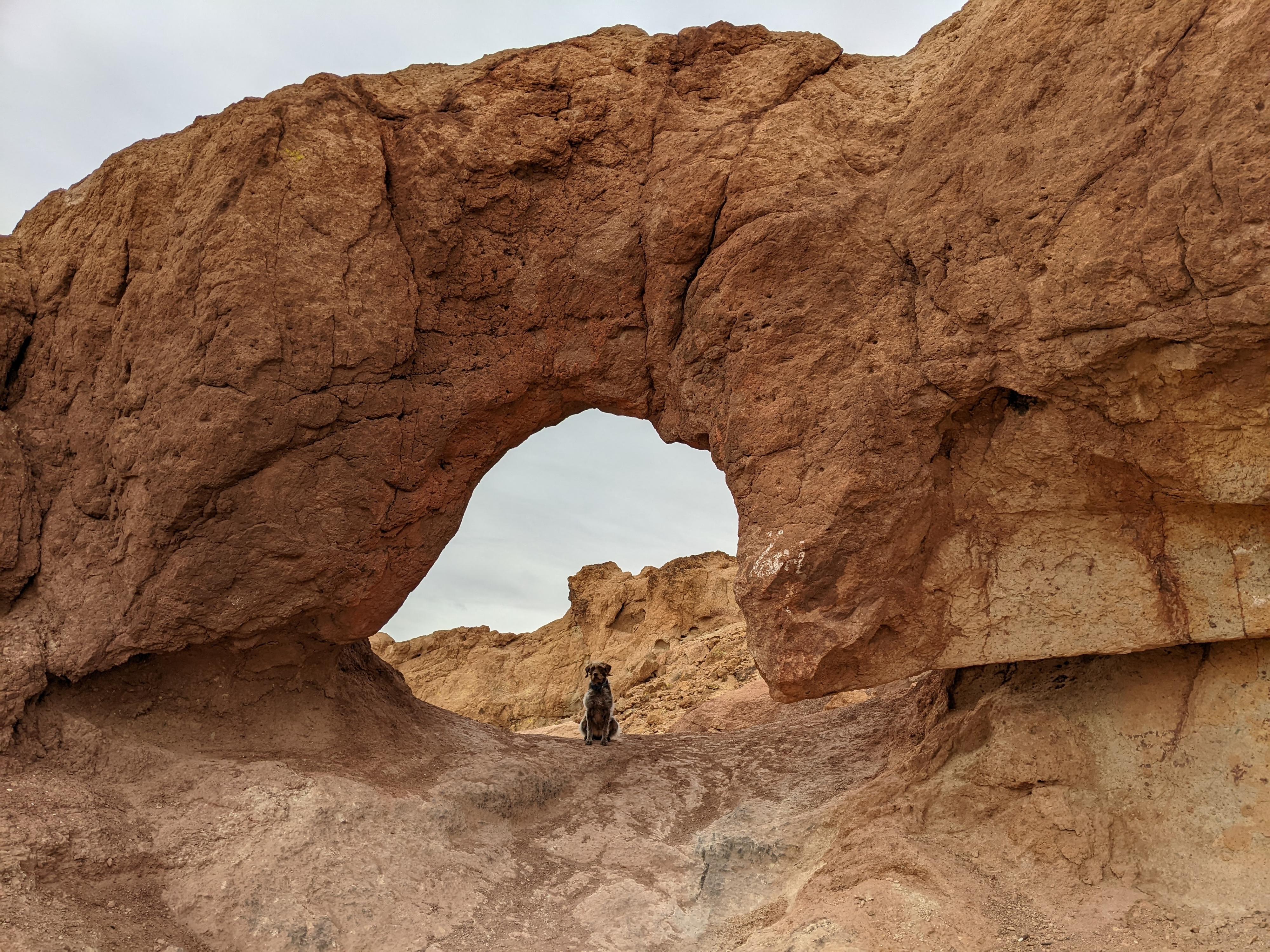
Kramer Arch, close to Calico, is a good introduction to the rugged mountains and a glimpse into the mining history that shaped the area.

Note: Reaching the arch requires a true high clearance 4-wheel drive. Those with low clearance vehicles, carefully driven, can make it to within about a mile one way of the arch and the rest walked.
Caution: Some drive through the arch. If doing so, I would recommend thoroughly checking the geometry of the east side of the arch before committing! It is a bit off-camber and seemed a little difficult with scratch potential if the tires slipped or were misplaced. Large vehicles will not fit.

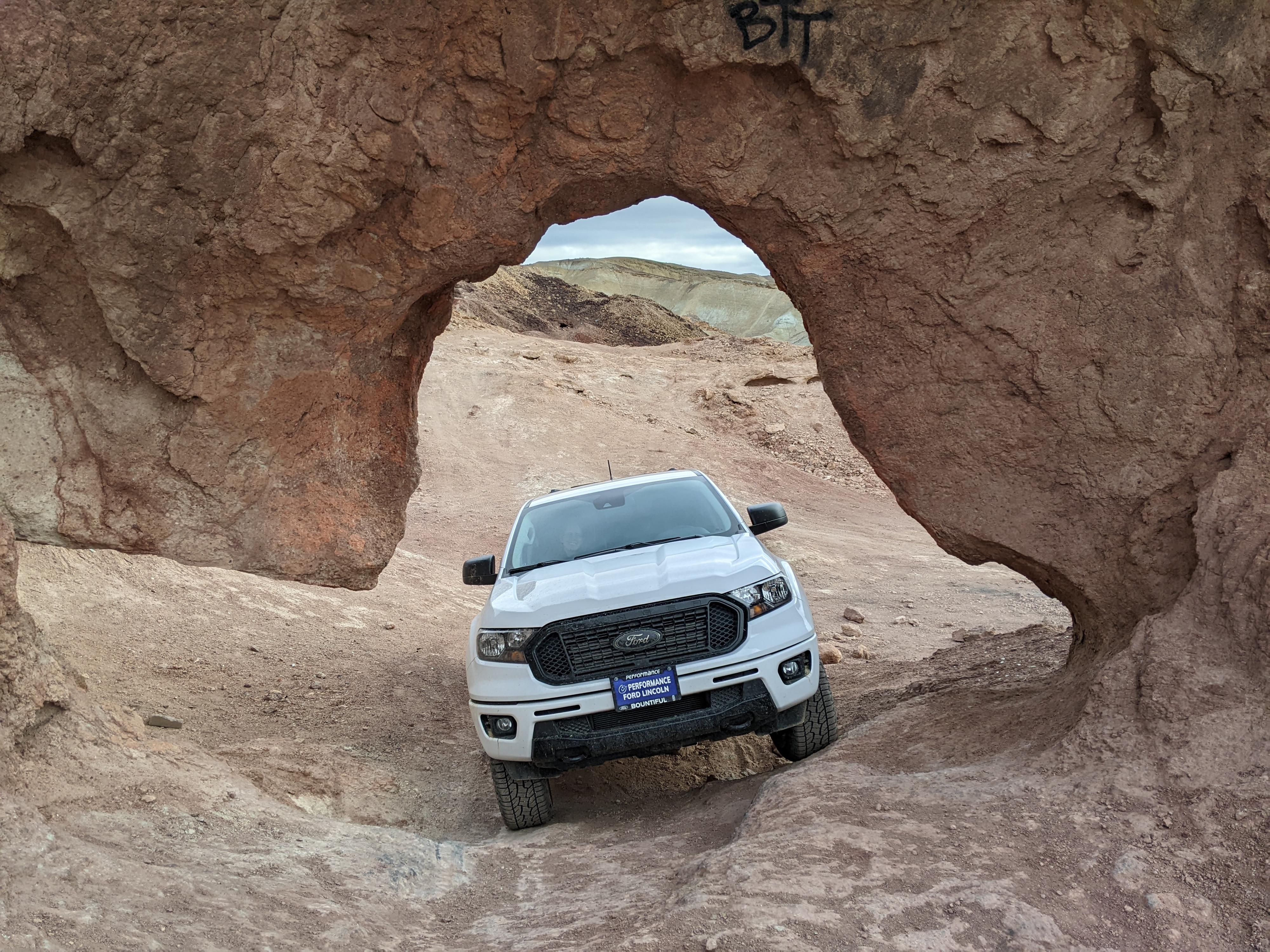
The driving directions below can be walked. Shortly after turning left in Mule Canyon (the junction at 1.6 miles described below), the road gets much rougher. If in a low clearance vehicle, I would not continue past the 1.6 mile mark and simply walk the rest.

Checking out the fit. A bit too tight for my taste.

Checking out the fit. A bit too tight for my taste.

Getting There

Reaching the start of the dirt road is just east of Calico Ghost town. From Calico Ghost town, go east out of the county park onto Ghost Town Road and follow it for 1.9 miles to Mule Canyon Road on the left. The Mule Canyon road starts off as a good dirt road. Reset your odometer as you turn onto the dirt road.

  • Turn off of Calico Road ( 11S 513804mE 3864309mN / N34° 55' 16" W116° 50' 56" )
  • 1.6 miles - Turn left as the canyon opens and divides. The road gets much rougher from here. ( 11S 514647mE 3866433mN / N34° 56' 25" W116° 50' 23" )
  • 2.5 miles - Turn right onto a lesser road heading east. The road divides soon. We went left. It is only about 0.3 miles from the last junction to Kramer Arch. Roads criss-cross the area, and the valley is dotted with mining ruins. The arch will be on the left with a dirt road going up to it and through it. ( 11S 514186mE 3867508mN / N34° 56' 60" W116° 50' 41" )
  • Kramer Arch ( 11S 514310mE 3867618mN / N34° 57' 04" W116° 50' 36" )
Abs on a windy day at Kramer Arch

Abs on a windy day at Kramer Arch

Route

The arch is quite a sight! Mining occurred in the valley around the arch, and taking the time to wander around a bit to visit the mines in highly recommended. Do not enter any open mine shafts or pits.


Maps

Printable Maps:
Kramer Arch

11S 514310mE 3867619mN

N34° 57' 04" W116° 50' 36"

Comments

Want to make a comment? Login and let yourself be heard.