Serpents Trail |

Colorado National Monument

Hiking Serpents Trail - Colorado National Monument Hiking Serpents Trail

Colorado National Monument

Overview

RATING: Easy / Moderate Hike
MAPS: COLORADO NATIONAL MONUMENT, CO

Fri

Rain showers likely before noon, then a chance of showers and thunderstorms between noon and 2pm, then a slight chance of showers and thunderstorms. Mostly cloudy, with a high near 55. South southwest wind 5 to 15 mph. Chance of precipitation is 60%.

55 | 40

Sat

A slight chance of rain showers after noon. Mostly cloudy, with a high near 62. South southwest wind 10 to 30 mph. Chance of precipitation is 20%.

62 | 45

Sun

Rain showers likely before noon, then showers and thunderstorms likely. Mostly cloudy, with a high near 55. Chance of precipitation is 70%.

55 | 45

Mon

A slight chance of rain showers before noon, then a chance of showers and thunderstorms. Partly sunny, with a high near 54.

54 | 36

Tue

Sunny, with a high near 58.

58 | 35

View Full Weather Details
SEASON: Any, hot in the summer
GEAR: Standard Hiking Gear
WATER: None

Fri

Rain showers likely before noon, then a chance of showers and thunderstorms between noon and 2pm, then a slight chance of showers and thunderstorms. Mostly cloudy, with a high near 55. South southwest wind 5 to 15 mph. Chance of precipitation is 60%.

55 | 40

Sat

A slight chance of rain showers after noon. Mostly cloudy, with a high near 62. South southwest wind 10 to 30 mph. Chance of precipitation is 20%.

62 | 45

Sun

Rain showers likely before noon, then showers and thunderstorms likely. Mostly cloudy, with a high near 55. Chance of precipitation is 70%.

55 | 45

Mon

A slight chance of rain showers before noon, then a chance of showers and thunderstorms. Partly sunny, with a high near 54.

54 | 36

Tue

Sunny, with a high near 58.

58 | 35

View Full Weather Details
The new road with Devil's Kitchen on the left.

The new road with Devil's Kitchen on the left.

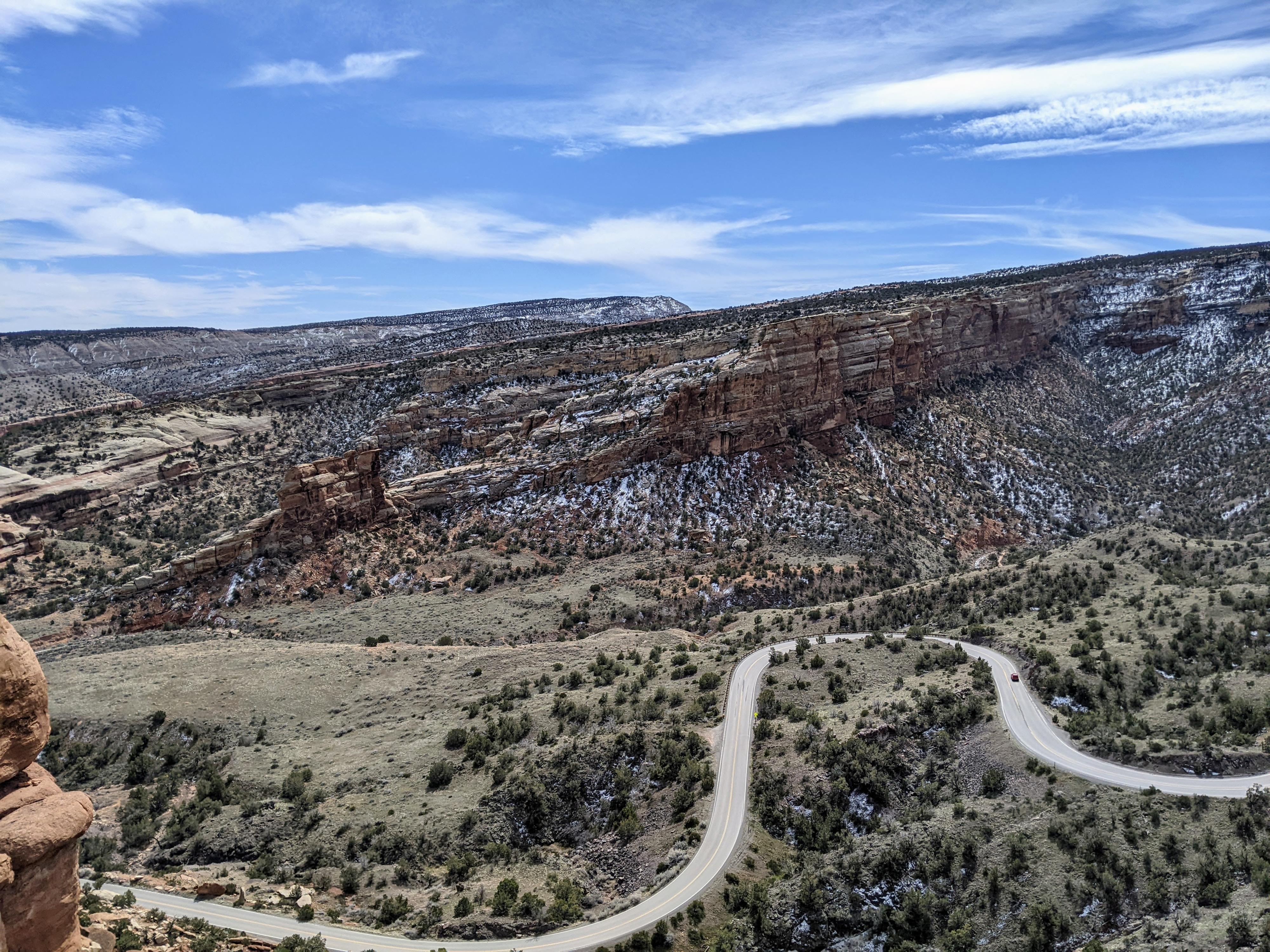
A local favorite for exercise, the Serpents Trail is a trail with much history in Colorado National Monument. John Otto was one of the earliest promoters of Colorado National Monument, and the monument's custodian from 1911-9127. He left is mark on many areas of the monument, including the design of the Serpents Trail. His enthusiasm for the area drove him to try to improve access for visitors. The Serpents Trail with its 16 switchbacks, often called “the crookedest road in the world”, was part of the main road in the monument until the 1950s.

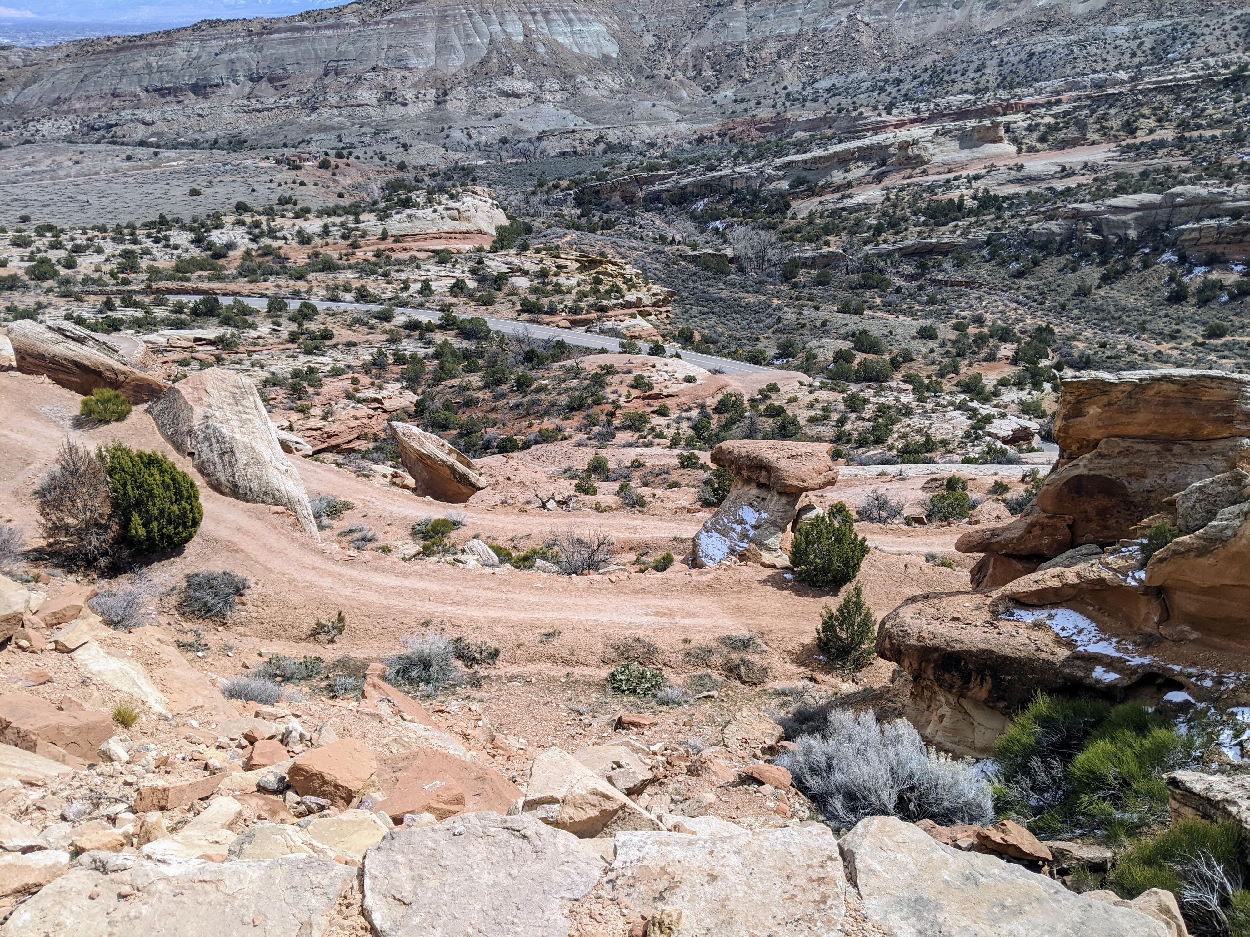
Today, a less steep park road cuts through a tunnel under the Serpents Trail and the old road has been turned into a hiking trail. The trail is about 2 miles one way with about 700 feet of elevation change. It is popular with locals looking to get some exercise. If you have 2 vehicles, or are willing to try to thumb a ride, a walk DOWN the Serpents Trail is an easy outing with outstanding views. With one vehicle as an out and back, it provides good exercise!

Just getting started on the trail.

Just getting started on the trail.

Getting There

From the east side entrance to Colorado National Monument, drive 0.2 miles past the entrance fee station.

The lower trailhead is on the left side of the road signed Devil's Kitchen trailhead. There is somewhat limited parking. If full, there is overflow parking at the Devil's Kitchen Picnic area that is just across the road from the trailhead, where a paved road goes a short distance to a picnic area. There is a restroom at the picnic area.

For the upper trailhead continue another 2.4 miles (2.6 miles total from the entrance) to a small parking area on the left. This one bend after exiting the tunnel.

The trail switchbacking down.

The trail switchbacking down.

Route

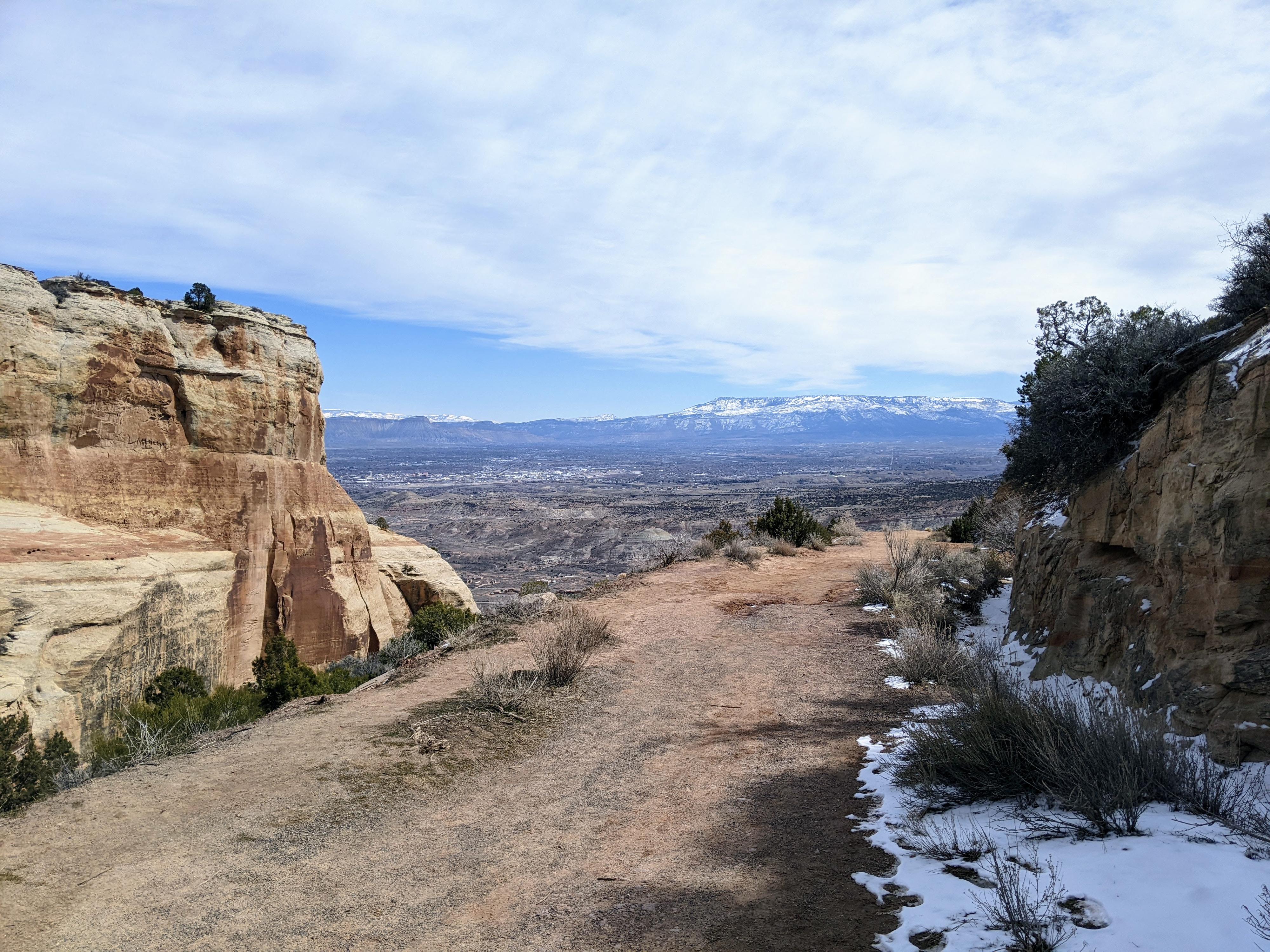
From the upper trailhead, simply follow the old dirt road as it winds down to the Devil's Kitchen trailhead. The views to the north of Grand Valley and the Book Cliffs are excellent along the way, and are the views east into Devil's Kitchen and No Thoroughfare Canyon areas.


Maps

Route / 1.91 miles / Elevation Range 5,041 - 5,829 ft.
Printable Maps:
Upper Trailhead

12S 703760mE 4323114mN

N39° 02' 00" W108° 38' 45"

Lower Trailhead

12S 705067mE 4322995mN

N39° 01' 55" W108° 37' 51"

Comments

Want to make a comment? Login and let yourself be heard.