 Hiking
Mineral Fork
Hiking
Mineral Fork
Big Cottonwood Canyon
Overview
Mineral Fork, as its name suggests, has a rich mining history. There are two major mines in the canyon. The Wasatch Mine sits at about 8,800 feet and the Regulator Johnson Mine that sits at a lofty 10,121 feet, near the top of the canyon. Mining was started in Mineral Fork in the 1880s. The mines were looking mining silver, gold, copper, and lead. Between the Wasatch and Regulator Johnson Mine, there were over 5,500' of tunnels, though neither mine produced much.
Today the old mining road is now a hiker and ATV trail. There is part of a structure at Wasatch Mine, but only a few remains of an old compressor and some rail line is left at the higher Regulator Johnson Mine.
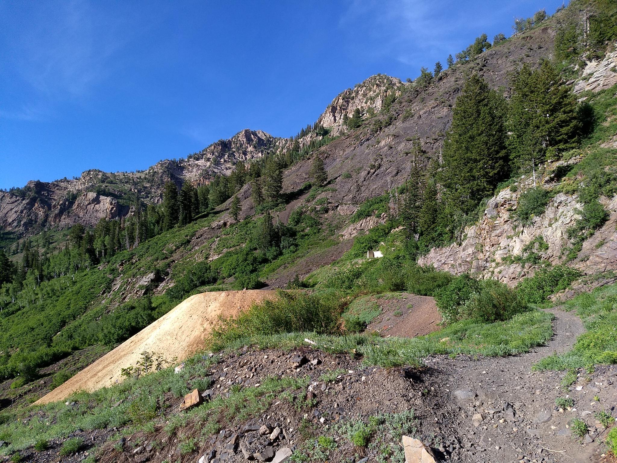
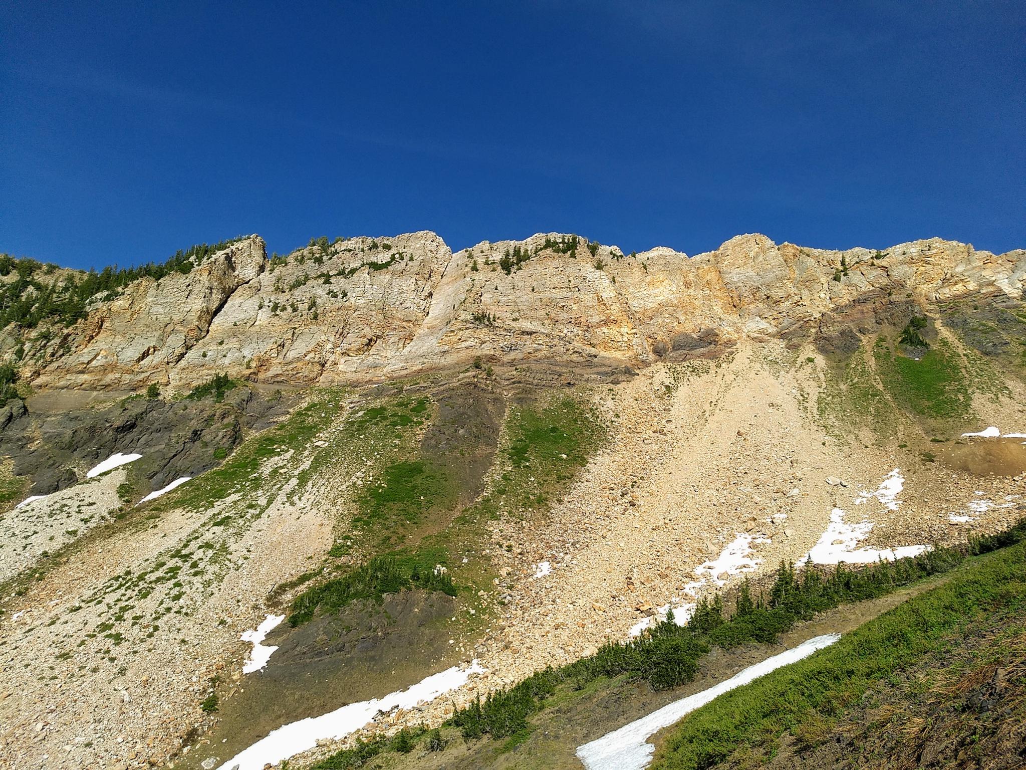
The canyon starts densely forested, but by the Wasatch Mine, the trees begin to open with views of the dramatic upper bowl. For those looking for a easy/moderate hike, the Wasatch Mine is a reasonable distance and great for groups. If you are looking for a big day, with almost 4000' of elevation gain, continuing to Regulator Johnson Mine is even better. The upper bowl is steep-walled, and very scenic, especially in early to mid-summer when the slopes are likely to be still covered in snow.
Getting There
Big Cottonwood Canyon is on the east side of the Salt Lake City Valley. Get there by taking I-215 to the east, taking exit 6 off the interstate and heading east.
Follow 6200 South which becomes Wasatch Blvd for 1.8 miles to the stop light and signs for Big Cottonwood Canyon.
Turn left at the light and reset your odometer.
Drive up Big Cottonwood Canyon. At 6.3 miles there is wide shoulder and gated side road on the right (south) side of the road. This is the trailhead.
Route Description
To Wasatch Mine (3.1 miles / 1.5-2 hours one way)
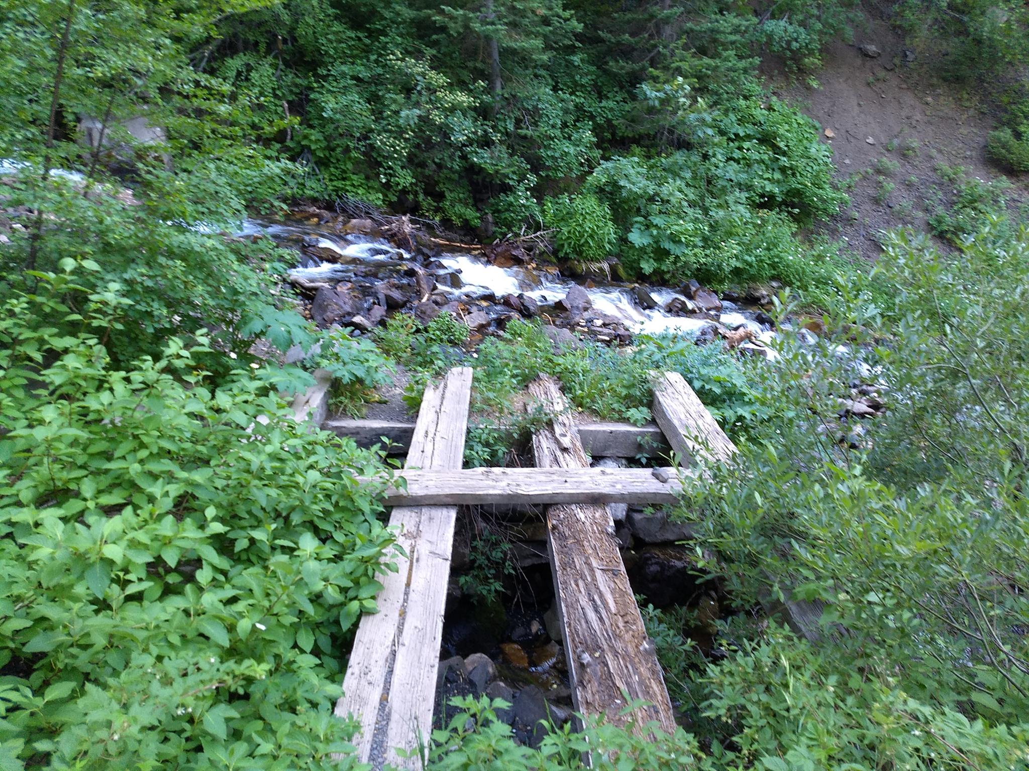
From the trailhead, follow the road as it crosses Big Cottonwood Creek, and begins a steep ascent. It crosses two small streams as it quickly climbs. Both of these are usually easy to keep your feet dry with a little rock hopping. After a few switchbacks, the trail begins to ease its ascent a bit, soon crossing the stream as it enters a more open area. This crossing has a couple of options, including a minimal log bridge on the downstream side as of 2019.
From the crossing, it is easy walking as the tree being to open, and glimpses of the upper basin begin to appear. A fork in the road is reached, with both forks going to Wasatch Mine. Left crosses the stream, climbs, and is generally a bit easier walking. Right stays in the canyon bottom and is quite rocky.
To Regulator Johnson Mine (5.25 miles / 3.5+ hours one way)
Continuing up from Wasatch Mine, the road begins its ascent, zig-zagging up steep switchbacks. As you get higher, the road forks. Both forks lead to Regulator Johnson. If snow-free, I think the right fork is more comfortable walking. The left fork gets more sun and is likely to melt off earlier in the spring. The road ends at a flat spot and old rust compressor ruins.
Photos
Maps

12T 440927E 4498643N
40°38'11"N 111°41'55"W
12T 441478E 4497433N
40°37'32"N 111°41'31"W
12T 442329E 4496296N
40°36'56"N 111°40'54"W
12T 442684E 4495775N
40°36'39"N 111°40'39"W
12T 443010E 4494644N
40°36'02"N 111°40'25"W
12T 442952E 4494552N
40°35'59"N 111°40'27"W