
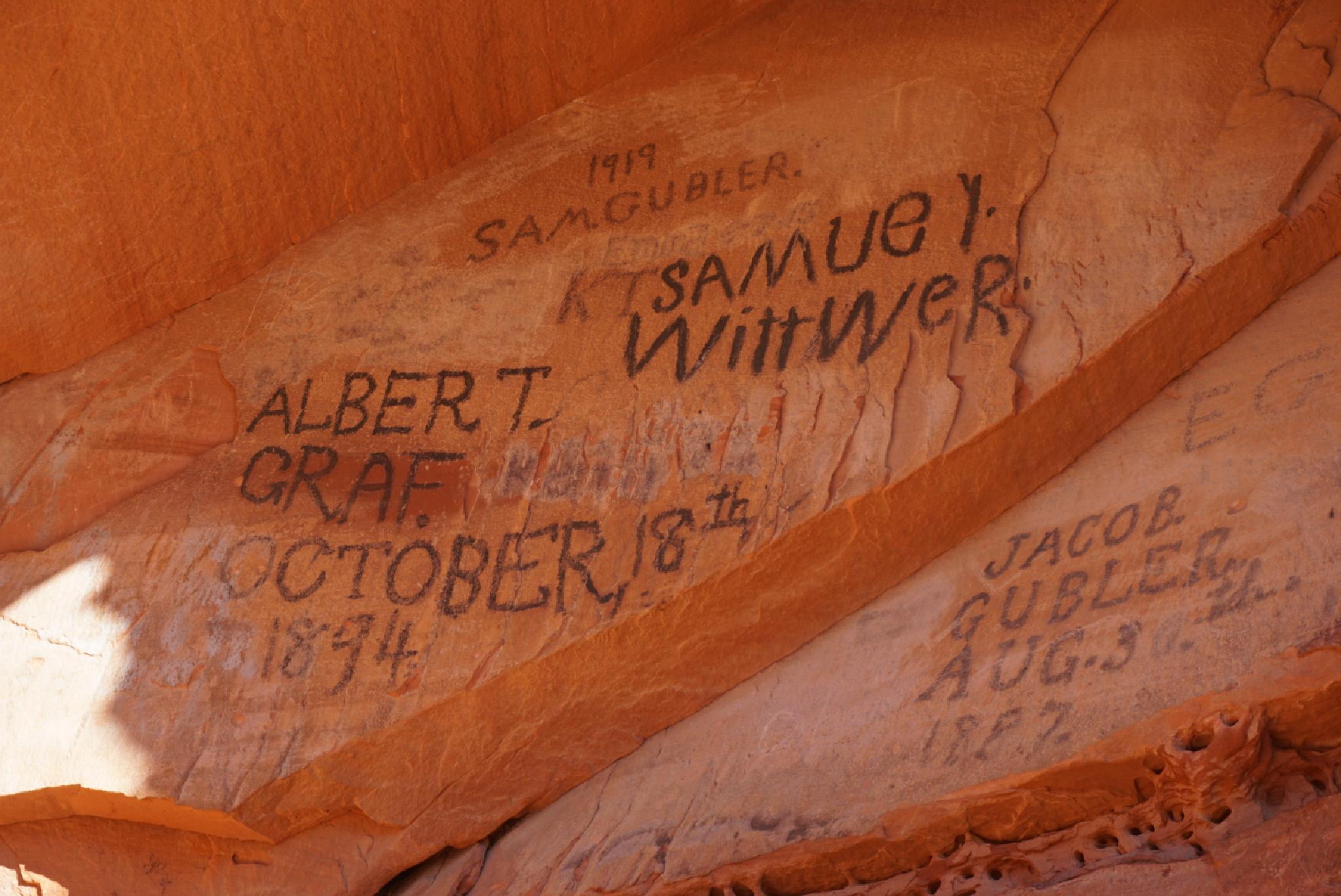
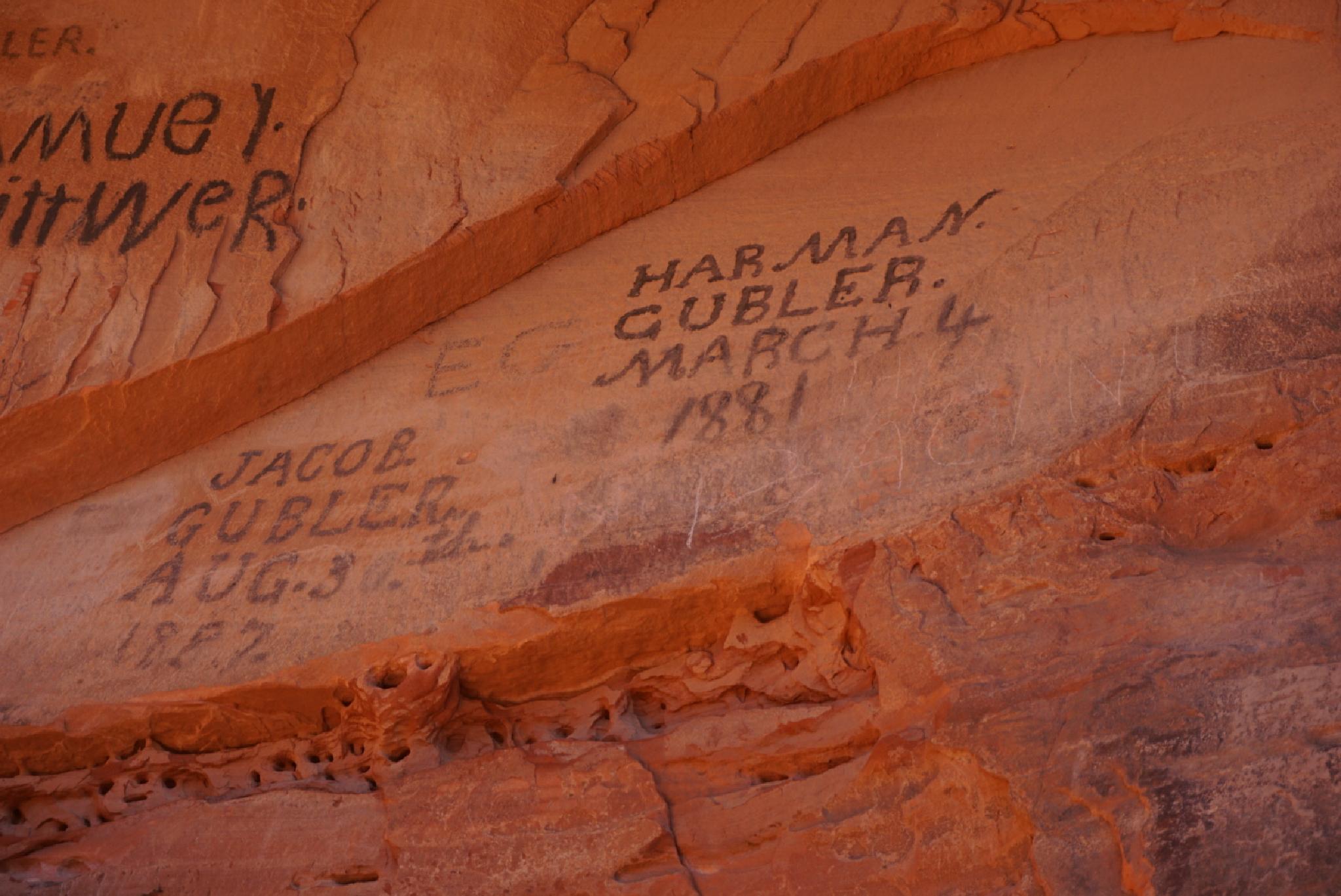
 Pioneer Names
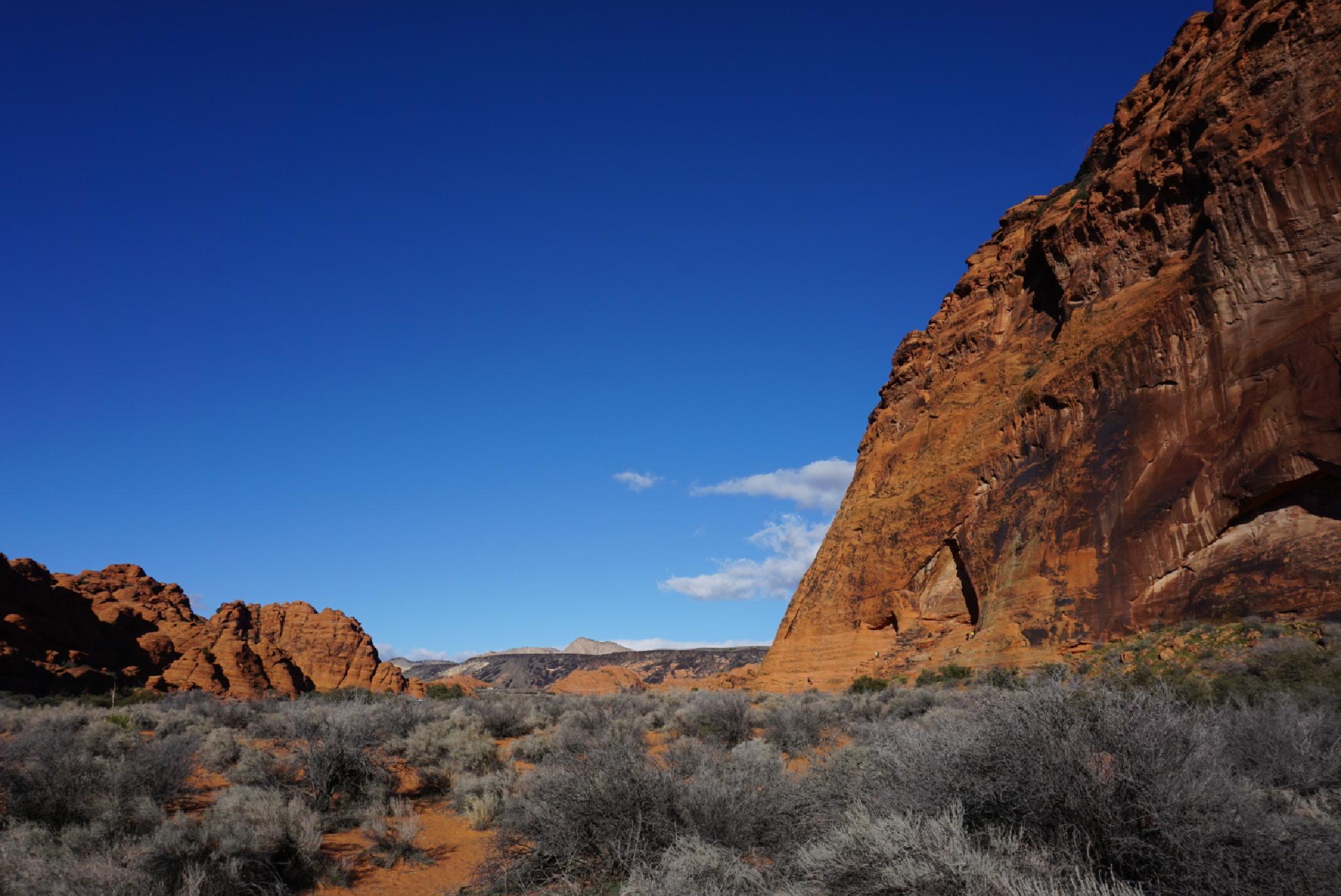
Snow Canyon
Overview
St. George was founded in 1861 by the Mormon church, under the direction of Erastus Snow. The settlement, initially, was meant to produce cotton. As the early pioneers settled the area, they left their marks on the country both in the naming of places, as well as literal marks. Snow Canyon is named after Erastus Snow.
This short trail visits an overhang near the main park road that has several pioneer names painted on the rock with axle grease from the late 1800s and early 1900s. Though a short hike, I enjoyed the history and scenery. It is easy to imagine, as you stare up at the tower walls and colorful views that early pioneers visited the canyon for picnics and other outings.
Getting There
From the south entrance of the park on Snow Canyon Road, reset your odometer as you enter the park. At 1.1 miles, the south end of the Pioneer Names Trail trailhead is on the right. Continue to 1.3 miles for the upper (and recommended) trailhead.
Route Description
The trail can be done as a one-way through hike with two cars, though it is short enough, that just walking the road back to your vehicle is easy enough. If just visiting the pioneer names proper, this is a short 10 minute out and back hike.
From the trailhead, the trail goes to the base of the cliff. The cliff is very popular with climbers. Just to the right is an overhang with the pioneer names. The scramble up to view the names closer is relatively easy, but be careful on the slickrock on your way back.
If you continue along the official trail, it hugs the tall cliffs, visiting a small hidden arch just before re-joining the main park road.
Maps

12S 265201E 4119890N
37°11'45"N 113°38'44"W
12S 265273E 4120075N
37°11'52"N 113°38'41"W
12S 265371E 4120033N
37°11'50"N 113°38'37"W
12S 265265E 4119853N
37°11'44"N 113°38'41"W