Balanced Rock |

Arches

Hiking Balanced Rock - ArchesRoadside Attraction Balanced Rock - Arches Balanced Rock

Arches

Overview

RATING: Roadside Attraction / Short Hike
MAPS: THE WINDOWS SECTION, UT;

Wed

Sunny, with a high near 80. South southwest wind 10 to 20 mph.

80 | 53

Thu

Mostly sunny, with a high near 72. South southwest wind 10 to 25 mph.

72 | 52

Fri

A slight chance of rain showers before noon, then a chance of showers and thunderstorms. Partly sunny, with a high near 67. Chance of precipitation is 40%.

67 | 48

Sat

A chance of showers and thunderstorms. Partly sunny, with a high near 61.

61 | 44

Sun

Sunny, with a high near 67.

67 | 41

View Full Weather Details
SEASON: Any
WATER: None.

Wed

Sunny, with a high near 80. South southwest wind 10 to 20 mph.

80 | 53

Thu

Mostly sunny, with a high near 72. South southwest wind 10 to 25 mph.

72 | 52

Fri

A slight chance of rain showers before noon, then a chance of showers and thunderstorms. Partly sunny, with a high near 67. Chance of precipitation is 40%.

67 | 48

Sat

A chance of showers and thunderstorms. Partly sunny, with a high near 61.

61 | 44

Sun

Sunny, with a high near 67.

67 | 41

View Full Weather Details
Balanced Rock informational sign.

Balanced Rock informational sign.

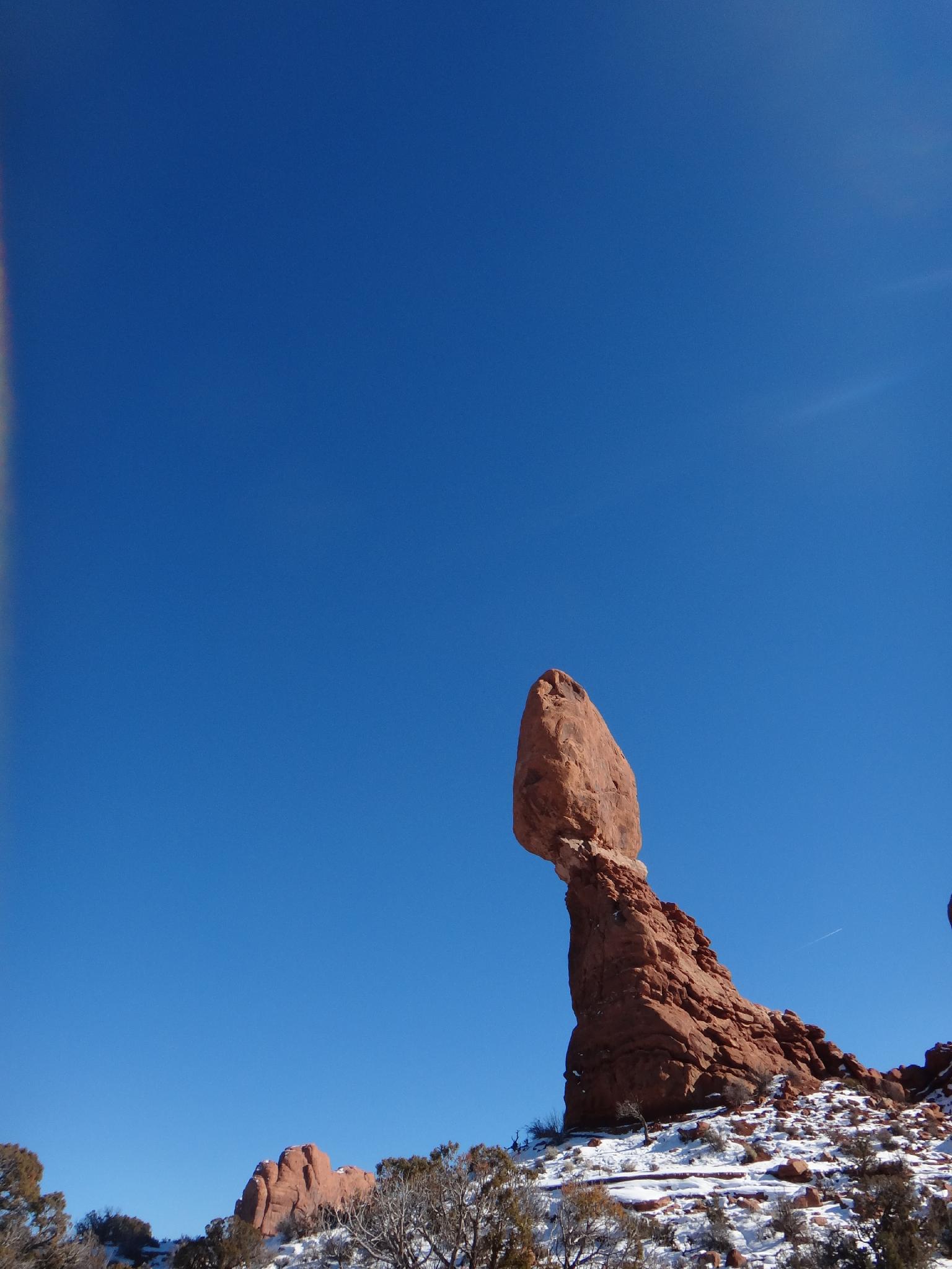
Balanced Rock is one of the iconic symbols of Arches National Park. It sits right next to the park road and is impossible not to visit if you are driving through the park.

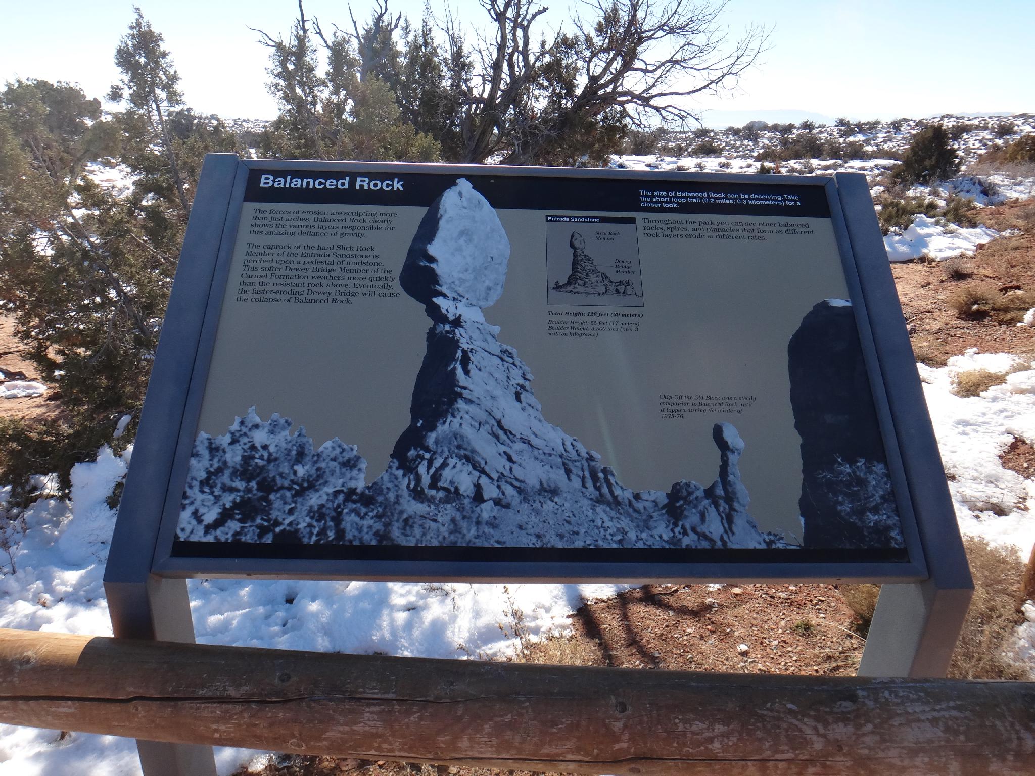
The iconic tower sits 128 ft tall and is composed of Entrada Sandstone top sitting on a Dewey Bridge Formation pedestal. The different erosion rates of the two types of sandstone are what created Balanced Rock and what will ultimately be its demise. As the base continues to weather, the rock will ultimately tumble.

It is interesting to note that until the winter of 1975/76, there was an additional small tower to the south of Balanced Rock called “Chip-Off-the-Old-Block”. The freeze/melt cycles caused the demise of Balanced Rocks smaller neighbor that winter. Will Balanced Rock stay balanced for a year? A hundred years? A thousand years? Time will tell.

Evening light is astounding on the rock, and the best time to visit. It makes a great way to end a day visiting the park.

The iconic Balanced Rock

The iconic Balanced Rock

Balanced Rock from a different side.

Balanced Rock from a different side.

Getting There

From the visitors center, follow the main park road 8.9 miles. Balanced Rock and the pullout are on the right.

Balanced Rock in the winter.

Balanced Rock in the winter.

Route

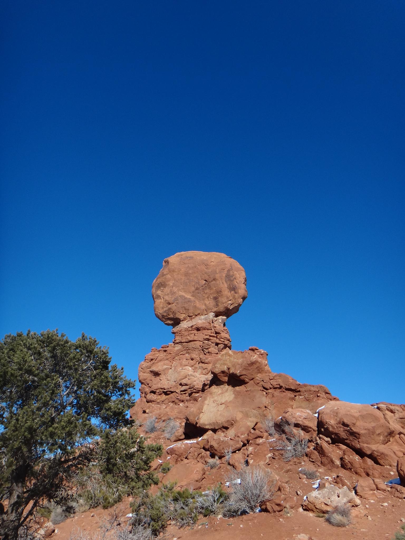
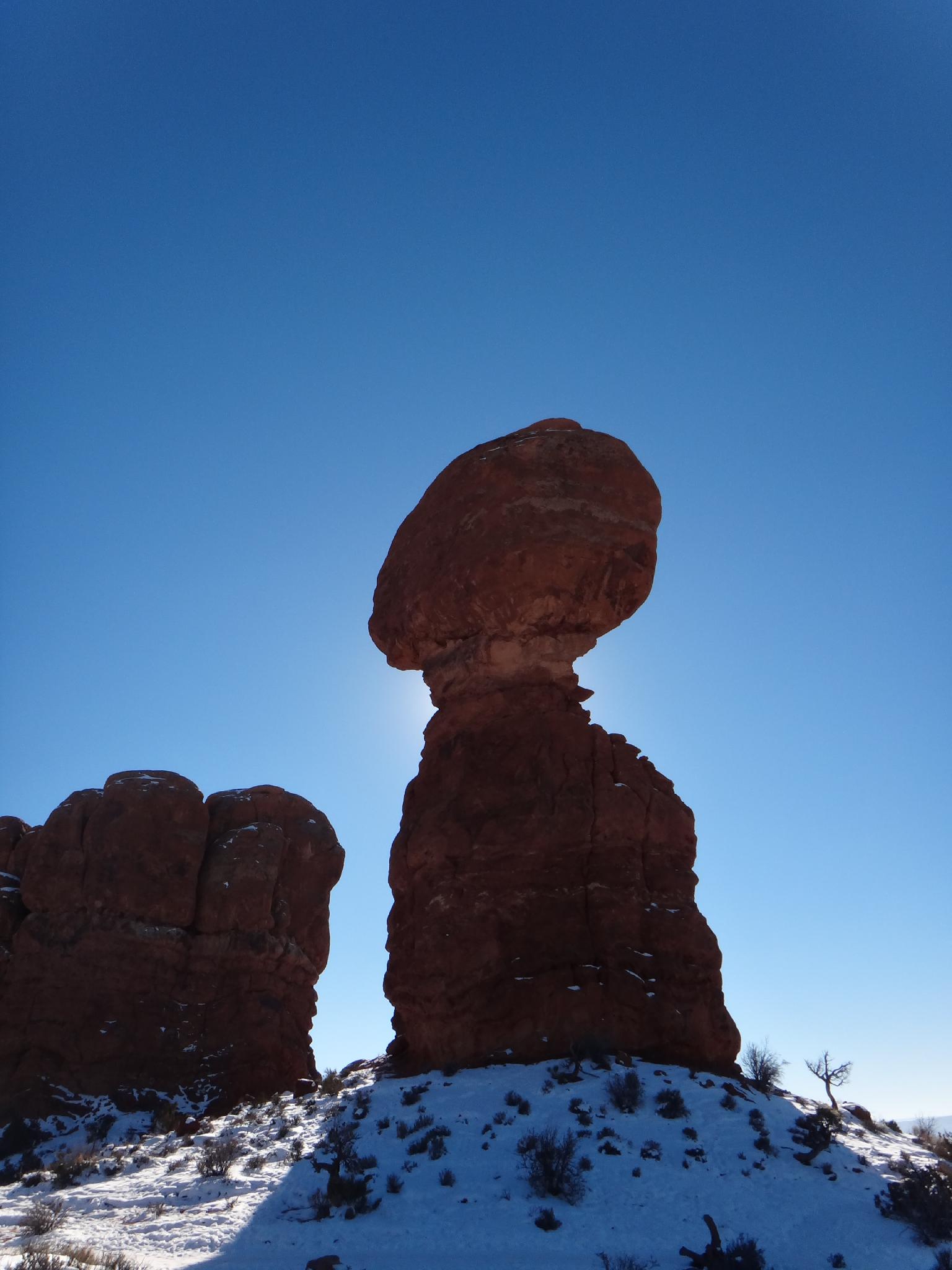
Many simply visit the parking area, take a few pictures, and move on. I would recommend taking the few minutes to hike the short (0.3 mile) trail that circles Balanced Rock to see it from all angles.

Note: There is a picnic area just across the road from the Balanced Rock turn out down the gravel road about 0.1 miles. It contains several picnic tables, a shade cover, and a vault toilet and makes a great lunch spot with nice views of Balanced Rock.


Maps

Route / 0.28 miles / Elevation Range 5,034 - 5,098 ft.
Printable Maps:
Trailhead

12S 624688mE 4284652mN

N38° 42' 06" W109° 33' 58"

Picnic Area

12S 624427mE 4284761mN

N38° 42' 10" W109° 34' 09"

Comments

Want to make a comment? Login and let yourself be heard.