 Hiking
American Fork Twin Peaks
Hiking
American Fork Twin Peaks
Salt Lake County Highpoint
Overview
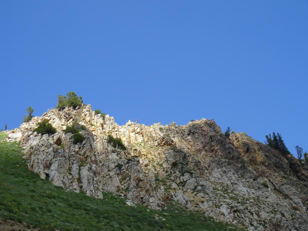
American Fork Twin Peaks is the highest peak in Salt Lake County. There are two common ways to reach the summit, hiking from the parking area of Snowbird, or hiking from the top of Hidden Peak Tram at Snowbird. In my opinion, the tram ride is worth the money, though some high pointers have told me this approach borders on cheating. If it is cheating, logic will dictate you start every high point hike from the lowest point in the state. :)
The route from the parking lot is easy, but start early, afternoon thunderstorms are common and thwarted must first attempt not 400 vertical feet from the summit. The Hidden Peak route looks very exposed and difficult from a distance, but once on the route, it has a few class 4 sections, but is overall very straightforward. My partner on the Hidden Peak route didn't have much exposed scrambling experience and found it very easy. I found the Hidden Peak route much more scenic and fun. Difficult and exposed enough to keep your attention, but not scary. Experienced scramblers will have no problems.
Getting There
Either option starts and the Snowbird Ski Resort up Little Cottonwood Canyon, just east of Salt Lake City.
- Take exit 295 for UT-209/9000 so, and head east.
- 0.3 mi - Keep left at the fork, follow signs for Sandy
- Slight left onto W 9000 S
- After 2.4 mi, Slight left onto E 9400 S
- After another 2.0 mi, Continue onto UT-209 E/E 9600 S St/Little Cottonwood Rd
- Follow UT209, then UT210 up little cottonwood canyon. About 10 miles up the canyon, take the 2nd Entry into Snowbird on the right.
Route Description
Summit: 3502 m ( 11490 ft. )
Tram Route Trailhead: 3344 m ( 10972 ft. )
Hiking Route Trailhead: 2449 m ( 8035 ft. )
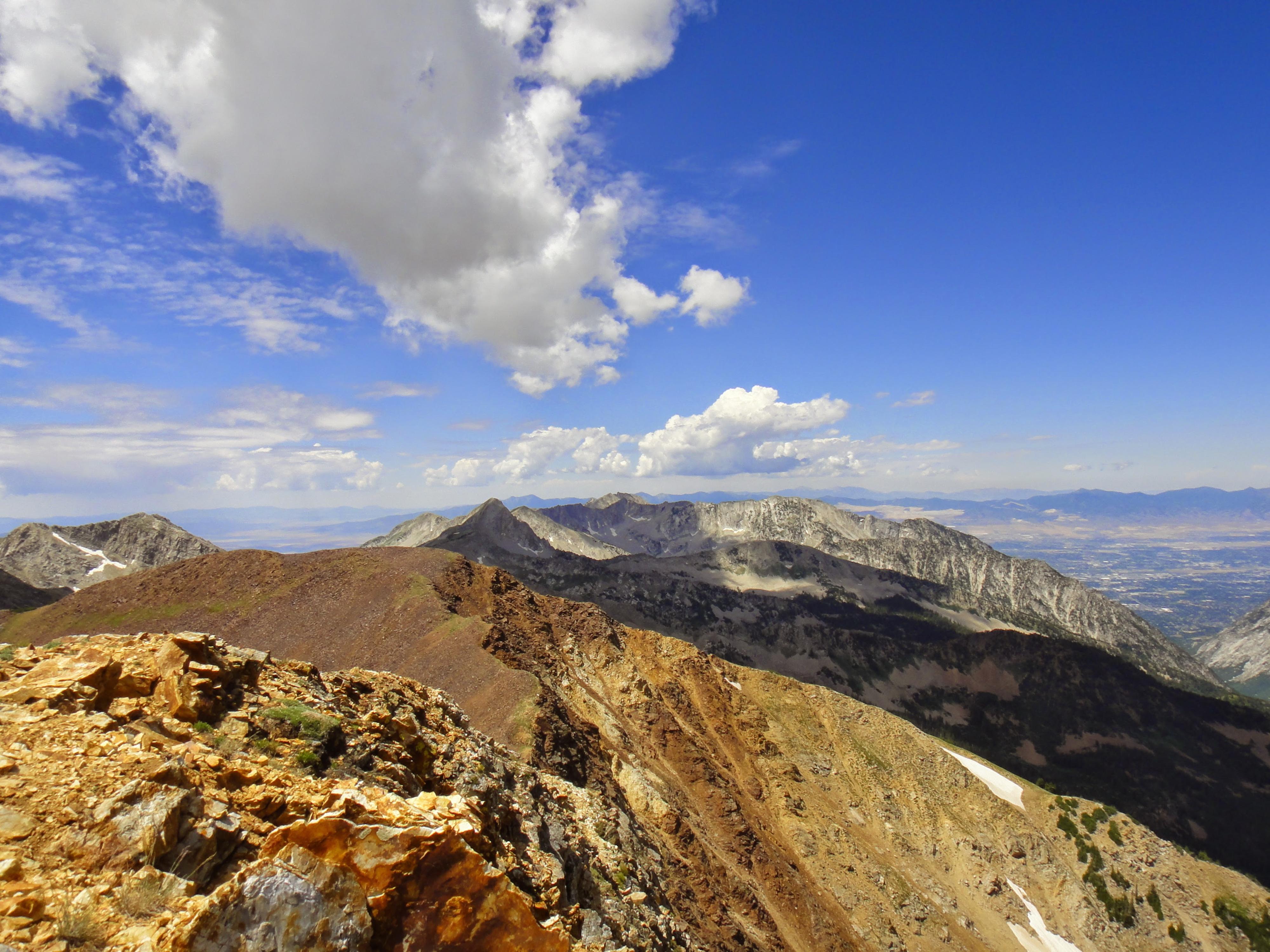
Tram Route (Class 4, 3-4 hours)
It taking the aerial tram, you want the Hidden Peak Tram, generally the only one running in the summer. It varies with season, but generally starts running about 9 AM.
From the top of the tram, follow the obvious ridge line west. A bit of easy scrambling leads across a pass, then a bit more scrambling up the other side becomes a steep loose trail. Follow the trail up, and then continue west to the West Twin, and high point marked by a cairn. Timpanogos is visible far in the distance to the south, with Box Elder Peak, and the Lone Peak areas visible to the west. To the northwest is the Broad Fork area, across the canyon. Stunning.
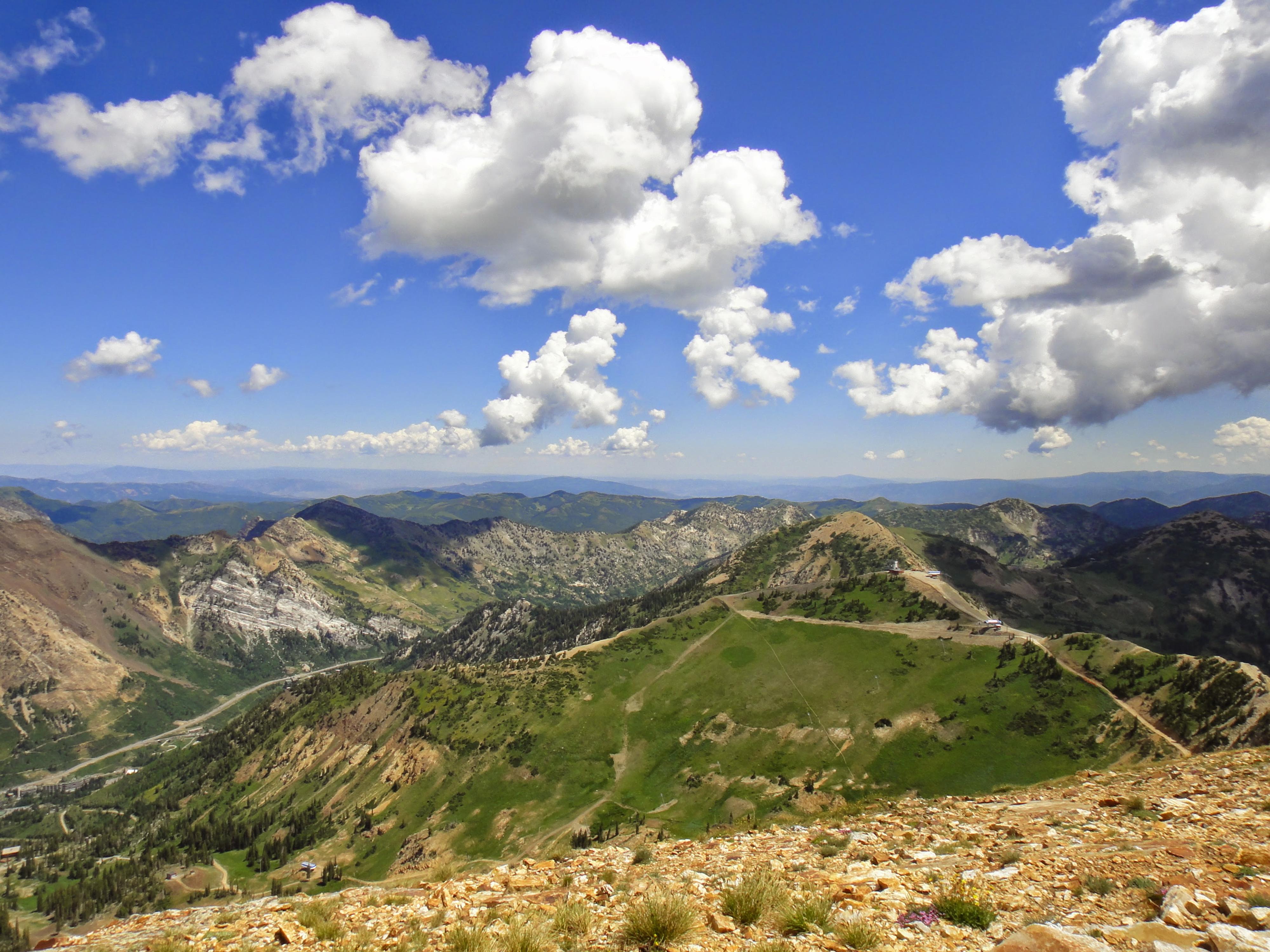
Hiking Route (Class 3 - 5-6 hours)
From the parking area head up to Gad Valley. Trails change a bit, so check the ski resort map at the base. The goal is to work up to Gad Valley, and the top of the Gad 2 Lift. The top of the lift is almost due north of the peak.
From the top of the Gad 2 Lift, go west, working up to the ridge line, then follow the ridgeline to the summit. There is a little loose rock getting to the ridge line, but then easy going. Return the way you came, or traverse the ridgeline east (via the Hidden Peak Route described above) and head down from there.
Photos
Maps

12T 444227E 4492303N
40°34'47"N 111°39'32"W
12T 445373E 4490202N
40°33'39"N 111°38'43"W
12T 444447E 4489200N
40°33'06"N 111°39'22"W