
 Farnsworth Canyon
Eastern Reef
Overview
Short narrows, a pictograph panel, big views, arches, and even an optional rappel or two, what more could a canyon offer? Farnsworth is a charmer, and a canyon I have visited many times over the years. Visiting the lower section of the canyon, through the narrows or up to the pictograph panel, offers an easy to access outing suitable for most and a good kid friendly hike. For those with a bit more energy, a jaunt up to the top of the reef offers big views and three hidden arches/bridges. Still not satisfied? Have some technical canyoneering skills? Returning via Jug Handle Arch canyon offers a rappel or two and is a lot of fun.
Currently (2015), the canyon is well setup, and very beginner friendly. Highly recommended for most groups. In 2003 or 2004, this was the first technical canyon I did solo. Re-visiting it 12 years later I was amazed at how well I remembered it, and how fun it was. A must do if you are in the area, I have visited the lower section many times as a quick jaunt in the evening to stretch the legs.
Getting There
South of I-70 about 25 miles on Highway 24 (about 25 miles north of Hanksville), a signed road goes off to the west signed Goblin Valley. Follow this paved road 5.1 miles to a junction and kiosk on the right.
At kiosk, go north on the road nearest the kisok to a 4-way junction in just a few hundred feet. Take the left fork heading northwest. Several small side roads leave that go to camping areas. Stay on the main road. At mile 1.0, the main road enters a major wash and divides. Go right. The road climbs out of the wash, and crosses a rough spot at 1.4 miles. This will stop low clearance vehicles. Continue to 2.5 miles where an old closed track leaves on the left. This is the trailhead.
Route Description
Rock art and historic sites are fragile, non-renewable cultural resources that, once damaged, can never be replaced. To ensure they are protected, please:
- Avoid Touching the Petroglyphs: Look and observe, BUT DO NOT TOUCH!
- Stay on the Trails: Stay on the most used trails when visiting sites, and don't create new trails or trample vegetation.
- Photography and Sketching is Allowed: Do not introduce any foreign substance to enhance the carved and pecked images for photographic or drawing purposes. Altering, defacing, or damaging the petroglyphs is against the law -- even if the damage is unintentional.
- Pets: Keep pets on a leash and clean up after them.
- Artifacts: If you happen to come across sherds (broken pottery) or lithics (flakes of stone tools), leave them where you see them. Once they are moved or removed, a piece of the past is forever lost.
To The Panel (1.3 miles / 45 minutes)
From the trailhead, follow the very faded 2-track a few minute west toward the reef and obvious Farnsworth Canyon. It is deep walled. Once in the canyon, follow it up stream through the lovely sculpted narrows. They end all too soon as the canyon opens quickly.
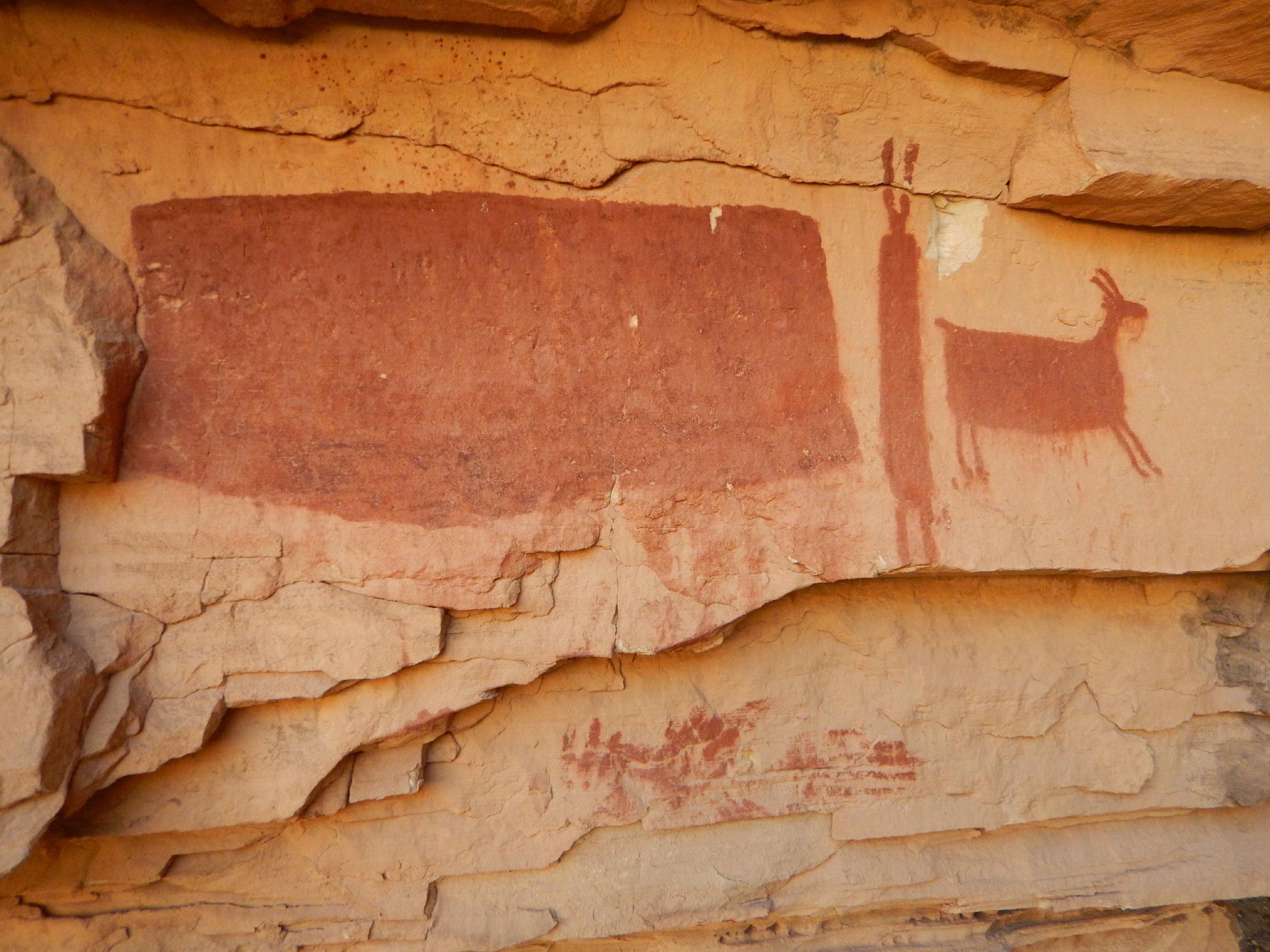
Stay in the main wash continuing up Farnsworth, keeping an eye out on the right for a surprisingly well preserved panel under an overhang. It is visible as a big red box from the wash, and worth the short side trip up to get a closer view.
To The Arches (2.75 miles past panel / 1.5 hours past panel)
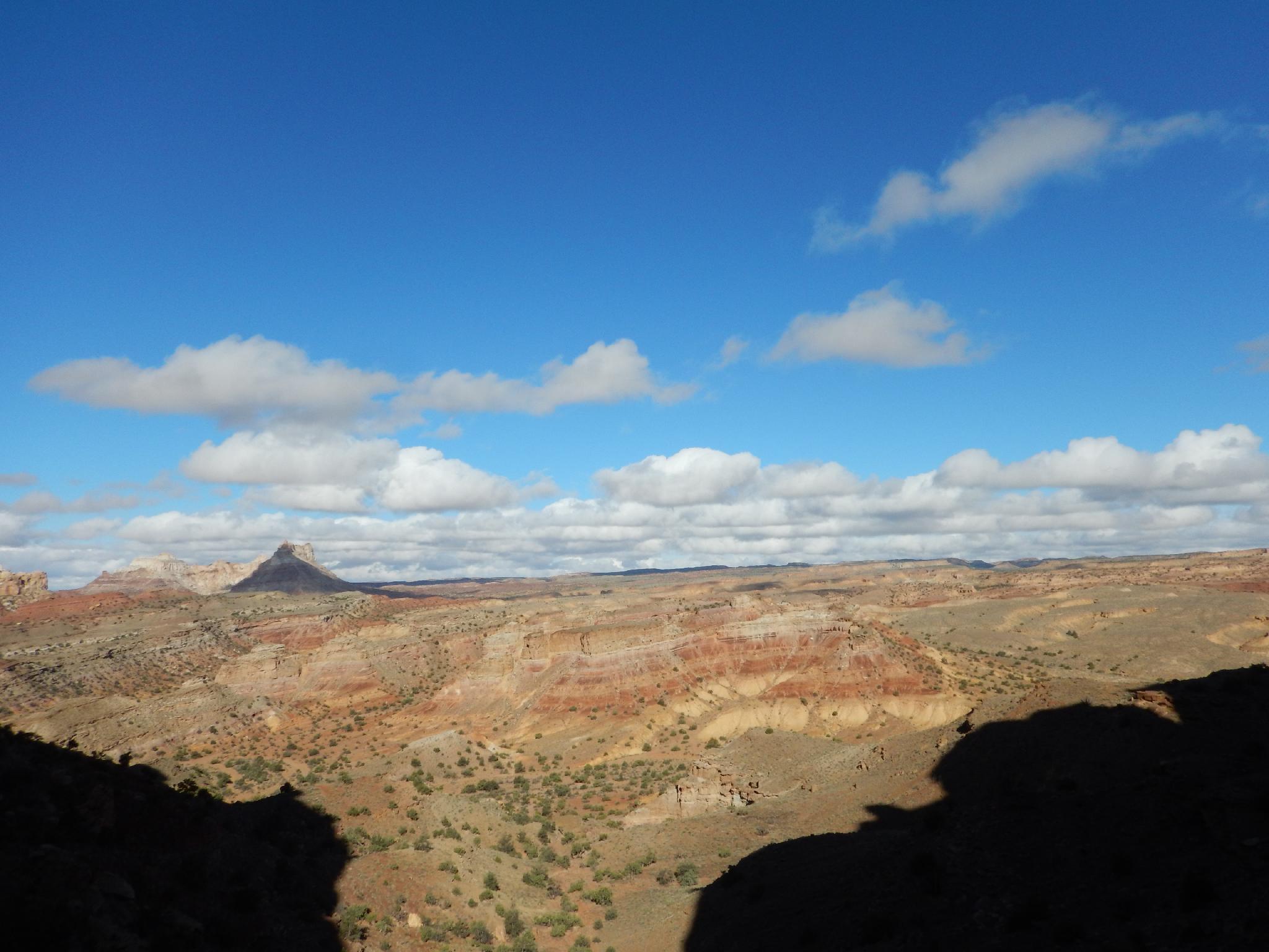
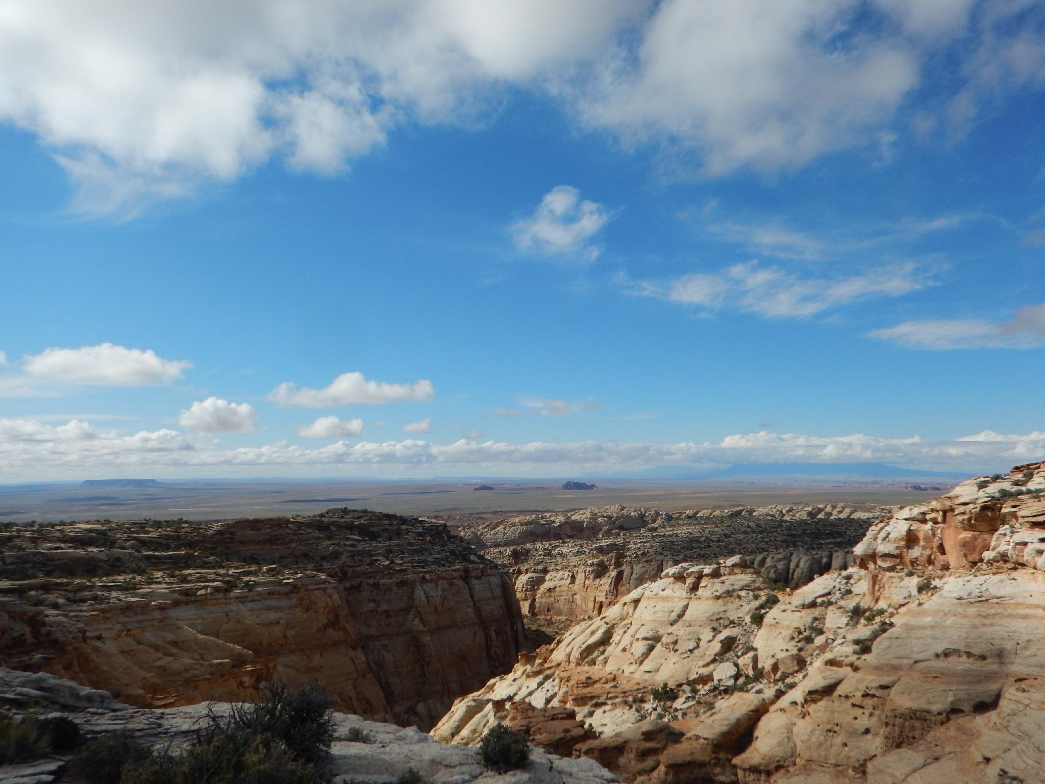
Continue up Farnsworth until it exits the back of the reef, and an old mining road leaves the wash on the right. Take the old mining road, soon entering another wash. Follow it up to a wooden fence and BLM information kiosk. From the kiosk, follow the ATV trail north up the wash. After a major bend, an old mining road leaves the wash heading up to a rubble gully that allows access to the top of the reef. Follow the old mining road as high as possible, then scramble up the gully to the top of the reef.
Route finding is a little tricky to find the arches. Go southwest a few minutes until a shallow drainage is encountered. Follow this down to the head of several canyons. There are 3 major canyons, with a bridge or arch in each, though they are very hard to spot or photograph. The first one (eastern most) is San Rafael Bridge, best viewed from below if doing the technical route. The middle one is Hidden Bridge, and the western most is Jug Handle Arch.
Down Jug Handle Arch (1 hour)
Jug Handle is the western most canyon/arch. It is best to walk the rim to the west until you spot the arch. The anchor is visible at the arch, and another anchor on the slab below. Reaching the anchor should be easy, so if it seems difficult, choose another route.
Rappel 1 is 60 m ( 197 ft. ) down and through Jug Handle Arch. Be very mindful of the pull, it can be tough and cause rope grooves. With a 60 m ( 197 ft. ) rappel, you can pass the anchor on the slab and continue to the canyon floor.
Below the first rappel is a rubble pile that is straightforward to down climb.
A minute below the rubble pile is a final drop that is about 7 m ( 23 ft. ). It is setup for a rappel, but if you traverse left on the slab, it reaches a corner and crack that begs to be downclimbed. I would recommend the downclimb over the rappel.
Below is a short section of slot before the canyon open. Follow it down picking around boulders to its confluence with Farnsworth.
Maps

12S 533493E 4279822N
38°39'59"N 110°36'54"W
12S 532707E 4281643N
38°40'58"N 110°37'26"W
12S 531713E 4282623N
38°41'30"N 110°38'07"W
12S 531769E 4282981N
38°41'42"N 110°38'05"W
12S 531937E 4283253N
38°41'50"N 110°37'58"W
12S 532283E 4282956N
38°41'41"N 110°37'44"W