 Roadside Attraction
Elephant Rock Arch
Roadside Attraction
Elephant Rock Arch
Tule Valley
Overview
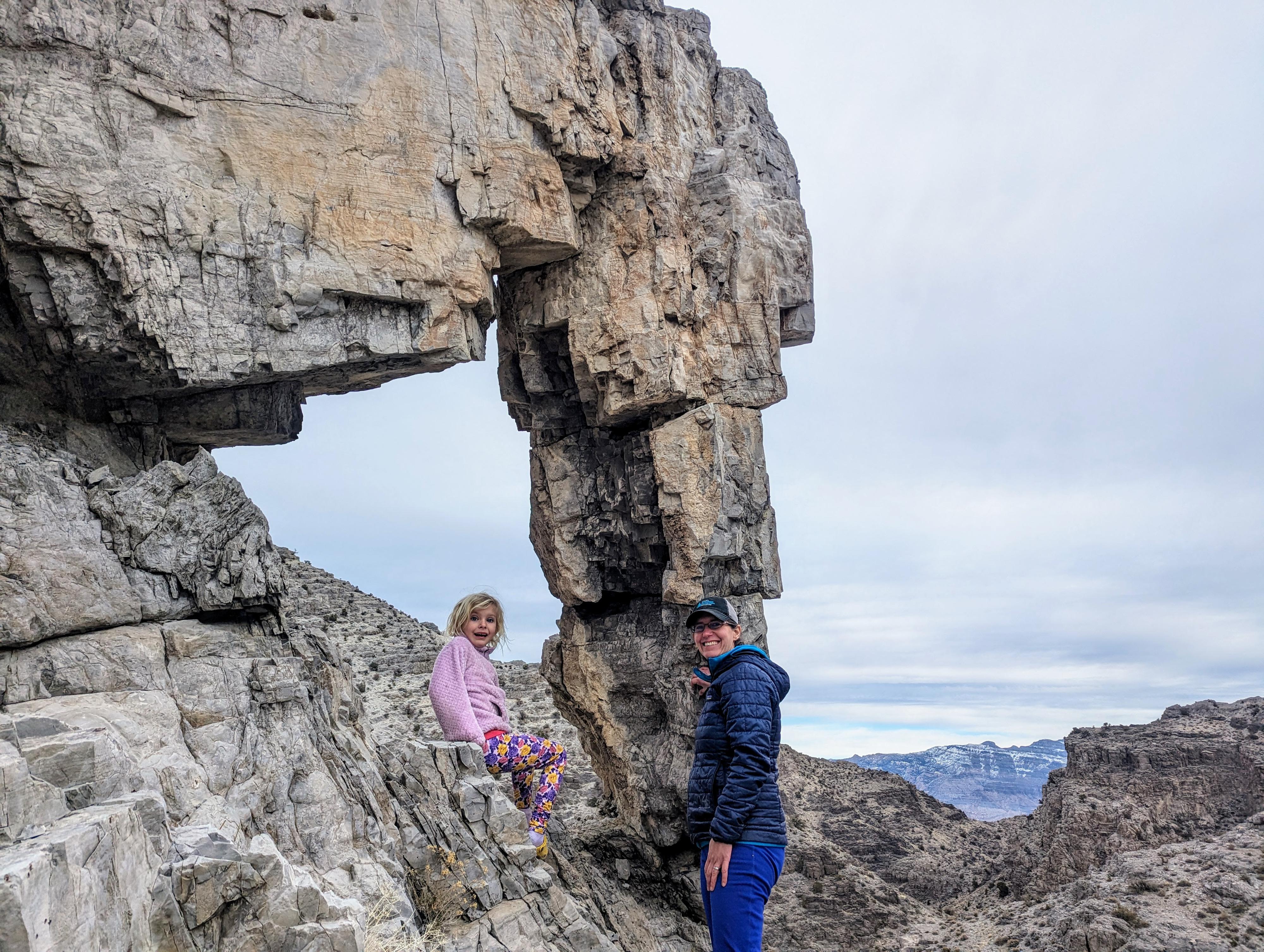
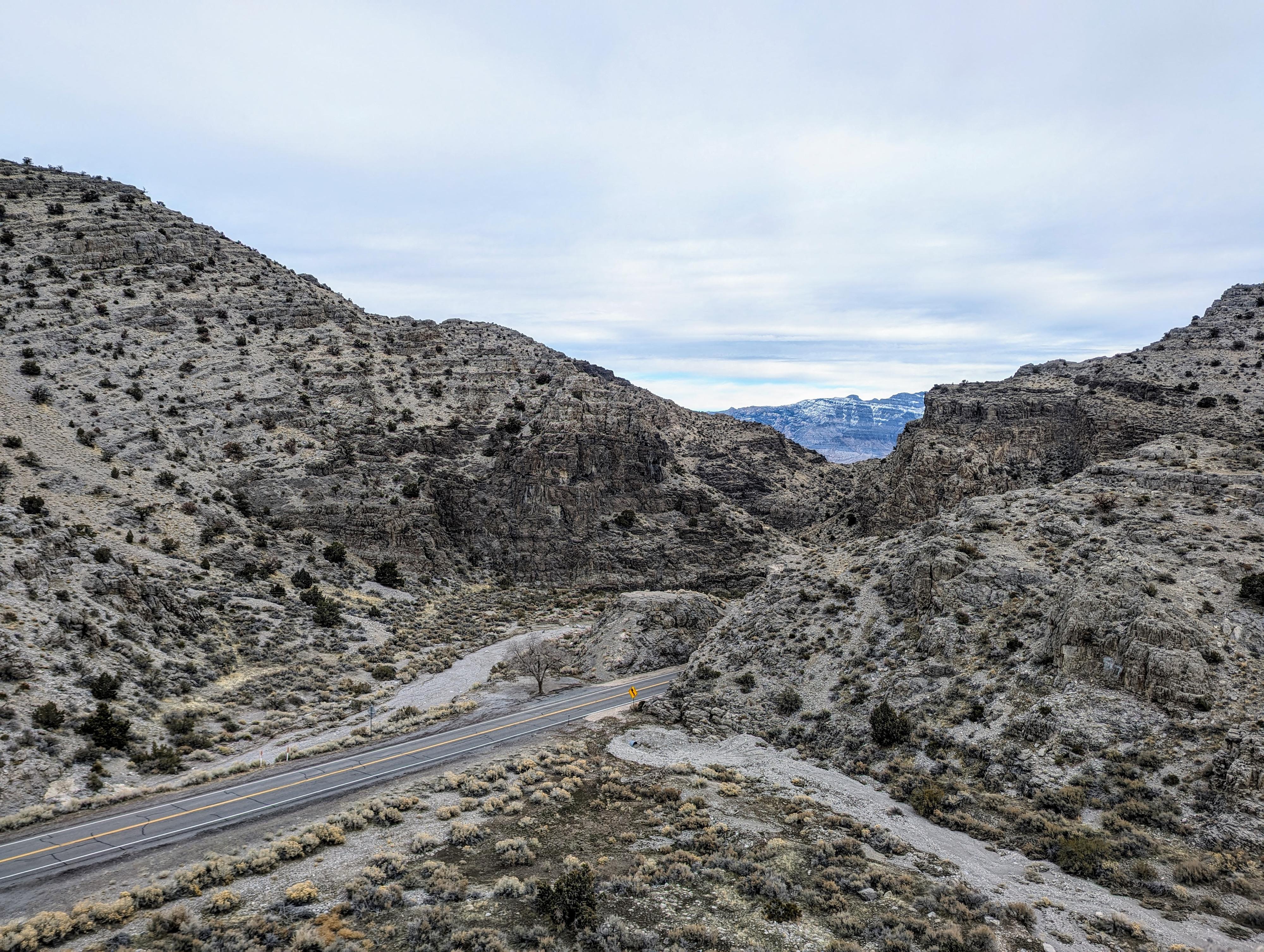
In King's Canyon, west of Delta on Highway 6, the loneliest highway in America, sits Elephant Rock Arch. The arch, in the Sevy Dolomite rock layer, sits on the south side of the highway at the confluence of Cat Canyon coming in from the south, and King's Canyon where the highway goes. The arch looks like an elephant's head and trunk, complete with a basket on its back that could carry people. In South East Asia, these baskets are referred to as howdahs.
I have driven by this arch countless times over the years, always admiring it as I zoomed by on the highway. Finally, in 2024, the family and I actually took the time to stop and give the arch a proper visit. It turned out to be a fun little adventure. This is a great spot to stop and stretch your legs for a few minutes.
Getting There
The arch is on highway 6, west of Delta, UT at mile 26.6. This is about 60 miles west of Delta, or 26.6 miles east of the Nevada/Utah state line.
Route Description
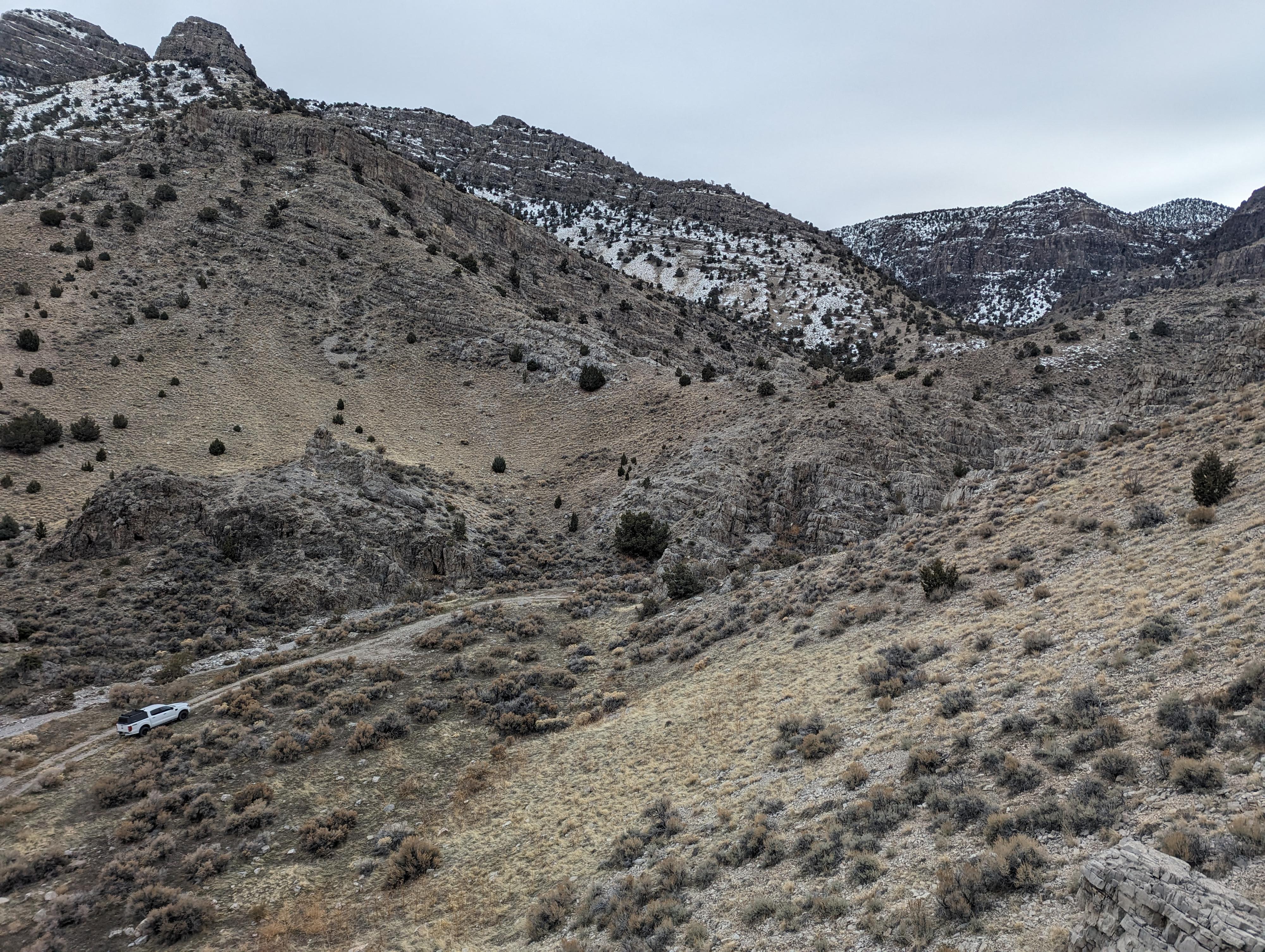
From the pullout, the arch is clearly visible to the south. If you are adventurous and don't mind some loose scrambling, visiting the arch is quite fun.
To visit, follow the two-track road from the highway to the south side of the arch. A steep, loose hill on the south side (opposite highway 6) of the arch is a pretty easy route to the arch. Right at the arch, in particular, there is a fair bit of exposure and looseness. Not recommended for beginners, be careful! The lofty perch has some broad views of King's Canyon.
Side Hike: Cat Canyon, that the two-track drives up, is rugged and pretty. The two-track ends just around the next bend above the arch at the Wilderness Boundary, but continuing up Cat Canyon is a nice hike in a very seldom visited canyon. The old and now closed two-track is visible in spots above the Wildrenss Boundary but is quickly eroding and becoming overgrown.
Maps

12S 277491E 4329288N
39°05'04"N 113°34'21"W
12S 277405E 4329188N
39°05'00"N 113°34'24"W