 Hiking
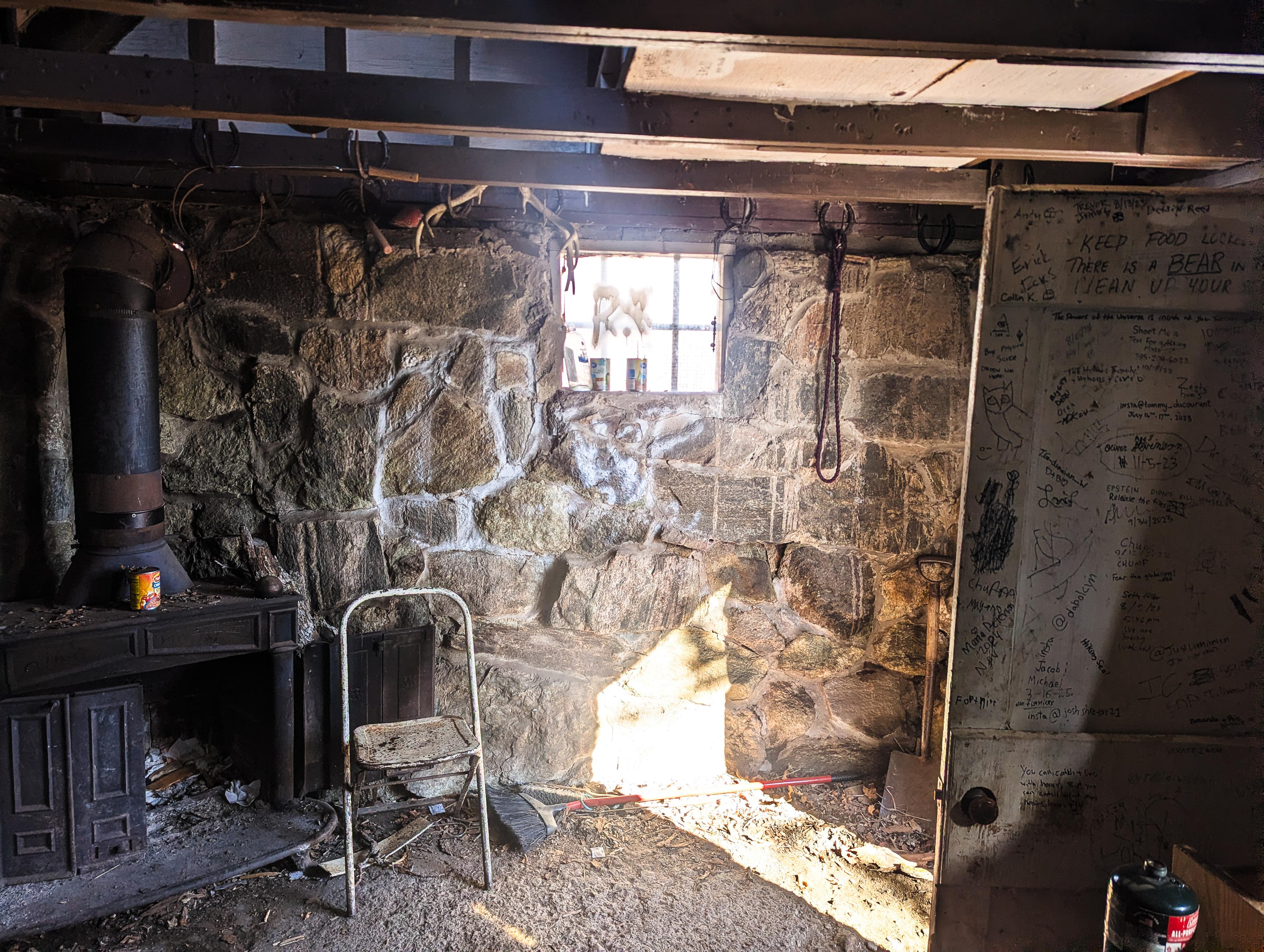
Adams Cabin
Hiking
Adams Cabin
Davis County
Overview
If you’re looking for a trail that trades casual switchbacks for a relentless vertical grind, the hike to the Adams Cabin is your calling. The numbers speak for themselves: you’ll be tackling 3,000 feet of elevation gain in just 2.75 miles. This is a "lungs-on-fire" kind of ascent! I had heard years ago the trail was strenuous, quite overgrown, and somewhat tricky to find. As of 2026, it is well-defined, easy to follow, and not overgrown. It is relentless, though! Aside from the cabin, the views of the valley and Great Lake Sale to the west and Thurston Peak to the east are quite good.
Getting There
The trailhead is off of US-89 near Fruit Heights. If coming from Salt Lake City, take the US-89 exit from I-15 about 10 miles north of Salt Lake, signed South Ogden. Follow this for about 6 miles to the Oak Hills Drive exit. Once off US-89, turn right, then left on Eastside Drive.
The parking area is here on the right, with an overflow parking area on the left. There is a restroom and water fountain at the trailhead.
Route Description
To The Base Of The Ridge (0.5 mile)
From the trailhead, the trail follows a fence line to the first switchback, where it quickly climbs a series of 11 or so switchbacks, gaining elevation. Between about switchbacks 10 and 11 is a bench and side trails on the right, a major side trail before, and a major side trail after the bench. Both side trails go to the smaller Lower Adams Canyon Falls; stay straight on the main path instead.
Once up the switchbacks, the trail mercifully flattens out and soon comes to the Bonneville Shoreline Trail junction.
Up to the Cabin (2.5 miles)
At the Bonneville / Adams Canyon junction, take neither, and instead follow the social trail heading up the ridge. There are a couple of social trails that lead up, close together. Take whichever looks easiest. From here to the cabin, you will be almost continuously going up. Though the social trail splits and braids in spots, all paths seem to come back together. Choose whichever looks easiest.
Work up the ridge; about 0.5 mile after starting up the ridge, the trail passes over and through a craggy rock area with nice views.
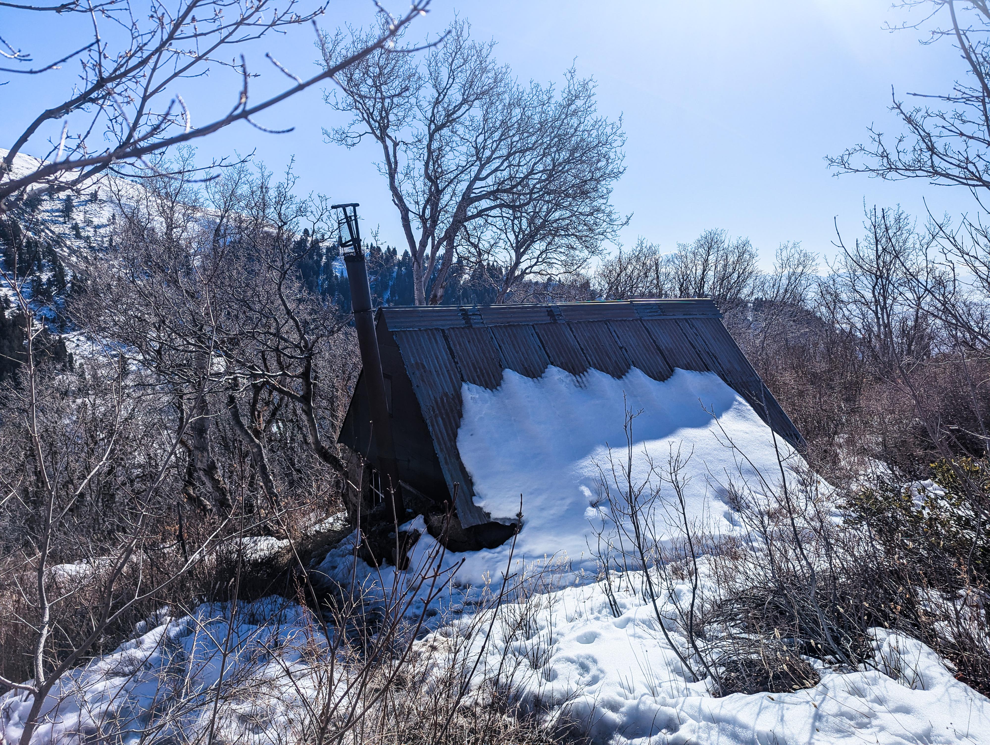
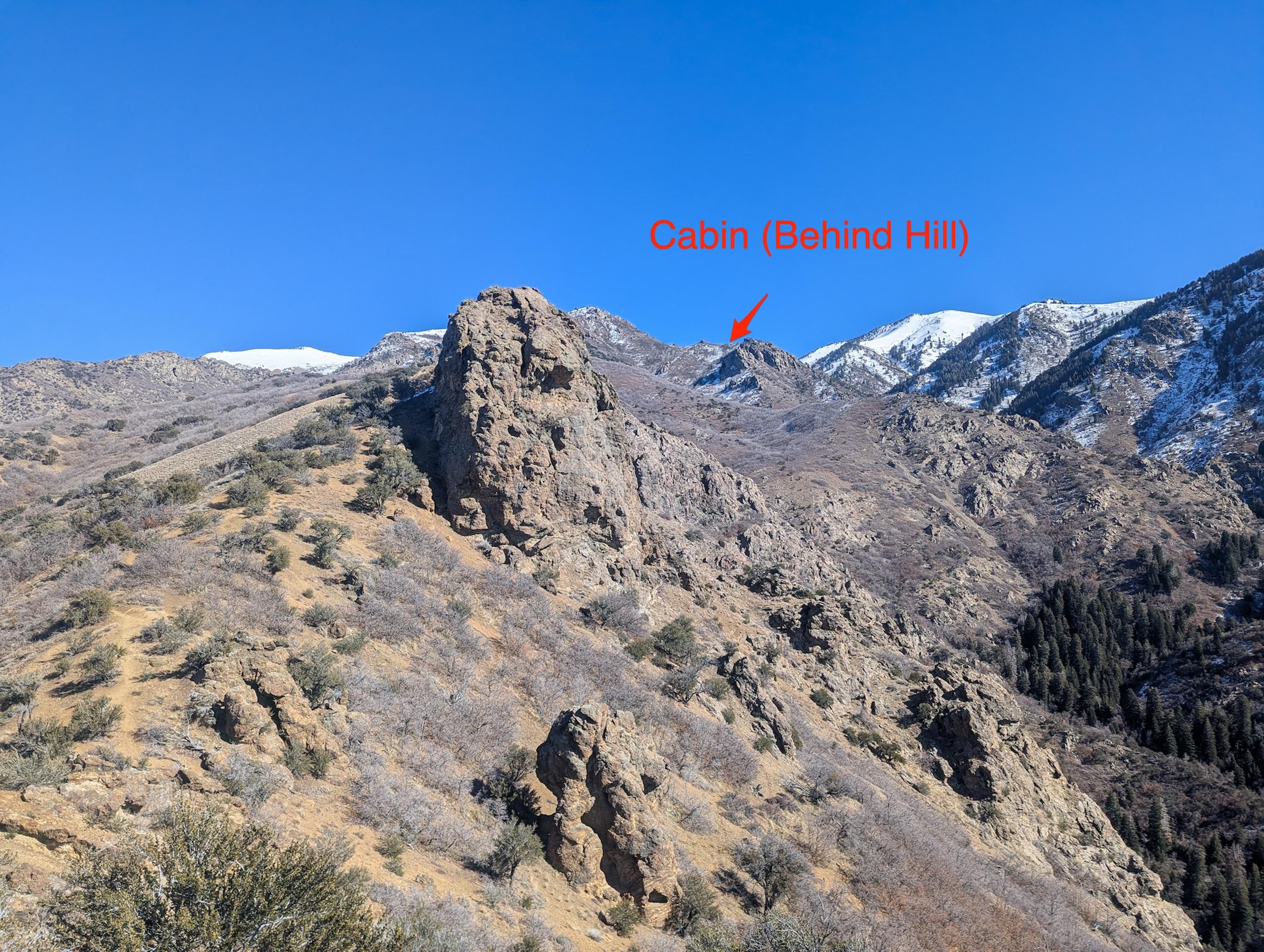
From the craggy area, if you look up at the highest point on the ridge and then look right, you will see a saddle with a rock outcropping, and then to the right of that, a cliff band. The cabin is just over the area where you see the rock outcropping. It is still a fair bit of elevation.
Continue up to about 7,600 ft in elevation, where you are getting close to the saddle and rock outcropping. Here you may or may not notice a minor junction. If you do, stay right. The trail angles up and over the saddle, then down a short distance to the cabin.
Return the same way.
Maps

12T 423550E 4546519N
41°03'59"N 111°54'36"W
12T 423787E 4546554N
41°04'00"N 111°54'26"W
12T 423820E 4546558N
41°04'00"N 111°54'24"W
12T 424082E 4546526N
41°03'59"N 111°54'13"W
12T 424633E 4546969N
41°04'14"N 111°53'50"W
12T 426480E 4547466N
41°04'30"N 111°52'31"W
12T 426595E 4547192N
41°04'22"N 111°52'26"W