Willow Lakes |

Stansbury Mountains

Hiking Willow Lakes - Stansbury Mountains Hiking Willow Lakes

Stansbury Mountains

Overview

RATING: Moderate Hike
MAPS: NORTH WILLOW CANYON, UT; DESERET PEAK WEST, UT; DESERET PEAK EAST, UT

Sun

A chance of snow showers. Partly sunny, with a high near 42. West northwest wind around 9 mph. Chance of precipitation is 30%.

42 | 29

Mon

A chance of rain showers after noon. Mostly sunny, with a high near 50. Chance of precipitation is 30%.

50 | 34

Tue

Sunny, with a high near 46.

46 | 28

Wed

A slight chance of snow showers. Mostly sunny, with a high near 39.

39 | 29

Thu

Sunny, with a high near 44.

44 | 28

View Full Weather Details
SEASON: Summer, Fall
GEAR: Standard Hiking Gear
WATER: Filterable at the lakes.

Sun

A chance of snow showers. Partly sunny, with a high near 42. West northwest wind around 9 mph. Chance of precipitation is 30%.

42 | 29

Mon

A chance of rain showers after noon. Mostly sunny, with a high near 50. Chance of precipitation is 30%.

50 | 34

Tue

Sunny, with a high near 46.

46 | 28

Wed

A slight chance of snow showers. Mostly sunny, with a high near 39.

39 | 29

Thu

Sunny, with a high near 44.

44 | 28

View Full Weather Details
A colorful sky with the Great Salt Lake in the distance.

A colorful sky with the Great Salt Lake in the distance.

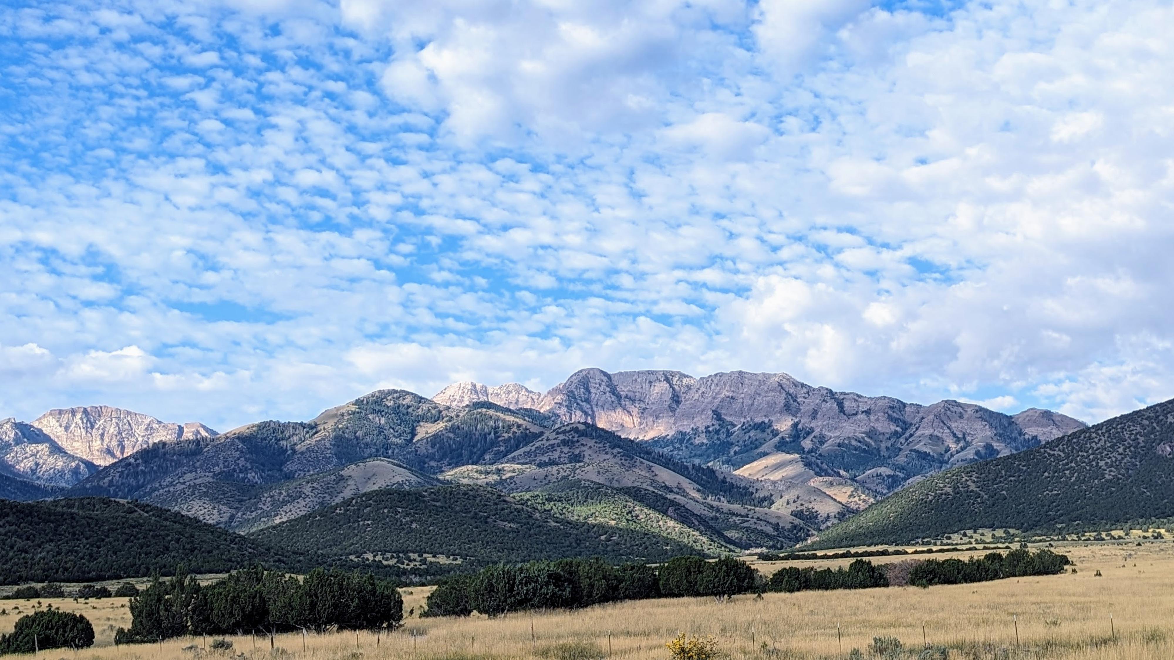
The Stansbury Mountains seem often overlooked when compared to the much more heavily travelled mountains along the Wasatch Front. Though not as dramatic, large, or expansive, the Stansbury Mountains hold a lot of charm in my opinion and, importantly to me, are a great place to find some solitude and space without crowds.

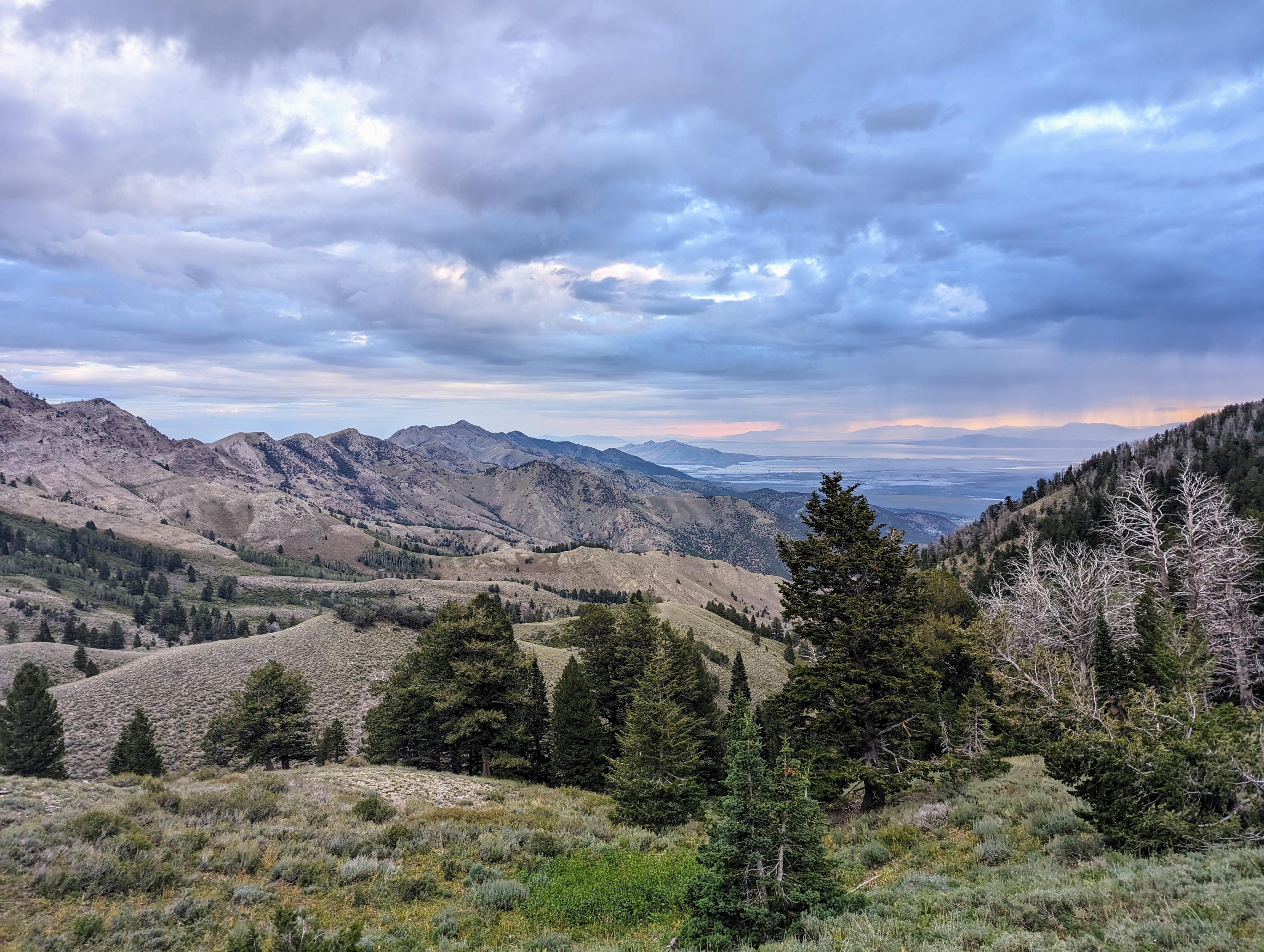
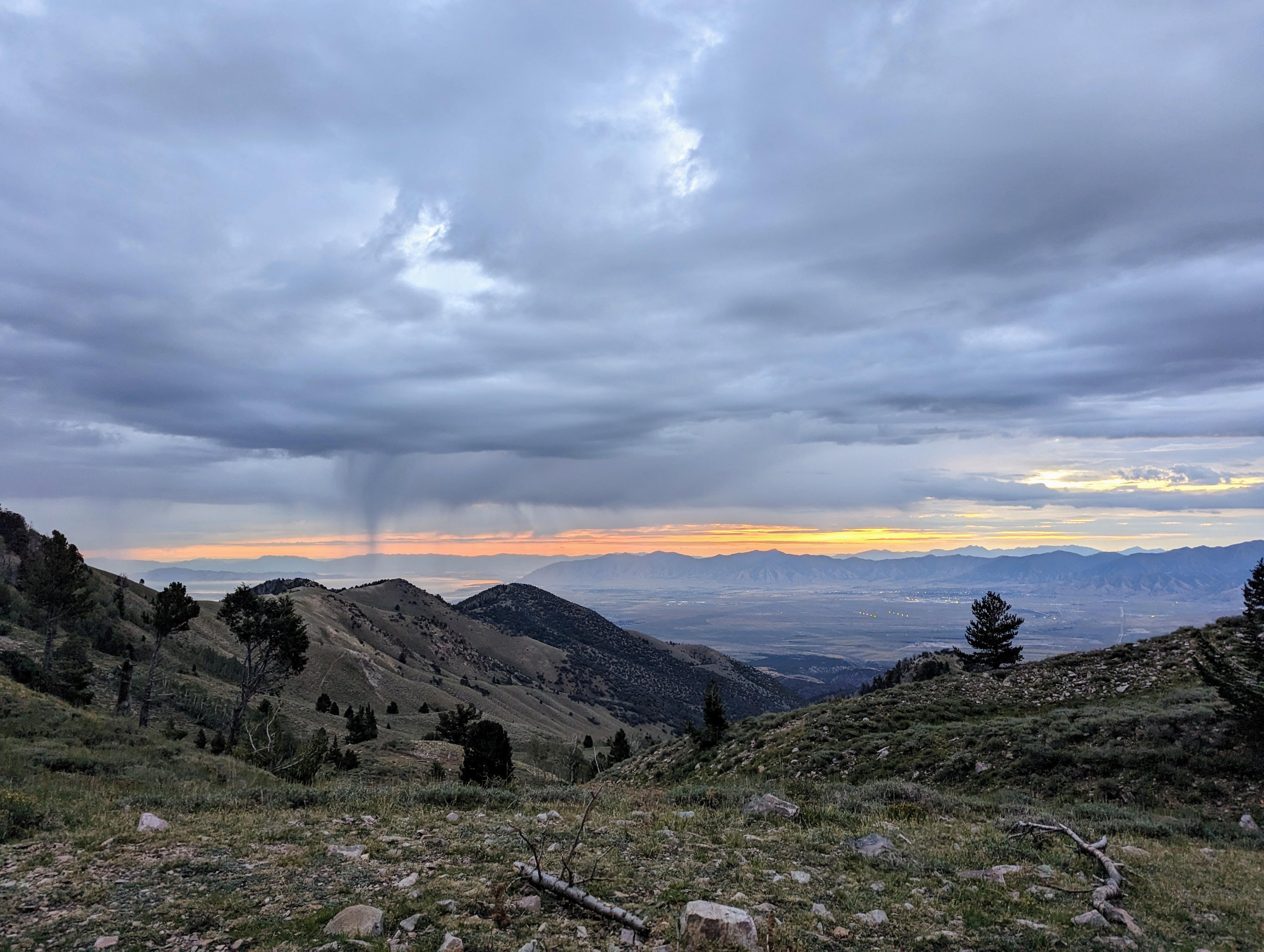
This hike visits the South and North Willow Lakes. Many hikers do Deseret Peak, the Tooele County high point, as their first hike in the range and often don't return to the range to explore further. Willow Lakes, especially via the north route described here, is not a frequently used trail. Expect big views of the Great Salt Lake, Tooele Valley, and the steep rocky spine of the range. The lakes, to my eye, are small and not particularly picturesque, but the trail to them, I found very scenic.

Season Note: The hike is a good summer after the snow has melted out through fall hike. On a big snow year, it may be mid-summer before the trail melts out. The trail is, however, very exposed to full sun. If hiking in the summer, pick a cooler day or start early. It is about 2,200' of elevation gain over 3 miles to reach South Willow Lake and could feel very long on a hot day!
The range from the drive in.

The range from the drive in.

Getting There

From Main Street in Grantsville, head south on West Street for about 3.7 miles to Davenport Road. This side road, on the right, starts out paved.

  • Reset your odometer as you head west onto the Davenport Canyon road. There are a few side roads along the way, but stay on the main road heading west. It starts paved, but turns to dirt soon. It is washboard at times, but generally good. ( 12T 373605mE 4489682mN / N40° 32' 54" W112° 29' 34" )
  • 4.15 miles - Junction. Right goes to Davenport Canyon. Go left instead. The road heads south, then bends west again. There is good primitive camping once inside the forest boundary, as well as a small campground. ( 12T 367094mE 4489336mN / N40° 32' 39" W112° 34' 10" )
  • 6.1 miles - North Willow Campground on the right. Stay straight. ( 12T 365196mE 4487528mN / N40° 31' 39" W112° 35' 29" )
  • 6.4 miles - Junction. Go left. The road worsens from here and becomes high clearance. ( 12T 364786mE 4487448mN / N40° 31' 36" W112° 35' 47" )
  • 6.65 miles - A couple of side roads leave on the right to the old mine. Stay left. ( 12T 364533mE 4487248mN / N40° 31' 30" W112° 35' 57" )
  • 7.45 miles - If you notice a road leaving on the left, stay right on the more travelled road. This junction isn't very obvious and most will just stay on the main road going left without even noticing it. ( 12T 364024mE 4486140mN / N40° 30' 53" W112° 36' 18" )
  • 7.6 miles - Road ends at the trailhead and a small parking area. ( 12T 363745mE 4485966mN / N40° 30' 48" W112° 36' 30" )
Dramatic skies near the Miner Canyon - South Willow Lake Junction

Dramatic skies near the Miner Canyon - South Willow Lake Junction

Route

From the trailhead, follow the trail as it quickly enters Wilderness and begins a steep climb up the sagebrush slope. At about 0.85 miles and 750 feet of elevation gain, you may notice a trail going off on the right. This appears to be a cattle trail that goes up to an old fence and views of the Great Salt Lake. Stay left here if it isn't obvious. The trail begins heading south, getting a bit less steep, and passing through a large grove of aspens. If it is a hot day, the shade will be welcome!

About 1.5 miles and 1200 feet of elevation gain from the trailhead, the trail crosses a stream. In late fall, I found this stream flowing surprisingly well, but easy to hop across.

North Willow Lake
If heading to North Willow Lake, keep an eye out on the right. About 0.15 miles past this stream crossing, at the top of a small hill, there is an open ridge heading southwest. On my visit, this ridge had a few cairns on a small social trail. There is not an official trail to North Willow Lake. My recommendation is to follow the ridge up to its apex, head west down and across a shallow drainage, then south to reach North Willow Lake tucked up at the base of the cliffs. North Willow Lake is smaller and less scenic than South Willow Lake.

South Willow Lake
Stay on the main trail heading south. The trail is easy to find and follow here, and climbs to a ridge overlooking Miners Fork Canyon. Continue as the trail descends to the bottom of Miners Fork. On my visit, this area was a mishmash of cow trails. Keep an eye on the map closely through here. Once across a small marshy area, the trail becomes more defined again and the junction to Miners Fork/South Willow Lake is reached. Pay attention to this junction, it can be somewhat easy to miss on the way down.

From the Miners Fork junction, the South Willow Lake trail heads west, climbing to the lake that is nestled below the cliffs in about 1/2 a mile. There are several campsites around the lake. The area has broad views and dramatic cliffs. Return the same way.


Maps

South Willow Lake / 6.23 miles / Elevation Range 7,350 - 9,147 ft.
Printable Maps:
Trailhead

12T 363738mE 4485962mN

N40° 30' 48" W112° 36' 30"

First Jct - Left

12T 362836mE 4485838mN

N40° 30' 43" W112° 37' 08"

Stream Crossing

12T 362659mE 4484970mN

N40° 30' 15" W112° 37' 15"

Cairned Ridge

12T 362822mE 4484889mN

N40° 30' 12" W112° 37' 08"

North Willow Lake

12T 362410mE 4484566mN

N40° 30' 01" W112° 37' 26"

South Willow Lake

12T 362232mE 4483376mN

N40° 29' 23" W112° 37' 32"

Miners Fork Junction

12T 362813mE 4483669mN

N40° 29' 33" W112° 37' 08"

Comments

Want to make a comment? Login and let yourself be heard.