
 Great Gusto Canyon
Eastern Reef
Overview
I consider a big part of the fun and enjoyment of canyoneering to be the route finding. Great Gusto Canyon is one of those rare days that I didn't lead the group to the spot where I thought we would end up, but instead to a different drainage entirely. The upshot of the snafu? Instead of finding and rappelling through the arch I had hoped we would be rappelling through, we found an undocumented and impressive natural bridge and rappelled through that instead! Bridge, arch, it is all good!
This is an advanced canyon because of the final jaw-dropping 85 m ( 279 ft. ) rappel. It is big, airy, and the bottom half free hanging. This is a drop only for very experienced canyoneers comfortable with long rappels!
Aside from the final big air rappel, the canyon is more of a hike with big views than a canyoneering experience. The drainage is mostly shallow and open with a number of different entrance and exit options. When the canyon drops 25m through Great Gusto Bridge, however, the canyon changes from a casual hiking romp to a beautiful and exhilarating couple of rappels.
Getting There
At mile marker 141.6 on highway 24, take the side road on the west side of the highway through the gate. This is about 26 miles north of Hanksville, or 18 miles south of I-70 if coming from Green River.
Route Description
Approach (2-2.5 hours / 3 miles)
From the Ernie Canyon trailhead, head up the sandy wash past the log fence. The canyon meanders through the Navajo layer for about a mile (20 minutes or so) and passes through an open area before cutting a steep-walled path into the reef. Just before the wash begins cutting into the reef, leave Ernie on the right (north) side and begin hiking up the reef.
For the first section, trend a bit north and west to avoid a few small side drainages of Ernie, but at the first skyline you can see from the bottom of Ernie, trend back to the rim of Ernie Canyon proper.
Continue along the rim using the easiest path. When the red Entrada valley of upper Great Gusto Canyon come into view, you are close. The bridge is hard to see from the rim, but a point just down canyon from the bridge offers a decent view.
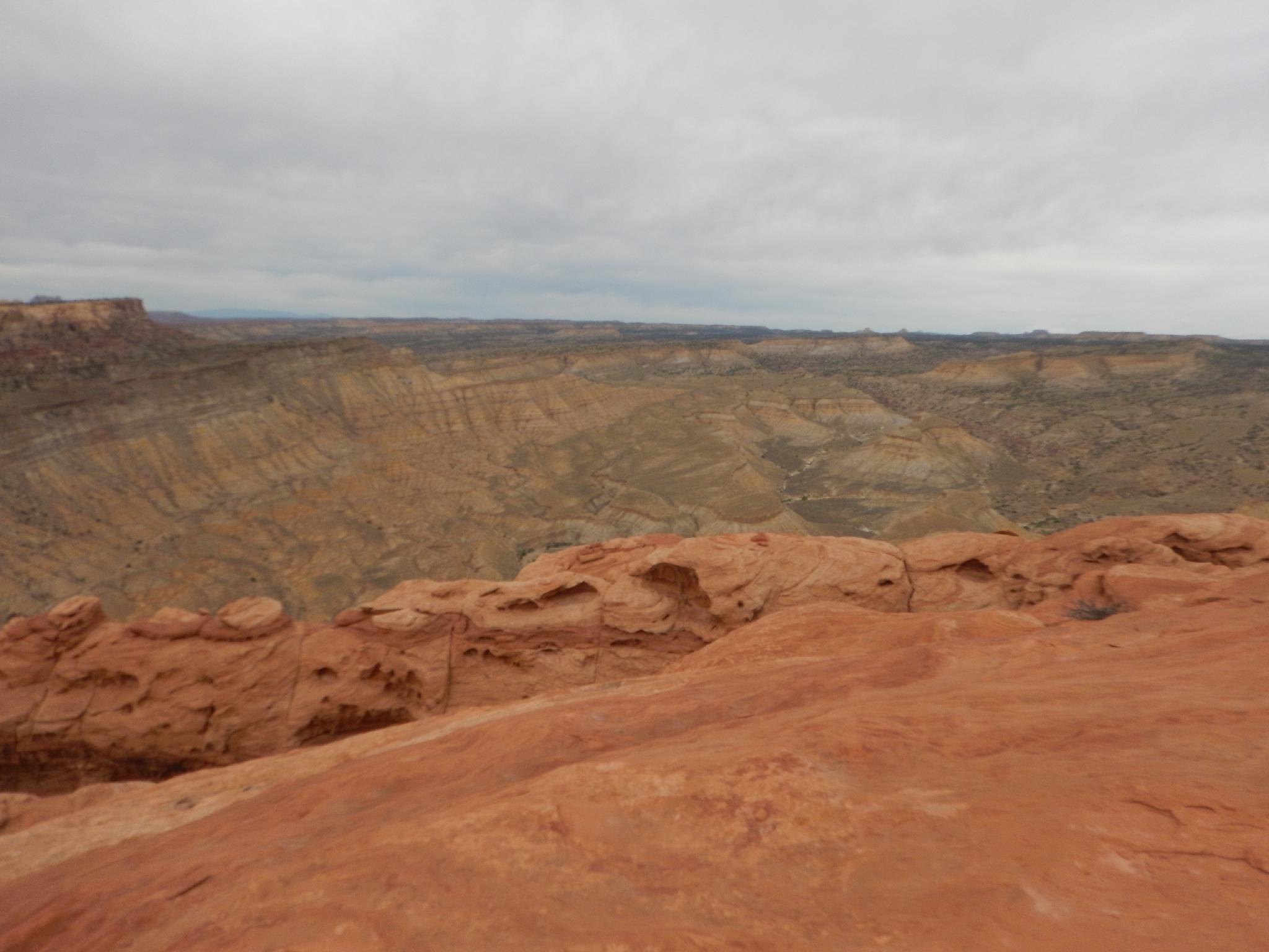
Follow along the rim of Great Gusto Canyon, picking the easiest path all the way to the head of the drainage and an excellent viewpoint. Temple Mountain is easily visible to the south from here, as well as a huge expanse of the interior of the Swell and even Gilbert Butte and the Henry Mountains to the south.
Canyon
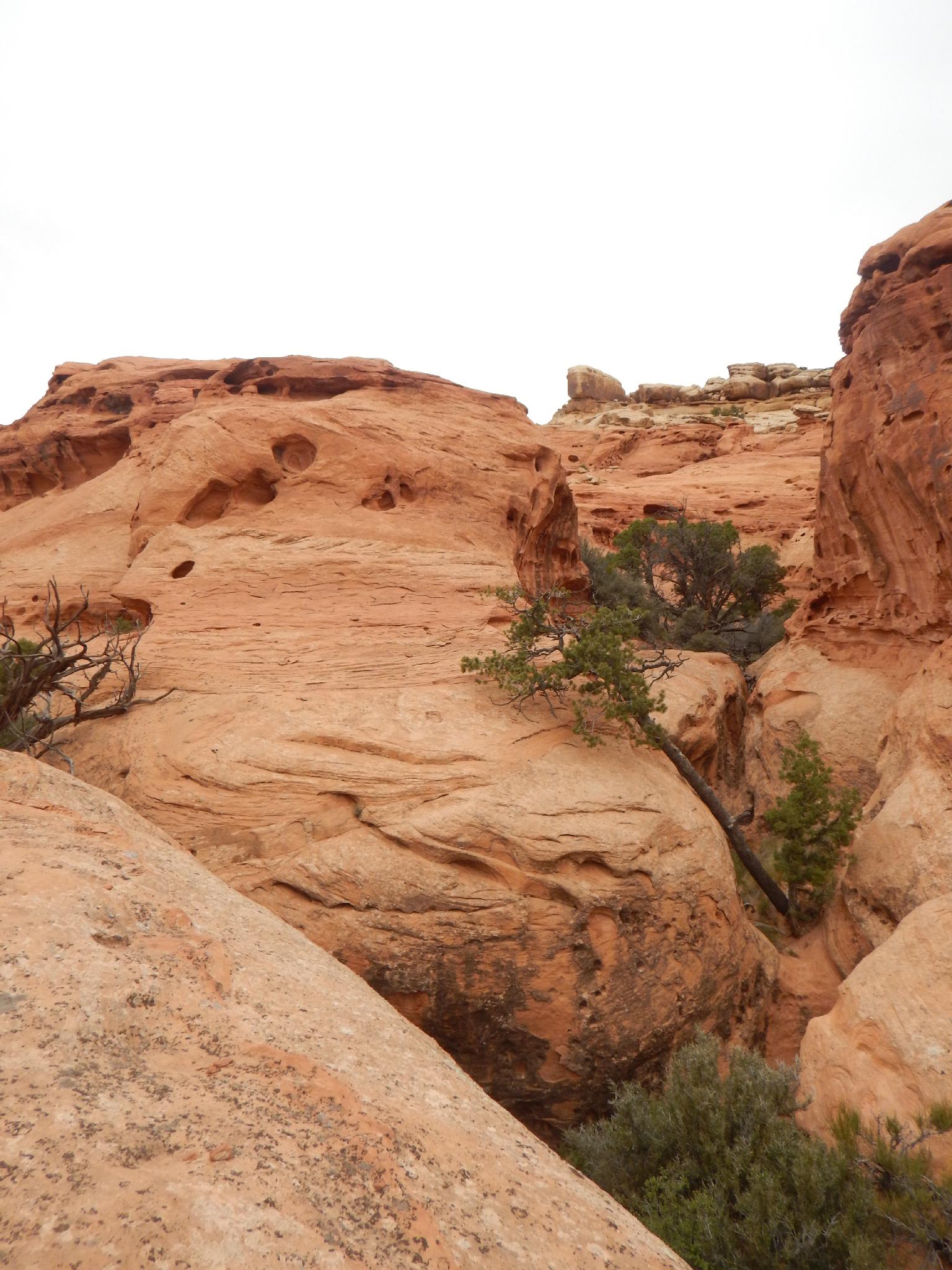
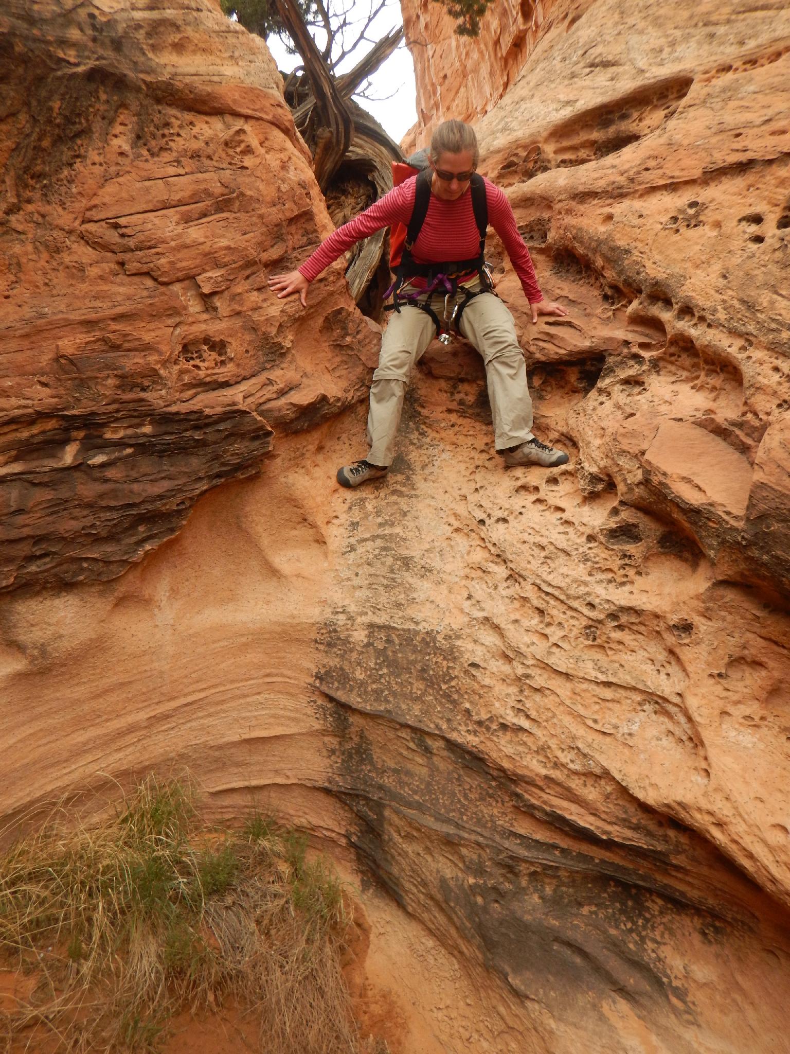
From the viewpoint, we contoured down and a bit left to a tree that offered an easy 20 m ( 66 ft. ) rappel into the brushy canyon bottom. There are a lot of options here. Once in the canyon bottom, it is a mostly easy amble down with a couple of downclimbs and small dryfalls that can be passed on the right. The canyon opens a bit with a possible scramble route in on the left before entrenching a bit again at a small fall.
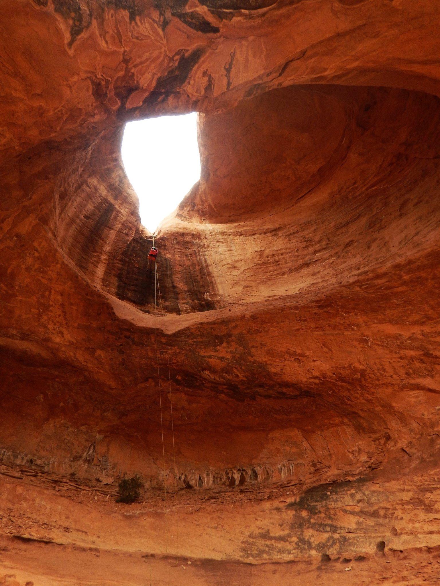
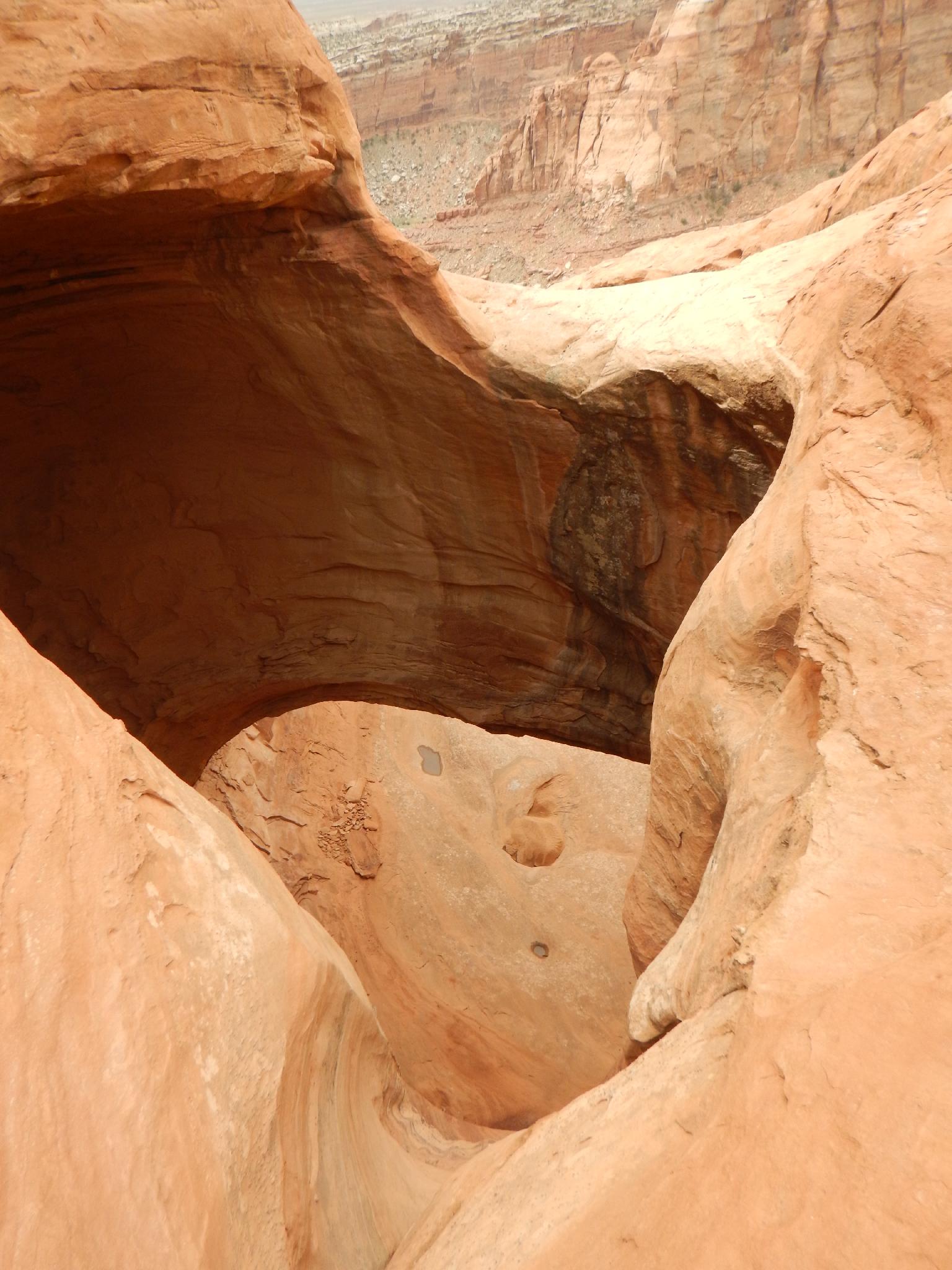
Shortly after is the confluence with a side drainage and the first rappel. Great Gusto Bridge is amazing close-up!
R1 - About 25 m ( 83 ft. ) from a tree through the bridge. Just below the bridge are two deep caves on the right, then a minute down the canyon is the big rappel and main event.
R2 - About 85 m ( 279 ft. ). This is a big rappel! Be sure to bring your A game and have plenty of friction. Experts only. We used a fiddlestick (be careful of potential tangle) , but if using webbing be sure to extend it all the way over the rounded edge to make retrieval possible and reduce rope grooves. The rappel rounds off, drops steeply to a ledge, then plummets down to the talus slope below. Below the ledge you will be dangling in space.
This rappel reminded me of the last rappel in Heaps for its airy nature.
Exit (1-1.5 hours / 2.75 miles)
You’re down! Phew! Congratulate yourselves on a well-done rappel. Looking up and left you can see the arch our group was originally headed for. ( Notch Arch )
Work down the talus slope, then either left or right of the drainage you were following allows easy access to the bottom of Ernie Canyon. Just across the way are the ruins of an old mining cabin.
It is about 2.75 miles from the last rappel down Ernie Canyon and back to the trailhead.
Maps

12S 540555E 4286788N
38°43'44"N 110°32'00"W
12S 539062E 4287081N
38°43'54"N 110°33'02"W
12S 537781E 4288966N
38°44'55"N 110°33'55"W
12S 537813E 4288942N
38°44'54"N 110°33'53"W
12S 538059E 4288490N
38°44'39"N 110°33'43"W
12S 538062E 4288416N
38°44'37"N 110°33'43"W
12S 538038E 4288728N
38°44'47"N 110°33'44"W
12S 538101E 4288130N
38°44'28"N 110°33'42"W