 Hiking
Spooky Canyon
Hiking
Spooky Canyon
Black Canyon
Overview
Just over the Colorado River from Las Vegas, in northern Arizona, is the short and delightful Spooky Canyon. Not to be confused with Peekaboo-Spooky-Brimstone in Utah, or Spooky and Not Spooky Canyons in the Mojave Desert, or any of the other Spooky Canyons around!
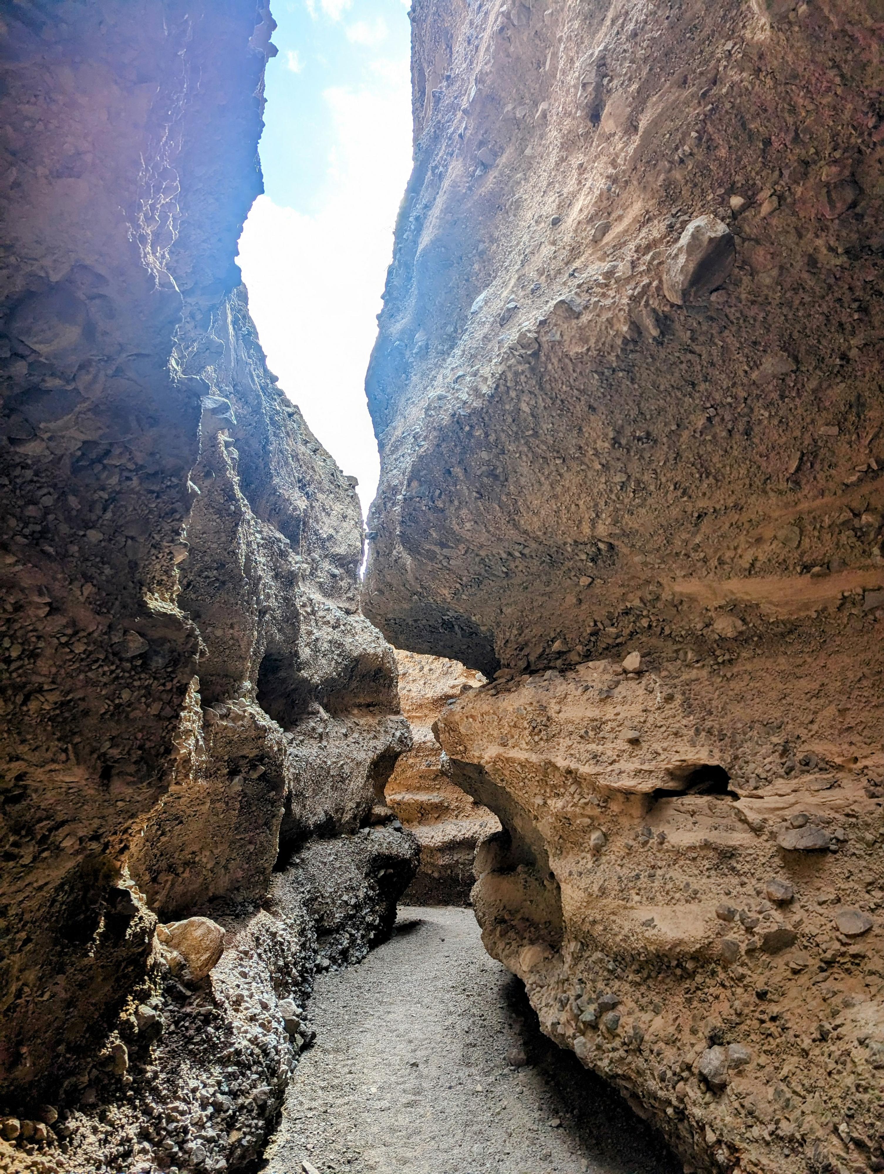
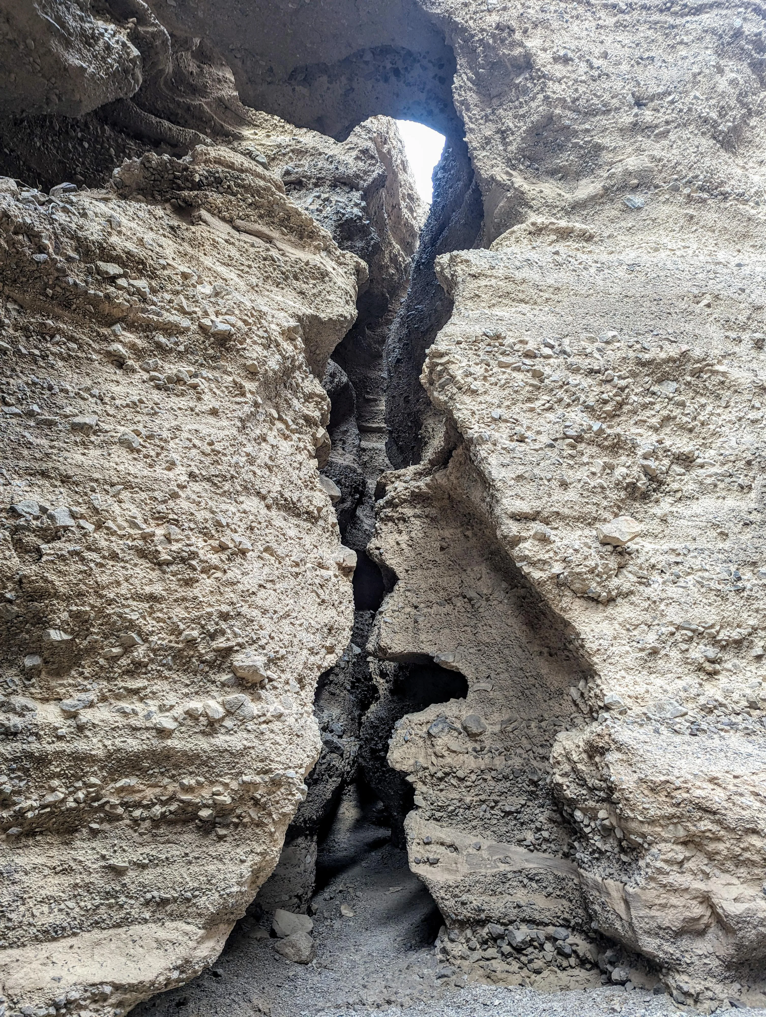
This Spooky Canyon is short, but a dramatic cobblestone canyon with deep, dark narrows and even an arch in its depths. Given it is a 2-minute walk off the highway, and takes less than an hour to visit, it is an easy canyon to visit if in the area. The short nature makes this not a destination I would make a special trip to visit. If you are in the area visiting Arizona Hot Springs, Hoover Dam, or any of the other things in the area, it is a very worthwhile stop. Kids and adults alike are likely to enjoy this outing.
Getting There
There are two options for the trailhead. The first, White Rock Canyon Trailhead, offers a good-sized paved parking area, and a restroom. If starting from this trailhead, it is about a half mile walk northbound along the highway to reach Spooky Canyon. The second is a small dirt pull-out right at Spooky Canyon. This offers a closer hike, but may be a little tricky getting on and off the highway. On a not-very-busy morning, we found the dirt parking area easy to get off and back on. Either way, the first step is to get to White Rock Canyon Trailhead.
White Rock Canyon Trailhead:
Coming from the north, go on I-11 in Nevada to where it becomes US-93 south at the Arizona state line. Once you cross into Arizona from Nevada, go 3.3 miles. Turn left at 3.3 miles where there is a signed turn to White Rock Canyon Trailhead. The road goes up a short distance to a large parking area. From this parking area, you will need to talk north along the highway for 0.4 miles to Spooky Canyon.
Dirt Parking Area:
From the White Rock Canyon Trailhead, travel north on the US-93 for 0.4 miles to a small dirt parking area right, just after a guardrail. This is right after passing Spooky Canyon.
Route Description
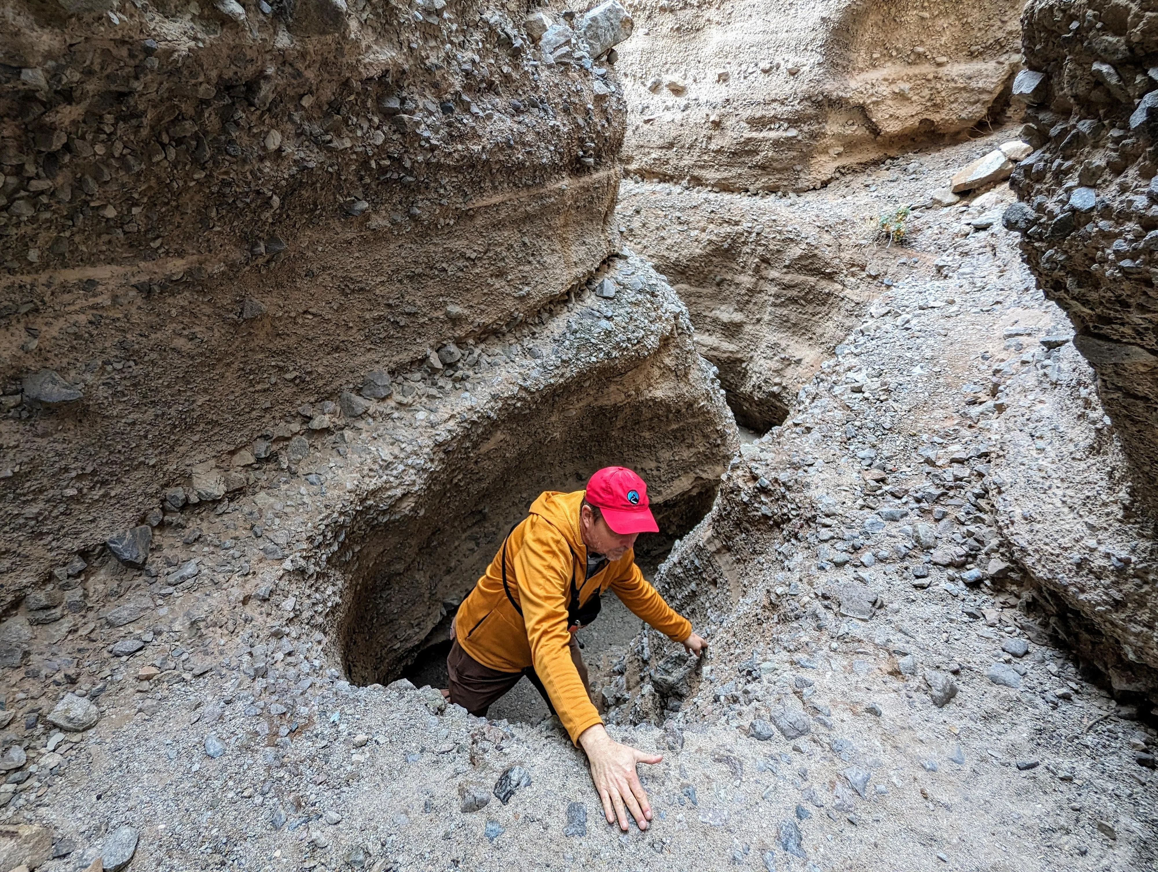
From the dirt parking area, follow the social trail down to the bottom of Spooky Canyon and head up the canyon. A first junction is soon reached. Left is an interesting short side canyon, and with some climbing, can be up climbed to where it opens up.
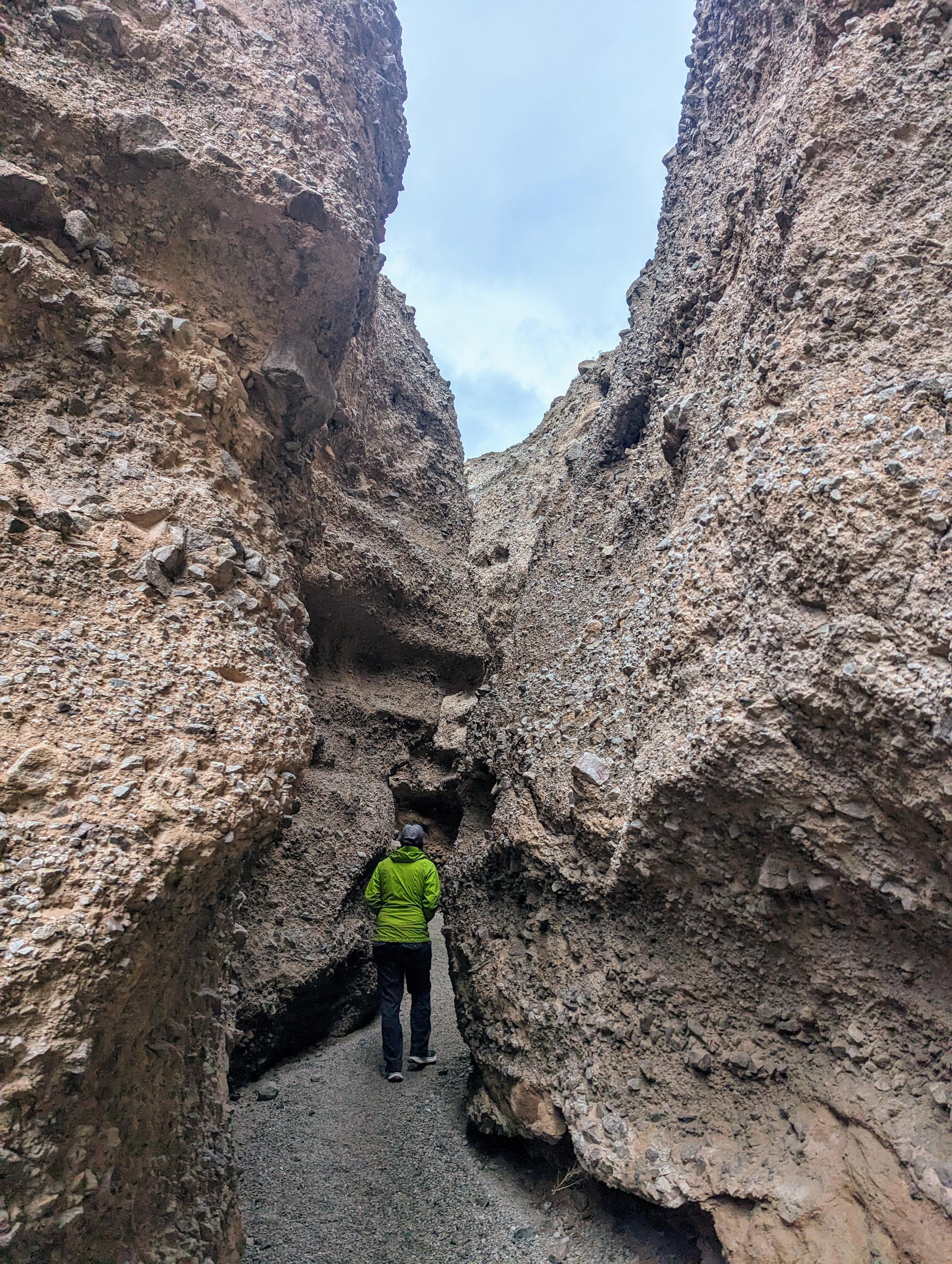
Continuing up the main (right) fork, the canyon deepens and narrows. The next junction is a very dramatic and sculpted side canyon coming in on the left. This, to our eyes, was the most captivating part of the canyon. You can go up the left fork a bit before ending at a tall dry fall. Right before the confluence of the left fork and main fork is an arch up above the canyon floor (on the left side of the main fork). This can be difficult to see without the right light, but is a fairly impressive arch.
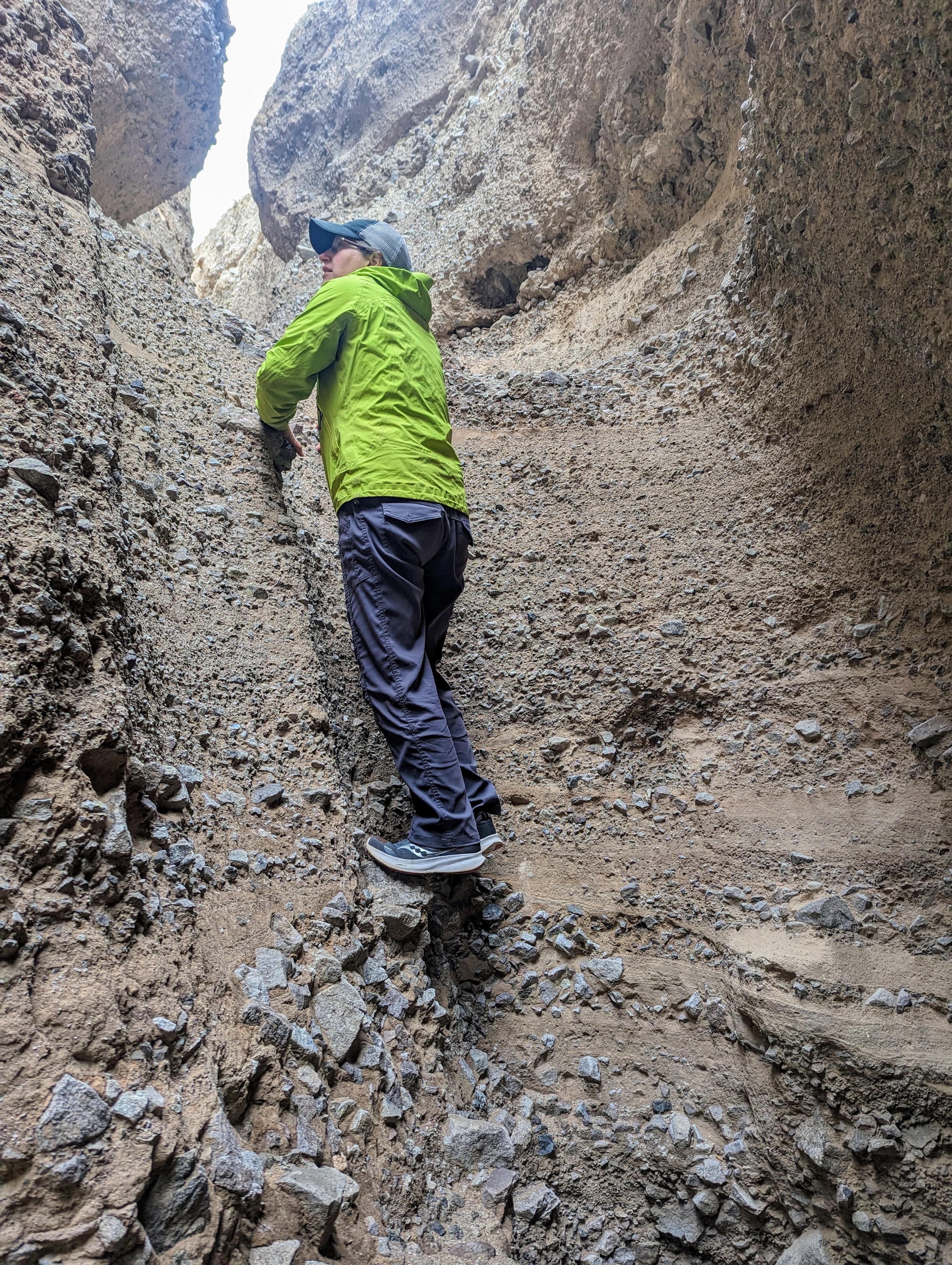
Continuing up the main fork, it gets deeper and more narrow before a final dry fall (4 m). This final fall is climb-able, but be very cautious of loose holds and remember if you go up you need to be able to get back down. Above this dry fall, the canyon opens immediately and is less interesting.
Return the way you came.
Photos
Videos
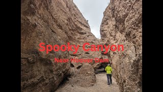
Spooky Canyon Video
Maps

11S 707526E 3984203N
35°58'49"N 114°41'53"W
11S 706668E 3984611N
35°59'03"N 114°42'27"W
11S 706840E 3984566N
35°59'01"N 114°42'20"W
11S 707159E 3984926N
35°59'12"N 114°42'07"W
11S 706893E 3984676N
35°59'05"N 114°42'18"W