
 Spooky and Not Spooky Canyons
Mojave
Overview
Afton Canyon is known as the Grand Canyon of the Mojave. Along its steep-walled conglomerate cliff wall lies the short but dramatic Spooky Canyon. Few canyons are as deep, dark, and cave-like as Spooky Canyon. This is one that you will need a headlamp to explore its black depths. Next door to Spooky Canyon is what I suppose could be dubbed Not Spooky Canyon. A similar canyon, Not Spooky is not as dark as Spooky Canyon but has similar obstacles and a sinuous nature. We, with limited information on our trip, ascended Not Spooky first and thought it was neat, but not as dark as we expected. After a more poking around, we found the true Spooky next door. Two canyons when we expected only one made for a happy mistake! Both canyons are short and likely to take an hour or so each.
Getting There
There are two ways to get to the trailhead. The first is from the west and Afton Campground area. This requires two water crossings of the Mojave River that can, at times, be quite deep. If coming in from the west, a true four-wheel drive is recommended, as is walking the water crossings first to make sure you are comfortable with the depth. Coming in from the east has no water crossings, though it is rough and a bit rocky in spots. High clearance is required, but true four-wheel drive should not be needed in most conditions.
Western Approach
Take exit 221 (between Baker and Barstow California) off of I-15 and head south. At 3.5 miles is the Afton Canyon Campground.
Just after the campground is the first potential water crossing. This one may be dry or quite shallow. The road follows along the railroad track for a couple of minutes, then crosses under the railroad bridge. On the downstream side of the railroad bridge is the second, deeper crossing. Be sure to check carefully before committing!
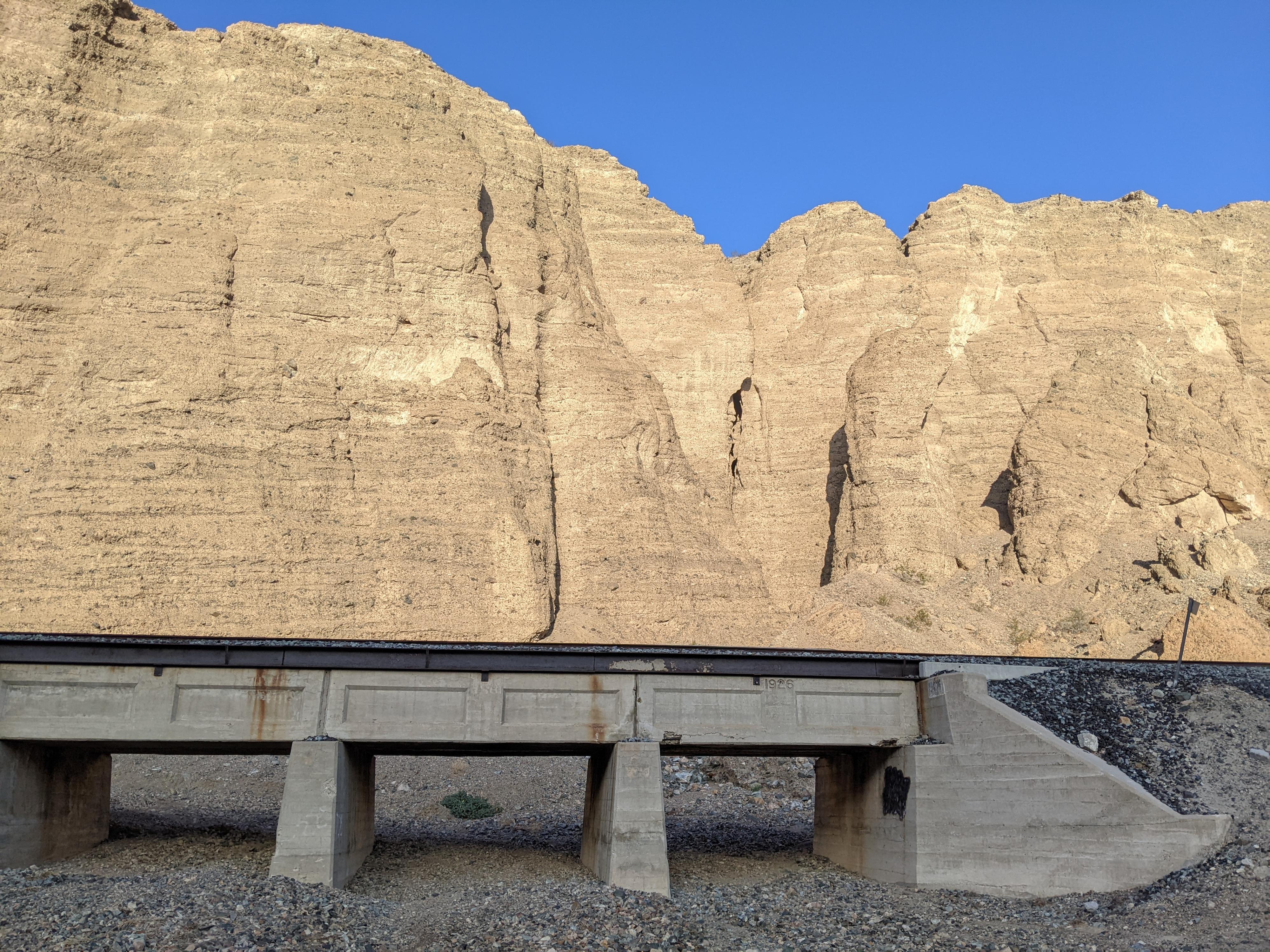
The road diverges through here, with several paths. Stay on whatever seems the best path. At about 7 miles from the Interstate, look for a concrete bridge on the railroad with one opening, and choose a path that gets close to the bridge. The bridge is the Spooky Canyon Trailhead. If in doubt, a minute more down the road will be a second concrete bridge with three openings. This second bridge is the NOT Spooky Canyon Trailhead.
Eastern Approach
The eastern approach starts at exit 230 (Basin Road) from I-15 between Baker and Barstow. There are many minor side roads. Stay on the main road for 2.0 miles to a junction. Go left at the junction after which the road gets a little rougher. At 3.7 miles, the road reaches the Mojave River, a wide sandy wash at this point. Turn right and drive up the bottom of the Mojave River, the roads braid and come together many times here.
The road passes under a railroad bridge and enters the deep-walled Afton Canyon. At 6.7 miles from the interstate, look for a concrete railroad bridge with 3 openings. This is the NOT Spooky Trailhead. The Spooky Trailhead is 1 minute further at the next bridge that has only one opening.
Route Description
Spooky Canyon
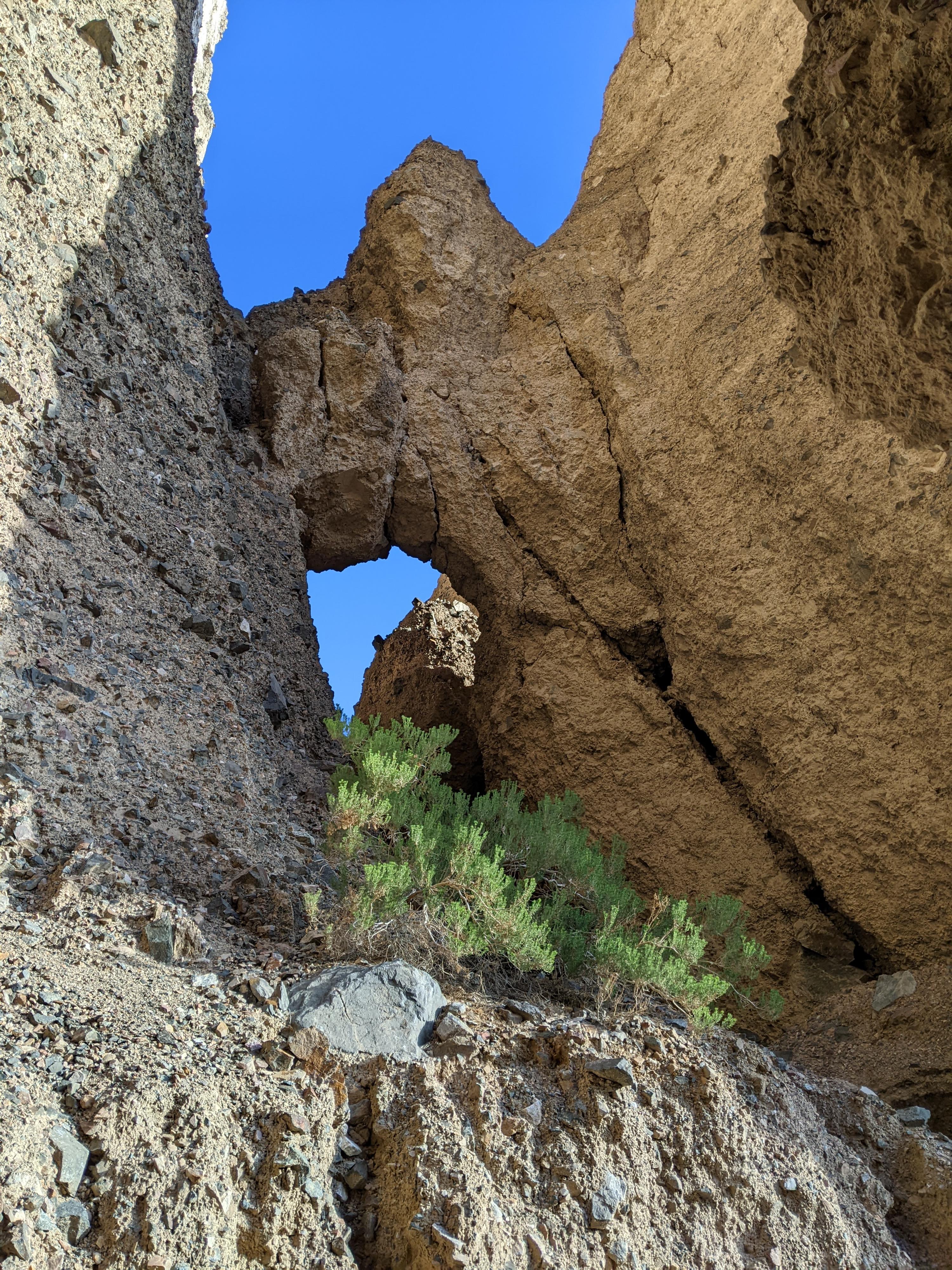
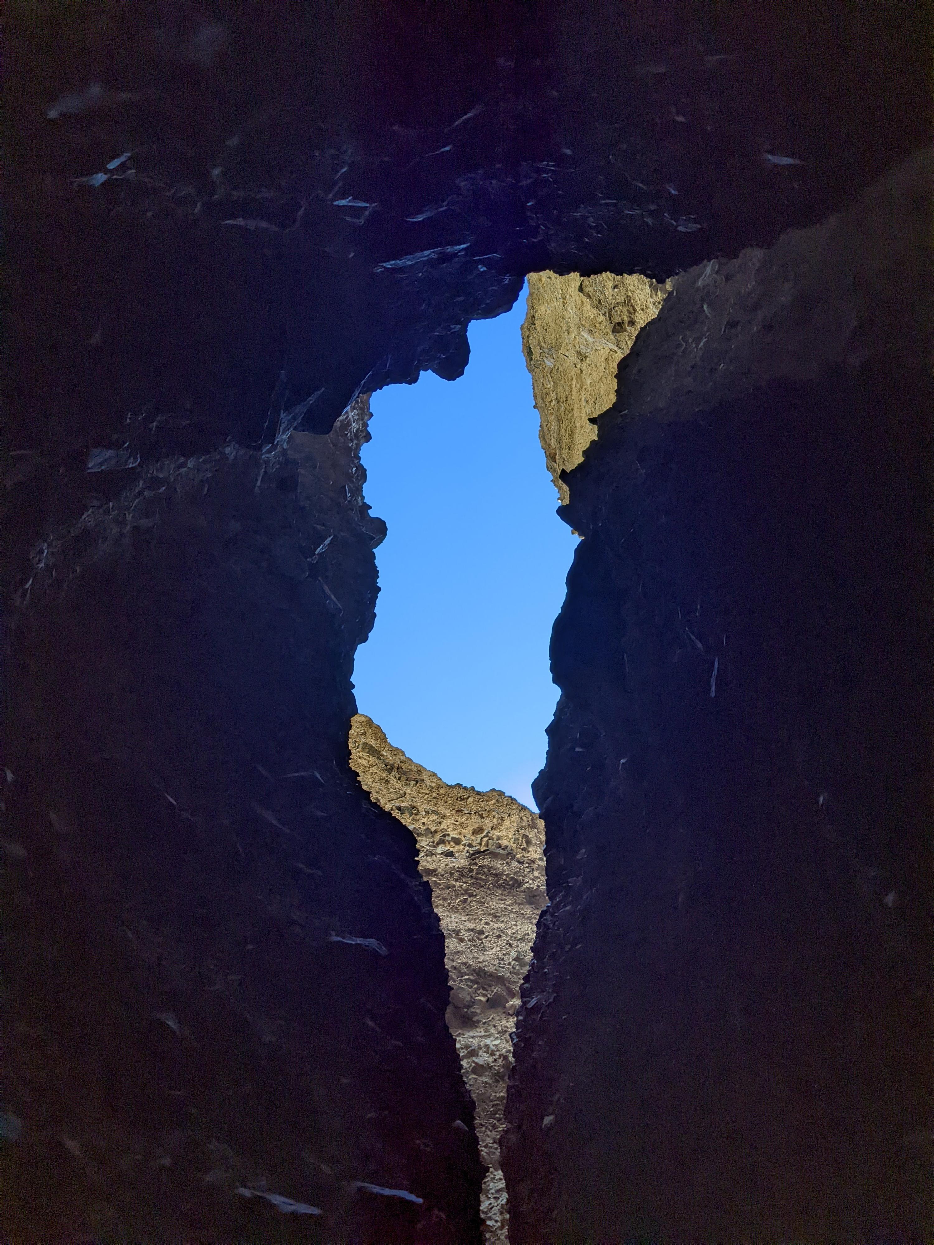
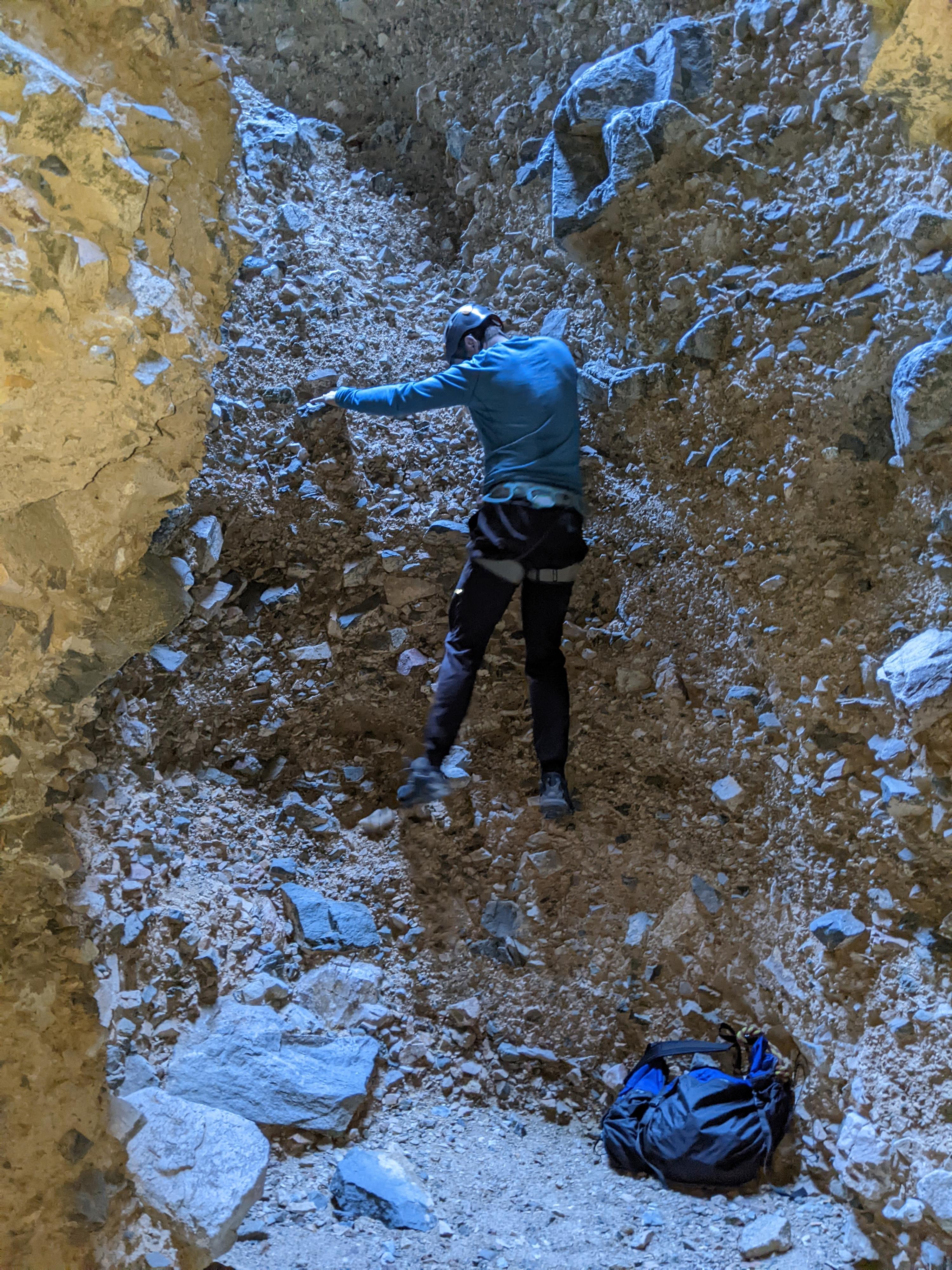
From the trailhead, walk under the railroad using the concrete underpass. The wash bottom you are in is Spooky Canyon. It is wide, gravel bottomed, and quickly deepens and you enter the conglomerate canyon. It is just a couple of bends before the canyon narrows and darkens. Once it narrows, you will need headlamps.
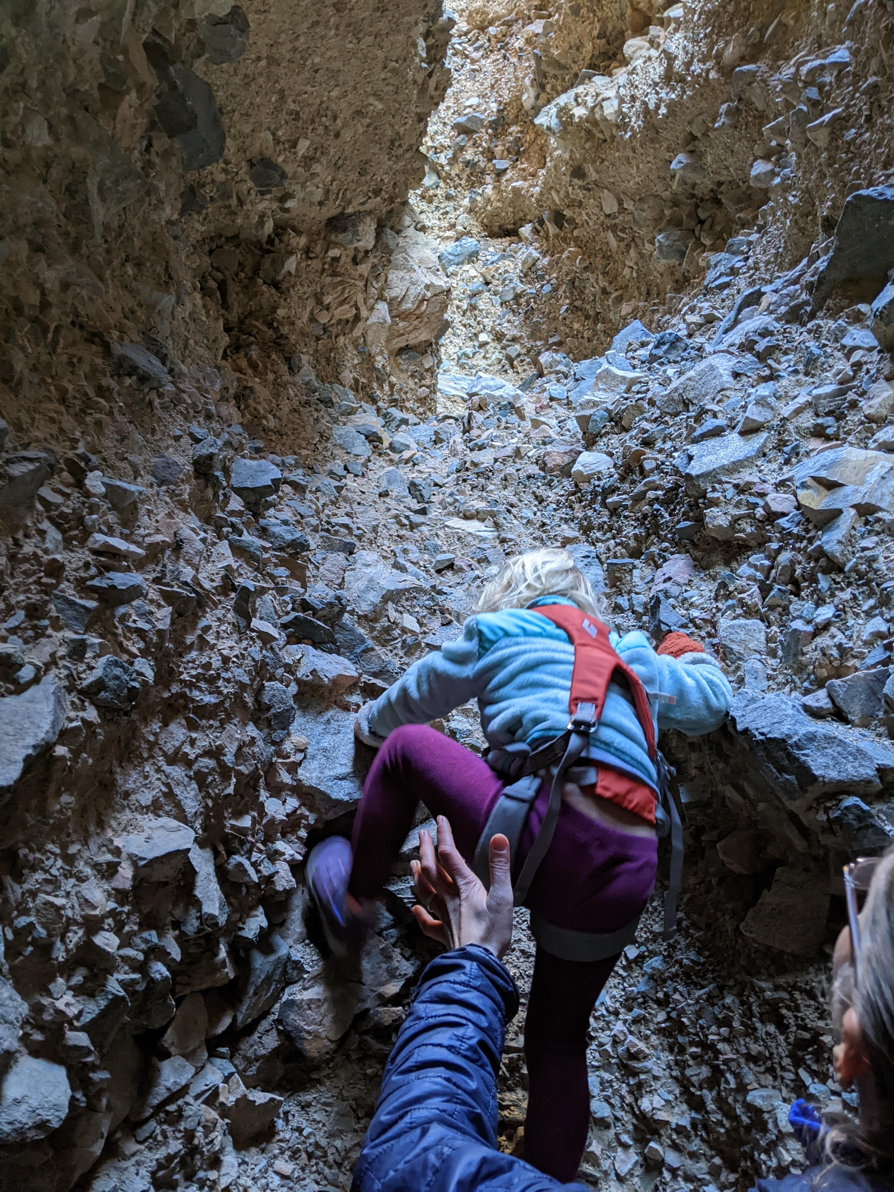
A few easy obstacles in the dark lead to a first real climbing obstacle. The first 5 m climb is low angle. A minute after the first obstacle is another two-stage fall that is slightly taller and more difficult. Above this, a couple of easier climbs lead to daylight and the top of the canyon. A remarkable and fun little canyon.
Not Spooky Canyon
Once under the railroad bridge that has 3 openings, go left up the drainage that has a concrete side. This is Not Spooky Canyon. The wash bends right and enters the conglomerate canyon. Unlike Spooky Canyon, this canyon has boulders on its floor and requires a bit of route finding and easy scrambling around boulders as you work up the canyon. Soon the canyon narrows and begins a sinuous path through. Though never as dark as Spooky, it is dramatic.
Like Spooky, the path is soon blocked by a climbing obstacle. The first climbing obstacle is an easy groovy, about 4 m. Just a bend or two above this first obstacle is the most difficult obstacle of the day. This dryfall is about 7 m with a vertical bottom that quickly eases into a lower angle slab. Easy climbing, but poor rock. Be careful of loose rock, especially on the vertical section.
A couple of more bends leads to an easier final up climb out of the conglomerate slot and to the open country above.
Photos
Videos
Spooky and Not Spooky Canyons
Maps

11S 561138E 3876685N
35°01'52"N 116°19'47"W
11S 561243E 3876828N
35°01'56"N 116°19'43"W
11S 561188E 3876898N
35°01'58"N 116°19'45"W