Lower Pleasant Creek Falls |

Boulder Mountain

Hiking Lower Pleasant Creek Falls - Boulder MountainRoadside Attraction Lower Pleasant Creek Falls - Boulder Mountain Lower Pleasant Creek Falls

Boulder Mountain

Overview

RATING: Roadside or short hike
MAPS: GOLDEN THRONE, UT

Sun

Mostly sunny, with a high near 58. Northwest wind 7 to 10 mph.

58 | 37

Mon

Sunny, with a high near 66.

66 | 39

Tue

Sunny, with a high near 70.

70 | 43

Wed

Sunny, with a high near 67.

67 | 45

Thu

Sunny, with a high near 68.

68 | 44

View Full Weather Details
SEASON: Late spring through fall.
WATER: Filterable from the stream if needed.

Sun

Mostly sunny, with a high near 58. Northwest wind 7 to 10 mph.

58 | 37

Mon

Sunny, with a high near 66.

66 | 39

Tue

Sunny, with a high near 70.

70 | 43

Wed

Sunny, with a high near 67.

67 | 45

Thu

Sunny, with a high near 68.

68 | 44

View Full Weather Details
Lower Pleasant Creek Falls - Boulder Mountain

Lower Pleasant Creek Falls - Boulder Mountain

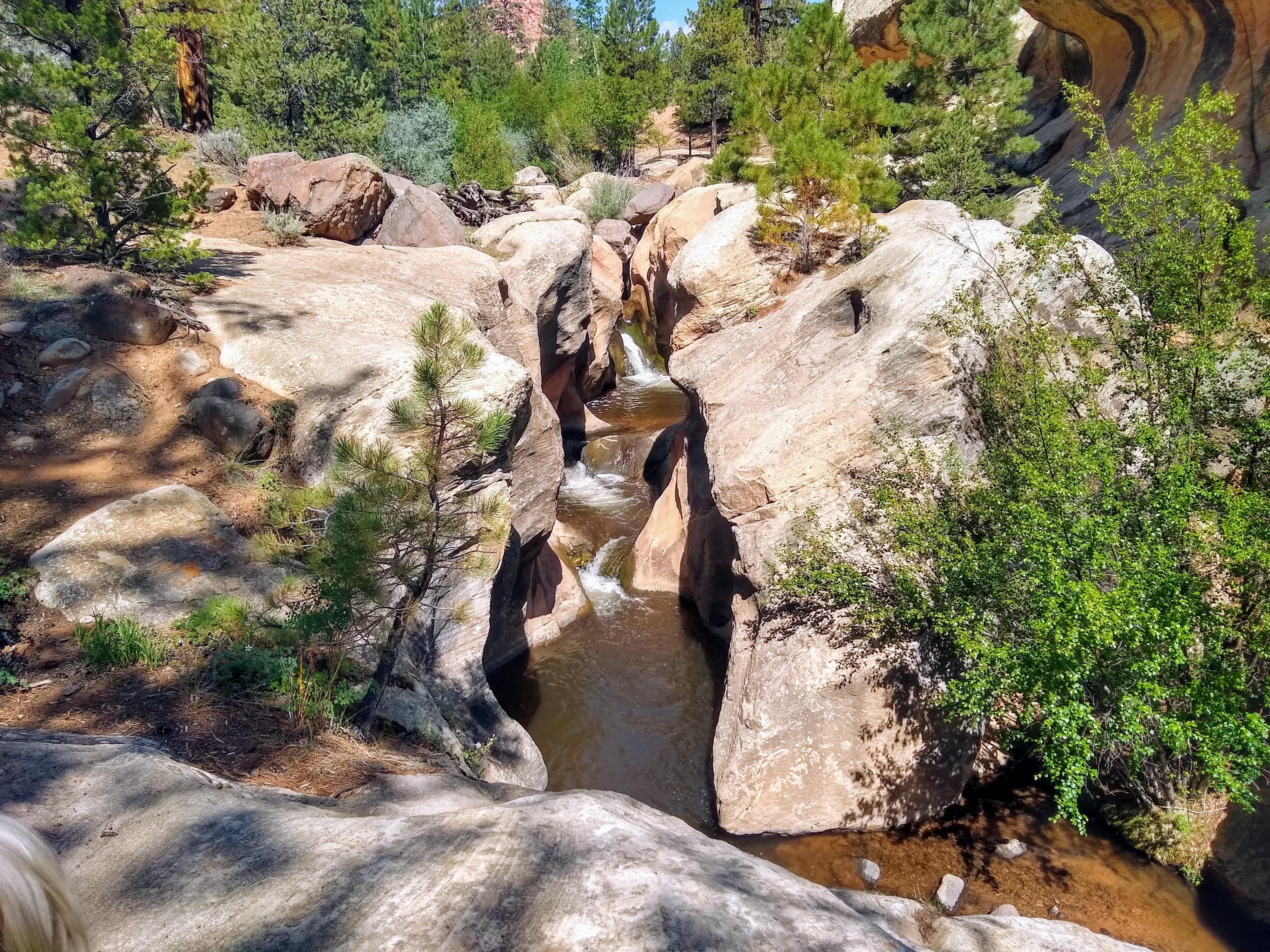
Pleasant Creek is very aptly named. The stream starts high on Boulder Mountain at nearly 11,000’ and winds its way down the eastern slope of the mountain through ponderosa pine, spruce, and lovely high mountain meadows. After passing through the high mountain environment, it transitions into the lower sandstone rock layers, passing through Capitol Reef National Park before joining the Fremont River. Before reaching Capitol Reef, the creek cuts a short but very picturesque narrow section of canyon in the Navajo Sandstone layer with a small waterfall.

This is either short hike or roadside attraction depending on the type of vehicle you have. Those with ATV’s or smaller 4-wheel drive vehicles can drive to the falls. High clearance vehicles can make it to within about 0.75 miles of the falls. In a Grand Cherokee, we opt-ed to walk the last 0.25 miles to the falls, more to enjoy the scenery while hiking than because the road was terribly difficult.

Diane and Abby enjoying Pleasant Creek on a hot summer day.

Diane and Abby enjoying Pleasant Creek on a hot summer day.

Getting There

The trailhead is east of UT-12 beyond Lower Bown Reservoir. To get there, head south on UT-12 from the UT-24/UT-12 junction east of Torrey. Follow UT-12 for about 17 miles to milepost 106.1.

  • MP 106.1 - Reset odometer as you turn off UT-12. This is signed Lower Bowns Reservoir. There are many side roads and primitive camping opportunities along the way. Stay on the main road until directed otherwise. ( 12S 470414mE 4216961mN / N38° 05' 60" W111° 20' 15" )
  • 3.15 miles - Junction. Right goes to Lower Bowns Reservoir. Go left here, toward Jorgenson Flat and Tantalus Creek. ( 12S 474801mE 4217886mN / N38° 06' 30" W111° 17' 15" )
  • 7.6 miles - Junction. Right goes to Captiol Reef. Go left here. ( 12S 480225mE 4221827mN / N38° 08' 39" W111° 13' 32" )
  • 7.85 miles - Pullout on the left. The road gets narrow and rockier as it descends into Pleasant Creek. Parking here is a good option if you don't want to negotiate the narrow/rougher road. ( 12S 480547mE 4222098mN / N38° 08' 48" W111° 13' 19" )
  • 8.15 miles - Cross Pleasant Creek. High Clearance 4x4 likely required. Check the crossing thoroughly before committing! ( 12S 480217mE 4222142mN / N38° 08' 49" W111° 13' 33" )
  • 8.25 miles - Side road on the right. Take this narrow/sandy track. ( 12S 480222mE 4222228mN / N38° 08' 52" W111° 13' 33" )
  • 8.5 miles - End of the Road ( 12S 480550mE 4222245mN / N38° 08' 52" W111° 13' 19" )
Diane and Ruby checking out the lower canyon.

Diane and Ruby checking out the lower canyon.

Route

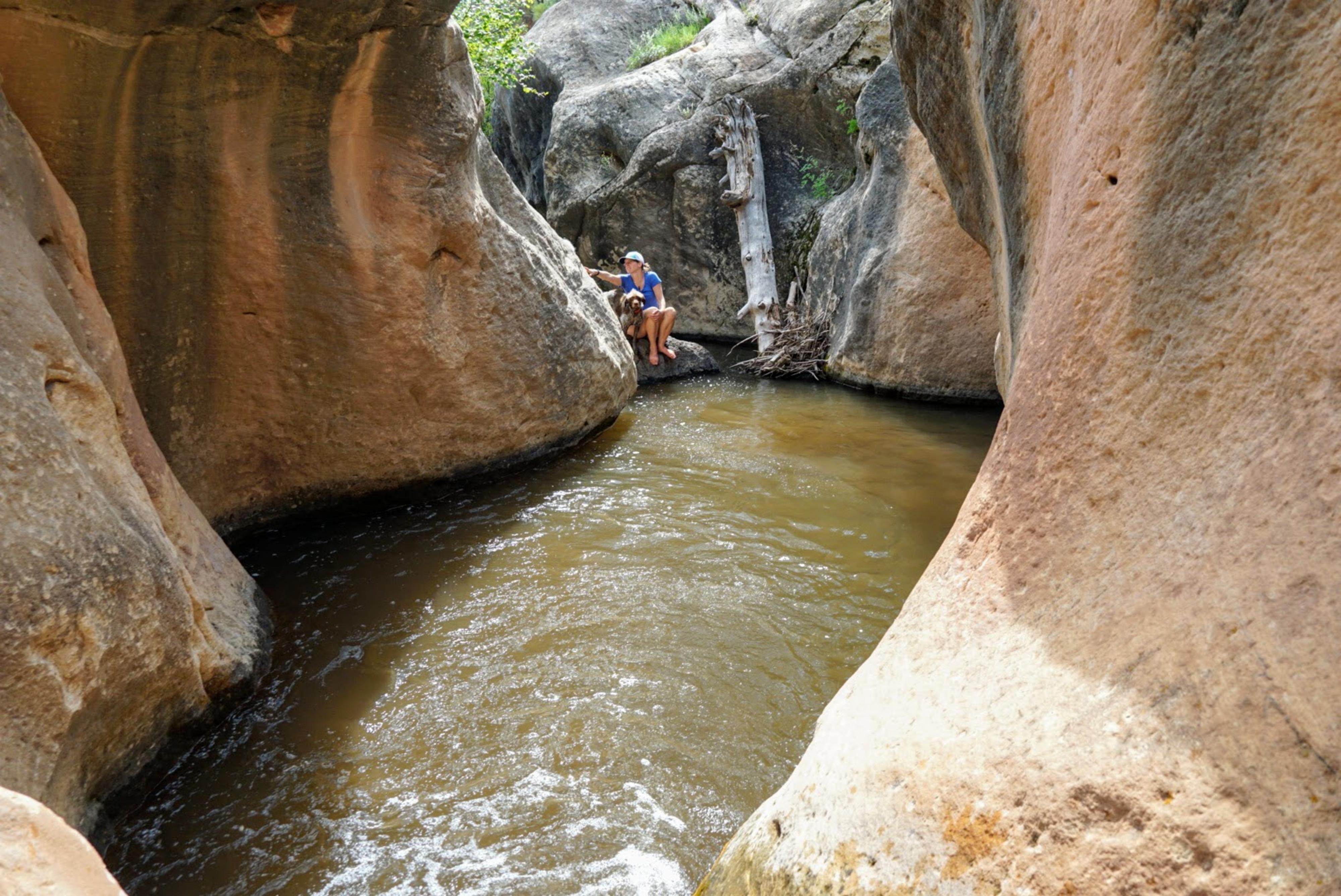
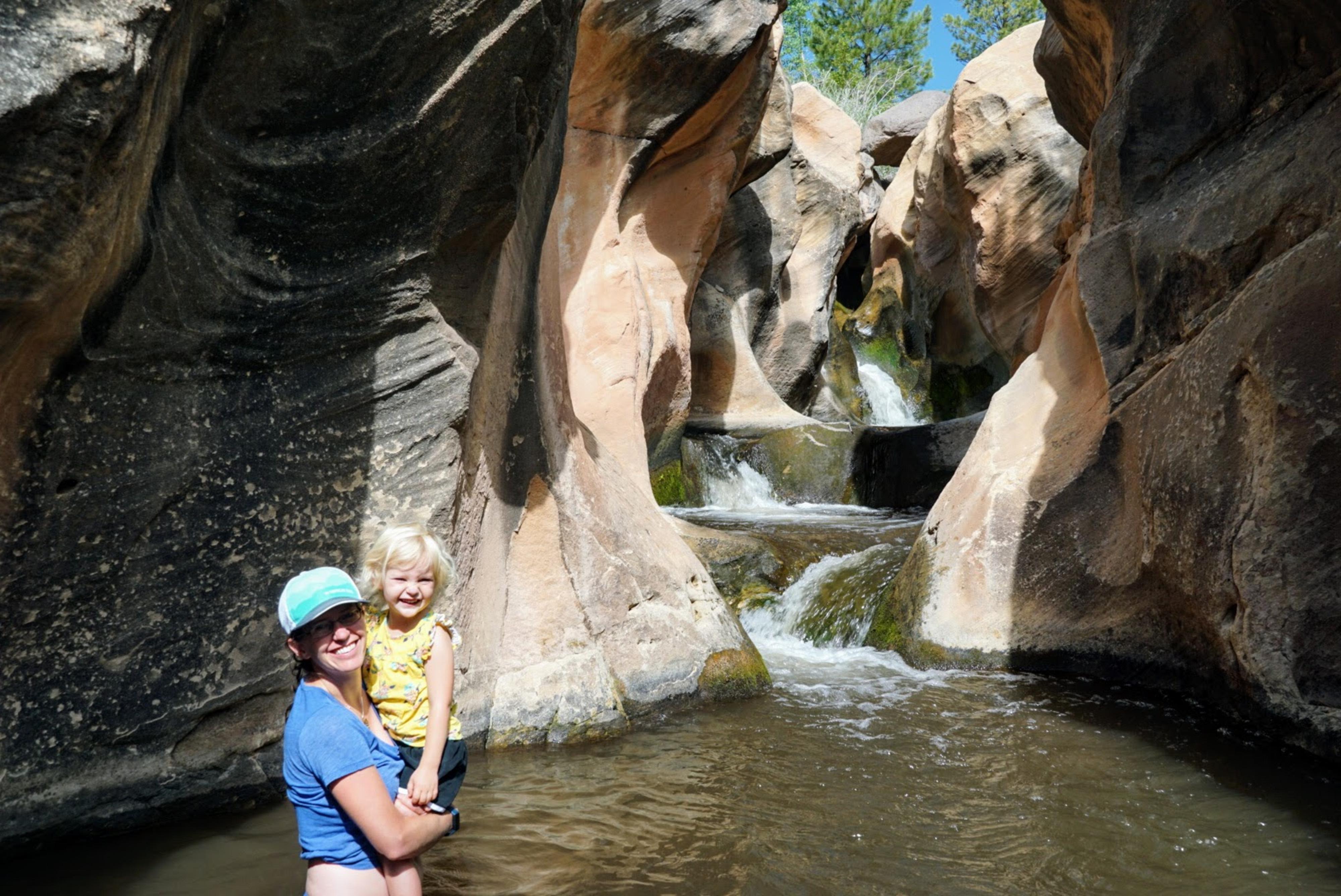
From the end of the road, Pleasant Creek is visible to the south. The falls are just below the parking area. To visit the falls and short section of sandstone canyon from below, cross Pleasant Creek and follow a social trail on the south side of the creek that follows the creek to where it is easy to get down to the creek proper. Climbing up to the falls from below, on our trip, had a few pools to about waist level. It is a stunning place to spend a hot afternoon.


Maps

Printable Maps:
7.85 miles - Pullout on the left. The road gets narrow and rockier as it descends into Pleasant Creek. Parking here is a good option if you don't want to negotiate the narrow/rougher road.

12S 480547mE 4222098mN

N38° 08' 48" W111° 13' 19"

8.15 miles - Cross Pleasant Creek. High Clearance 4x4 likely required. Check the crossing thoroughly before committing!

12S 480217mE 4222142mN

N38° 08' 49" W111° 13' 33"

8.25 miles - Side road on the right. Take this narrow/sandy track.

12S 480222mE 4222228mN

N38° 08' 52" W111° 13' 33"

8.5 miles - End of the Road

12S 480550mE 4222246mN

N38° 08' 52" W111° 13' 19"

Falls

12S 480602mE 4222206mN

N38° 08' 51" W111° 13' 17"

Creek Access

12S 480647mE 4222212mN

N38° 08' 51" W111° 13' 15"

Comments

Want to make a comment? Login and let yourself be heard.