Mount Garfield |

Grand Junction

Hiking Mount Garfield - Grand Junction Hiking Mount Garfield

Grand Junction

Overview

RATING: Strenuous Hike
MAPS: CLIFTON, CO; ROUND MOUNTAIN, CO

Fri

Rain showers likely before noon, then a chance of showers and thunderstorms between noon and 4pm, then a slight chance of showers and thunderstorms. Mostly cloudy, with a high near 56. Southwest wind 10 to 15 mph. Chance of precipitation is 70%.

56 | 40

Sat

A slight chance of rain showers after noon. Cloudy, with a high near 62. South southwest wind 15 to 25 mph, with gusts as high as 40 mph. Chance of precipitation is 20%.

62 | 44

Sun

Rain showers likely before noon, then showers and thunderstorms likely. Mostly cloudy, with a high near 56. Chance of precipitation is 70%.

56 | 45

Mon

A slight chance of rain showers before noon, then a chance of showers and thunderstorms. Partly sunny, with a high near 55.

55 | 36

Tue

Sunny, with a high near 60.

60 | 34

View Full Weather Details
SEASON: Fall, Winter, Spring (hot in summer)
GEAR: Standard Hiking Gear
WATER: None

Fri

Rain showers likely before noon, then a chance of showers and thunderstorms between noon and 4pm, then a slight chance of showers and thunderstorms. Mostly cloudy, with a high near 56. Southwest wind 10 to 15 mph. Chance of precipitation is 70%.

56 | 40

Sat

A slight chance of rain showers after noon. Cloudy, with a high near 62. South southwest wind 15 to 25 mph, with gusts as high as 40 mph. Chance of precipitation is 20%.

62 | 44

Sun

Rain showers likely before noon, then showers and thunderstorms likely. Mostly cloudy, with a high near 56. Chance of precipitation is 70%.

56 | 45

Mon

A slight chance of rain showers before noon, then a chance of showers and thunderstorms. Partly sunny, with a high near 55.

55 | 36

Tue

Sunny, with a high near 60.

60 | 34

View Full Weather Details
Amazing sunrise along the upper part of the trail.

Amazing sunrise along the upper part of the trail.

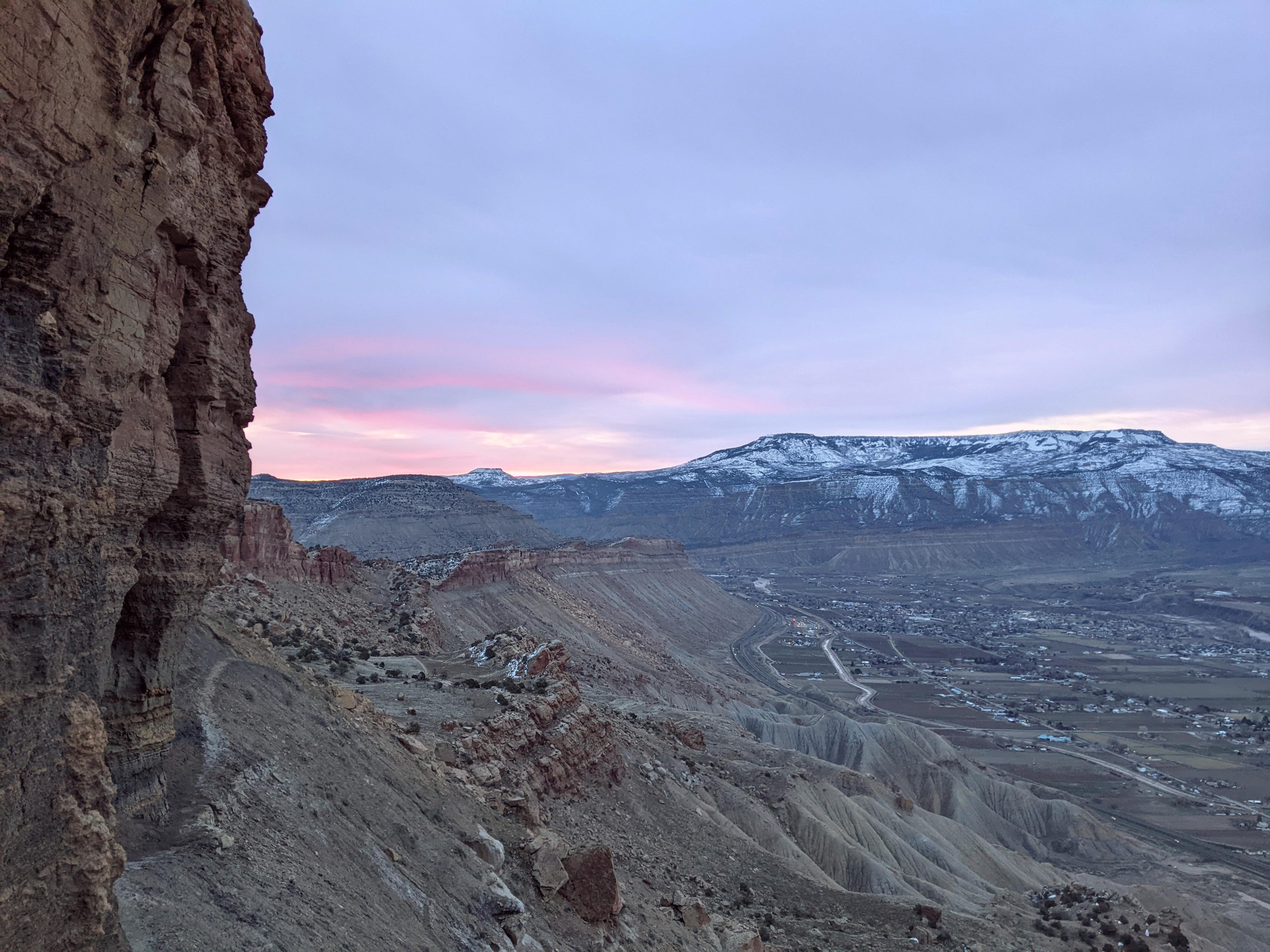
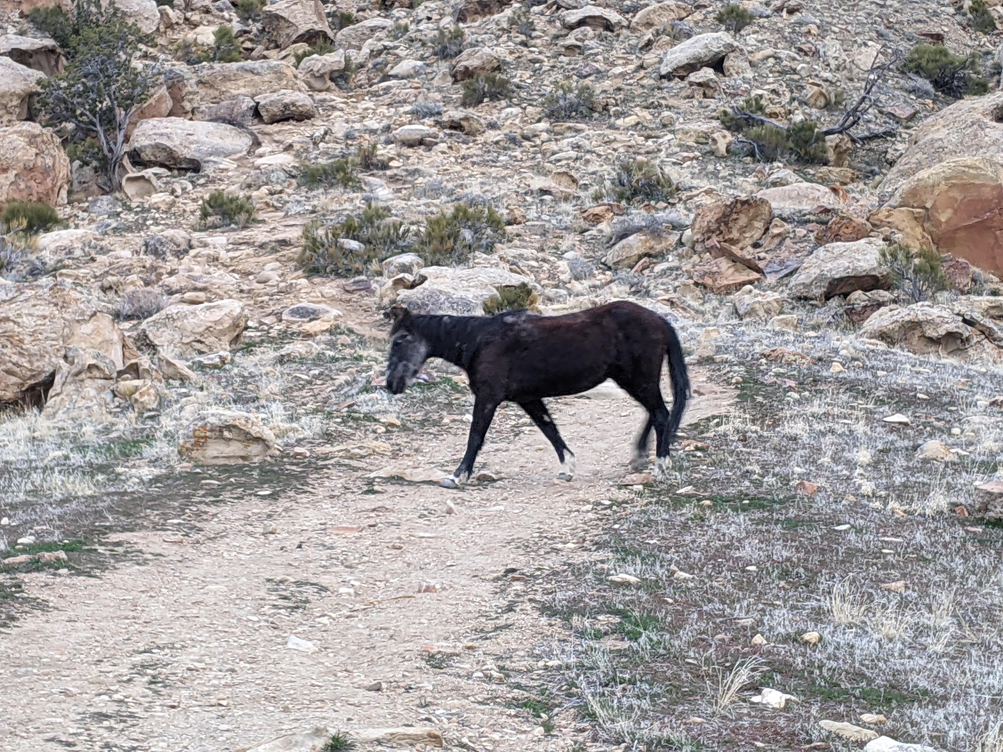
Mt Garfield is one of the iconic peaks in the Grand Valley area. The 6,765 ft peak rises almost 2,000 ft above the surrounding valley and is the highest point in that portion of the Book Cliff Range. It is seen from many places in the area and quite a dramatic summit to hike! The backside of the Book Cliffs is home to wild horses that are occasionally seen along the trail.

This route, from near Palisade, is the most common route to the summit and one that is open year around. Popular does not equal easy! The hike begins with about 1 minute of flat hiking before immediately starting a steep climb up the Mancos Shale layer. The trail, according to my watch, climbed about 1,900 feet in almost exactly 2 miles. Very steep by my standards!

History Note: The peak is named after President James Garfield, and was named a year after his death. The area near the top of the Mancos Shale was mined from 1930 to the 1960s and produced substantial coal. The mine was named the Gearhart Mine, and some ruins are visible along the trail. The coal was transported to near the trailhead via aerial tram.
Notes: The trail has no shade and is south facing. Do not attempt this in hot weather. If trying to do this in warm temps, I would start at or before sunrise and bring plenty of water. Alternatively, on my first attempt, it had snowed lightly the night before. The route was impassibly slippery. Two days of sunshine later, and the route was dry and lovely. Ideally, you want cool, dry conditions for this one.
Lucky wild horse sighting!

Lucky wild horse sighting!

Getting There

On the east side of the Grand Valley, take exit 42 off I-70 (US-6/Palisade), and head south off the interstate on 37 3/10 Rd/Elberta Ave.

Take the first right onto G 7/10 Road. Follow this as it heads west for about 1.5 miles, makes a hard right turn, and goes under the freeway. The trailhead is just after going under the freeway and up a small hill at a large dirt parking.

WARNING: The underpass that goes under the freeway is prone to holding water after recent precipitation. Be cautious if it has standing water in it. On both of my visits, the water was nearly bumper deep on a Ford Ranger.
The STEEP dirt ridge near the start of the trail.

The STEEP dirt ridge near the start of the trail.

Route

From the trailhead, locate the trail heading up the steep ridge just west of the trailhead. A marking post was near the base of the ridge on my hike. Do any warm up needed at the parking lot because about a 1 minute from the trailhead begins the steep ascent up the dirt ridge. Stay on the most used trail as you head up, particularly higher up, it branches a bit.

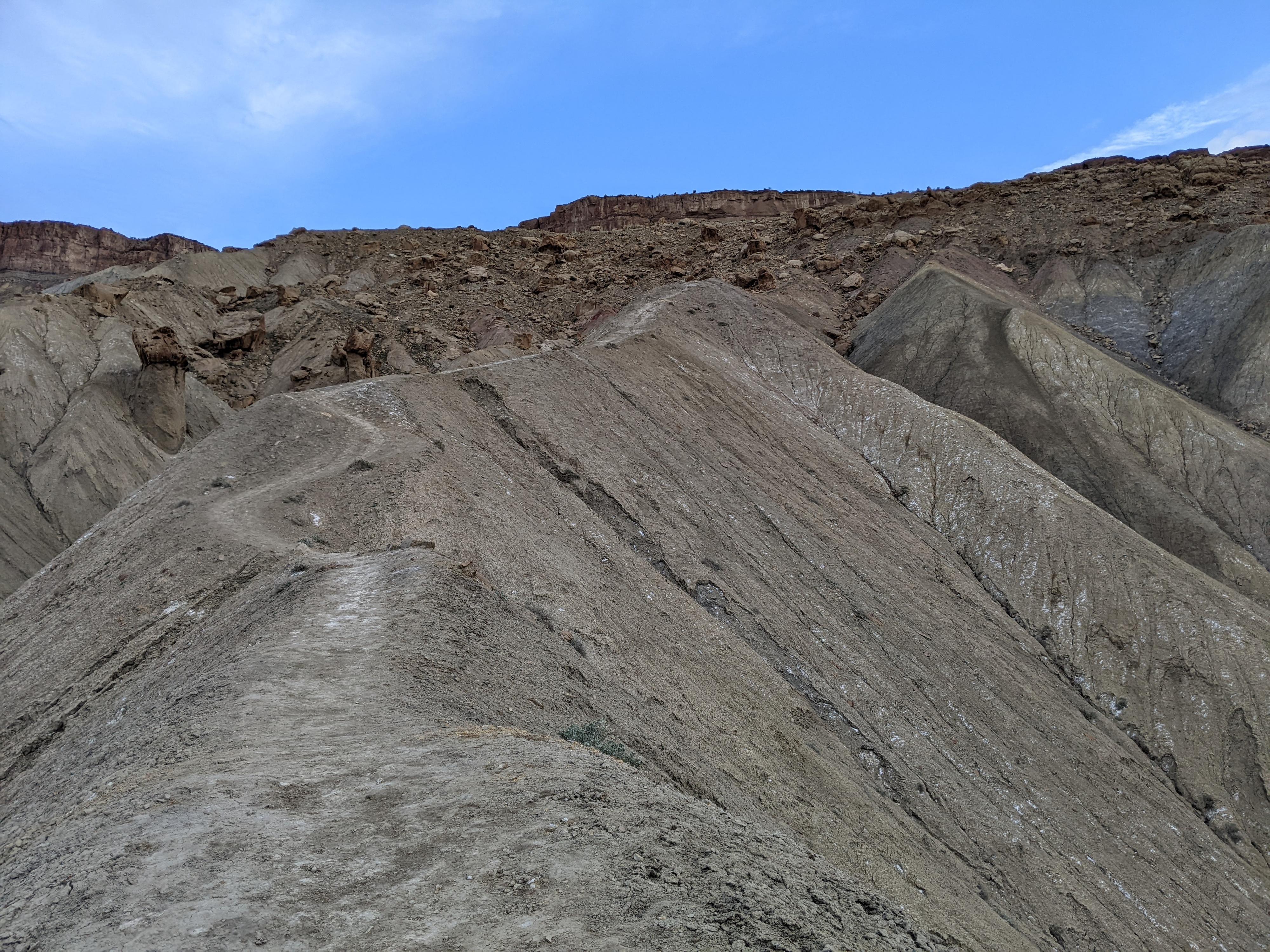
After about a 1,000 feet of gain, a flat area is reached. This is a good spot for a break and to take in the views. The trail heads north and a touch west across the flat and begins climbing again up a boulder covered slope. As you work up the slope, stay on the most used trail heading up, then west to flatter ground.

The trail heads west, across a second flat area, before climbing again along the edge of the cliff. This section is quite dramatic and leads to the top of the Mancos Shale layer.

Continue on the most used trail. It heads north briefly, then circles back and up to the top of Mt. Garfield. There is a flag and benchmark on top, as well as excellent views of the Grand Valley and Colorado National Monument to the south. Return the same way.


Maps

Route / 4.06 miles / Elevation Range 4,829 - 6,769 ft.
Printable Maps:
Mt Garfield Trailhead

12S 725755mE 4333201mN

N39° 07' 07" W108° 23' 19"

First Flats

12S 725379mE 4333883mN

N39° 07' 30" W108° 23' 34"

Second Flats

12S 725147mE 4334075mN

N39° 07' 36" W108° 23' 44"

Mt Garfield

12S 723852mE 4333823mN

N39° 07' 29" W108° 24' 38"

Comments

Want to make a comment? Login and let yourself be heard.