 Hiking
Mud Springs Point
Hiking
Mud Springs Point
Griffin Top
Overview
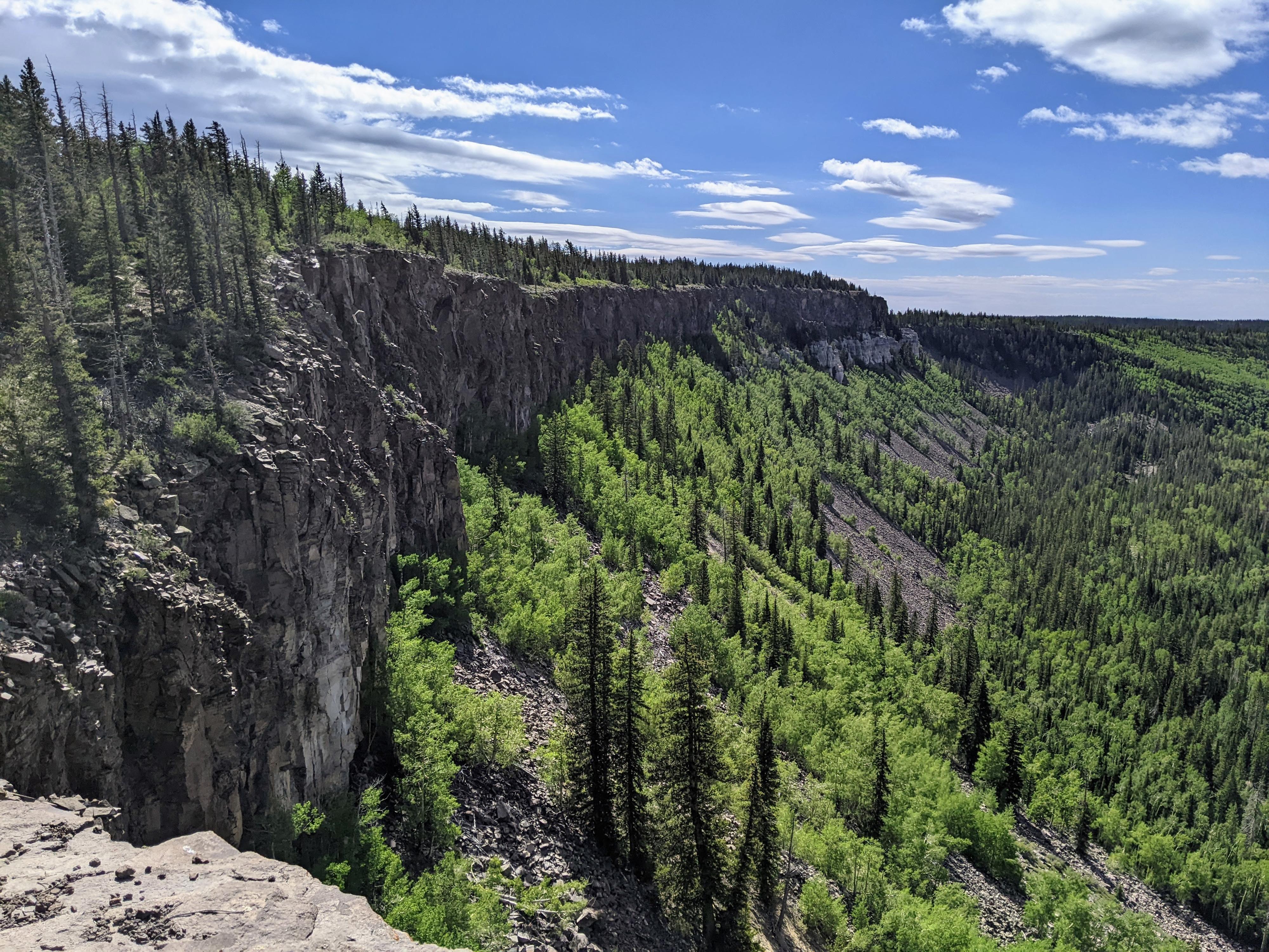
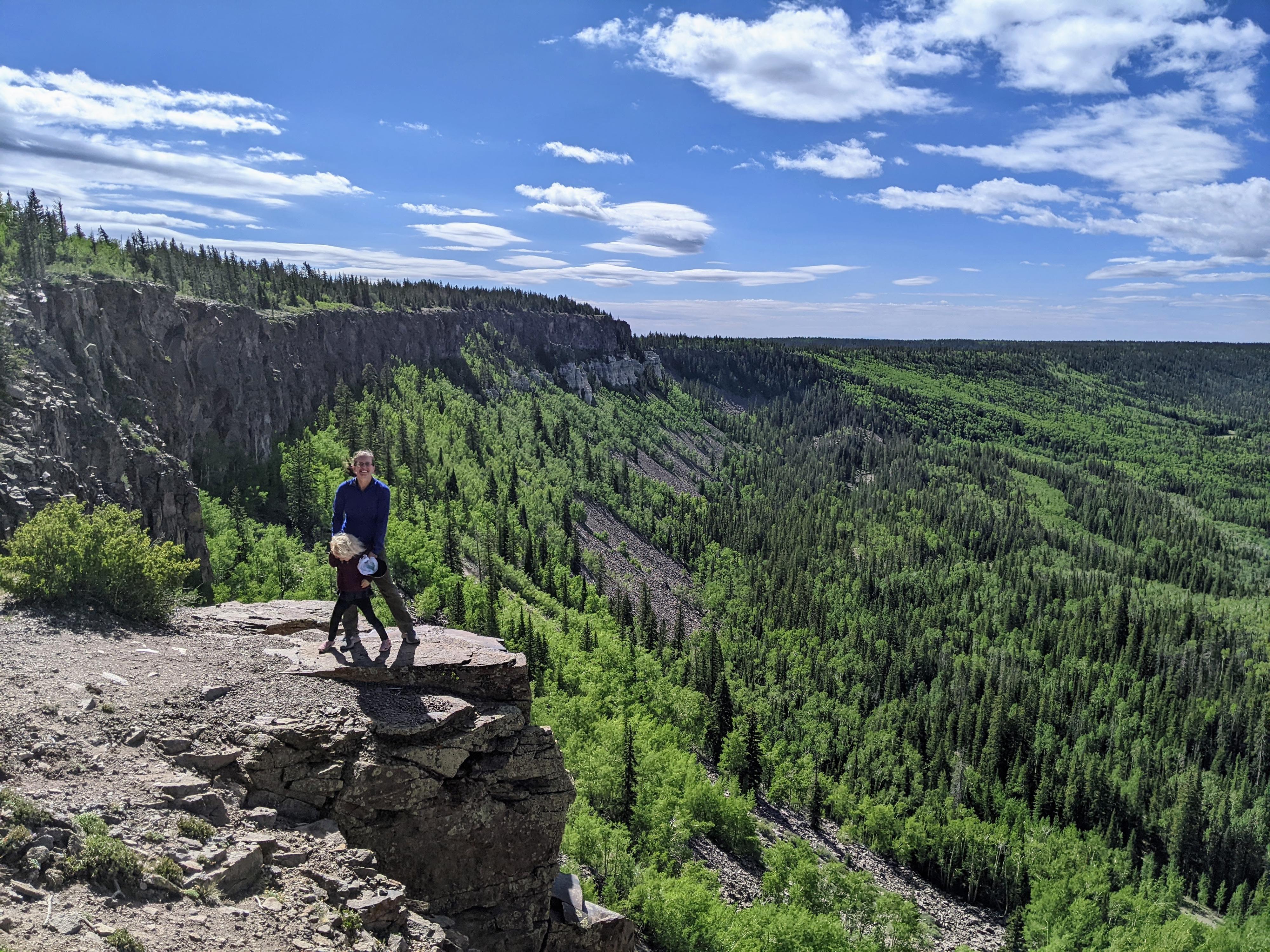
Mud Springs Point is the high-point of Griffin Top in the Escalante Mountains, just northwest of the town of Escalante. As a bit of a high-point bagger, this one was on my list because of the views I expected it to have. We were not disappointed!
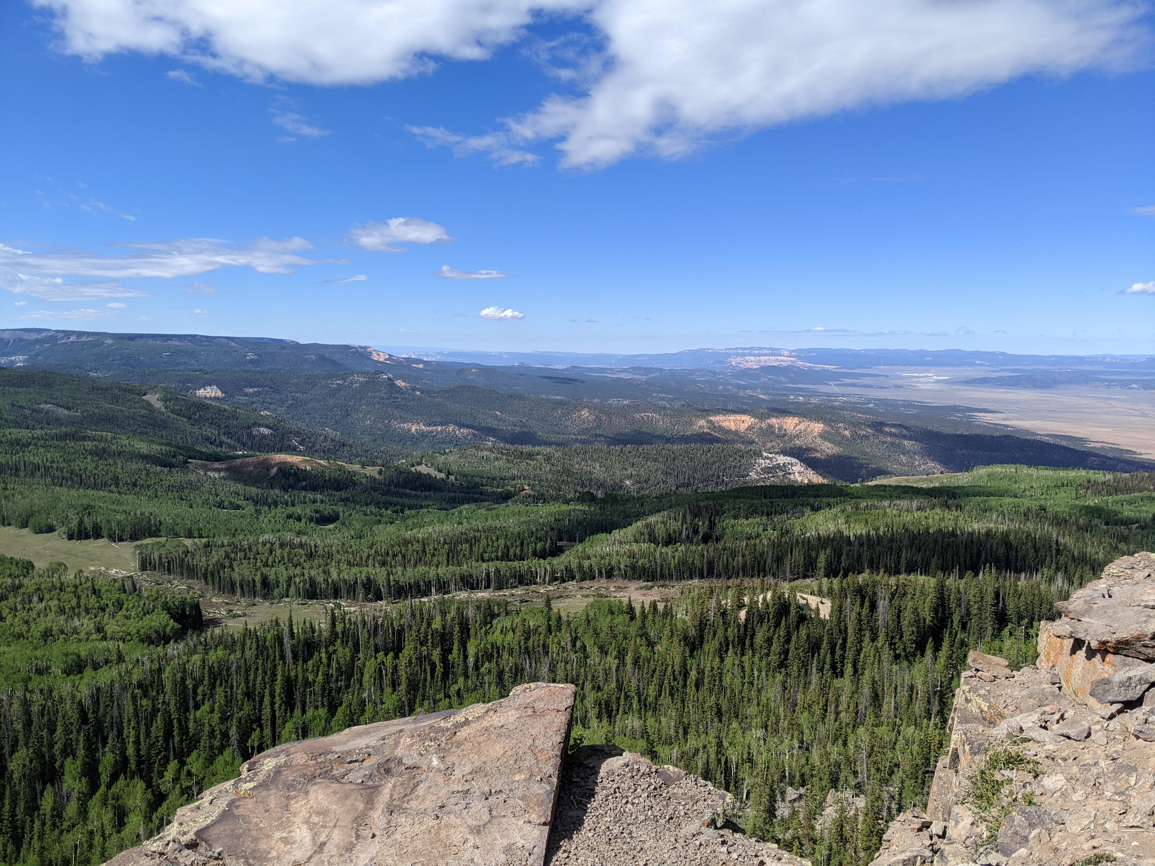
The hike is short, but along the top of a dramatic cliff wall with broad views to the west and south in the Bryce and Zion directions. A very nice little amble and great picnic spot. Fall will bring dramatic colors, if your timing is right!
Getting There
From the town of Escalante, head west on UT-12 for about 5 miles to mile marker 54.8 where a good, graded dirt road leaves on the right (Old Escalante Road).
Take this dirt road and reset your odometer. Stay on the dirt road as it crosses a wash, then bends and heads west. Ignore the many side roads. Follow this road for 14.6 miles to a 4-way junction at a high saddle.
Go right on this saddle, on forest road 140 and reset your odometer. FR-140 climbs quickly with several switchbacks. The views along the drive of Escalante are excellent. Follow FR-140 for 7.7 miles to a side road on the left (FR-1377) This side road is lesser used and will require high clearance. There are good campsites off this road. Follow the road to its end in 2.1 miles at the edge of a cliff.
Route Description
Navigation is easy for this one. From the trailhead, follow along the rim of the cliff, heading west. There was a pretty good social trail on our visit. A few minor deviations may be needed away from the top of the cliff, but generally stay near the edge. It is only about 0.25 miles from the trailhead to Mud Springs Point.
The point faces west with views of Johns Valley below and the Paunsaugunt Plateau beyond. To the south is the Bryce Canyon area, and some peaks in Zion are just visible as well. Return the same way.
Maps

12S 421623E 4195528N
37°54'14"N 111°53'30"W
12S 421308E 4195666N
37°54'18"N 111°53'42"W
12S 423937E 4196508N
37°54'47"N 111°51'55"W