 Hiking
Brimhall Arch
Hiking
Brimhall Arch
Waterpocket Fold
Overview
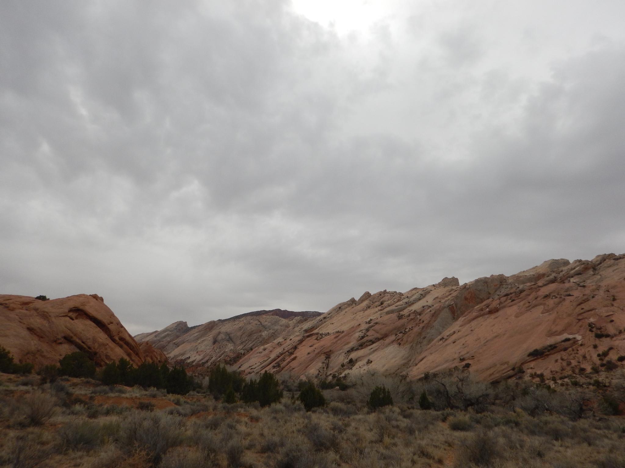
For an advertised park route, this one surprised me with its sporty nature! The route, tucked at the south end of the park, is seldom trodden but offers excellent views of the Waterpocket Fold and an impressive arch to boot. Be prepared, however, this one is for experienced hikers only. En route, you'll climb an exposed rock pile/ladder, as well as a likely short and bitterly cold swim before getting within sight of the arch. Good fun for the desert aficionado, not so much for the uninitiated.
Be sure to bring a drybag or others means of shuttling clothes and cameras across the pool. You will likely be full on swimming, and take it from the voice of experience, you're not likely to want to re-swim it when you realize you left your camera with the pile of extra dry clothes on the downstream side....
Getting There
Travel east out of Capitol Reef National Park on highway 24. Just past the park, 0.25 miles, is the well signed Notom road.
Route Description
From the trailhead, follow the signed Brimhall Arch trail. It is easy to follow as it descends a bit and heads north before making a quicker and steeper descent down to Halls Creek. There are some old cowboy signatures along the way. This must have been an incredibly isolated place to be passing though back in the early 1900's!
Once at Halls Creek, cross it and head downstream. There are quite a few social trails here, pick one and head down a few minutes to the first side canyon coming in on the right.
In 1879, a Mormon expedition made the Hole-In-The-Rock crossing on their way to settle southeastern Utah. One member of the expedition was Charles Hall. After the expedition Charles Hall created a ferry at Halls crossing (about 30 miles upstream from Hole-In-The-Rock) in 1882. The old wagon road that meanders down Halls Creek was constructed to support the ferry and allow settlers to cross the Colorado.
The ferry created a small settlement at the mouth of Halls Creek (under the waters of Lake Powell now), but the settlement and ferry were abandoned after only a couple of years. Charles Hall was also prominent in helping create other settlements, including Escalante and Parowan.
If you look closely, you can see section of this road as you near Halls Creek though it is mostly overgrown now.
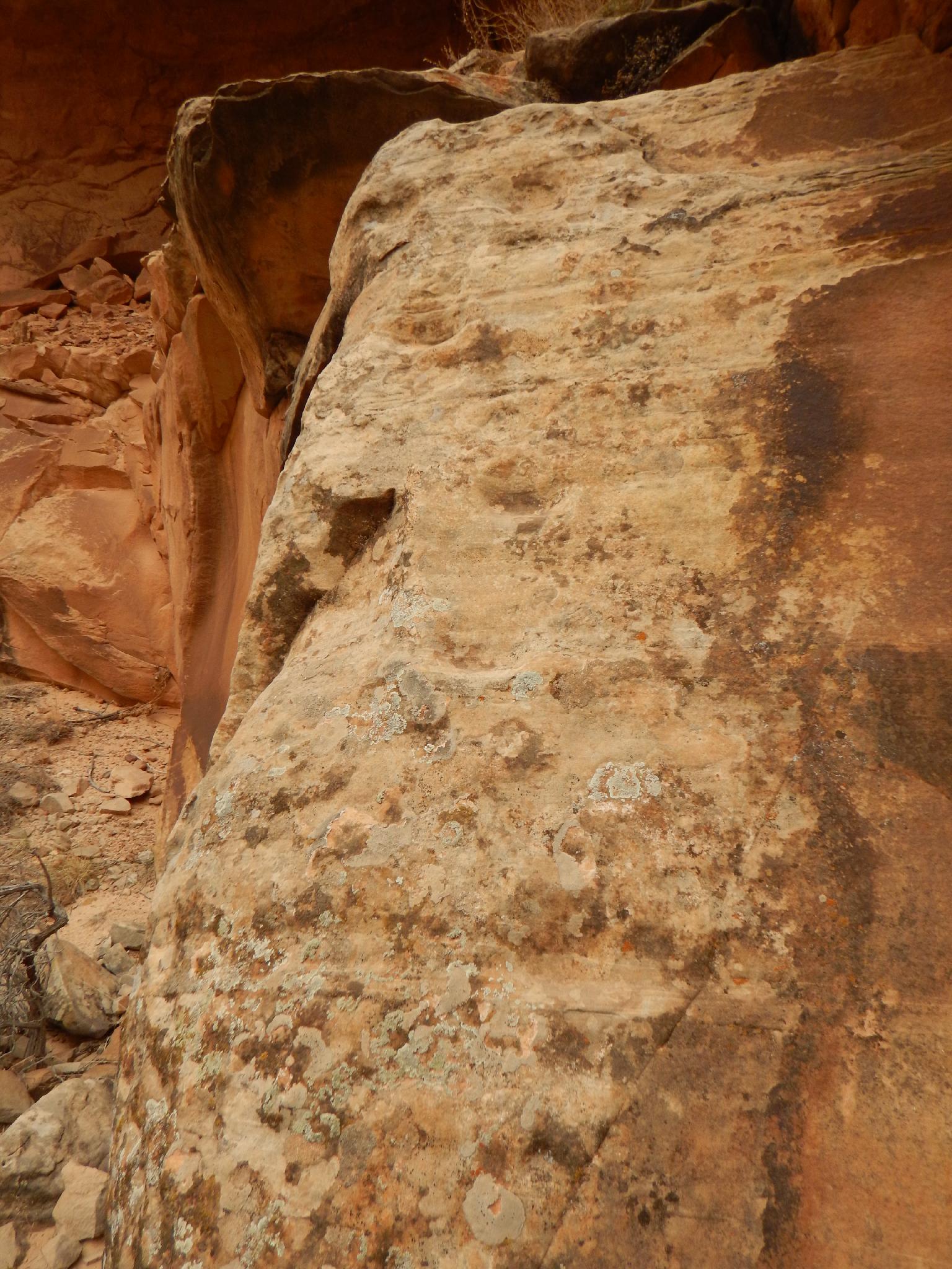
Hiking up the side canyon, keep an eye out for an alcove on the left. On the west side of this alcove are some old moki steps presumably used to visit the alcove as well as some very faint rock art.
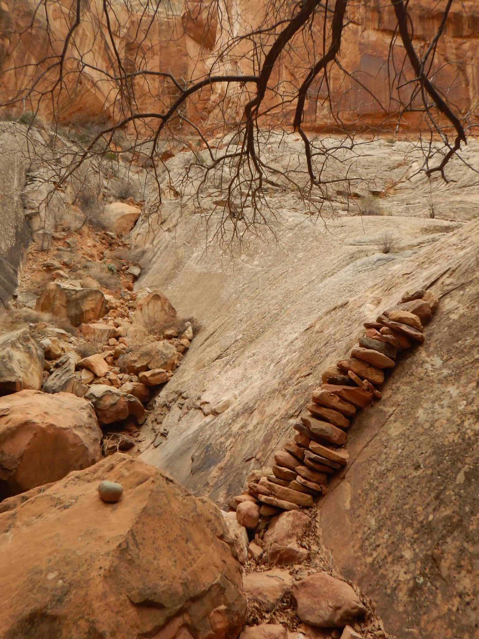
Continuing up from the alcove, the fun begins at a dryfall and plunge pool. A stack of rocks allows careful passing of this obstacle on the right. Be very careful both going up and coming down, the pile is a bit more unstable on the way down than the way up!
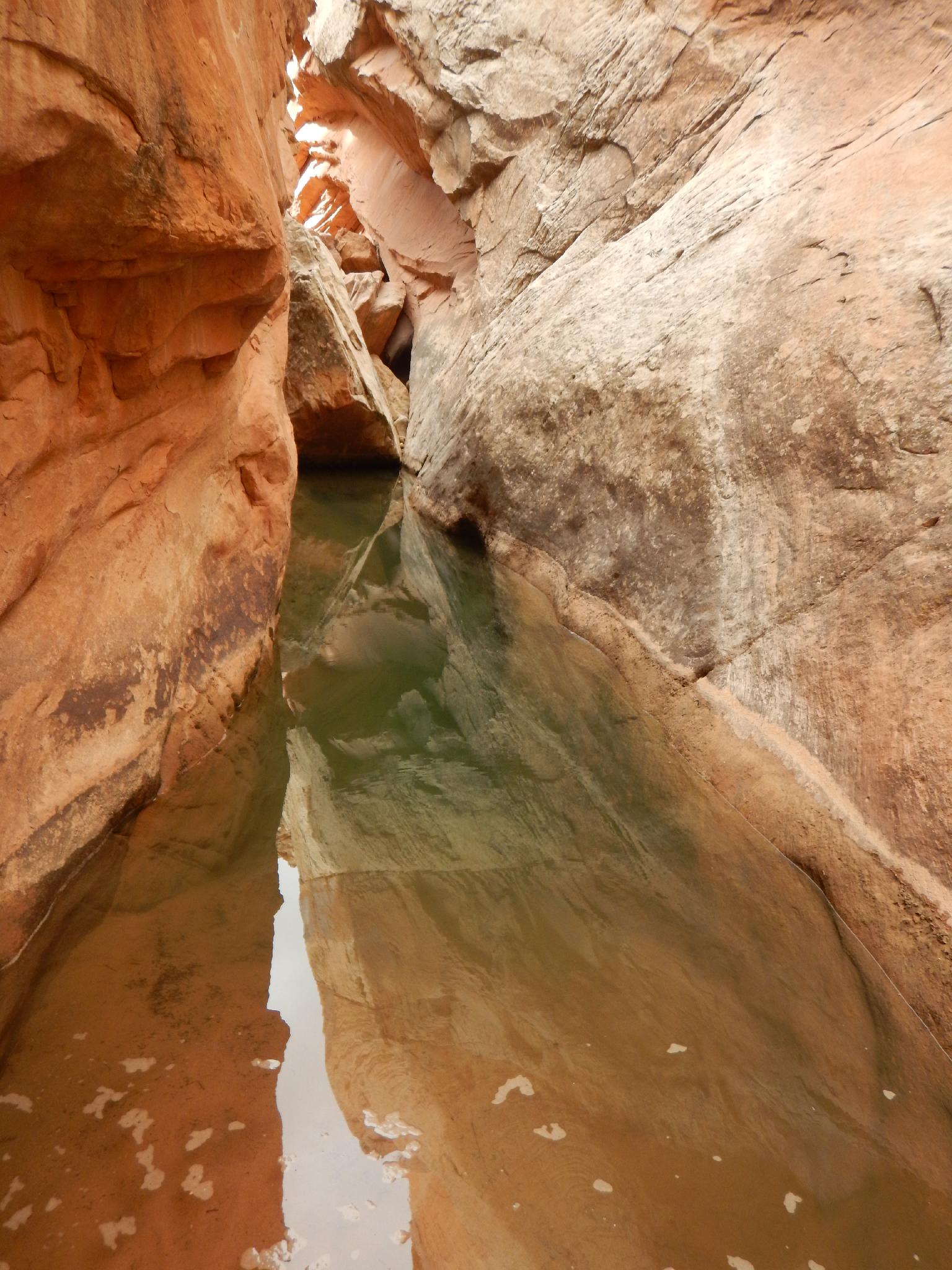
Shortly up from the rock pile, the canyon makes a left and narrows as it cuts between the cliffs. This is the second obstacle, the arctic swimming pool. On my trip, it was crystal clear and way over my head. You will likely be swimming, then need to do a few 4th class scramble moves to escape the other side. Be sure everything that needs to be dry bagged is.
(and don't leave your camera on the big rock downstream of this if you want pictures of the arch.. ;))
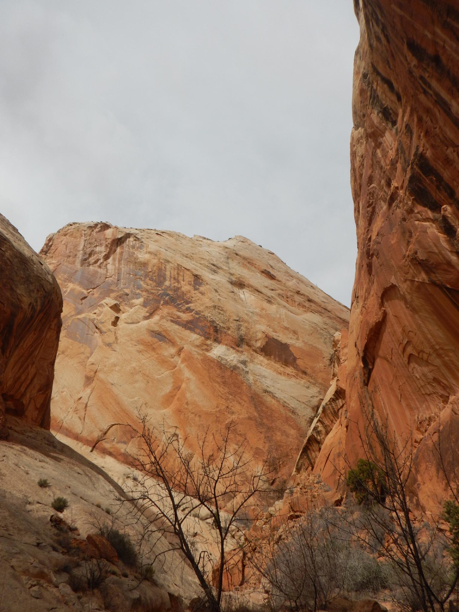
The canyon quickly opens, follow it up around a major bend to the right by hiking along the bank. Brimhall Arch is visible shortly above this bend on the left. The arch is said to have a greater than 120' span in the largest span. Stunning!
Return the same way.
Maps

12S 506164E 4174516N
37°43'04"N 110°55'48"W
12S 505825E 4175090N
37°43'23"N 110°56'02"W
12S 505314E 4174760N
37°43'12"N 110°56'23"W
12S 504783E 4174360N
37°42'59"N 110°56'45"W
12S 504698E 4174498N
37°43'04"N 110°56'48"W
12S 504342E 4174340N
37°42'59"N 110°57'03"W