 Hiking
South Fork of Mule Canyon (House of Fire Ruin)
Hiking
South Fork of Mule Canyon (House of Fire Ruin)
Cedar Mesa
Overview
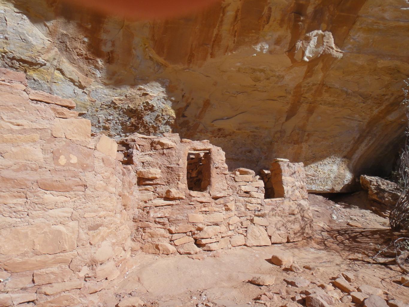
The South Fork of Mule Canyon is home to the House of Fire Ruin. Named for the unique, flame-like striations in the rock ceiling above the granaries in afternoon light, it has become one of the most iconic and photographed locations in the area. Once you have visited, you will notice photographs of it in countless places.
Because the trailhead sits just off the pavement, it remains accessible even when winter snows or summer monsoons turn other area dirt roads into impassable mud. It is a relatively easy but high beauty-for-effort hike. The out-and-back to House of Fire Ruin is about 2 miles and easily done in a couple of hours. It is a well-traveled trail suitable for most, though bring plenty of water in hot times of the year.
In addition to House of Fire Ruin, there are several additional ruins farther up the canyon for those looking for a longer hike. The upper section, past House of Fire, tends to be quieter and less visited. About 10 miles round-trip visits the upper ruins that are not as dramatic as House of Fire but still well worth visiting in my opinion.
Logistics
Chasing the Glow: To capture the famous "fire" effect, timing is everything. The best light typically occurs when the sun reflects off the canyon’s south wall and bounces back into the alcove. Late morning to mid-afternoon is generally the window when the ceiling begins to glow with deep oranges and reds. In the early morning, the ruin is beautiful but remains in flat shadow.
Fees & Regulations: A BLM day-use fee is required (available at the trailhead kiosk).
Pets: Dogs are welcome to join the hike but must be leashed at all times to protect the fragile archaeological sites.
Comforts: The trailhead is now a large parking area with a pit toilet and picnic tables.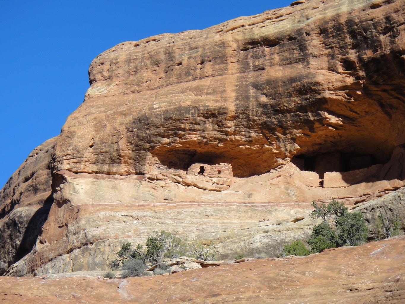
Getting There
Take highway 95 to milepost 101.8, which is 101.8 miles south-east from Hanksville, or about 23 miles west of Blanding. Turn off the highway, and almost immediately into the large parking area that is the trailhead.
Route Description
Rock art and historic sites are fragile, non-renewable cultural resources that, once damaged, can never be replaced. To ensure they are protected, please:
- Avoid Touching the Petroglyphs: Look and observe, BUT DO NOT TOUCH!
- Stay on the Trails: Stay on the most used trails when visiting sites, and don't create new trails or trample vegetation.
- Photography and Sketching is Allowed: Do not introduce any foreign substance to enhance the carved and pecked images for photographic or drawing purposes. Altering, defacing, or damaging the petroglyphs is against the law -- even if the damage is unintentional.
- Pets: Keep pets on a leash and clean up after them.
- Artifacts: If you happen to come across sherds (broken pottery) or lithics (flakes of stone tools), leave them where you see them. Once they are moved or removed, a piece of the past is forever lost.
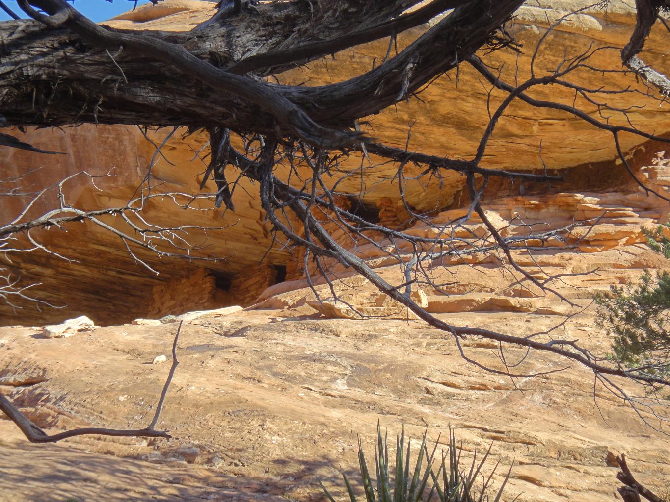
From the trailhead, walk the road about 1/4 of a mile to where it crosses the South Fork of Mule Canyon. A good social trail leave the road on the north side of the drainage and heads up the canyon bottom. About a mile (20-30 minutes) from the trailhead, the first ruin is on the right. This is House of Fire Ruin. All the ruins are on the right (south facing) side of the canyon. Keep a sharp eye out, there are many ruins on various levels of the canyon.
About 3 miles from the trailhead, a pool and small dryfall force the trail up and out of the canyon floor on the south side. Follow the trail around the dryfall, and look for a big ruin a few minutes up the canyon on the right. It is well hidden by large trees, but a good landmark and very good ruin.
Continue up from the big ruin to the next side canyon coming in on the right. This side canyon contains Wall Ruin, a fantastic ruin. Follow the side canyon up about 5 minutes to the obvious ruin on the right (east) wall.
Continuing up in the main canyon, there are several more ruins shortly above the Wall Ruin side canyon. The most spectacular of these, Doorway Ruin, is in the next side canyon up from the Wall Ruin side canyon. Access is by going up the side canyon and traversing back to the ruin. Be careful, it is easy, but very exposed.
There is not much above Doorway Ruin, return the way you came.
Photos
Maps

12S 612018E 4155245N
37°32'15"N 109°43'55"W
12S 610916E 4155922N
37°32'37"N 109°44'40"W
12S 609667E 4156788N
37°33'06"N 109°45'30"W
12S 608874E 4157009N
37°33'13"N 109°46'03"W
12S 608546E 4157295N
37°33'23"N 109°46'16"W
12S 607925E 4157668N
37°33'35"N 109°46'41"W
12S 607850E 4158152N
37°33'51"N 109°46'44"W
12S 607461E 4158125N
37°33'50"N 109°46'60"W
12S 607125E 4158254N
37°33'54"N 109°47'13"W