 Roadside Attraction
UT-162 Panels
Roadside Attraction
UT-162 Panels
Bluff
Overview
Just east of Bluff, on UT-162, are several rock art panels and a ruin just north of the road. These are easy to visit and have some different artistic styles represented. For me, there are more dramatic panels in the area, but the easy of access makes these a must-visit if you are passing through and have an hour to spare.
Getting There
From the junction of US-191 and UT-162 on the north end of Bluff, reset your odometer and head east on UT-162. Sites are described below in approximate mileages from this junction, and all sites are on the left (north) side of the road.
Route Description
Rock art and historic sites are fragile, non-renewable cultural resources that, once damaged, can never be replaced. To ensure they are protected, please:
- Avoid Touching the Petroglyphs: Look and observe, BUT DO NOT TOUCH!
- Stay on the Trails: Stay on the most used trails when visiting sites, and don't create new trails or trample vegetation.
- Photography and Sketching is Allowed: Do not introduce any foreign substance to enhance the carved and pecked images for photographic or drawing purposes. Altering, defacing, or damaging the petroglyphs is against the law -- even if the damage is unintentional.
- Pets: Keep pets on a leash and clean up after them.
- Artifacts: If you happen to come across sherds (broken pottery) or lithics (flakes of stone tools), leave them where you see them. Once they are moved or removed, a piece of the past is forever lost.
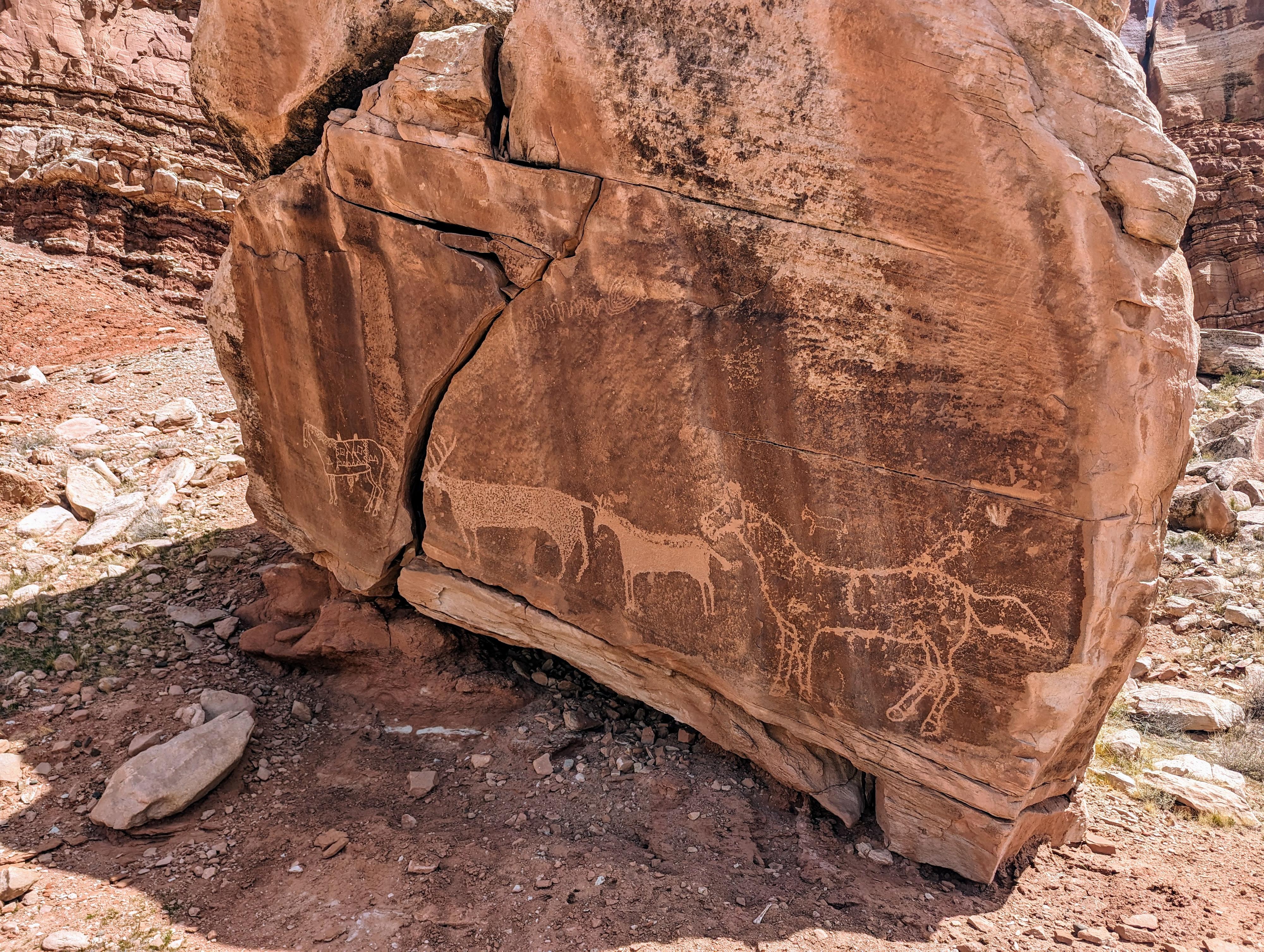
0.18 miles - A small side road on the left goes past a corral to a boulder with several images including horses.
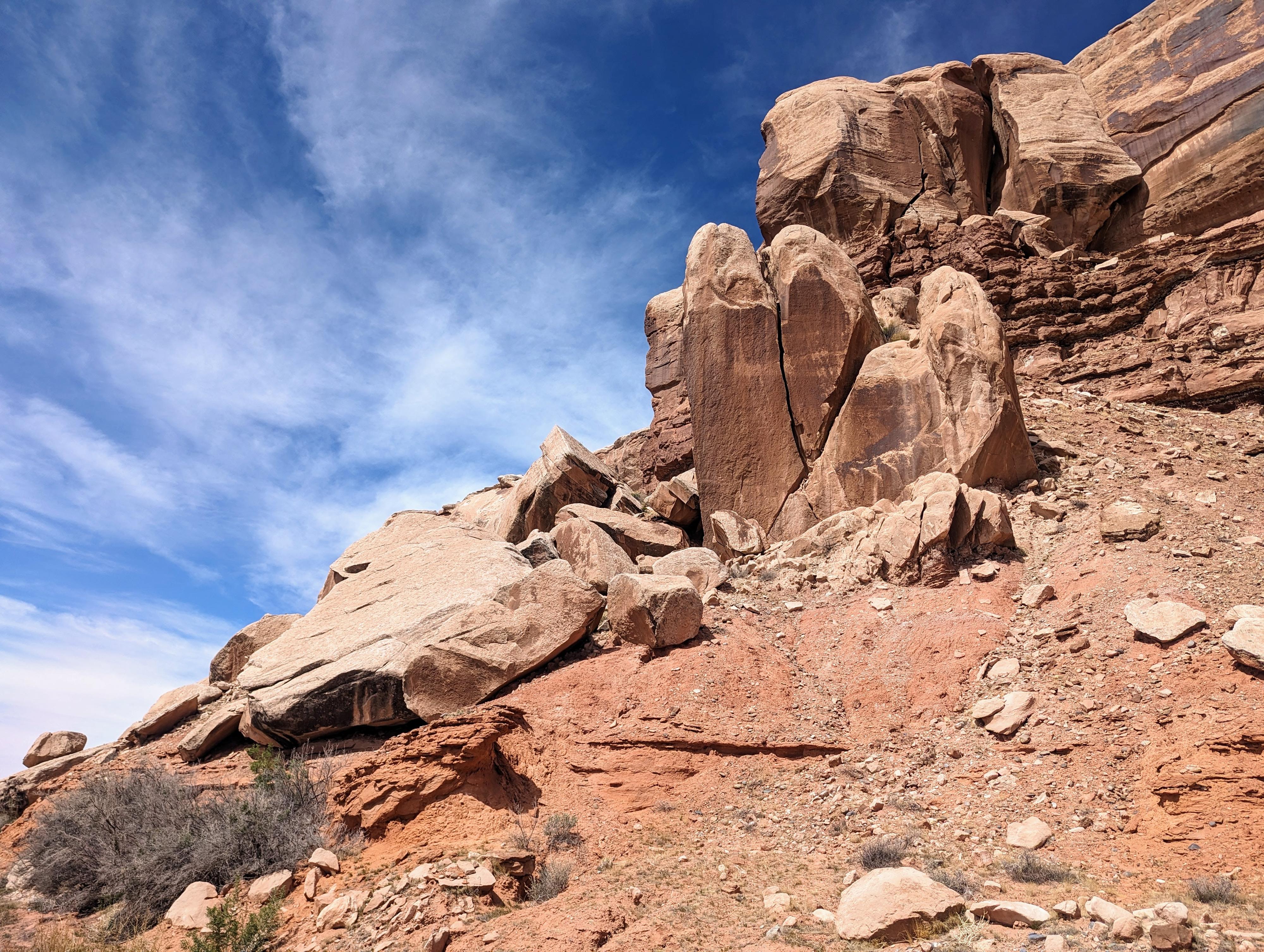
0.48 miles - Look for a jumble of boulders above the road. The boulders have a vertical and about a 45 degree crack on them. These boulders have several images. They are difficult to see from the road and a short but steep and somewhat loose hike to visit up close.
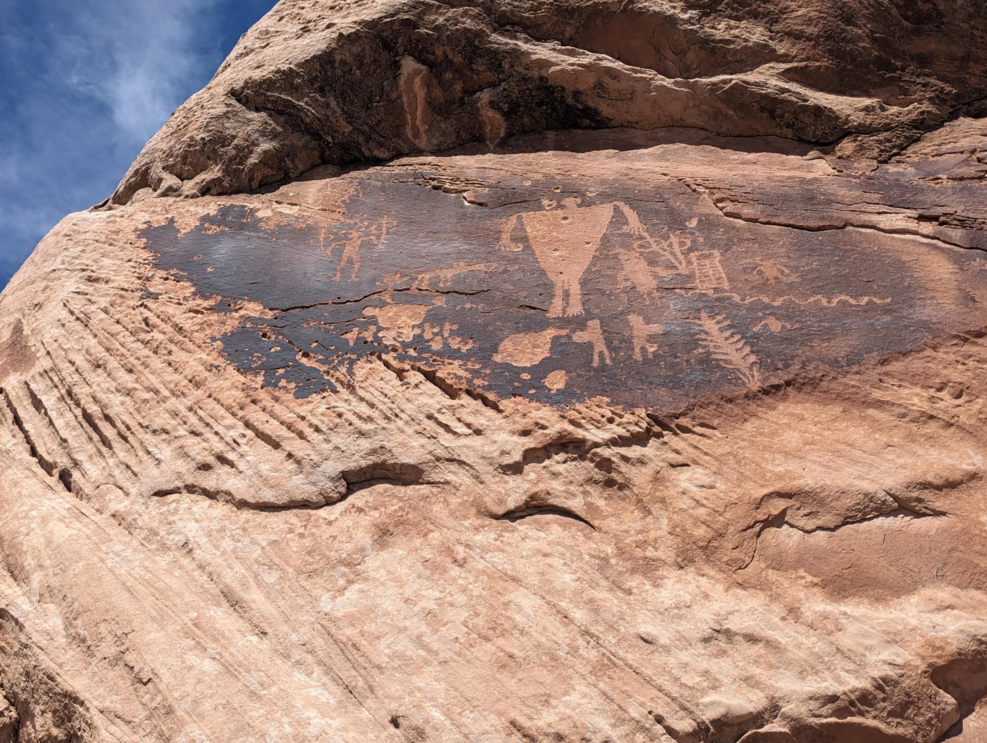
0.77 miles - Probably the most dramatic panel on this section of road. This one is often referred to as the Atalatal panel. It is visible from the road, but well worth the short hike up to get a closer view.
2.33 miles - A spur road leaves on the left. Follow it up, going right at the first junction not far from the paved road. Follow the spur road up to its end. On the cliff just past the parking area is a panel that has faint rock art until you are up close to it. Some refer to this as the ghost panel because the rock art is so hard to spot from a distance.
2.85 miles - The final stop. A side road leaves on the left through a gate. Follow the side road to its end, being sure to close the gate behind you. The side road ends at a small save with a ruin wall in it. Quite an interesting site!
Maps

12S 629190E 4127520N
37°17'07"N 109°32'33"W
12S 629232E 4127572N
37°17'09"N 109°32'32"W
12S 629655E 4127430N
37°17'04"N 109°32'15"W
12S 629645E 4127457N
37°17'05"N 109°32'15"W
12S 630118E 4127456N
37°17'05"N 109°31'56"W
12S 630114E 4127502N
37°17'06"N 109°31'56"W
12S 632509E 4127265N
37°16'57"N 109°30'19"W
12S 632597E 4127586N
37°17'08"N 109°30'15"W
12S 633299E 4127451N
37°17'03"N 109°29'47"W
12S 633329E 4127577N
37°17'07"N 109°29'45"W