 Canyoneering
Boundary Canyon
Canyoneering
Boundary Canyon
Zion West Side
Overview
Boundary Canyon is Kolob Canyons little brother and neighbor. Much shorter, this is a great first step for those aspiring to do Kolob. Boundary and Kolob are both generally exited up the much maligned MIA trail, and by doing Boundary first, you can get it figured out before a much longer Kolob day.
The canyon is spring feed, and can flow from spring through fall, or dry up some years. Because it is spring fed, a wetsuit is required, though there are typically no swims, so a full 3mm is sufficient except in very cold conditions. I've been through Boundary 3 times, twice flowing and once dry. All three trips were a treat, but if you can catch it flowing it is quite a bit more fun and more Kolob-ish.
Be sure to check with the water conservation district. They should be releasing less than 5 CFS from Kolob, or the exit from Boundary down Kolob to the MIA may be difficult and dangerous.
As an aside, times for the exit vary widely. My best time up the MIA from the bottom of Kolob to the dirt road was 47 minutes, and that was quite fast. Most other trips have been about an hour up the MIA, then another hour from the top of the MIA to the trailhead. Don't underestimate the effort to get up the MIA.
Getting There
Start Trailhead
From the Zion Visitor Center, head west on UT-9 for about 12 miles until you reach the town of Virgin. The Kolob Reservoir Road goes off on the right as you enter the town.
Route Description
Approach 45-60 minutes (1.8 miles)
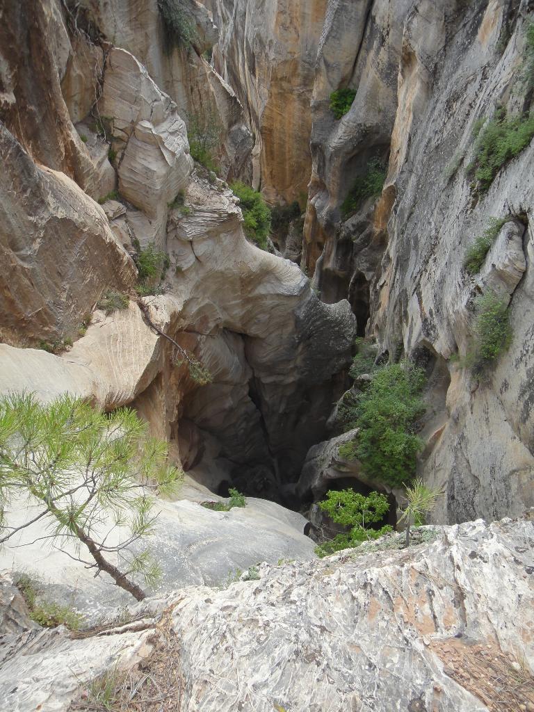
Pass through the gate and follow the dirt road as it heads into the MIA camp. At the first major junction, (10 minutes / signed MIA Camp to the right) stay left. A few minutes after the junction, begin looking for a ridge line to head down on your left (north). Boundary is the canyon immediately to the north of the road, the trick is finding the easiest path down to it. Follow a ridge line of your choice down into Boundary proper, then down Boundary a short distance until it drops where it cuts into sandstone. You may have a bit of bushwacking in this section.
Canyon to MIA
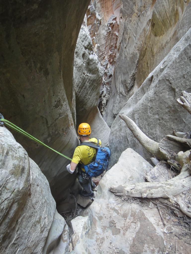
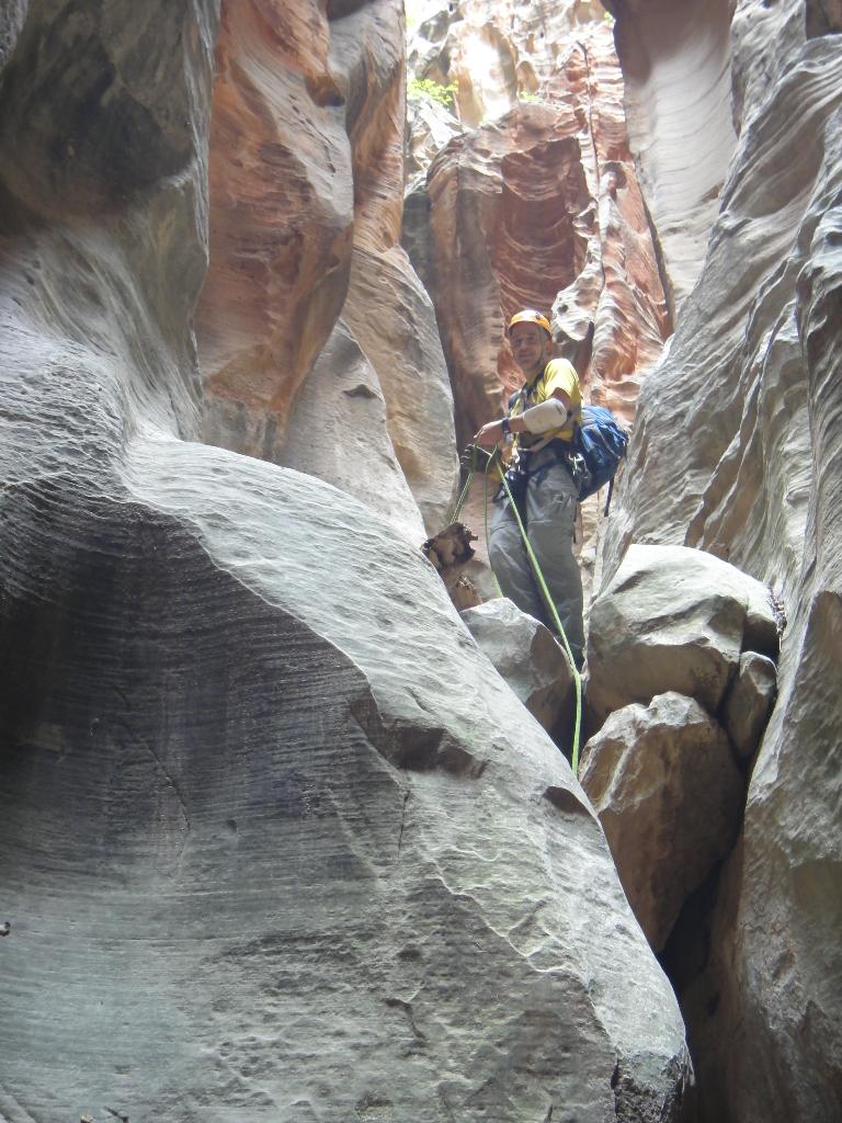
The canyon drops quickly and precipitously. If it is flowing, put on your wetsuits before the first rap. If it is dry, you probably won't need your wetsuit at all.
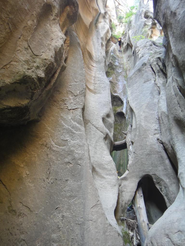
Rappel 1 is best done from the head of the canyon. Continue down past several ledges a full 50 m ( 165 ft. ) to the canyon floor.
All rappels now come in short order. For rappel 2, rappel about 20 m ( 66 ft. ), combining 3 short drops into one rappel.
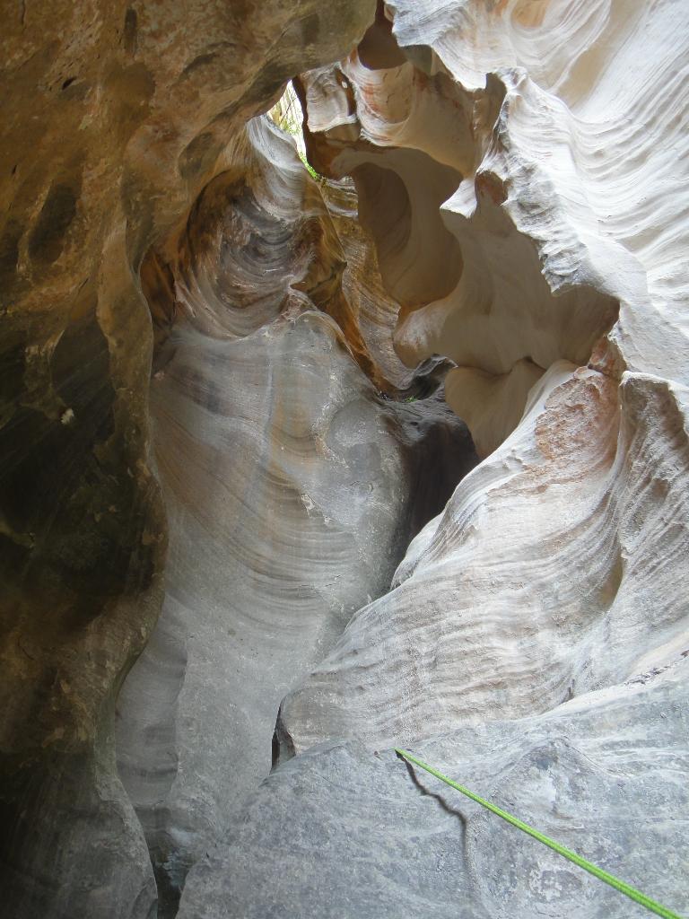
Rappel 3 is my favorite spot in the canyon, and drops about 28 m ( 92 ft. ). Don't throw your rope, drop it straight down or rappel with it to avoid getting it tangled in the log at the bottom. The end of the rappel deposits you in an amazing spot, right under a bridge.
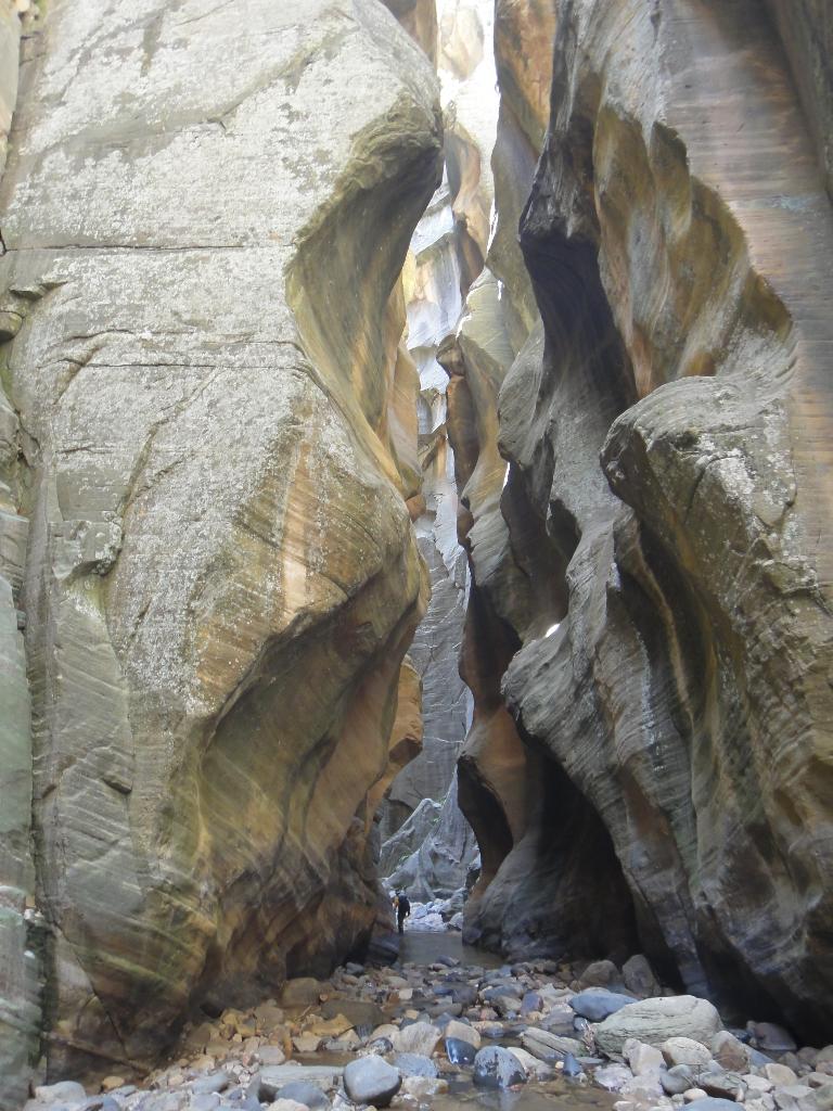
Rappel 4 is about 20 m ( 66 ft. ) and followed by rappel 5 that is about 15 m ( 50 ft. ). Rappel 6 is a short 5 m ( 17 ft. ), then the final rappel is about 20 m ( 66 ft. ) to a shallow pool. Unfortunately, the technical section is done.
From the last rap in Boundary, follow an intermittent trail down to Kolob proper. It is a bit bushy, but not bad. Once at Kolob, go right, downstream. After a particularly scenic narrows section, the canyon opens a bit with a brush covered hillside on the right that is the first place that looks reasonable to escape. The MIA Trail usually has a large cairn on a boulder at its base to mark it. Expect about 30-45 minutes from the Boundary/Kolob confluence to the MIA.
MIA Exit (1-2 hours)
Ah, the MIA! It is often maligned, and for good reason. It is a steep struggle to the top, but has gotten a bit better over the years with more foot traffic. It is now fairly straightforward to find and follow.
From the bottom, follow the trail up steeply, and then left into a rocky gully bottom. Follow the gully up with a couple of 4th class moves to the bottom of a dryfall. This dryfall is the bottom of Pipe Spring Canyon. Go right, following the trail along the base of the sandstone wall. The trail then zigzags steeply up the sandy slope to a saddle area. Phew! The saddle is about the 1/2-way mark.
The trail descends a bit into the valley, then goes across the valley. Continue on the trail as it reaches the bottom of another dryfall. Go right, up the wash bottom to the first junction. The trail leaves the wash here and climbs steeply up the left slope. Follow the now well-travelled trail up to a traverse, and then a final steep section to an old road.
Top of the MIA To The Trailhead (1 hour / 2.4 miles)
Once on the dirt road, go left. In a couple of minutes a junction is reached with a spring flowing out a white pipe. This is a great place to re-hydrate and cool off. Follow the right fork of the road a few minutes past the spring to an old road going off on the right. Take it as it climbs up, eventually passing a fenced water tank. Traverse along the fence, then follow the old road up to the ridge. At the ridge, the road has a 4 way junction. Go left, up the ridge. It passes through a gate (the NPS boundary), and continues. The less used road soon merges with the more well travelled main road. Go right, following it back to the West Rim Trailhead.
Photos
Videos
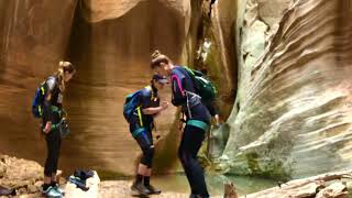
Boundary - June 2018

Boundary Canyon - Fall 2020 (Dry Conditions)
Maps

12S 320916E 4139125N
37°22'54"N 113°01'22"W
12S 322892E 4140231N
37°23'31"N 113°00'03"W
12S 324477E 4138850N
37°22'47"N 112°58'57"W
12S 323758E 4138912N
37°22'49"N 112°59'26"W
12S 323590E 4138797N
37°22'45"N 112°59'33"W
12S 323006E 4139085N
37°22'54"N 112°59'57"W
12S 323203E 4139130N
37°22'55"N 112°59'49"W
12S 322469E 4139394N
37°23'04"N 113°00'19"W