 Hiking
Zion Narrows From the Bottom
Hiking
Zion Narrows From the Bottom
Zion Main Canyon
Overview
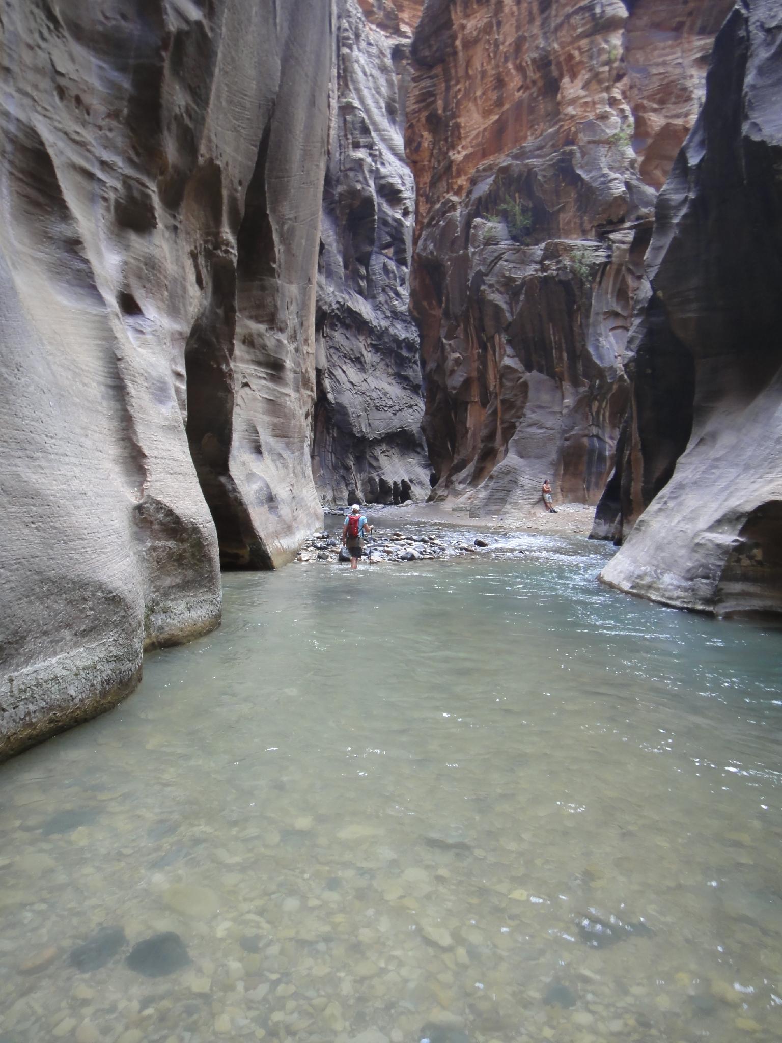
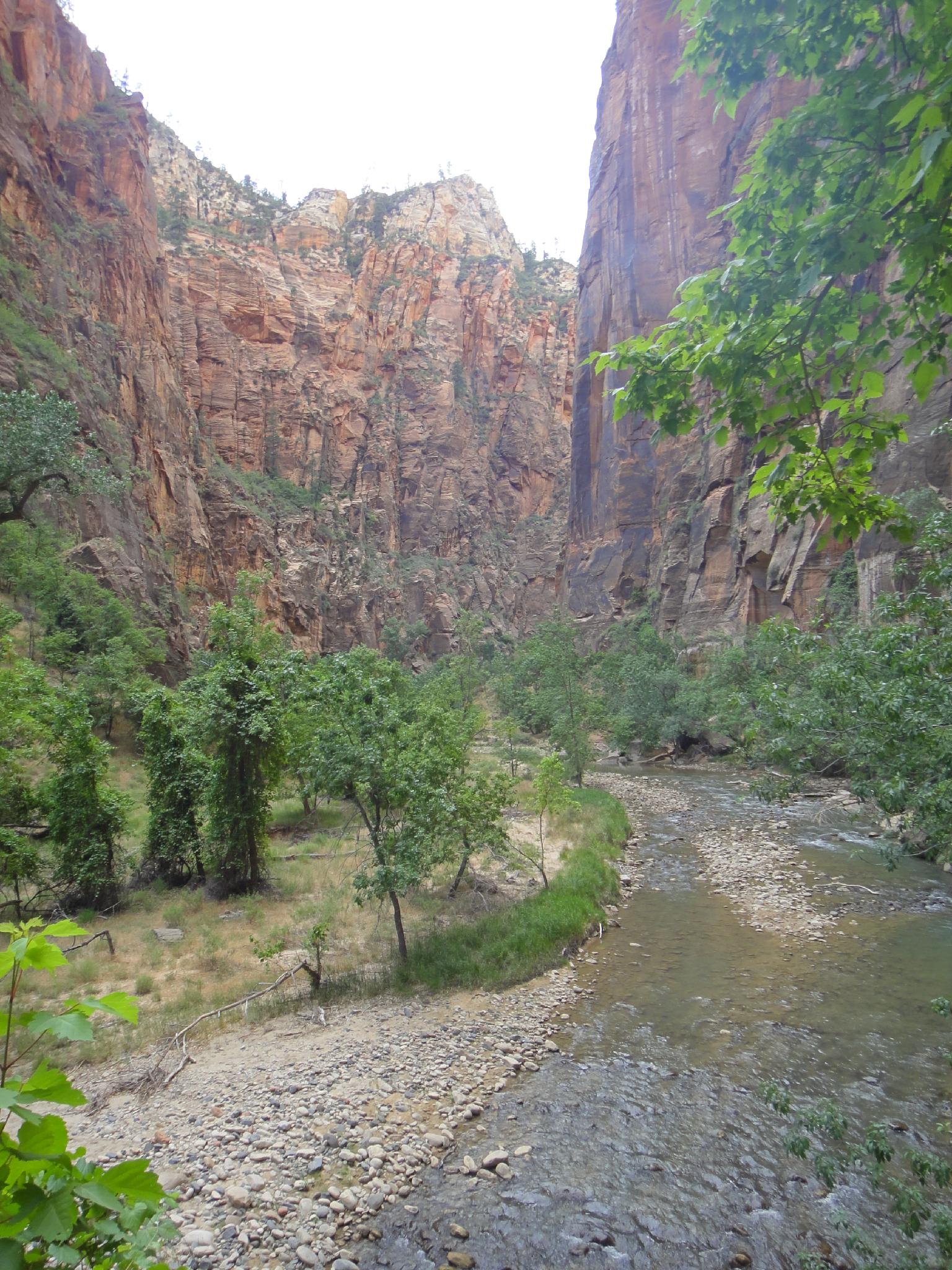
The most visited hike in Zion National Park, the Narrows likely need no introduction, but I'll give them one. The Narrows of the Virgin River, or more often referred to as just The Narrows, offer one of the unique attractions in Zion National Park. As the Virgin River cuts its way through the sandstone layers of the park, it is funneled down to a narrow chasm 22' wide and over 1500' deep in its narrowest spots.
The Narrows refers to a 16-mile section of the Virgin River that starts at Chamberlains Ranch and winds its way down to the Temple Of Sinawava in the main Zion Canyon. Hiking the full distance will require a somewhat difficult to get permit and is generally done as a 2-day backpack. This description is for the far more popular hike up from the bottom (Temple Of Sinawava) as far as motivation allows and returning the same way. If you can make it about 2 hours up, you will visit the narrowest and deepest section of the Narrows, and awe-inspiring place some refer to as Wall Street.
The Narrows is my top recommendation for those visiting Zion, but requires a few caveats.
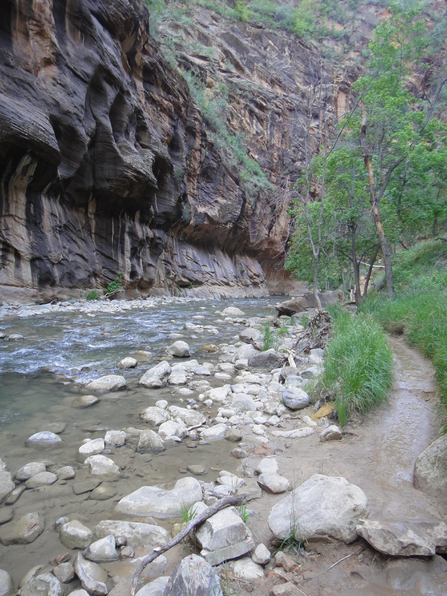
- You will be wading in the river much of the time, which makes the hike suitable during hot times of the year. If visiting in late fall or winter, rent a drysuit from one of the local companies in Springdale to greatly improve the experience. Even in the heat of the summer, it is easy to get chilled in the narrows.
- The hike is not accessible during spring runoff. I would not recommend this hike for most groups if the Virgin is flowing over 120CFS. Check with the visitor center for current flows.
- A walking stick or trekking poles will improve the experience. Much of the hiking is over slick river cobbles. You will likely get pretty wet and stumble at least a few times.
- Don't do this hike if rain is in the forecast. Particularly in the Wall Street section, there is no high ground to be had, and a flash flood could be fatal.
- Hiking shoes or running shoes recommended. Sandals and flip flops are difficult in the often very murky and cobblestone bottomed river.
Not up for the adventurous river hike? Those who are wanting a tamer outing should still consider hiking to the entrance of the narrows. The Riverside Walk, the first part of this hike, is a well maintained and accessible trail that offers excellent scenery while being suitable for most. (2 miles round trip to the entrance to the narrows)
Getting There
The hike starts at the end of the Zion Shuttle system. During summer/fall, taking the Zion Shuttle is the only way to reach the trailhead. Take the shuttle from the Visitor Center to its last stop in the canyon, the Temple of Sinawava.
Route Description
Approach (20-30 minutes / 1 mile)
From the Temple of Sinawava, follow the wide and accessible Riverside Walk Trail for about 1 mile to its end at the entrance to the narrows.
The Narrows
From the stairs and large landing area, it is time to get your feet wet! Head upstream, major landmarks are:
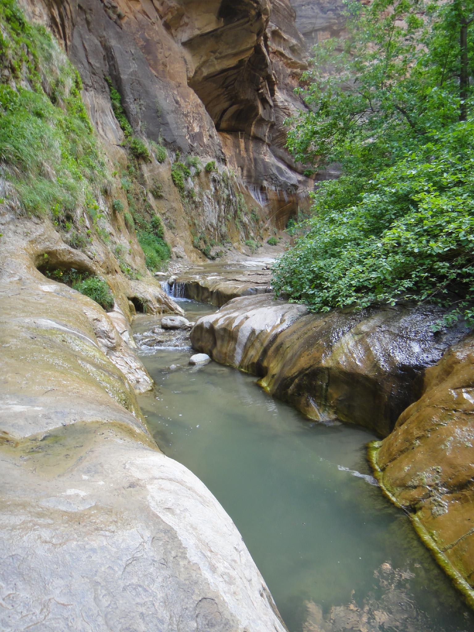
Mystery Falls (10 minutes / 0.3 miles up from the end of the Riverside Walk) -This impressive 110' high waterfall marks the end of Mystery Canyon and is a favorite picture spot when canyoneers are descending from above.
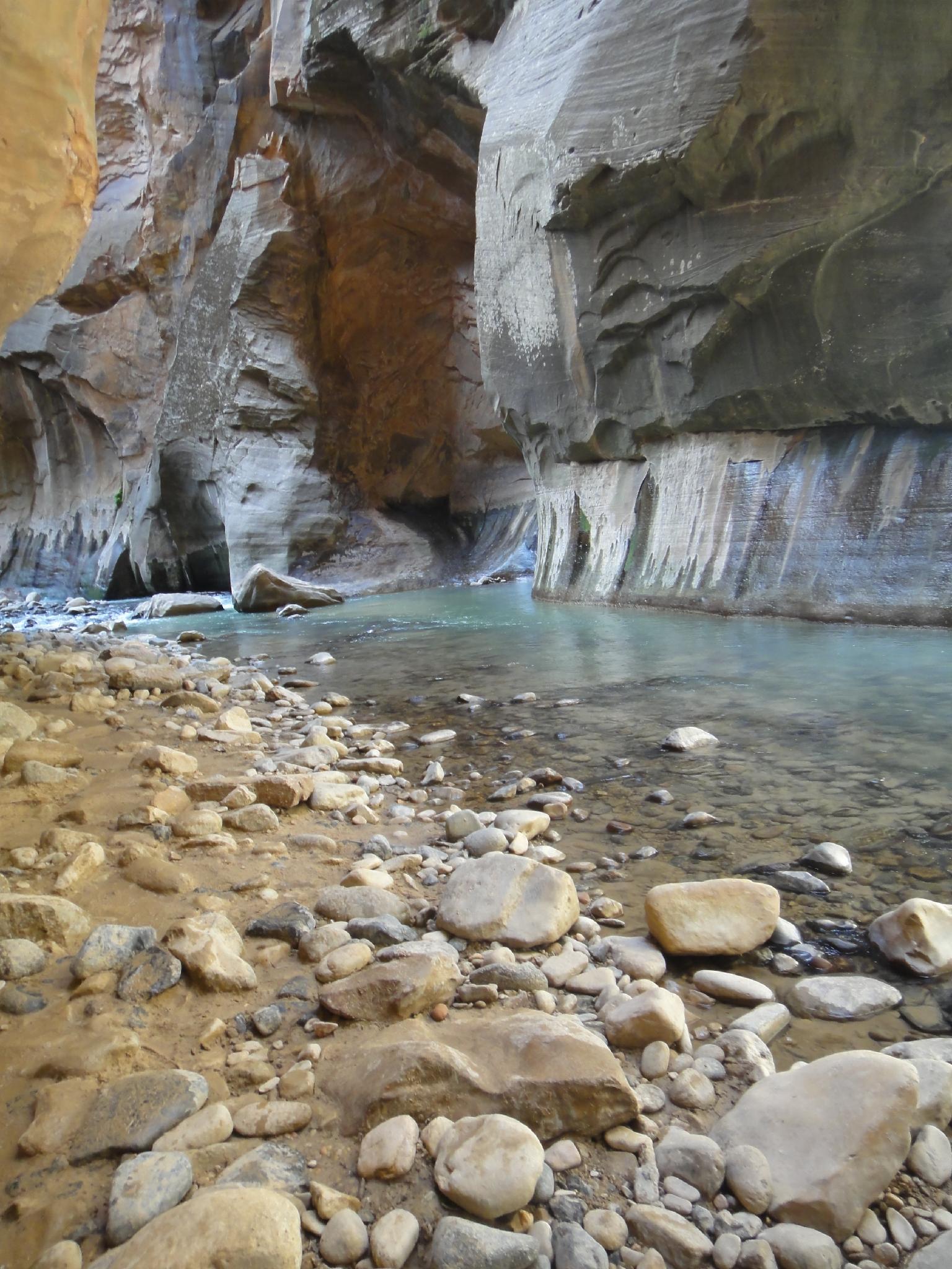
From Mystery Falls, the usual path crisscrosses the Virgin countless times, staying on dry banks for short sections in between wades. As the walls begin to narrow at the start of Wall Street, however, you will be wading most of the time.
About 1.25 miles up from Mystery Falls, Wall Street starts when the walls narrow and the Virgin River fills the canyon bottom. Just a few minutes up from the start of Wall Street is the confluence with Orderville Canyon coming in on the right. Most groups will take 1.5 to 2 hours to reach the confluence with Orderville Canyon.
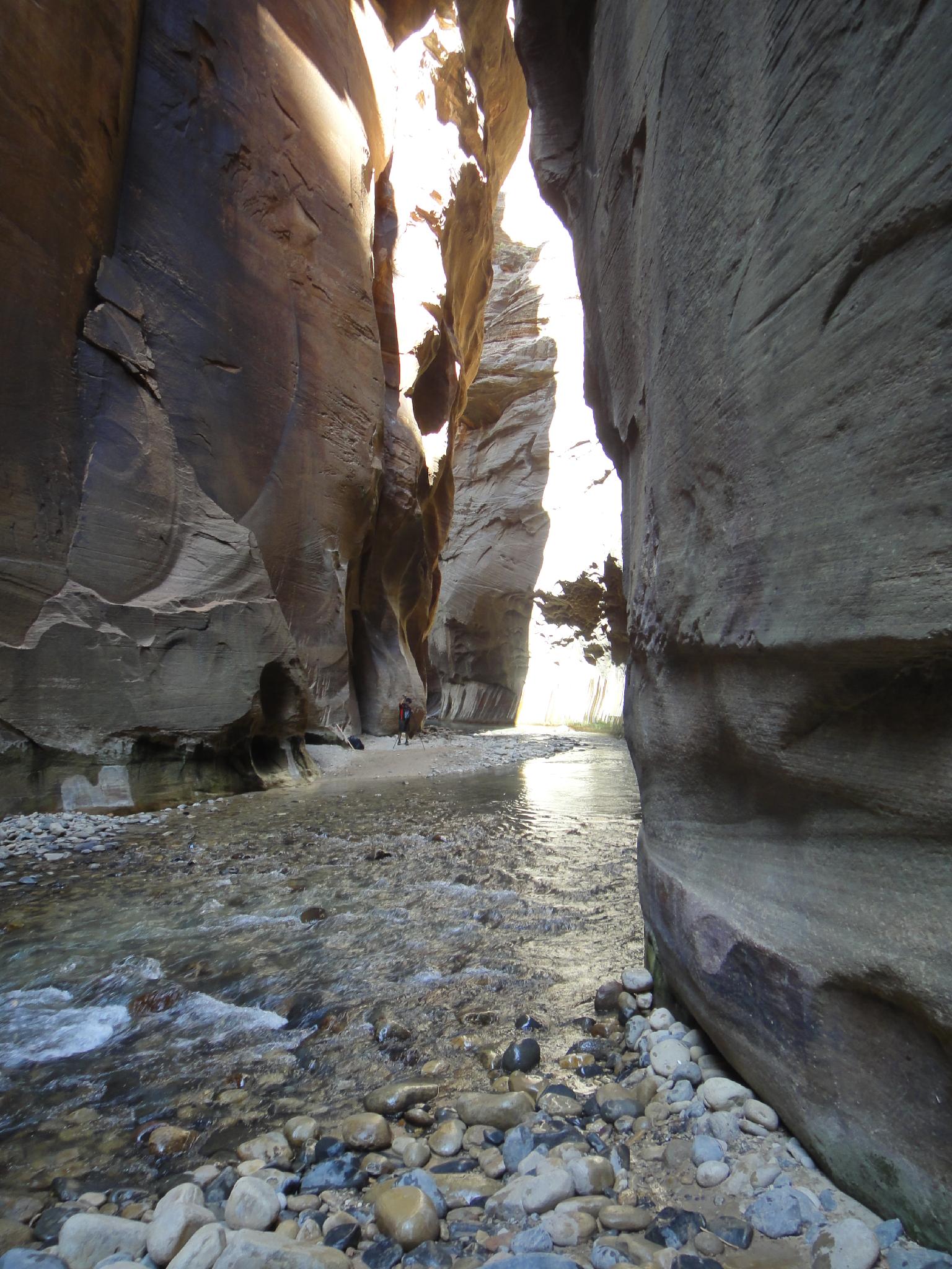
Continuing above the Orderville Canyon confluence, you are in the narrowest section of the Narrows. This section lasts about a mile and is stunning. As the walls begin to open, I would recommend this as the turn around spot. If continuing up the canyon, you are not allowed to continue past Big Springs. Finding Big Springs is easy, it is the obvious.. well.. Big Spring gushing from the wall. If you reach one of the designed NPS campsites you have gone too far.
Total distance one way to Big Spring is about 4.5 miles, 9 miles round trip. This will take most of a day given the slow walking in the narrows.
Maps

12S 327338E 4128291N
37°17'07"N 112°56'52"W
12S 327324E 4129568N
37°17'48"N 112°56'53"W
12S 327668E 4129848N
37°17'58"N 112°56'40"W
12S 327483E 4130799N
37°18'28"N 112°56'48"W
12S 326633E 4133411N
37°19'52"N 112°57'25"W