 Hiking
Mill B Overlook
Hiking
Mill B Overlook
Big Cottonwood Canyon
Overview
For a short outing, Mill B Overlook has some of the best views Broads Fork, Dromedary Peak, and Twin Peaks. The hike is generally mellow enough for most, and the length makes it a good choice for an after-work outing.
We were pleasantly surprised at the views from the overlook; they are stunning!
Getting There
Big Cottonwood Canyon is on the east side of the Salt Lake City Valley. Get there by taking I-215 to the east, taking exit 6 off the interstate and heading east.
Follow 6200 South which becomes Wasatch Blvd for 1.8 miles to the stop light and signs for Big Cottonwood Canyon.
Turn left at the light and reset your odometer.
Drive up Big Cottonwood Canyon. At 4.7 miles, just at the start of the S-Curve, the trailhead is on the right side of the road. Just after this is another smaller parking area. You want this second, smaller parking area. It is the Hidden Falls/Mill B Trailhead.
Route Description
From the parking area, the trail leaves on the north side off the lot. There is a sign here with a trail map. The trail quickly crosses the Big Cottonwood Canyon road. This is a busy road, and the crossing is on a curve. Use great caution when crossing!
Once across, the main trail goes right and begins climbing switchbacks up Mill B Fork. A side trail part way up the switchbacks goes off on the right to a climbing area. Stay on the main trail. After several switchbacks, the trail reaches a flat section and quickly descends to the creek.
About 1.1 miles from the trailhead, the trail crosses into the Wilderness Area. A few minutes later, it begins big sweeping switchbacks again as it climbs to the viewpoint.
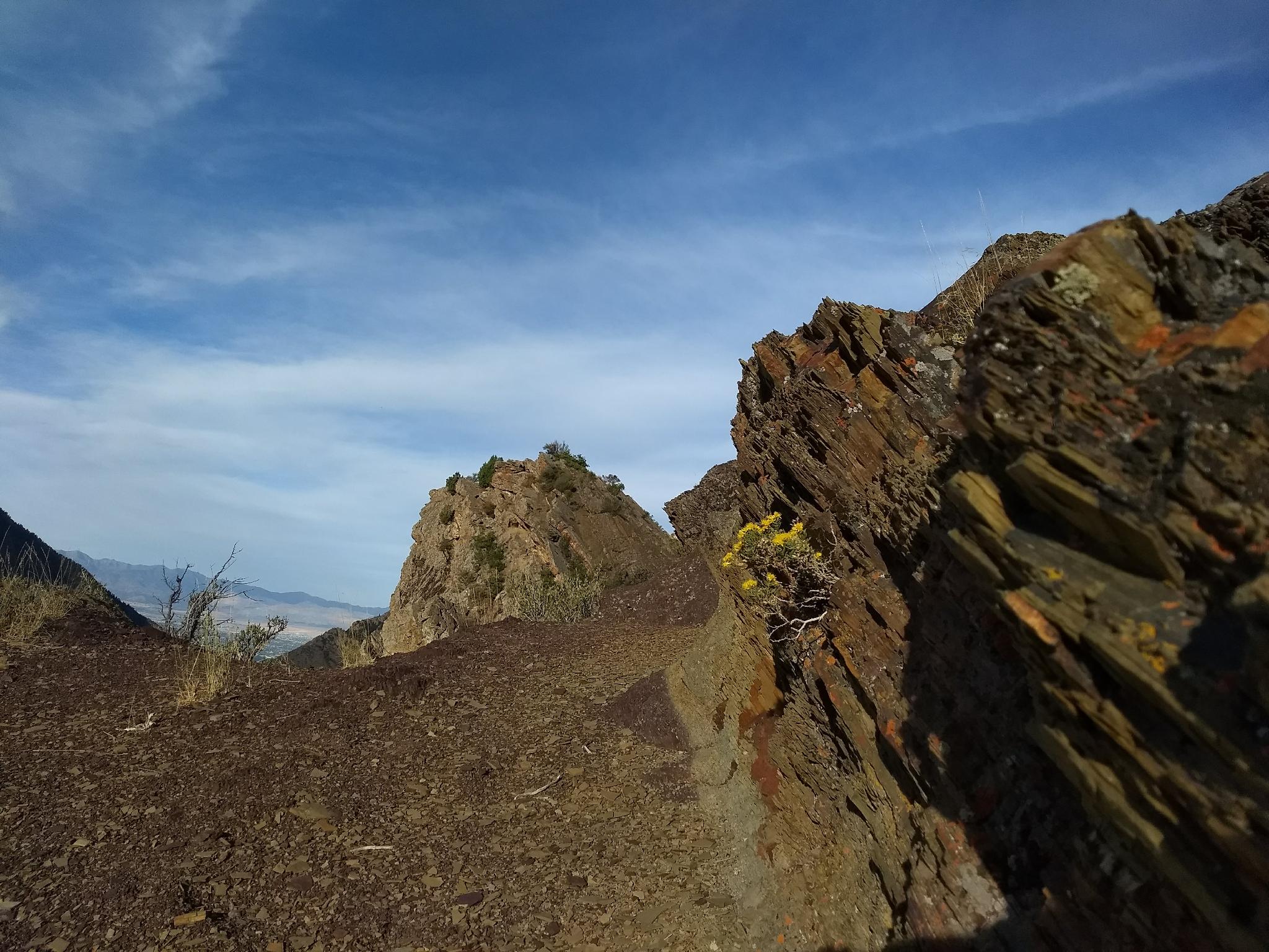
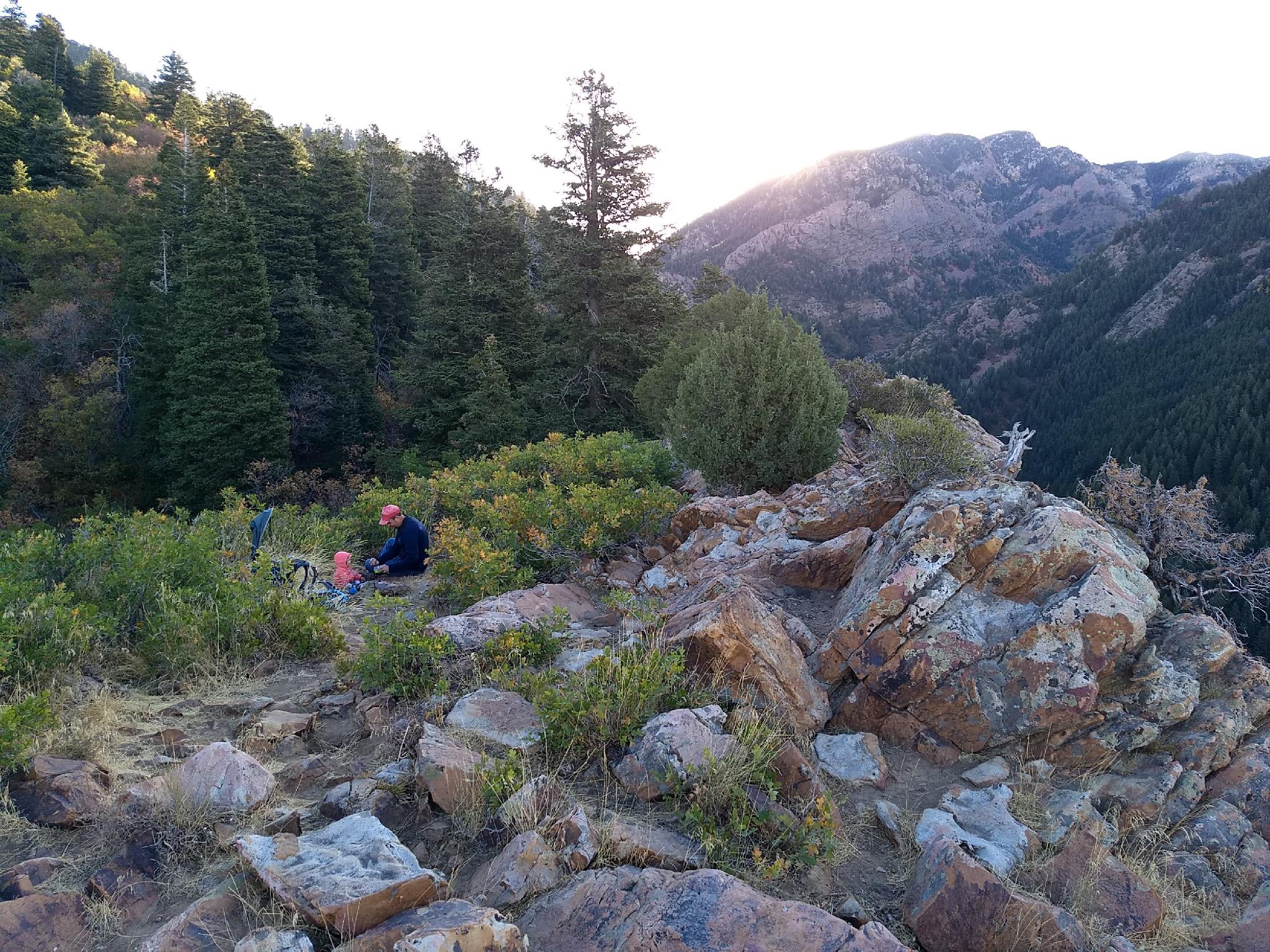
As the trail feels like it is reaching the skyline, look for a well used social path on the right that goes up to the rock outcropping. The rock outcropping is the overlook, and an excellent break or lunch spot.
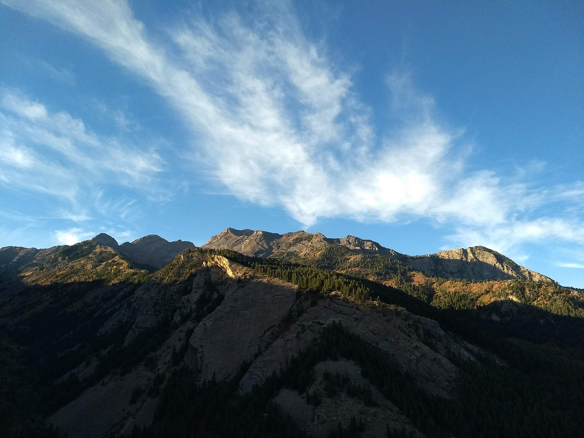
From the viewpoint: Almost due south is Mill B South Fork. The upper reaches of Mill B South Fork have Lake Blanche and Sundial Peak. Just west of Mill B South is Broads Fork. At the top of Broads Fork, you can see Dromedary Peak separating Mill B South and Broads Fork, as well as Twin Peaks to the west of Dromedary Peak.
The area around the rock outcropping has fascinating geology where the quartzite layer has collided with a layer below it.
Photos
Maps

12T 438758E 4498415N
40°38'04"N 111°43'27"W
12T 438983E 4498730N
40°38'14"N 111°43'18"W
12T 439373E 4498638N
40°38'11"N 111°43'01"W
12T 439340E 4498597N
40°38'10"N 111°43'02"W
12T 440454E 4500615N
40°39'15"N 111°42'16"W