 Hiking
Coalville Ledge
Hiking
Coalville Ledge
Coalville
Overview
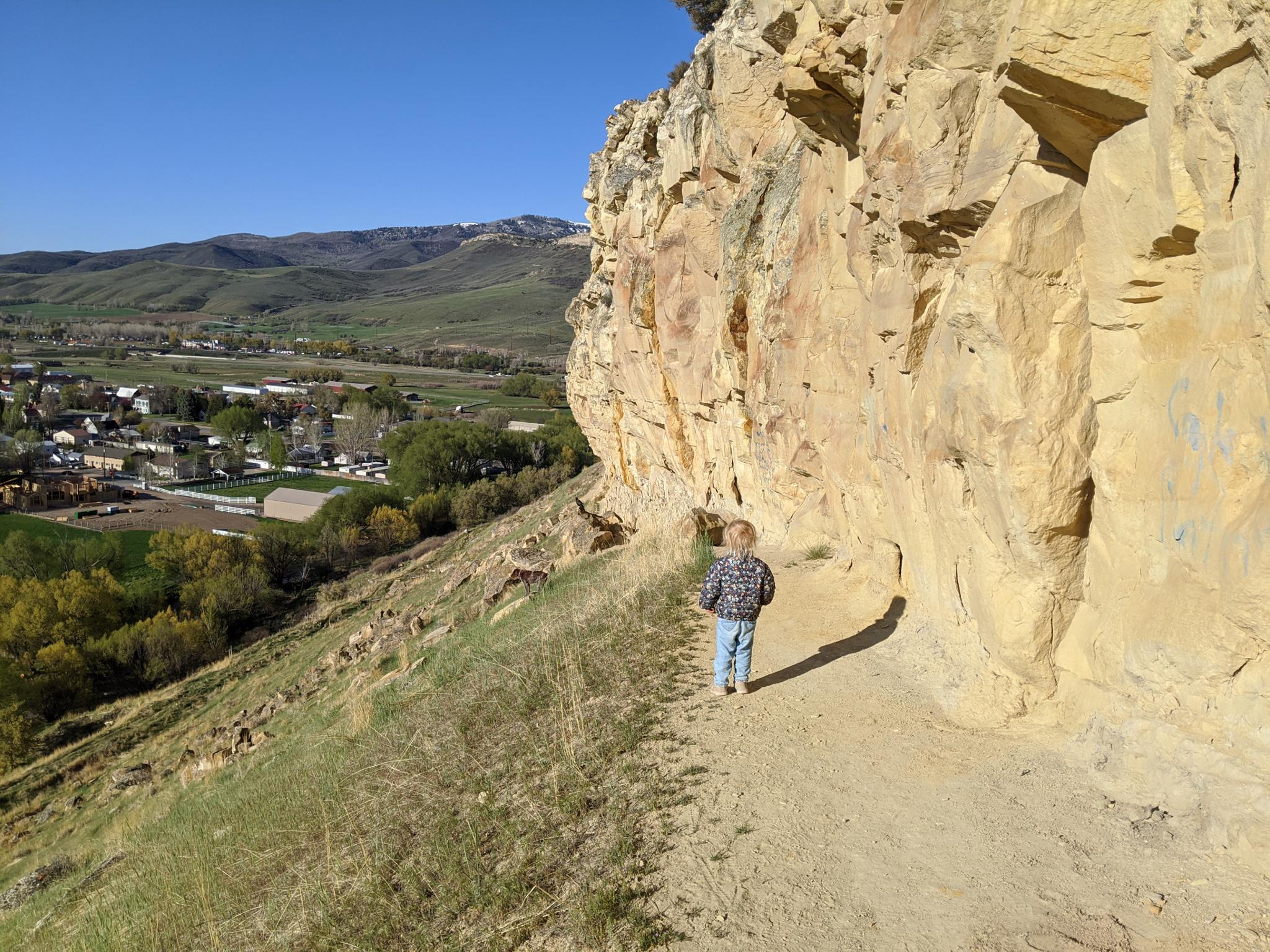
The town of Coalville was founded in 1859 after coal was found near the nearby Chalk Creek. The small town sits in a very picturesque valley near the confluence of Chalk Creek and the Weber River. Just north of the downtown area is a sandstone rib/cliff band up the hillside to the top of a ridge. The sandstone cliff band is known as the Coalville Ledge.
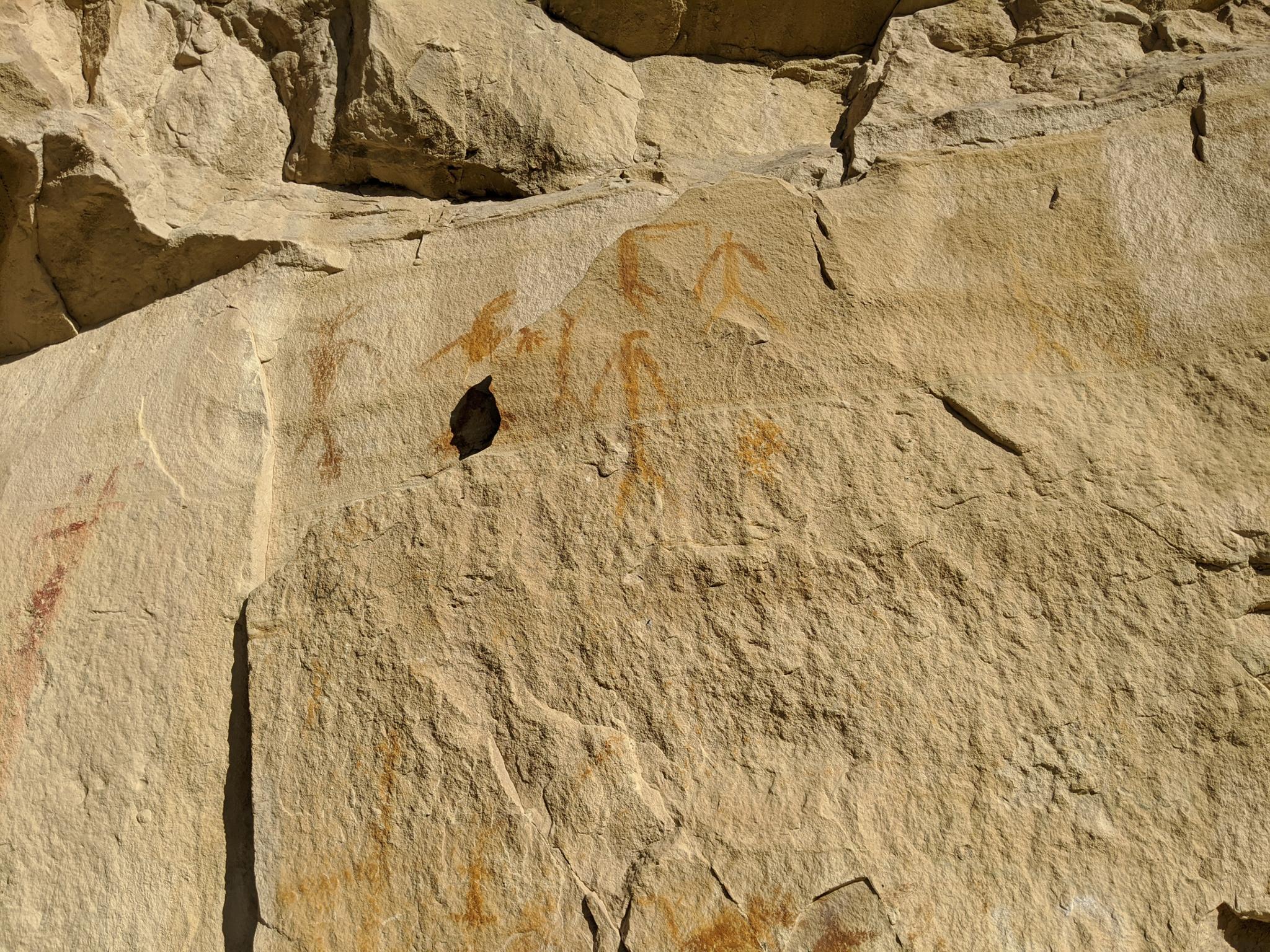
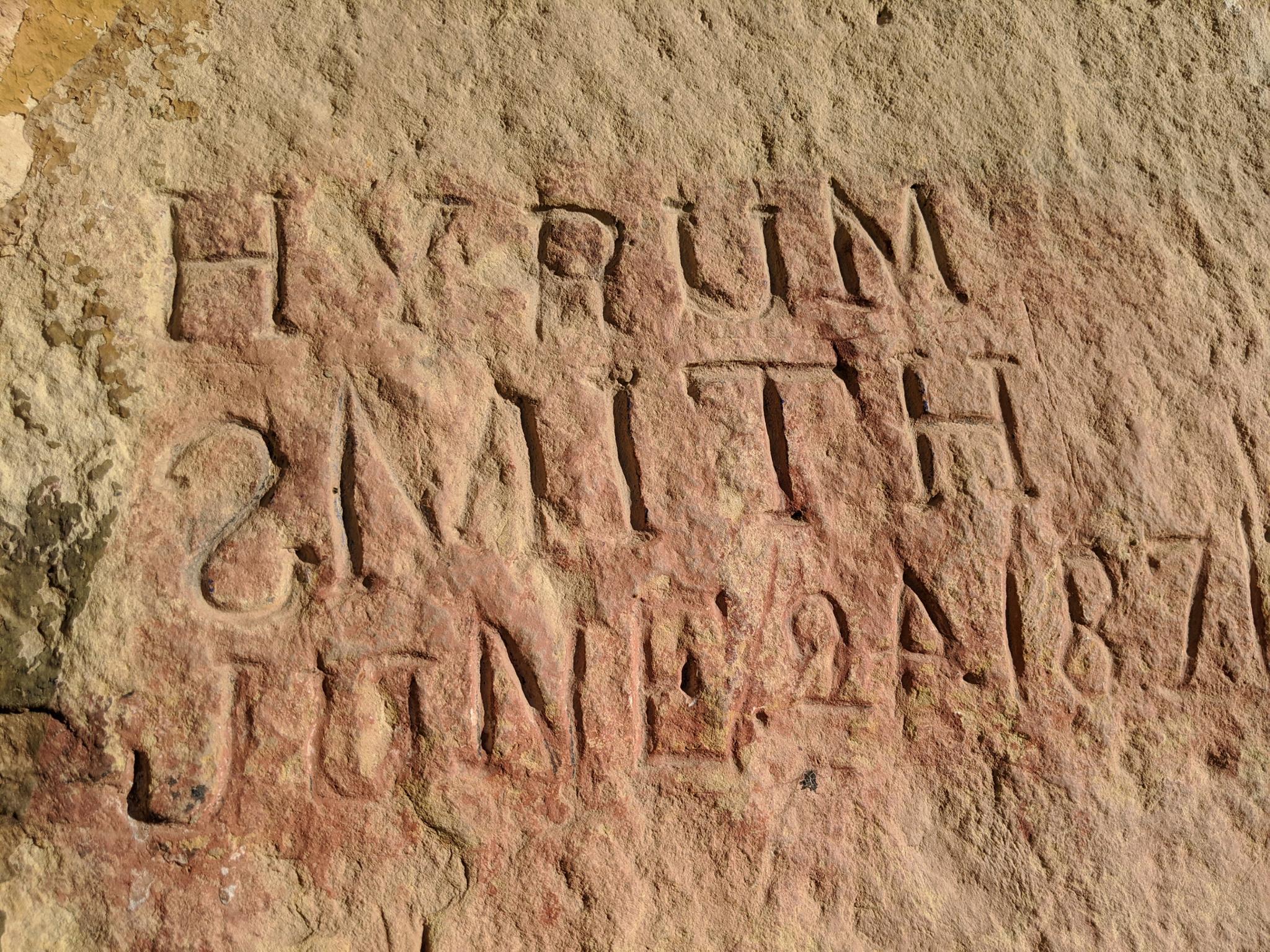
The Coalville Ledge is a register of sorts. Perched above Chalk Creek, Native Americans left pictographs and petroglyphs on the ledge. When pioneers settled the area, they left their mark by carving names into the sandstone or writing on the cliffs with grease. Unfortunately, in more recent times, the ledge had become the site of an immense amount of spray-painted graffiti. The more modern graffiti has overwritten some of the old petroglyphs and pictographs. The views, rock art, and history of the place make it worthwhile to visit. We enjoyed a morning at the ledge immensely. An information sign and trail have been created in the last couple of years encouraging visitors to visit and to visit responsibly.
Getting There
From downtown Coalville, head north on Main Street. Just past the Polar King, the road crosses Chalk Creek. The trailhead is on the right, just after crossing Chalk Creek. There is an informational sign at the trailhead.
Route Description
Rock art and historic sites are fragile, non-renewable cultural resources that, once damaged, can never be replaced. To ensure they are protected, please:
- Avoid Touching the Petroglyphs: Look and observe, BUT DO NOT TOUCH!
- Stay on the Trails: Stay on the most used trails when visiting sites, and don't create new trails or trample vegetation.
- Photography and Sketching is Allowed: Do not introduce any foreign substance to enhance the carved and pecked images for photographic or drawing purposes. Altering, defacing, or damaging the petroglyphs is against the law -- even if the damage is unintentional.
- Pets: Keep pets on a leash and clean up after them.
- Artifacts: If you happen to come across sherds (broken pottery) or lithics (flakes of stone tools), leave them where you see them. Once they are moved or removed, a piece of the past is forever lost.
From the trailhead, follow the constructed trail and it climbs up to the sandstone cliff band. The old aqueduct tunnel is the first thing encountered. Our toddler thought wandering through was hoot!
Beyond the aqueduct, the cliff band begins a mix of rock art and graffiti. The trail continues up along the cliff band, through a gate in a fence, and up to the top of the ridge and an excellent overlook of Echo Reservoir and the valley below.
The petroglyphs and pictographs are intermixed throughout, and to my untrained eye, sometimes hard to decipher from more modern graffiti. It seemed the long we looked at a section of cliff, the more interesting designs we could see. The petroglyphs seemed often painted over and hard to pick out without a very close look.
Return the same way.
Photos
Maps

12T 466217E 4530103N
40°55'17"N 111°24'04"W
12T 466517E 4530415N
40°55'27"N 111°23'52"W