 Hiking
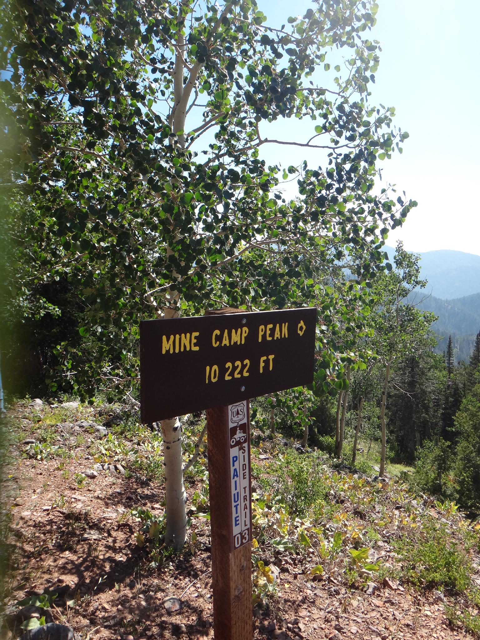
Mine Camp Peak
Hiking
Mine Camp Peak
Millard County Highpoint
Overview
Wed

70°
|
61°
Thu
73°
|
59°
Fri
77°
|
61°
Sat
78°
|
62°
Sun
77°
|
64°
RATING:
Easy Hiking.
LENGTH:
1 hour (0.9 mile)
MAPS:
Sunset Peak, UT; White Pine Peak, UT
SEASON:
Summer, Fall
GEAR:
Standard Hiking Gear
WATER:
None.
Wed
70°
|
61°
Thu
73°
|
59°
Fri
77°
|
61°
Sat
78°
|
62°
Sun
77°
|
64°
Mine Camp Peak is usually done for the sole reason it is a county highpoint. Located in the Pavant (also known as Pahvant) mountains, the hike is a short (less than 1 mile round trip) affair to a summit overlooking the West Desert and lower peaks of the Pavant mountains. Aside from being a county high point, there is not much to recommend it. The trailhead is a short distance off the Paiute ATV trail, and makes a nice diversion if riding ATV's in the area.
The mountains are named after the Pavant Indians, a band of the Ute tribe. The Pavant mountains are less dramatic and jagged than many of the other mountain ranges in Utah, and thus seem to be much less visited.
The mountains are named after the Pavant Indians, a band of the Ute tribe. The Pavant mountains are less dramatic and jagged than many of the other mountain ranges in Utah, and thus seem to be much less visited.
Getting There
Mine Camp Peak is in the Pavant Range (also known as Pahvant), off of the Paiute ATV Trail. There are many access routes, the shortest coming up from Fillmore. The Fillmore approach is often rougher and more difficult, so the easier approach via Richfield is described. The approach described below is generally passable by high clearance or better vehicles. A carefully driven car can also generally make it, but a few rocky sections will deter many from bringing the family Oldsmobile all the way to the trailhead.
From 300 North in Richfield, go west, resetting your odometer as you cross under the freeway:
From 300 North in Richfield, go west, resetting your odometer as you cross under the freeway:
- The dirt road climbs and passes a water tank on the left. At 0.8 miles, you enter Forest Service Land.
- 1.3 miles - Pass Forest Service Gate
- 4.6 miles - Go left (straight)
- 7.9 miles - Right on Chalk Creek Road / Sand Rock Ridge (road #96)
- 14.1 miles - Right across cattle guard (Sand Rock Ridge/White Pine Oak)
- 15.5 miles - Pass old building
- 15.7 miles - Bathroom / picnic on the left
- 15.8 miles - Left on Sand Rock Ridge
- 18.1 miles, park right before the cattle guard. A sign across the road points out Mine Camp Peak
Route Description
Summit: 3116 m ( 10224 ft. )
Trailhead: 3026 m ( 9928 ft. )
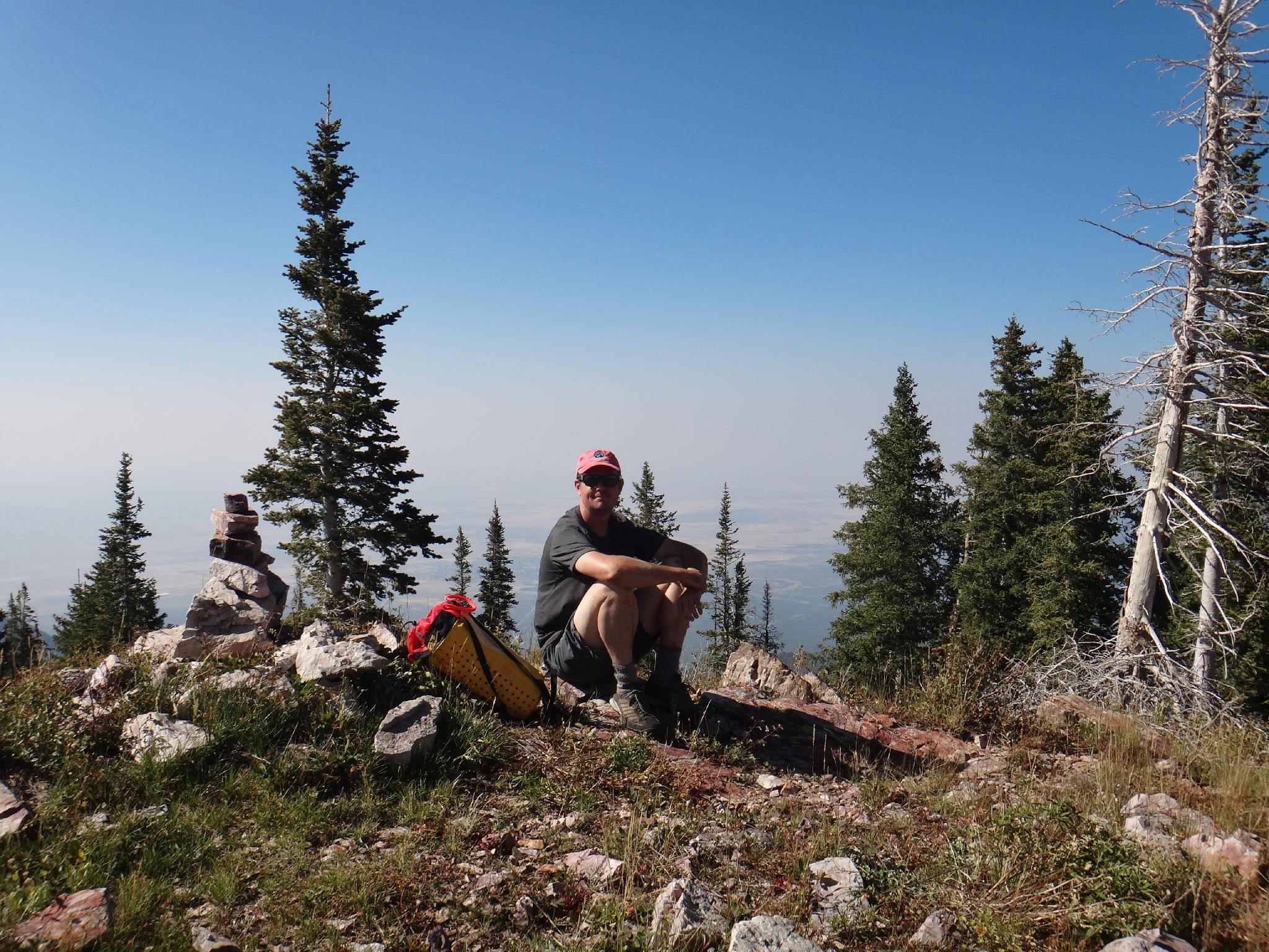
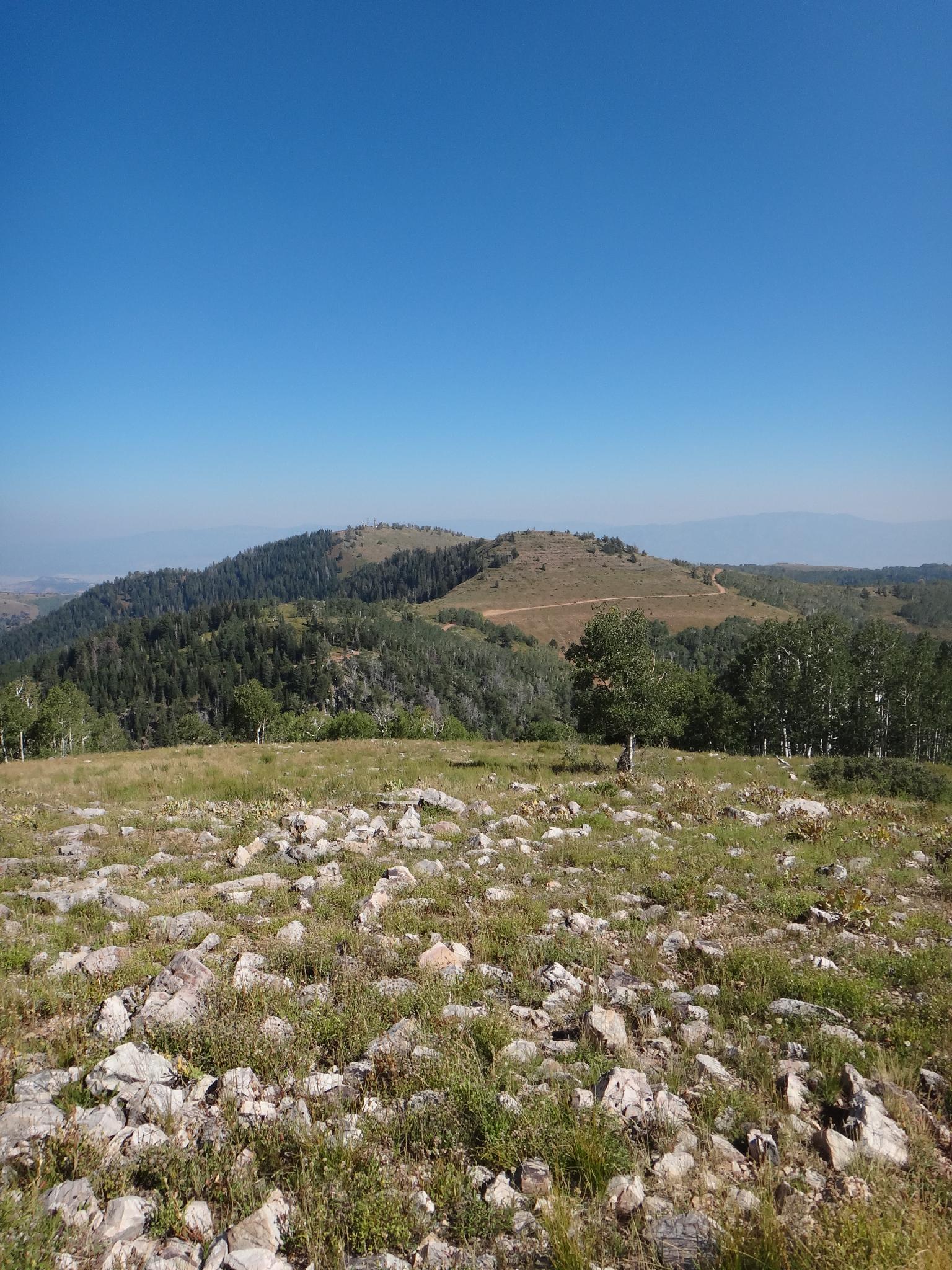
From the trailhead, cross the cattleguard, then follow a use trail down to the saddle and up the ridge line to the summit of Mine Camp peak. It fades in spots, but as staying on the ridge-line is the easiest path. On a clear day, Fillmore and the West Desert are visible to the west. Return the same way.
Trailhead: 3026 m ( 9928 ft. )
From the trailhead, cross the cattleguard, then follow a use trail down to the saddle and up the ridge line to the summit of Mine Camp peak. It fades in spots, but as staying on the ridge-line is the easiest path. On a clear day, Fillmore and the West Desert are visible to the west. Return the same way.
Maps
Route /
0.84
miles /
Elevation Range 9,823
- 10,222
ft.
Printable Maps:


Trailhead
12S 391840E 4303272N
38°52'18"N 112°14'48"W
Summit
12S 391274E 4303505N
38°52'25"N 112°15'12"W