
 Lower Trachyte
Upper Lake
Overview
I must admit, I have a bit of a fascination with Trachyte Creek. By land, it is easily accessible from UT-276. Though close to the highway, it feels remote, quiet, and beautiful. I've spent many days in Trachyte or its side canyons over the years. It was one of my early introductions to hiking in the desert and a place I have come back to many times over the years.
My experience from the lake was during a horrendously windy Memorial Day weekend trip. Boating to Trachyte from Hite was a bit above my comfort level due to the wind. Once at Trachyte, we were sheltered from the wind among the boulders and had a wonderful couple of days camping at the lake and taking day hikes up Trachyte and Swett.
From the lake, most will probably want to visit the lower parts of Swett Canyon or wander up to Woodruff Canyon. Depending on lake levels, reaching Woodruff Canyon and returning is about 4-5 miles and a nice outing.
Getting There
Trachyte Creek is about mile 134, which is about 36 miles up the lake from Bullfrog Marina on the north (left) side of the lake.
Route Description
Swett Canyon
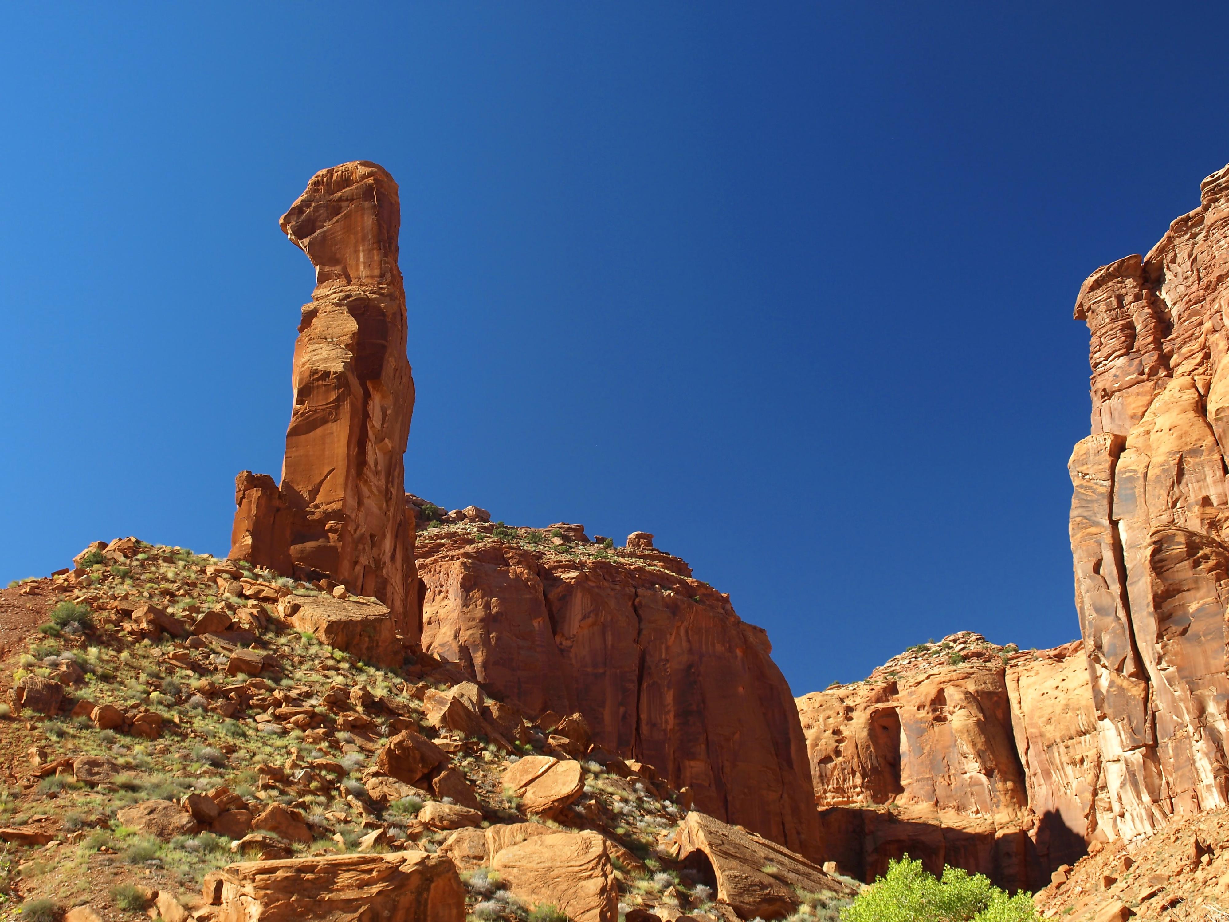
From the lake, head up to the first major left tributary of Trachyte. This is Swett Canyon; it is wide and easy walking. About 1/2 mile up Swett, a side canyon comes in on the south (left) that has a sandstone tower near its confluence that looks like a person's profile. This is Hoskinnini Monument. There are some pretty narrows in upper Swett (the right fork at the monument), but they are another hour or so above the monument and require moderate climbing to ascend from below.
The landmark is named in honor of Chief Hoskinnini (also spelled Hoskaninni), a prominent Navajo leader known as "The Angry One" (Hush-Kaaney). He is celebrated for his defiance and strategic leadership during one of the most difficult periods in Navajo history.
Evading the Long Walk: In 1863, when the U.S. military, led by Kit Carson, began the forced removal of the Navajo people to Bosque Redondo (the "Long Walk"), Hoskinnini refused to surrender. He led a small band of 17 people into the deep, labyrinthine canyons around Navajo Mountain and the San Juan River.
For over four years, his group lived in total secrecy in this rugged wilderness. They survived by hunting, gathering seeds, and carefully growing their small herd of sheep.
The Legend of Silver: When the band finally emerged from hiding after the 1868 treaty, they were among the wealthiest Navajo in the region, possessing significant silver jewelry. This led to enduring legends of a "secret silver mine" that Hoskinnini reportedly discovered during his exile but never revealed to outsiders.
Following his death in 1912, he was remembered not just as a fierce resister but also as a generous leader who helped fellow tribal members rebuild their lives after they returned from internment.
Woodruff Canyon
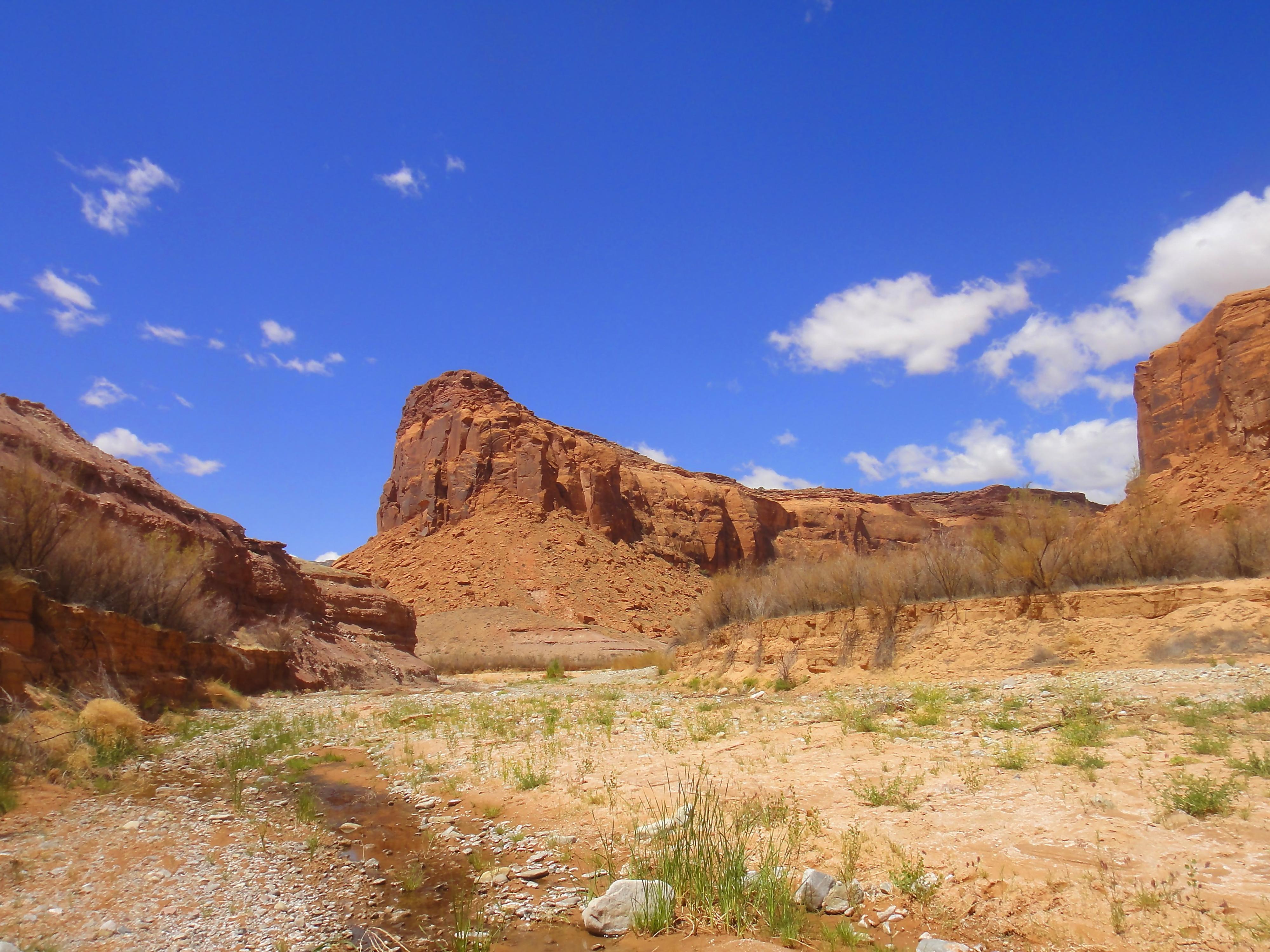
It is 2-2.5 miles up Trachyte to the confluence with Woodruff Canyon. It is the obvious side canyon coming in on the west (left) side. En route Trachyte usually has sections of flowing water and seeps coming out of the walls in places.
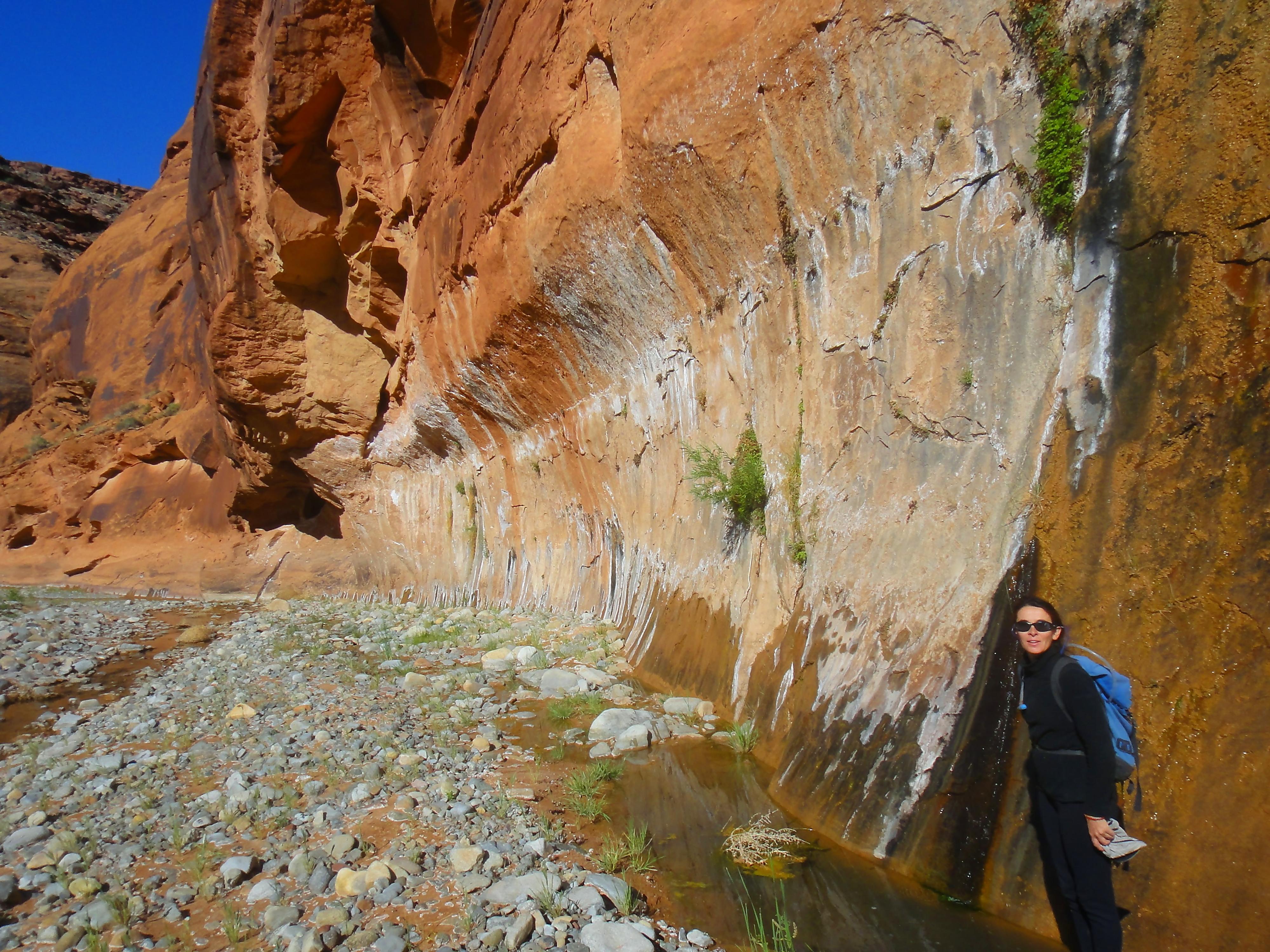
The lower section of Woodruff is pretty and worth checking out if you have time and energy.
As you head up Woodruff, you will shortly encounter a large boulder and likely a swimming pool to cross. This can be passed on the right with a little scrambling. (Class 4 / 4 m) if you are trying to stay dry.
Above this obstacle, in 20 minutes or so, the canyon narrows with a side canyon coming in on the left via a dry fall. A short (4 m ( 14 ft. )) waterfall appears right around the corner. Passing it requires a bit of scrambling. The easiest way is 100 m back down canyon from the waterfall, just down canyon from the side canyon entering. Look on the left (looking down canyon) for a wall that is heavily pocketed and has several ledges. This looks harder from the bottom than it is. With a partner, it's easy to boost one person up a ledge, then help the others. (Class 4 / 6 m ( 20 ft. ))
Photos
Maps

12S 547907E 4185474N
37°48'55"N 110°27'21"W
12S 544552E 4187827N
37°50'12"N 110°29'37"W
12S 543591E 4187148N
37°49'51"N 110°30'17"W
12S 540557E 4188367N
37°50'31"N 110°32'21"W
12S 543209E 4189912N
37°51'20"N 110°30'32"W
12S 542683E 4190189N
37°51'29"N 110°30'53"W