 Hiking
Peruvian Gulch and Mount Baldy
Hiking
Peruvian Gulch and Mount Baldy
Little Cottonwood Canyon
Overview
Peruvian Gulch is said to have been named by an early miner that saw a likeness to South America’s Andes in the gulch. The area is now part of Snowbird Ski resort and has been developed heavily developed to support skiing in the winter.
In the summers, the trail is most often used by hikers who take the tram up to Hidden Peak and hike back to the base (about 4 miles). If you are looking for a good workout, hiking from the base to the top of Hidden Peak or Mount Baldy is a good one without about 3,000’ feet of elevation gain in 8-ish miles round trip.
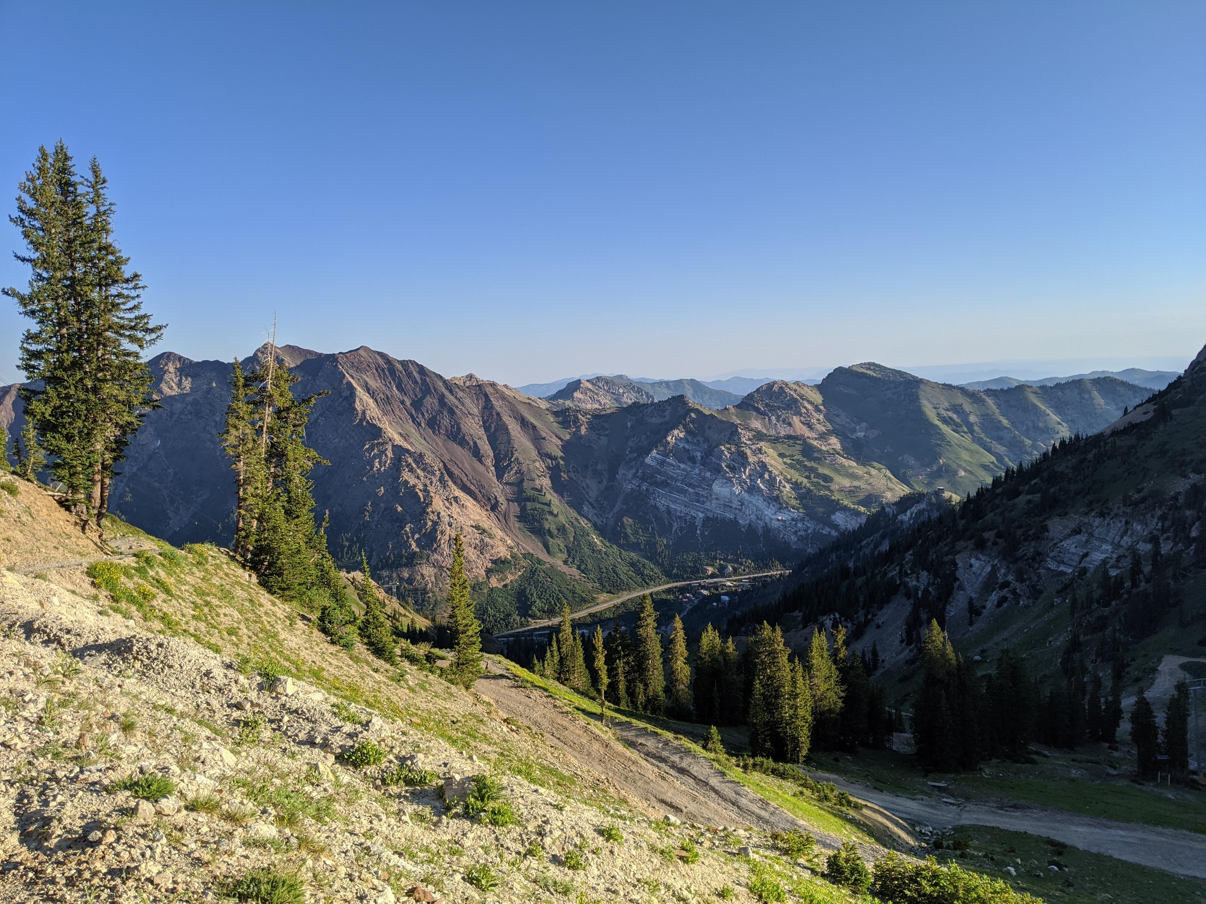
Though I am not generally one to enjoy hiking ski resorts, the wildflowers along the trail, views from Gorilla Pass into Mineral Basin, and summit of Mount Baldy made this an enjoyable morning out. The tram opens at 11AM, so if hiking from the base and starting early, you are likely to have the mountain mostly to yourself and morning light is outstanding. On my visit, I saw only a few other people on the trail, and all were starting up later in the morning as I was almost back down.
Getting There
Little Cottonwood Canyon is on the east side of the Salt Lake City Valley. Get there by following I-215 to the east, taking exit 6 off the interstate and heading east toward the mountains.
Follow 6200 South which becomes Wasatch Blvd for 1.8 miles to the stop light and signs for Big Cottonwood Canyon. Continue south (straight) through the light an additional 2.3 miles to a junction and light. Stay left here, reaching the mouth of Little Cottonwood Canyon in an additional 1.6 miles.
From the mouth of Little Cottonwood, travel up the canyon 6.4 miles to the Snowbird Center on the right. Park anywhere in the large parking lot. The trail starts near the Snowbird Center and tram.
Route Description
The trail, being in a ski resort, is well signed. From the parking area, head east on Creek Road, then right where it branches onto Chip’s Run. Just after this, the trail splits off and becomes a single track that quickly begins winding up the hillside. This is just after passing the Mountain Coaster attraction. Though this sounds confusing to find, the trails are well marked and easy to follow!
As you head up Peruvian Gulch, the trail crosses many roads and splits many times. Junctions are well marked. In general, the Peruvian Gulch Hiking Trail is the one I recommend. It is steeper, but more scenic. The Peruvian Road Trail leads to the same place but is longer and is open to bicycle traffic. It is easy to mix different sections as the two trails cross and mingle several times en route to the top of the Peruvian Gulch ski lift. As you climb higher up the gulch, Mount Baldy to the east (left) and Hidden Peak to the right (west) come into sharper view. The two are quite a contrast, with Hidden Peak housing a large ski lift and ski resort building and Mount Baldy being open and undeveloped.
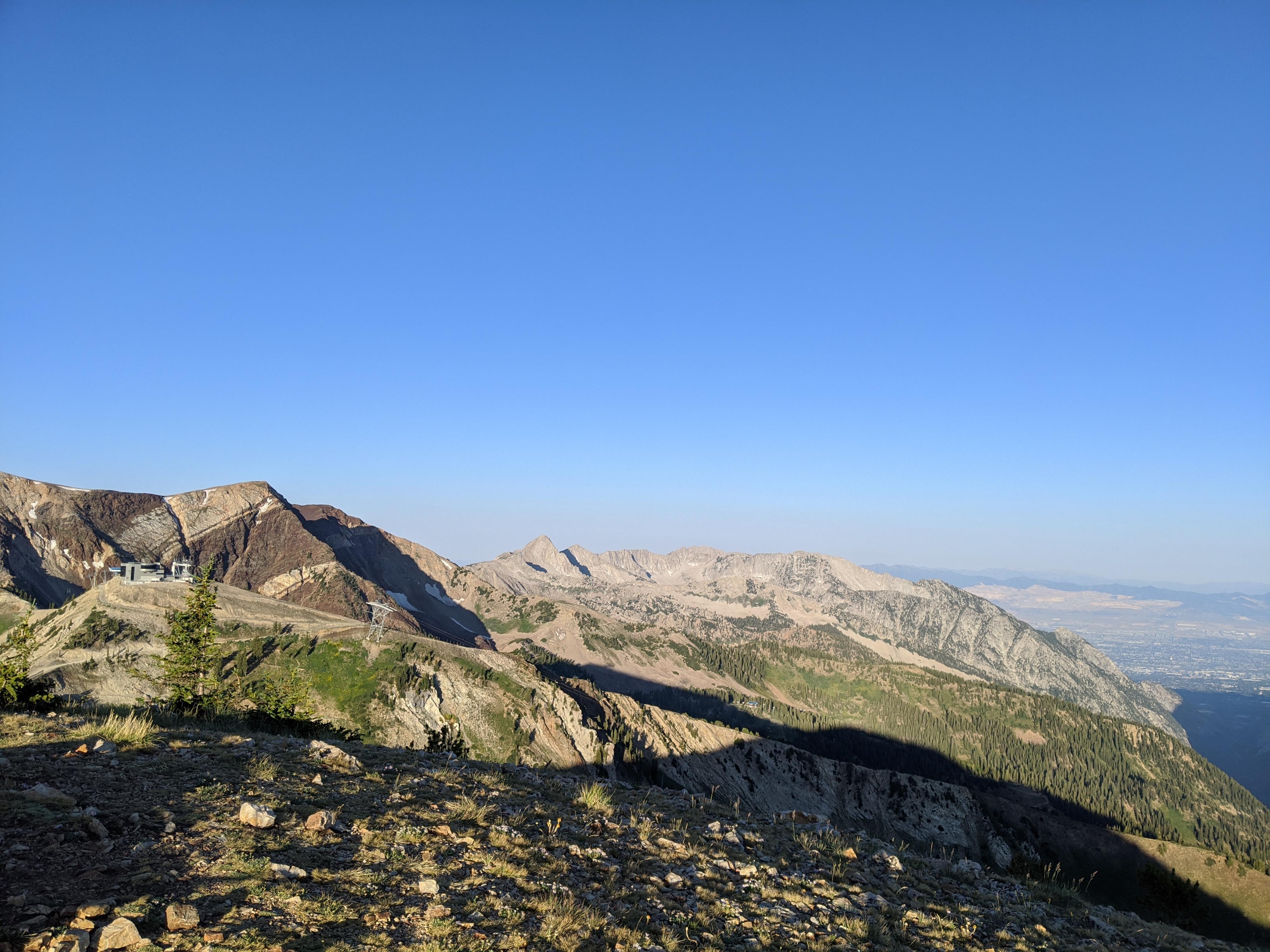
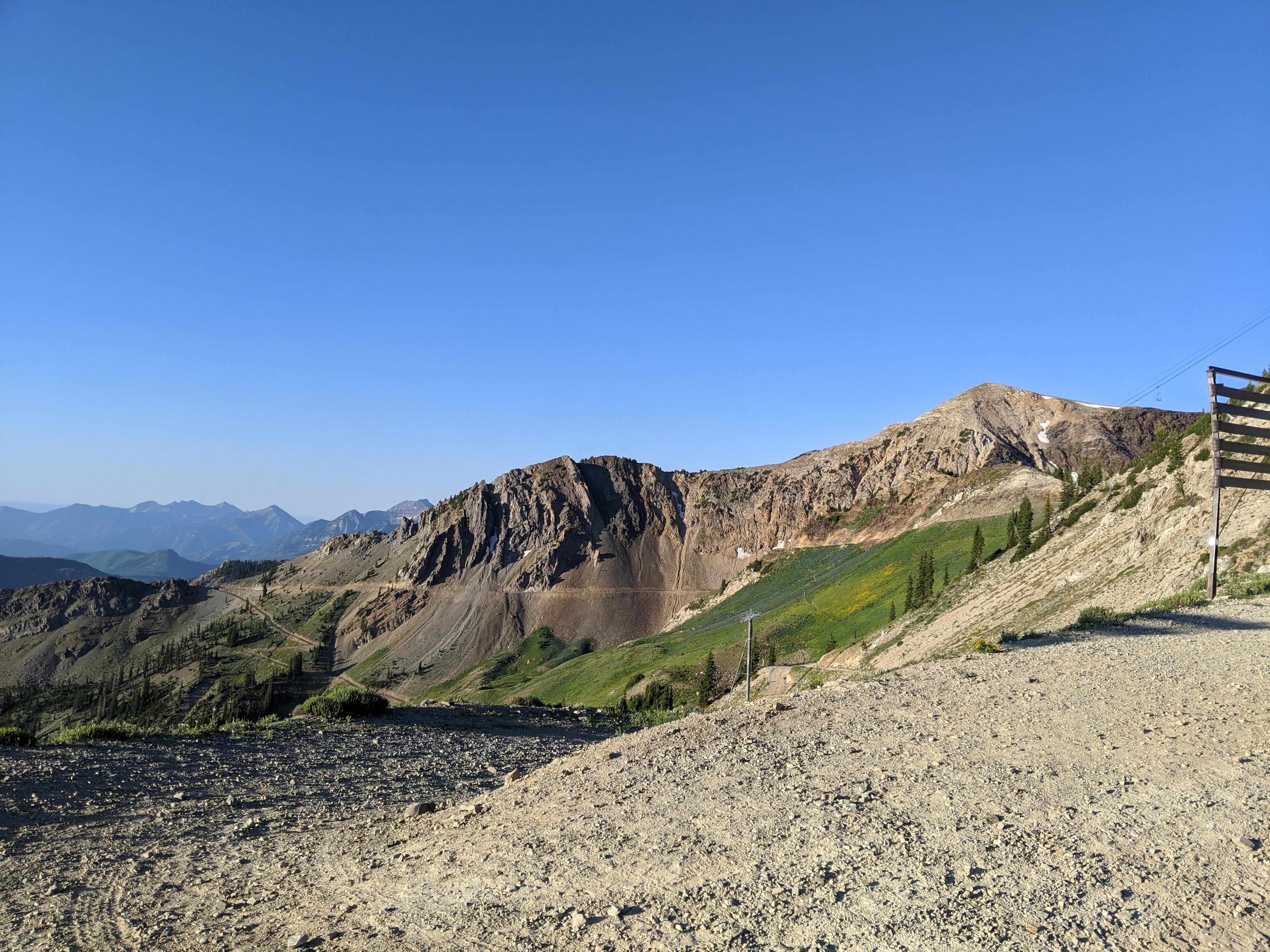
From the top of the Peruvian Gulch ski lift, continue up the service road as it makes three switchbacks to Gorilla Pass. The pass offers excellent views down into Mineral Basin, the American Fork Twin Peaks to the west, and of Mount Timpanogos area in the distance to the south.
Decision time! Right continues up the service road a short distance to the developed summit of Hidden Peak. Magnificent views and an easy summit to reach. Left follows a single-track trail along the ridge that climbs gently up to the summit of Mount Baldy. Both are excellent summits with nice views. Mount Baldy is my favorite simply because it is less developed.
Photos
Maps

12T 444230E 4492287N
40°34'46"N 111°39'32"W
12T 444744E 4492390N
40°34'50"N 111°39'10"W
12T 445577E 4490432N
40°33'46"N 111°38'34"W
12T 445593E 4490319N
40°33'43"N 111°38'34"W
12T 445365E 4490154N
40°33'37"N 111°38'43"W
12T 445972E 4490982N
40°34'04"N 111°38'18"W