 Hiking
Gilbert Peak
Hiking
Gilbert Peak
Summit County Highpoint
Overview
Gilbert Peak is the 3rd highest peak in Utah, and less than a hundred feet lower than Kings Peak, Utah's highest. At 13,442', it is one of 17 Utah 13ers. Though it sees much less visitation than its neighbor Kings Peak, I would rate Gilbert Peak as the more aesthetic and enjoyable of the two.
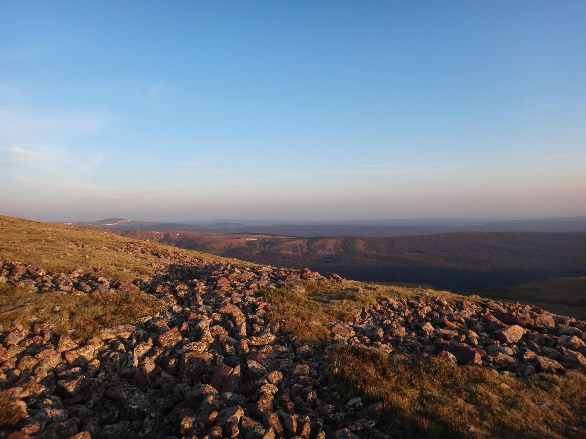
The ~20 mile round-trip makes this slightly more approachable to do in a day than Kings Peak, but most will want to backpack it. If visiting Kings Peak on the same trip, it makes sense to backpack in to the Dollar Lake area, camp, and visit Kings and Gilbert from there, accessing Gilbert via its west ridge directly east of Dollar Lake. If just visiting Gilbert, however, I would strongly recommend a loop up the north slope and down the west ridge. If doing the loop, Elkhorn Crossing makes a great base camp. The loop offers a more gradual ascent up a stunning ridge, with a quick descent to good trail from Dollar Lake out.
Getting There
From Mountain View Wyoming, go south out of town on WY-410 toward Robertson. At 6.4 miles, WY-410 makes a hard right hand turn. Instead, continue straight on county road 283, resetting your odometer. The county road is signed forest access, and is a good, well graded dirt road. It crosses a wide open flat before climbing and entering the forest.
Stay on the good road for 12.1 miles from WY-410 to a signed junction. Go left, toward Henry's Fork. Follow this well graded road 7.0 miles to where it makes a U-bend to the left. Henry's Fork Campground/Trailhead is signed (straight ahead, instead of making the bend), and 3.4 miles at the end of the road.
There is a small campground at the trailhead with a pit toilet (no water), however there are many good primitive campsites nearby that will likely be quieter.
Route Description
Summit: 4097 m ( 13442 ft. )
Trailhead: 2878 m ( 9443 ft. )
Trailhead to Elkhorn Crossing (~5.25 miles / about 2 hours)
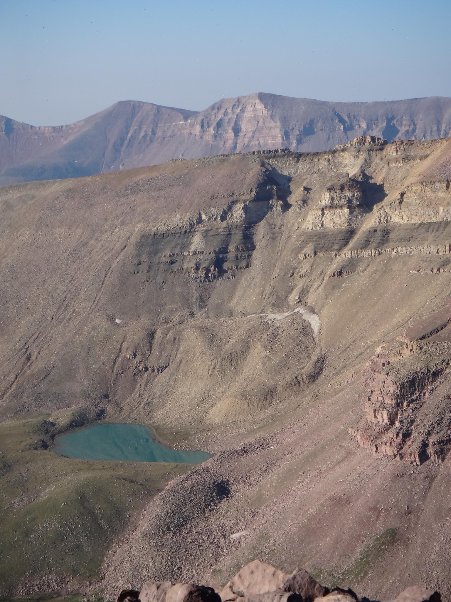
From the trailhead, the well use trail heads south. A side trail to Alligator Lake on the right is unsigned and easy to miss, but the main trail is not. Follow the main trail about 5 miles to Elkhorn Crossing. There are a couple of decent campsites along the trail before Elkhorn Crossing, but from the crossing up, the camping gets much better (and more crowded). The basin comes into dramatic view as the trees open at the crossing. Be sure to stay on the main trail headed up the basin after crossing Henry Fork.
Elkhorn Crossing is where the north slope and west ridge routes diverge.
West Ridge via Dollar Lake (~11 miles from the trailhead / about 5-6 hours)
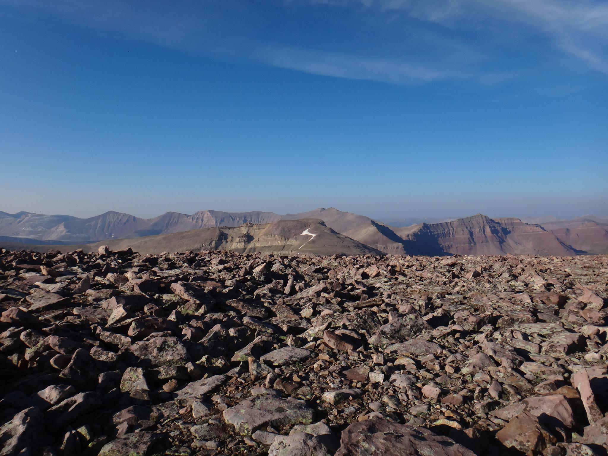
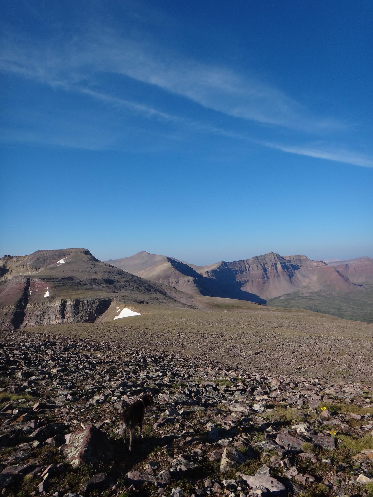
Dollar Lake is an easy 2.5 or so miles above Elkhorn Crossing on the left/east side of the trail. The obvious ridge that works up from behind the lake is the objective. Work due east from Dollar Lake up to the ridge and circle east for the easiest path. Once above treeline the going is steep, but easy and straightforward. Follow the ridge and it ascends steeply, then flattens out and is more gradual to the summit of Gilbert to the east. As late as August there were several springs flowing on the flat plain before the last push to the summit, but filling up on water at Dollar Lake is prudent.
North Slope (~10 miles from the trailhead / about 5-6 hours)
The easiest approach is to follow the Beaver Lake trail as it heads north, then circles back east and south up to tree line along a cliff above a gully. This trail, at least when I visited, was frustrating hard to find and follow by headlamp. If needed, head due east up to tree line from Elkhorn Crossing going cross country. Many options, but all need to reach tree line.
From tree line, head south up the gentle north slope. The going is easy and the views spectacular. Many snow fields and springs dotted this slope to as high as about 12,000' in the mid-August trip I visited. At about 12,400', the final steeper, rocky section is visible. It is easiest to traverse to the west/southwest side and ascent less rocky/steep areas to the true summit.
Maps

12T 556336E 4528908N
40°54'34"N 110°19'52"W
12T 551933E 4522675N
40°51'13"N 110°23'02"W
12T 552304E 4519556N
40°49'31"N 110°22'47"W
12T 555622E 4519373N
40°49'25"N 110°20'25"W