 Hiking
Porter Fork
Hiking
Porter Fork
Millcreek Canyon
Overview
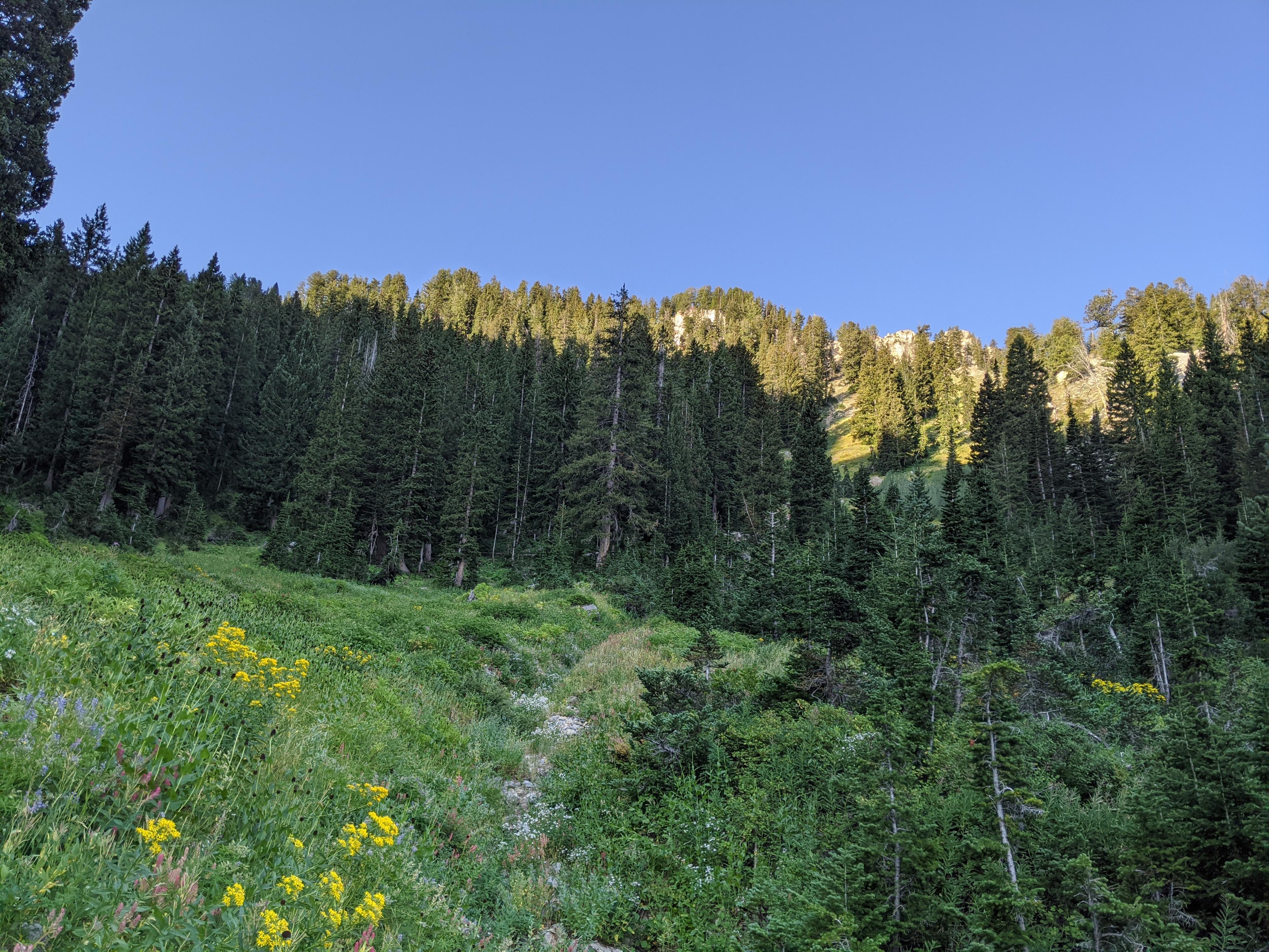
Porter Fork is one of two summer home areas in Millcreek Canyon. The lower section of Porter Fork is a paved road the climbs steadily up through summer homes. The plentiful shade and babbling sounds of the stream make this a particularly idyllic place. Many, looking for a short hike, walk up from the trailhead to the end of the paved road. This makes for about a 3-mile round trip hike in a lovely setting. The road is only open to those staying at the summer homes, so does not see much traffic.
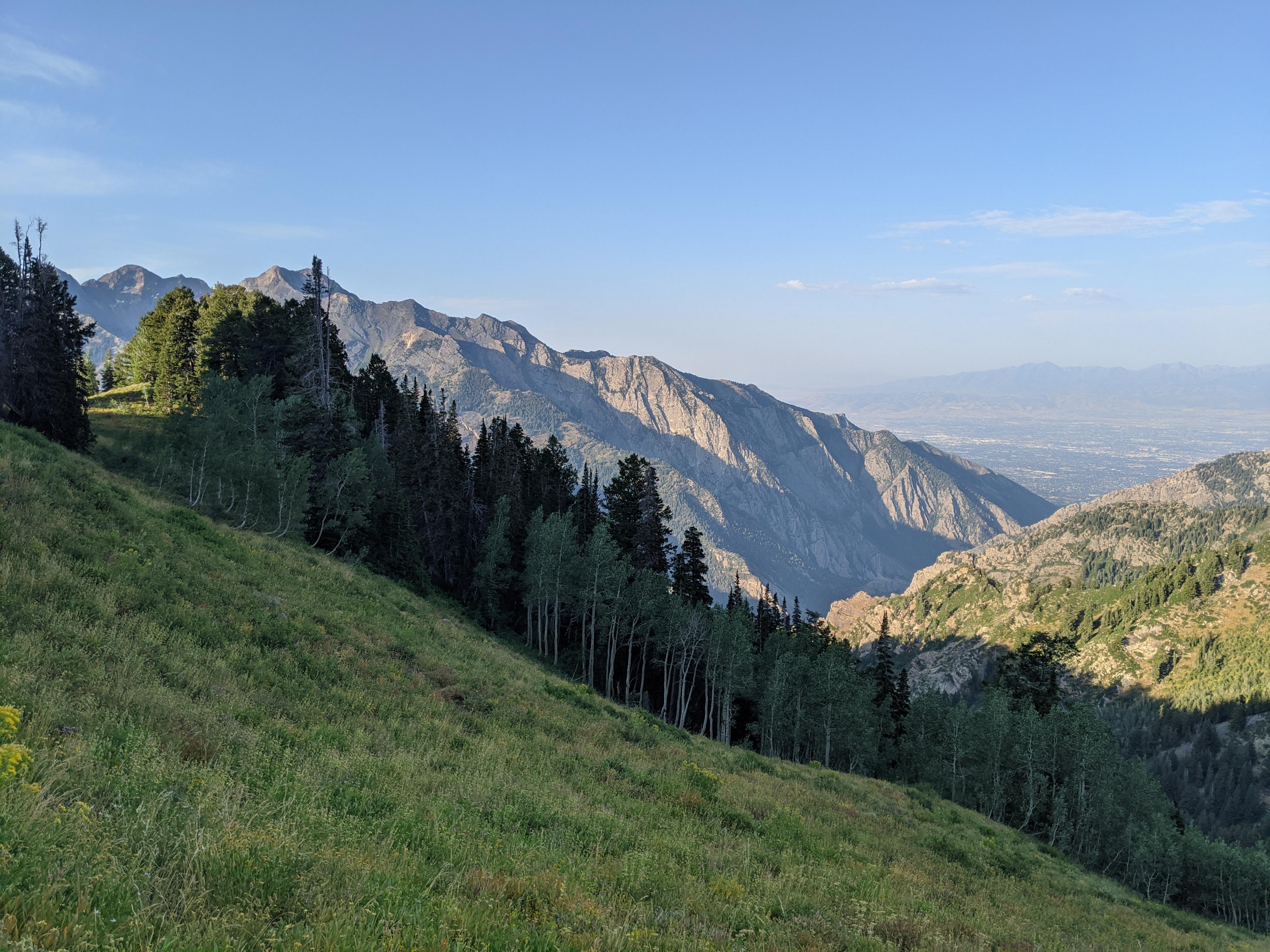
The end of the road marks the wilderness boundary where the trail narrows and becomes quite steep. Those wanting a bigger outing can follow Porter Fork up to a pass overlooking Big Cottonwood Canyon. The views from the pass are outstanding, but the greater than 3000’ of elevation gain in the 4-ish miles from the trailhead to the pass makes it a workout!
Of the side canyons in Millcreek, I thought the views from the pass at the top of Porter Fork were the best, but the scenery in the canyon before the pass was more densely forested and not quite as good. From the pass, you can continue east using the Desolation Trail on the Big Cottonwood Canyon side to Baker Pass and descend Bowman Fork Trail, but this is a strenuous 12-mile loop. Most will be content with an out-and-back to the pass, and what I recommend. Dogs are allowed in Porter Fork, but NOT over the pass into Big Cottonwood Cayon.
Getting There
Millcreek Canyon is on the east side of the Salt Lake Valley, just south of I-80 and Parleys Canyon. To get there, take I-215 South from I-80 and take exit 4 off of I-215 and go left (east) on 3900 South.
Turn left on Wasatch Blvd just after crossing under the highway, then the next right on Millcreek Canyon Road.
0.7 miles from the junction of Wasatch Blvd and Millcreek Canyon Road is the entrance to Millcreek Canyon and the pay booth.
Mileage below is from the pay booth.
- 0.7 miles - Pipeline Trailhead on the left (north).
- 2.4 miles - Church Fork Trailhead on the left (north).
- 2.5 miles - Desolation on the right (south).
- 3.4 miles - Porter Fork on the right (south). There are a few spots to park near the gate. If this parking is full, continue up canyon. There are several small parking areas on the left just past Porter Fork.
Route Description
Navigation is easy on this one! From the trailhead and gate, follow the road as it crosses the stream and heads up into Porter Fork. The paved road meanders through an eclectic mix of summer homes. Some of the houses are clearly newer design, while many appear to date back to the early/mid-20th century. It is a peaceful place!
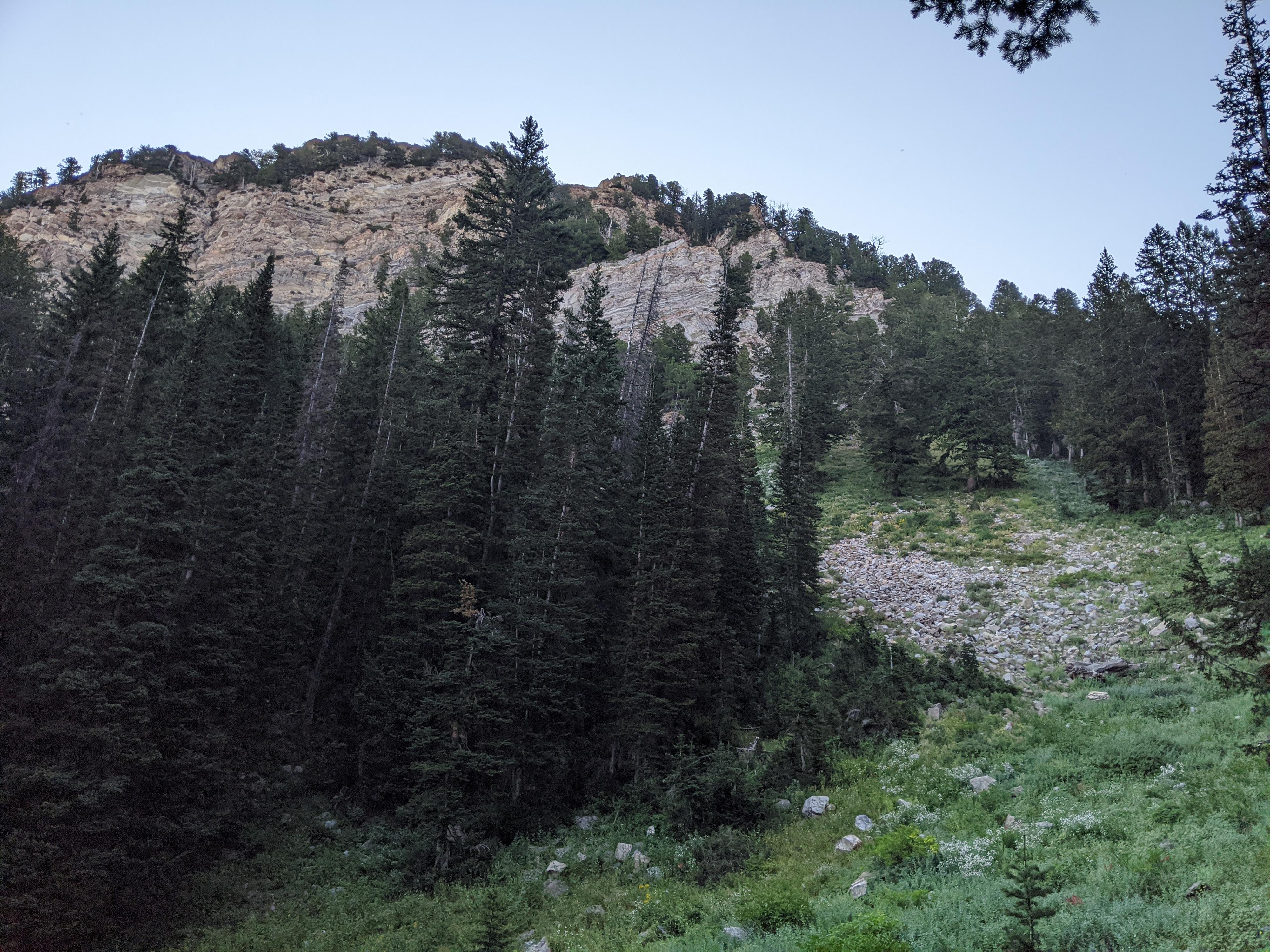
At the end of the road, the path becomes an old miner road where it crosses into the Wilderness Area. Follow it up, with it ended in about 10 minutes and becoming a single-track trail from here on. The trail climbs steadily and steeply up, with views of Mount Raymond and limestone cliffs on the right. 3.5 miles from the trailhead, just below the pass, the Desolation trail goes off on the right.
The Desolation Trail starts at Desolation Lake in upper Big Cottonwood Canyon, contours down Big Cottonwood, cross the pass above, then continues down to the bottom of Millcreek Canyon one fork to the west. Go left here, reaching the pass in just a few minutes. From the pass, there are excellent views south of Big Cottonwood Canyon and the Salt Lake Valley, as well as west of the rugged Wildcat Ridge that continues out to Mount Olympus.
Maps

12T 438960E 4505629N
40°41'58"N 111°43'21"W
12T 440059E 4503833N
40°40'60"N 111°42'34"W
12T 440058E 4501235N
40°39'35"N 111°42'33"W
12T 440108E 4501184N
40°39'34"N 111°42'31"W