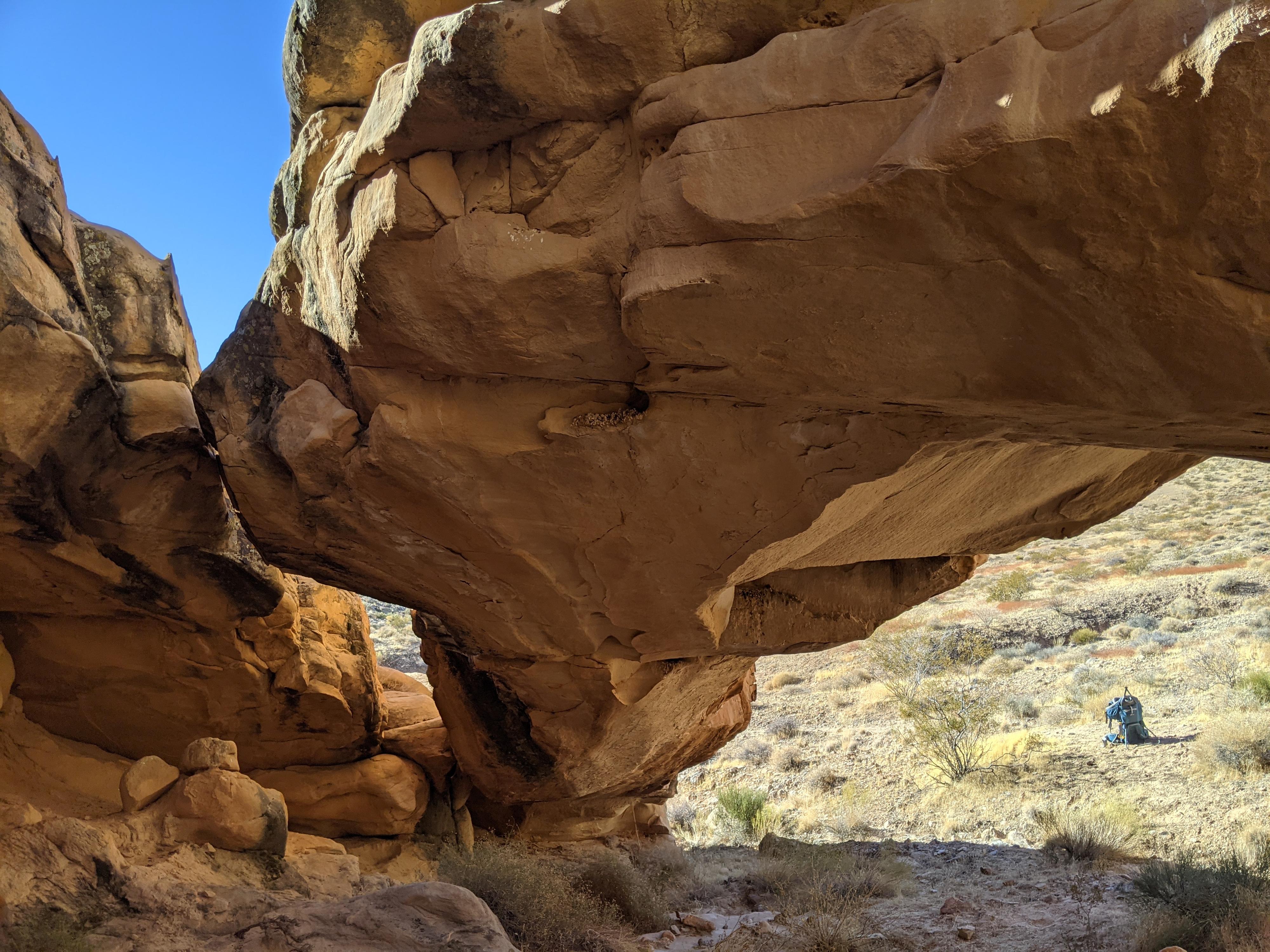
Doodlebug Arch |

Gold Butte National Monument

Hiking Doodlebug Arch - Gold Butte National Monument Hiking Doodlebug Arch

Gold Butte National Monument

Overview

RATING: Easy Hike
MAPS: Whitney Pocket, NV; Devils Throat, NV;

Fri

A slight chance of rain showers before 11am, then showers and thunderstorms likely. Partly sunny, with a high near 68. South southwest wind 9 to 14 mph. Chance of precipitation is 60%.

68 | 57

Sat

Sunny, with a high near 72.

72 | 51

Sun

Sunny, with a high near 77.

77 | 55

Mon

Sunny, with a high near 83.

83 | 58

Tue

Sunny, with a high near 88.

88 | 62

View Full Weather Details
SEASON: Fall, Winter, Spring (Hot in summer)
GEAR: Standard Hiking Gear
WATER: None

Fri

A slight chance of rain showers before 11am, then showers and thunderstorms likely. Partly sunny, with a high near 68. South southwest wind 9 to 14 mph. Chance of precipitation is 60%.

68 | 57

Sat

Sunny, with a high near 72.

72 | 51

Sun

Sunny, with a high near 77.

77 | 55

Mon

Sunny, with a high near 83.

83 | 58

Tue

Sunny, with a high near 88.

88 | 62

View Full Weather Details
Doodlebug Arch - Gold Butte National Monument

Doodlebug Arch - Gold Butte National Monument

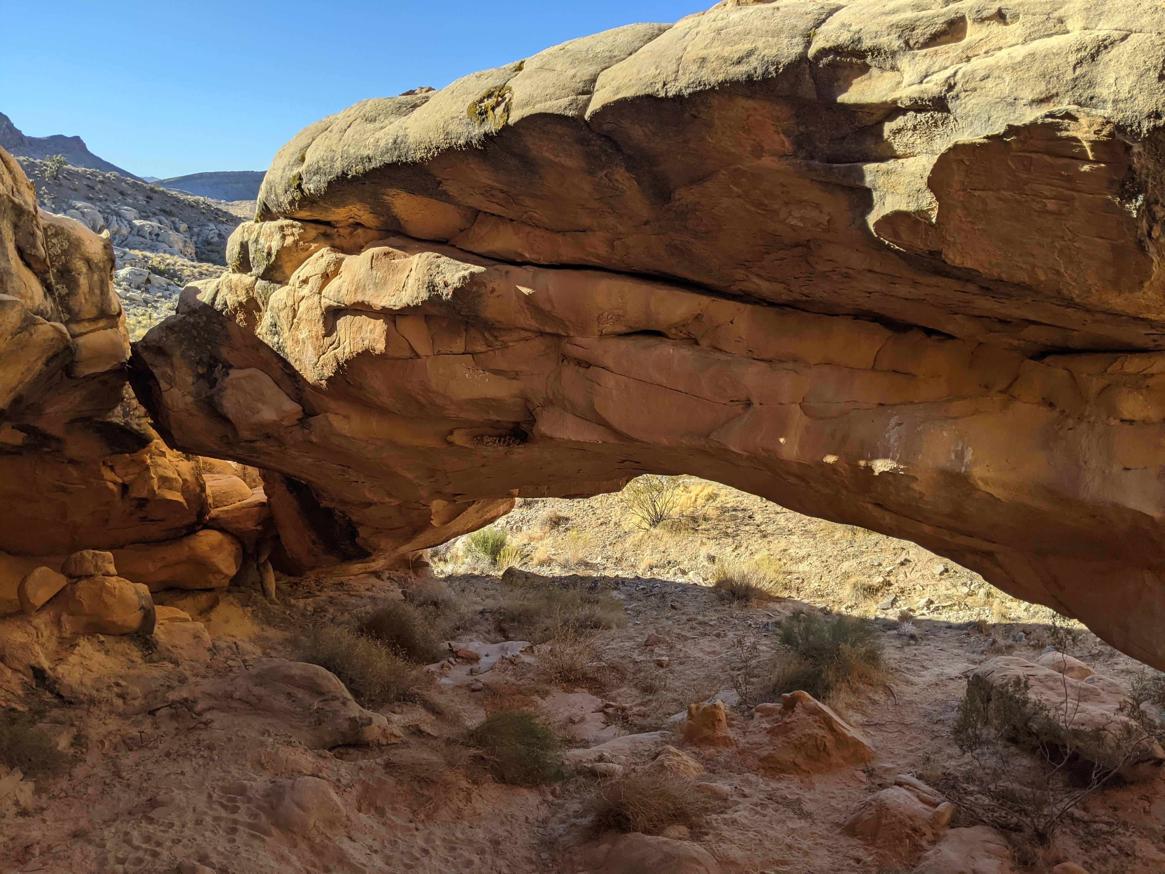
Doodlebug Arch, near Whitney Pocket is a popular short hike to a scenic arch. This is a hike that has both open desert views as you meander through Joshua Trees and a stretch of sandstone canyon. It is a fun hike, and quite family friendly. The area is a mishmash of old roads (now closed) and social trails. Moderate route finding or a GPS recommended. The arch hides well until right up to it!

Naming Note: What is a Doodlebug? It is the larva stage of the Antlion. When in the larva stage, the bugs leave “doodles” in the sand as they make tracks. The larva also makes indentations in the sand to trap ants, one of their main food sources. Antlions are found all over the world, in about 2000 species, including in Gold Butte. When the larva mature, they become an insect that looks similar to a dragonfly. The adult stage of life is quite short, compared to the larval stage, so most people recognize the antlion larva better than the mature insect.
Note: Reaching the trailhead requires high clearance. There is not great camping near the trailhead, but many great sites near the main Gold Butte Road and Whitney Pocket.
Sandstone beauty on the hike to Doodlebug.

Sandstone beauty on the hike to Doodlebug.

Getting There

Reaching Gold Butte starts by taking exit 112 off Interstate 15. This is about 70 miles east of Las Vegas, or 10 miles west of Mesquite Nevada. From exit 112, head south for 3.1 miles on NV-170 toward Riverside. Just after the road crosses the Virgin River, turn right onto Gold Butte Road.

  • Reset your odometer as you turn west onto Gold Butte Road. This is an old paved road that is a bit rough and gravel in sections, but passable by all vehicles in most conditions. ( 11S 748409mE 4068726mN / N36° 43' 54" W114° 13' 05" )
  • 19.7 miles - Side road on the right This is called Black Butte Rd. For reference, this is about 1.4 miles BEFORE reaching Whitney Pocket. ( 11S 754102mE 4046527mN / N36° 31' 49" W114° 09' 43" )
  • Black Butte Side Road - Reset your odometer as you leave the main Gold Butte Road. There are a few side roads, stay right past the first couple of these. Follow the road as it heads south/west. ( 11S 754102mE 4046527mN / N36° 31' 49" W114° 09' 43" )
  • Black Butte Side Road - 0.7 miles - Side road on the left. This is the side road to Doodlebug Arch and Poop Panel. To reach the Doodlebug/Poop Panel trailhead drive or walk this rough road 0.25 miles to a fenced pullout at a large rock. ( 11S 753586mE 4045498mN / N36° 31' 17" W114° 10' 05" )
Doodlebug Arch

Doodlebug Arch

Route

The hike starts on the rough jeep road that connects Whitney Pocket to First Rock. This road requires high clearance 4-wheel drive but can be walked if needed. I describe coming from the west since it is a shorter section of road, though you can also walk from Whitney Pocket.

From the pullout, head east. The road quickly reaches a wide wash. Go right (east) along the tracks in the wash. Keep an eye out on the right for a low pass. It is about 0.3 miles from the trailhead to a small drainage that heads up to the pass. Follow the drainage up the pass and an old road along the ridge.

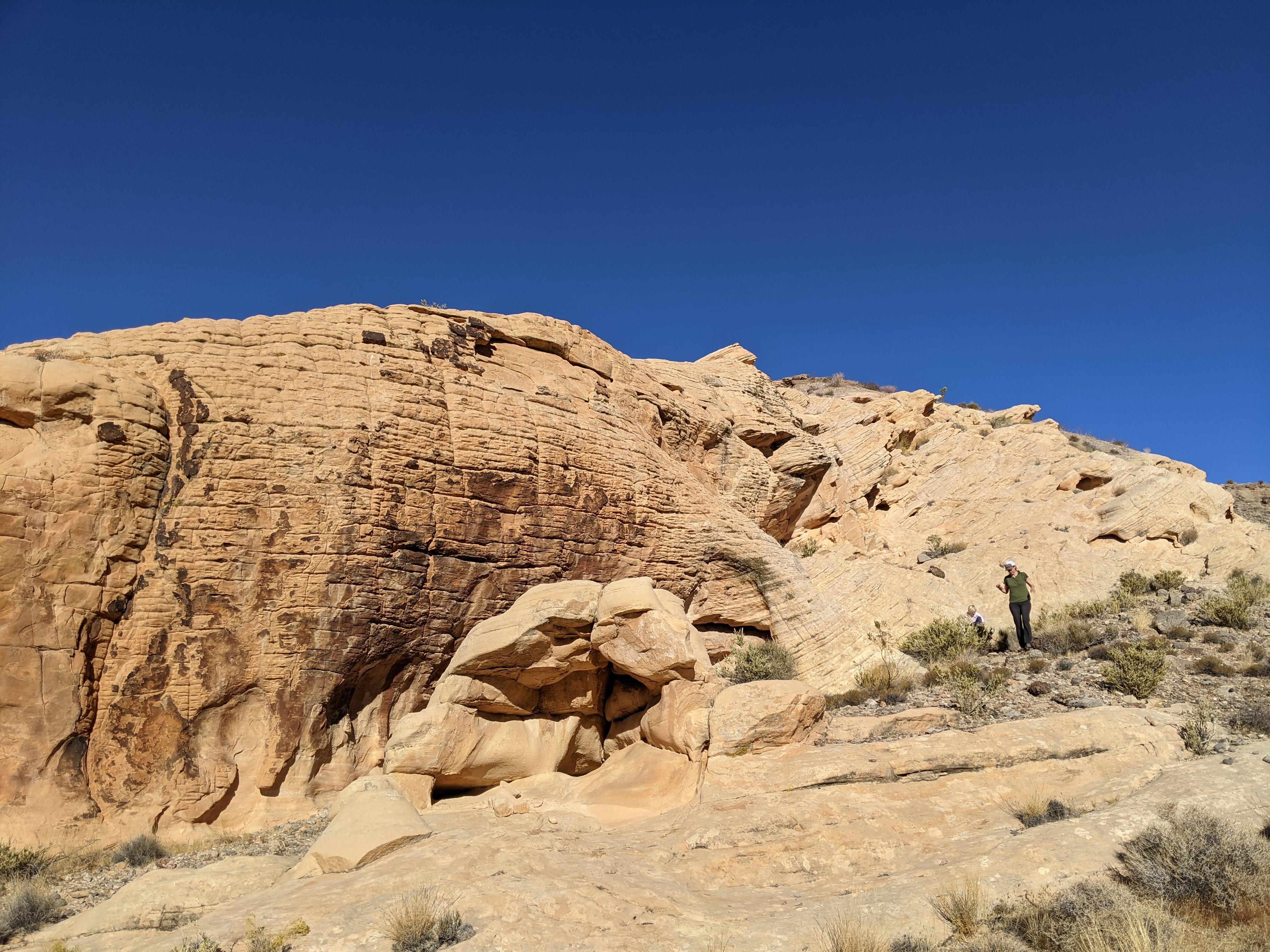
Drop down from the pass into the wide drainage that heads southwest. A short distance down from the pass, the drainage becomes sandstone lined and quit pretty. After passing through a short section of red sandstone, watch for the social trail to leave on the left.

The social trail passes between two sandstone walls, then heads west to the last sandstone outcropping visible on the right (north) side of the drainage. Doodlebug Arch is here, and only visible when right up on it. It is on the west side of the sandstone outcropping.

Return the same way.

Alternate Return: From the pass, the old roads head west along the ridge, and provide a nice alternate return. Be sure to drop down to the red rock outcropping that is the trailhead. There are a couple of old roads, both end up at the outcropping.


Maps

Loop Route / 1.98 miles / Elevation Range 2,705 - 2,906 ft.
Printable Maps:
Trailhead

11S 753926mE 4045607mN

N36° 31' 20" W114° 09' 51"

Poop Panel

11S 753959mE 4045571mN

N36° 31' 19" W114° 09' 50"

Wash

11S 754029mE 4045670mN

N36° 31' 22" W114° 09' 47"

Small Side Drainage

11S 754423mE 4045630mN

N36° 31' 20" W114° 09' 31"

Pass

11S 754417mE 4045435mN

N36° 31' 14" W114° 09' 31"

Doodlebug Arch

11S 753951mE 4045156mN

N36° 31' 05" W114° 09' 50"

Comments

Want to make a comment? Login and let yourself be heard.