 Hiking
Petroglyph and Cowboy Trails
Hiking
Petroglyph and Cowboy Trails
Sloan Conservation Area
Overview
Sloan Canyon National Conservation Area, located a short distance from Las Vegas in southern Nevada, is renowned for its ancient petroglyphs. The area contains more than 300 panels and nearly 1,700 petroglyphs from the Puebloan, Patayan, and Southern Paiute people from the Archaic to historic times. These petroglyphs, etched into the rock faces of the canyon, depict various scenes such as hunting, religious ceremonies, and everyday life, offering insights into the cultural heritage of the ancient inhabitants.
The hike described here visits the largest concentration of rock art in the conservation area and is highly recommended if you are interested in rock art. It is an astounding gallery left by the ancient peoples.
- No pets are allowed on the trail.
- The hike is brutally hot in the summer. If visiting in warmer times of the year, be sure to pack plenty of water and start early.
- The hike has a couple of "dry falls" as the trailhead sign indicates that require minor scrambling to get up. These should not be difficult for most hikers, but do be careful on them.
- Even though the suburbs have reached the edges of the conservation area, this is still a wild place, not a city park! Be respectful, pick up any trash you find, and just generally be a good visitor.
Getting There
Subdivisions have expanded to almost the edge of the Conservation Area, and the directions to access the trailhead are changing a bit as well as new roads and subdivisions are built. Currently, 2024, this seems the easiest route, though your smartphone might find a better route. The destination to look for is the Sloan Canyon Visitor Contact Station.
From Las Vegas, head south on I-15. It is about 15 miles or so from downtown Las Vegas to I-15 exit 27 (St. Rose Parkway).
Once off exit 27:
- Go east (straight) onto St. Rose Pkwy for 0.4 miles.
- Turn right onto Las Vegas Blvd and follow it for 0.4 miles.
- Turn left onto Volunteer Blvd and follow it for 1.8 miles.
- Turn right onto Via Inspirada and follow it for 1.4 miles to a traffic circle. Take the first exit to stay on Via Inspirada. In 0.3 miles is a second traffic circle. Take the 4th exit to stay on Via Inspirada.
- 0.2 miles after the second traffic circle, turn right onto Via Monet.
- Follow Via Monet 0.6 miles, then turn left on Montage Street.
- Follow Montage Street for 0.4 miles where it becomes Democracy Drive. Follow Democracy Drive 0.5 miles, then turn right on Nawghaw Poa Road.
- Nawghaw Poa Road ends in about 0.75 miles at the BLM Visitor Contact Station and trailhead. There are porta-potties at the trailhead and a BLM visitor trailer.
Route Description
Rock art and historic sites are fragile, non-renewable cultural resources that, once damaged, can never be replaced. To ensure they are protected, please:
- Avoid Touching the Petroglyphs: Look and observe, BUT DO NOT TOUCH!
- Stay on the Trails: Stay on the most used trails when visiting sites, and don't create new trails or trample vegetation.
- Photography and Sketching is Allowed: Do not introduce any foreign substance to enhance the carved and pecked images for photographic or drawing purposes. Altering, defacing, or damaging the petroglyphs is against the law -- even if the damage is unintentional.
- Pets: Keep pets on a leash and clean up after them.
- Artifacts: If you happen to come across sherds (broken pottery) or lithics (flakes of stone tools), leave them where you see them. Once they are moved or removed, a piece of the past is forever lost.
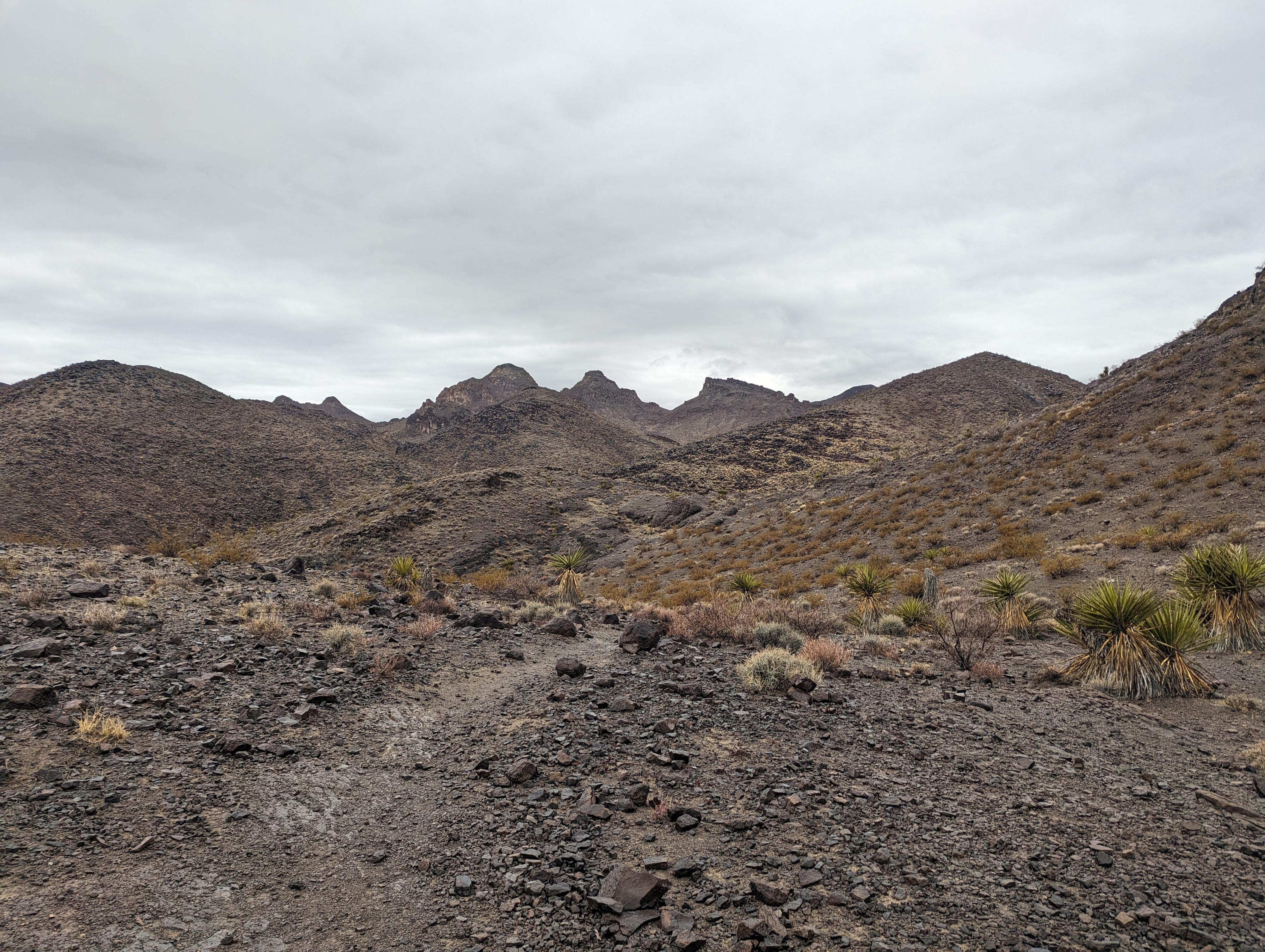
The trailhead has a detail map and information about the trail. The trail crosses high, open desert for about a half a mile before descending to the wide-wash bottom and heading up the wash.
Head up the wash bottom. The hike, to my eye, gets more interesting once in the wash and cliffs and rock formations begin. About 1.3 miles from the trailhead, a junction is reach with a canyon coming in on the right. This is the Cowboy trail that will be used for the loop return. Stay left here in the main canyon.
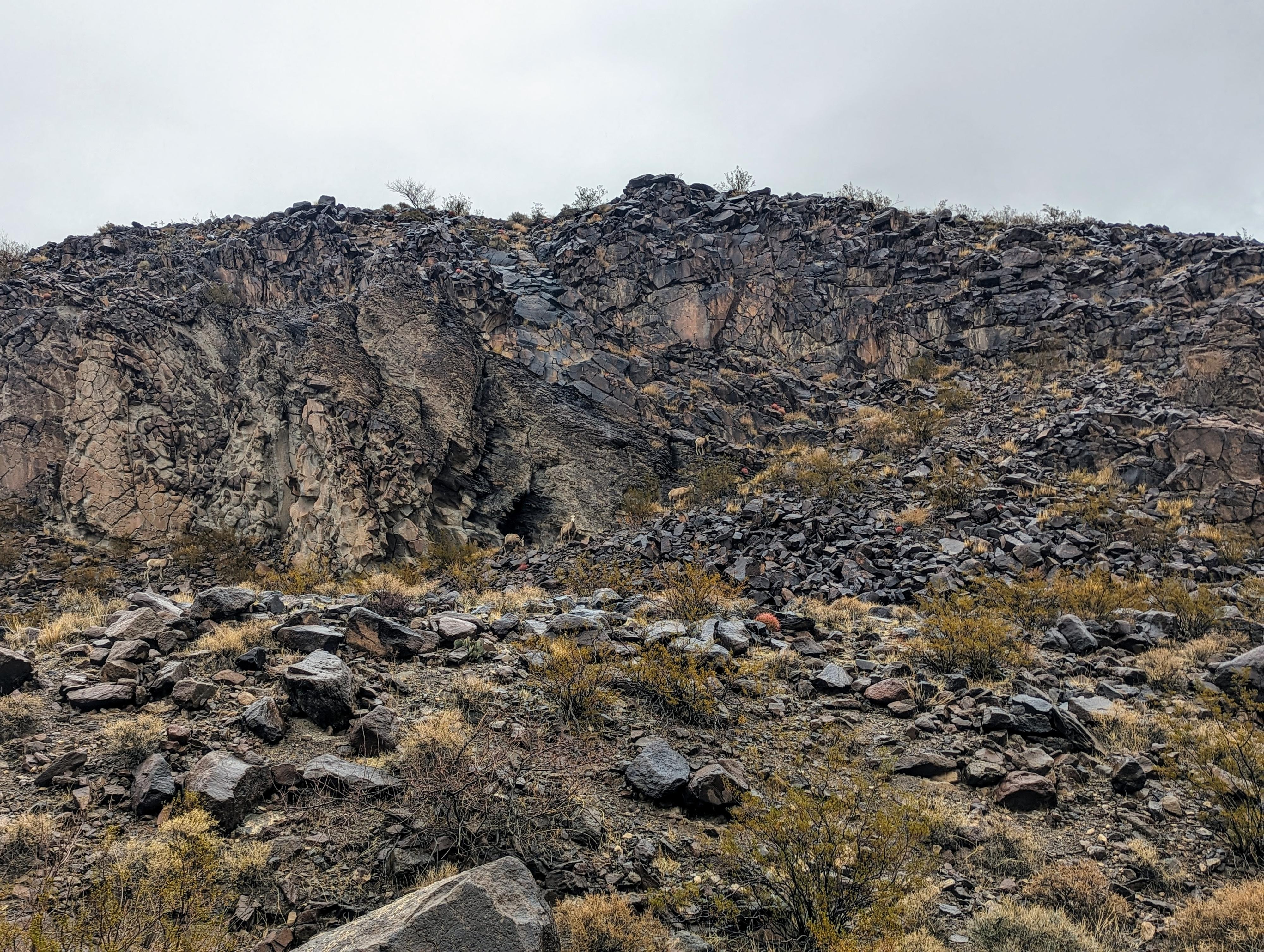
The canyon deepens and a few small obstacles present themselves. We saw several Bighorn Sheep in this section, so keep an eye out.
About 0.4 miles from the junction, the canyon narrows and the dry fall obstacles the trailhead sign mentions are reached. These are all pretty easy. If they seem difficult, look around. The most difficult obstacle is right before the canyon makes a hard left turn and opens.
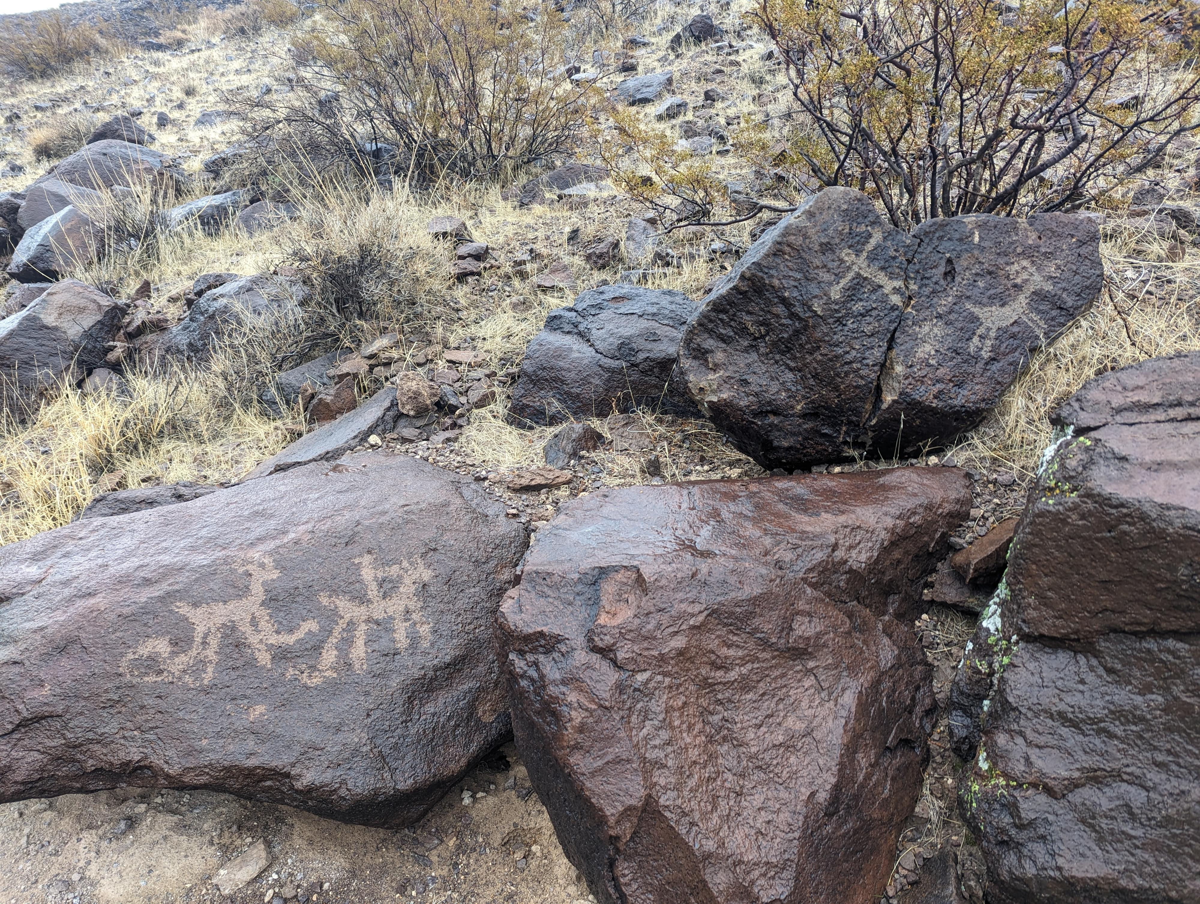
Once you have made the left turn, begin looking for the petroglyphs. All that we saw were on the right (west) side of the wash on the boulders scattered up the hillside. There are many, many panels! It is a fascinating place to look around. BE CAREFUL WHERE YOU STEP! SOME PANELS WOULD BE EASY TO STEP ON IF YOU AREN'T PAYING ATTENTION.
The panels extend for several hundred feet along the hillside along this wash. If not motivated to do the loop, you can return the same way from here. We found a few more petroglyphs a bit up from the main concentration, but most of the panels appear to be clustered in this area.
Loop Return
To return via the loop/Cowboy Trail, continue up the wash. A side wash comes in on the left, but stay right in the main wash. We found one more small petroglyph side a few hundred feet past this side wash with what, to me, looked like a hunter and bighorn sheep.
Continue in the main wash, keep an eye on the right for a side wash coming down. There is a trail marker and trail leaving the wash here. Take this trail, the Cowboy Trail. It climbs the wash to a pass with broad views of Las Vegas and the surrounding desert before descending into a wash that returns back to the main canyon. Go left once you reach the main canyon to follow the trail you came in on back to the trailhead.
Photos
Maps

11S 669064E 3976279N
35°54'58"N 115°07'35"W
11S 669196E 3974652N
35°54'06"N 115°07'30"W
11S 669338E 3974220N
35°53'51"N 115°07'25"W
11S 669301E 3974197N
35°53'51"N 115°07'27"W
11S 669201E 3973882N
35°53'41"N 115°07'31"W
11S 668979E 3973838N
35°53'39"N 115°07'40"W