 Hiking
Turtlehead Peak
Hiking
Turtlehead Peak
Red Rock Canyon Conservation Area
Overview
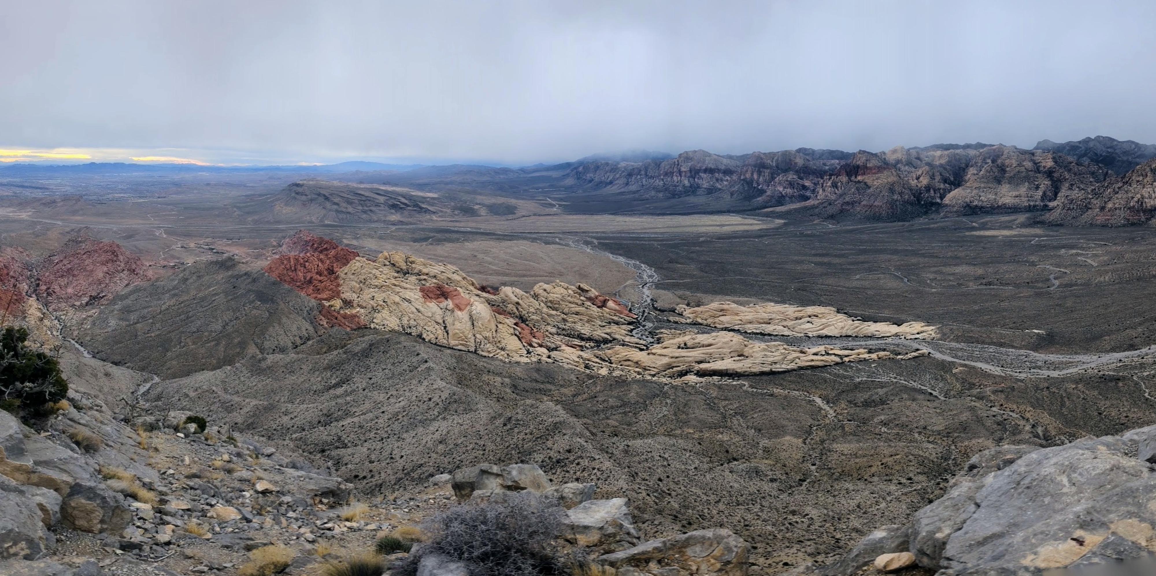
Turtlehead Peak, though not the highest point in Red Rock Canyon National Conservation Area, is a one of the easier and more popular summits to reach. The summit and hike have breathtaking panoramic views of the surrounding Mojave Desert landscape and the iconic red sandstone formations that characterize the region.
The hike involves some steep, loose sections, and a plethora of social trails. I would not recommend this for absolute beginning hikers, but for those with a little experience, it is an excellent outing. On our Las Vegas trip, this turned out to be an unexpected highlight when our other plans had been cancelled due to weather. At a moderate pace, it took us about 2 hours roundtrip.
Timed entry reservations can be made at Recreation.gov by visiting https://www.recreation.gov/timed-entry/10075177, or by calling (877) 444-6777.
Getting There
From the Red Rock Canyon fee booth, follow the scenic drive 2.5 miles to the Sandstone Quarry Overlook/Trailhead side road on the right. Follow the side road to its end in about 0.1 miles at the trailhead. There are restrooms at the trailhead.
Route Description
The trail is signed and initially easy to follow. From the trailhead, head north on the major trail. Be sure to NOT take the left trail at the Grand Circle Loop Jct, but instead continue straight.
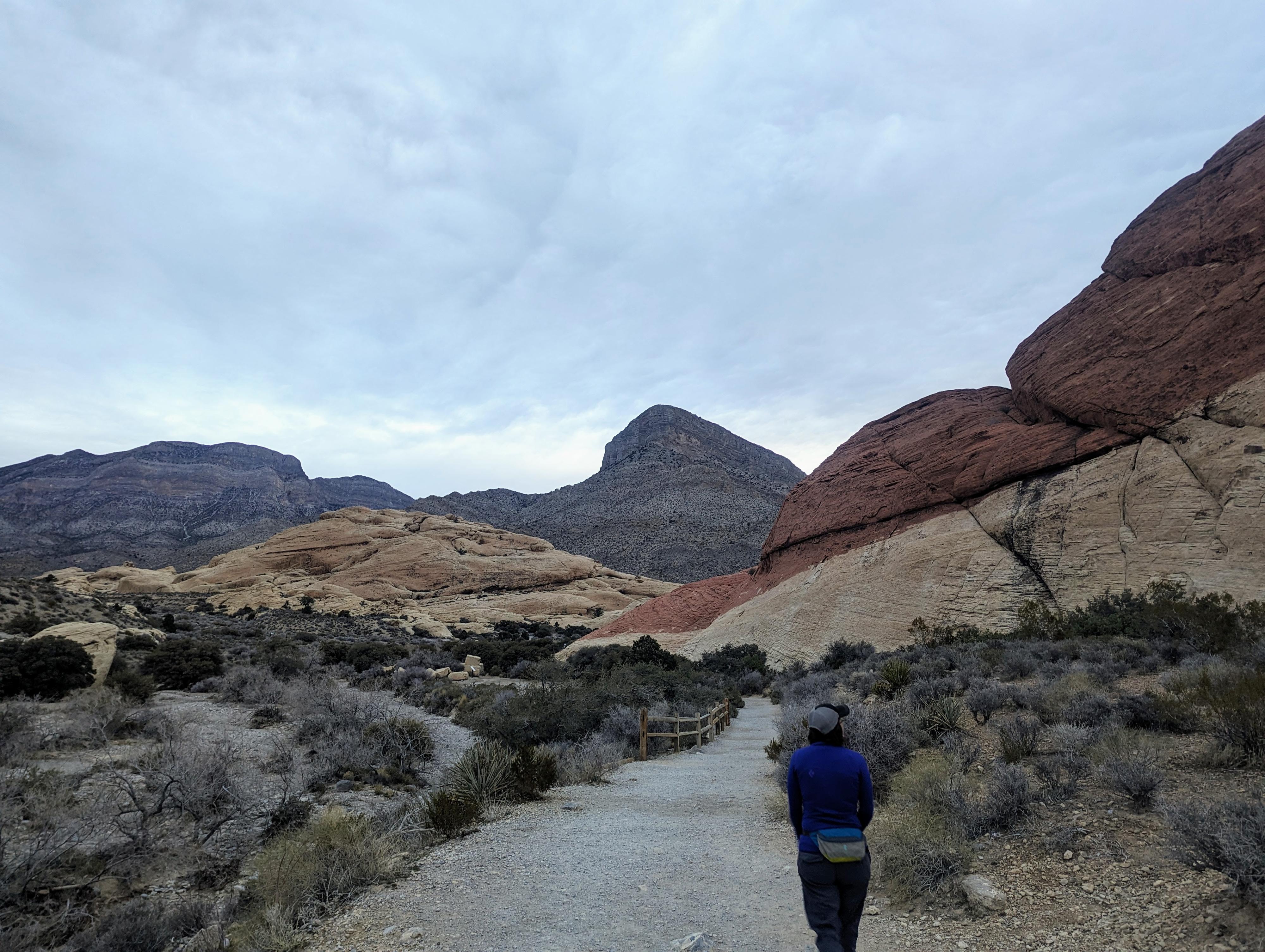
In less than 1/4 of a mile from the trailhead, the Sandstone Quarry is on the right. Stay on the main trail as it crosses the wash.
In just a few minutes after crossing the wash is a major junction. Left is signed for Turtlehead Peak, right goes to Calico Tanks. Go left. Follow the Turtlehead Peak trail as it heads north up the wash bottom and, in a few minutes, climbs out of the wash bottom and passes through a couple of sandstone hills.
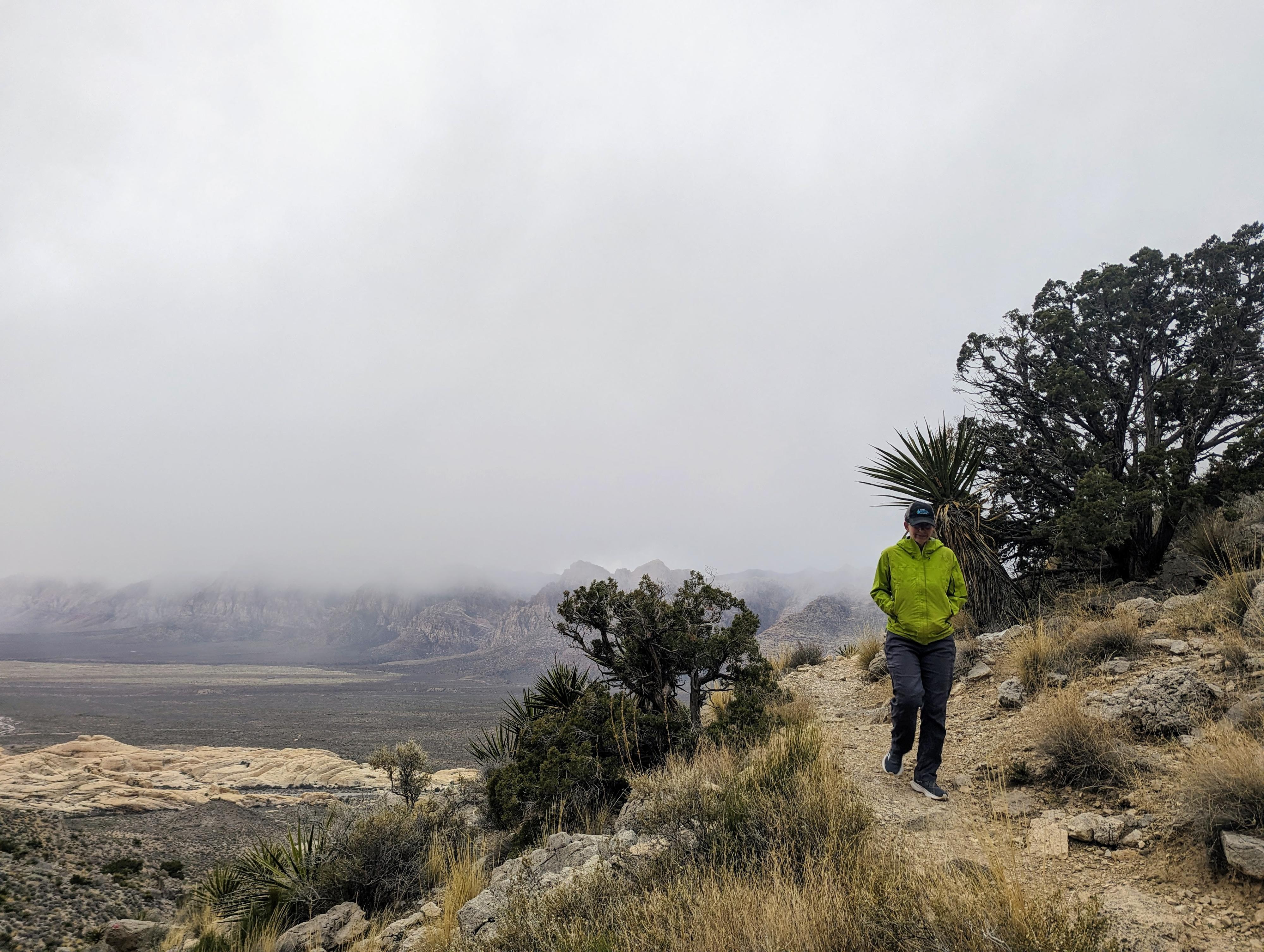
The trail now begins climbing toward the obvious drainage that leads to the low point left of the peak. In this section, the trail is easy to follow, but as it steepens, more social trails diverge and coalesce. Look for trail markers and/or paint spots that mark the trail. At one point, you are likely to come to a junction. We went right and up to the ridge on the way up, and the opposite trail on the way down. Once at the ridge, the trails coalesce again and head east then south toward the summit.
Again, social trails crisscross the area as it heads up toward the summit, and it is difficult to determine which is most used. In general, simply follow the trail with the least resistance up to the summit.
The summit has great views of Red Rocks to the south and west, Las Vegas to the east, and the Mojave Desert all around.
Return the same way.
Photos
Maps

11S 639387E 4003044N
36°09'44"N 115°27'01"W
11S 639400E 4003182N
36°09'48"N 115°27'01"W
11S 639337E 4003358N
36°09'54"N 115°27'03"W
11S 639414E 4005281N
36°10'56"N 115°26'59"W
11S 639519E 4005449N
36°11'02"N 115°26'54"W
11S 639742E 4005056N
36°10'49"N 115°26'46"W